Tag Archives: map

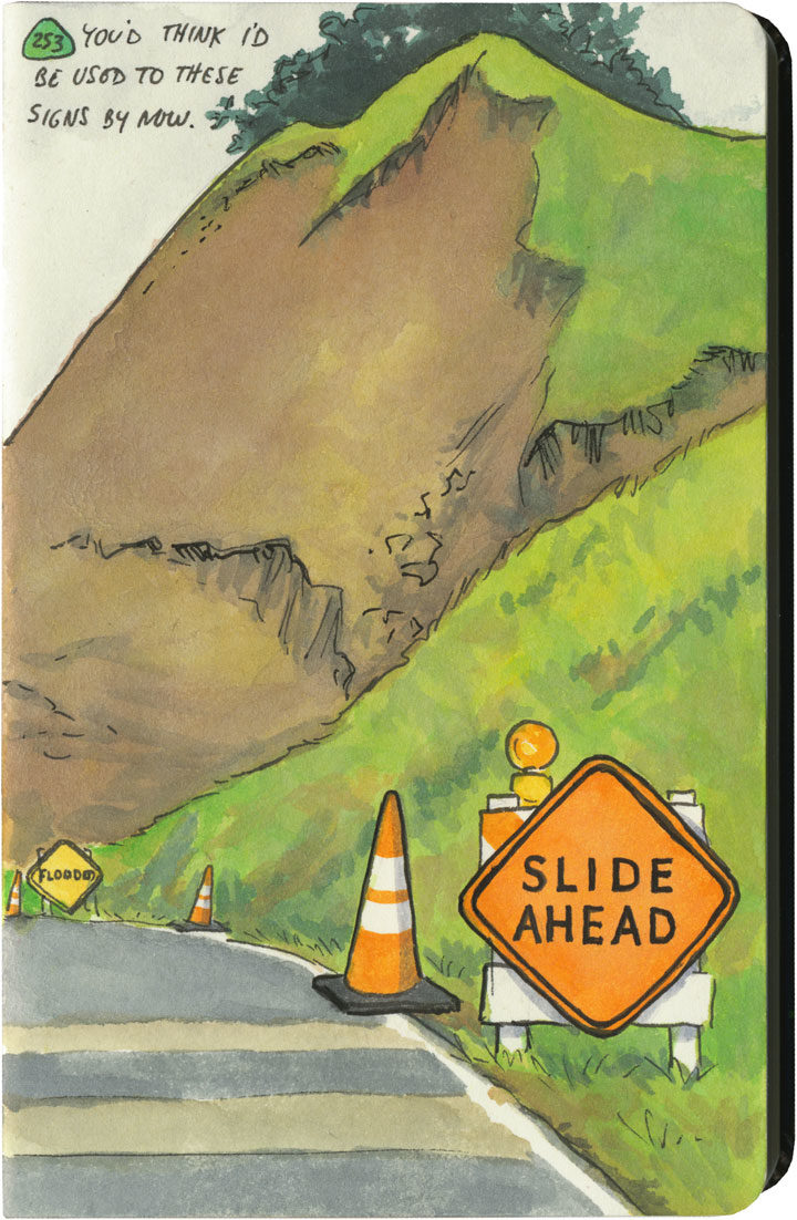
Landslide sketch by Chandler O'Leary

The long detour

I spent nearly all of April breaking in my new car with a 6500-mile road trip up and down the West Coast. I’ve done many similar trips in the past, but this one had a completely different feel to it. And that’s because the severe drought—which for more than seven years had parched California and gifted me with suspiciously perfect weather and unusually good road conditions—was over.

This year, California had just come out of one of its wettest winters on record. All that rain after such a long drought had brutal effects on hillsides and roadbeds all over the state. I quickly became accustomed to seeing signs like this one everywhere I went—to the point where I lost count of the number of detours, patched pavement, and in-progress landslides along my route. Over and over again I either had to make adjustments to my plans (I had to cut the Big Sur Coast out entirely, since Highway One has been closed there since February), or else take extra time to pick my way over some truly scary patches of pavement.

Landslide sketch by Chandler O'Leary

The state of affairs was so unpredictable that I got in the habit of checking road conditions on my phone a day or two ahead of each day’s planned route. On one cursory inspection, I stopped dead, my eyes widening at what I saw: Highway 101, my route through the redwoods, which happens to be the only route through the redwoods, was closed. Completely closed. No detour, the warning said.

No detour.

By this time I was familiar with the Norcal Coast—I knew that it’s pretty darn audacious of Highway 101 even to be there, what with the mountains that squeeze right up to the rugged, rain-soaked coastline. I remember driving through there in the past, marveling at the engineering required to put a road there in the first place, and being thankful that nothing had blocked my way and left me up the proverbial creek—yet I never actually looked at a map to see what kind of workaround a closure would require. Well I was about to find out.

Luckily, this little monkey wrench couldn’t have happened on a better day. This happened to be the shortest day of the trip, with just over 100 miles between hotels. And I only had one real plan for the day: to explore the Lost Coast, that rugged swath of coastline traversed only by primitive roads, where tourists feared to tread.

Nevermind—a massive rockslide just north of Leggett put paid to that plan. I still needed to get to Ferndale, though, if I wanted to honor my reservation that night and make it to the next leg of the trip. And since there was “no detour,” I scoured my maps to see just what that would mean.

Landslide detour map sketch by Chandler O'Leary

Uh, yeah. This is what it means. It means crossing back east over the mountains on State Route 20, then a trek up through nearly the entire length of the Sacramento Valley (that little Highway 99 jog was just a break to save my sanity), then back over the mountains to 101 again on State Route 36. There are no east-west highways between 20 and 36, either. This was my route, the new plan. I added up the mileage of what I’d have to do the next day: nearly 400 miles.

I set an early alarm, asked the universe to refrain from any more surprises, and went to bed.

Landslide detour sketch by Chandler O'Leary

The next day was was both beautiful and harrowing. I got to see a broad swath of the state I’d never experienced before. And I also got hit with some home truths about this modern life we all take for granted—how easy it would be for nature to knock it all right out. As I wound my way over mountain pass after mountain pass, the roads got scarier and scarier. There were places where it was obvious the hillsides were trying their best to slough off their ribbon of road—and I just hoped the mountains wouldn’t win the fight on that particular day. The very worst came near the very end, a ten-mile stretch of obviously temporary, hastily repaired state highway. The pavement was so precarious, so narrow, that they didn’t bother with a yellow stripe. And at least half of the curves were completely blind, making it necessary to do that horn-honking oh-god-oh-god-here-I-come ritual before each one.

Landslide detour sketch by Chandler O'Leary

Now, don’t get me wrong—I love mountain driving. I love curvy roads. And I love unexpected adventures. And my desire for it all is darn near insatiable. But by about the ninth hour of tortuous highway and the almost total lack of towns, services or cell signal, I’d all but lost interest in the adventure of it all. I just wanted to get there in one piece.

Lost Coast road sketch by Chandler O'Leary

When I finally did, I ended up a stone’s throw from the other end of that Lost Coast road that had been the original plan. I’d been to this spot before, and had always found that Capetown-Petrolia sign enticing and mysterious—what lay down that road, beyond that dark wall of trees?

This time, though, at the sight of all the warning signs they’d erected here (Chains required! No motorhomes! No services!), I just started laughing. Because after the day I’d just had, I could not have cared less. My curiosity had gone on strike—and in its place was a powerful desire to crawl right into bed.
 

Save

Save

Save

Save

Save

Save

Save

Save

Save

Sketch by Chandler O'Leary

Four-wheeled farewell

If you’ve been reading here for awhile, you’ve seen this picture before—and others like it. My car, Wild Blue, has made many appearances here over the years, because she’s as much a character in my stories as any place I’ve visited.

Sketch by Chandler O'Leary

In fact, she’s sometimes the star—though even when she isn’t, she’s never far from my mind.

Mt. Rainier letterpress print by Chandler O'Leary

She’s even made some cameos in my studio work.

Map sketch by Chandler O'Leary

She was the first and only car I’ve ever owned (thanks to years of living in dense cities, I didn’t need to buy one until my mid-twenties), and she took me nearly everywhere. I always thought I’d drive her to the moon, but it doesn’t matter that we fell a little short. She was the beating heart of my adventures, each highway another artery feeding our little love story.

Yet all stories have to end. Back in February I was gearing up for another big solo trip—a doozy this time, with 6500 miles of mostly remote mountain and desert roads. Blue already had many costly age-related repairs coming due, and I didn’t think she had another trip like that in her. So we took one last winding local drive together, and then I put her out to pasture.

Goodbye, Blue. Hello, Silver.

Car sketch by Chandler O'Leary

This new gal and I have had plenty of time to get acquainted—after all, she got well and truly broken in this spring with that big trip (more on that next time). And she’s the first car the Tailor and I have bought together, as we want to remain a one-car household. We had to make little compromises over what we each wanted, of course, but the biggest one was the compromise I had to make with the auto industry: I had to give up my stick shift. We really wanted this model, and a manual transmission simply isn’t an option anymore for this one.

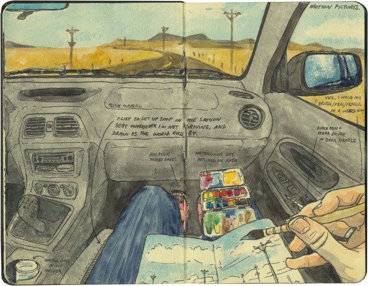
For all I had to give up, and for all the frills and furbelows that seem to accompany all new cars (though I’ll admit I love having USB ports at last)—this car has plenty of qualities that fit my personality. No GPS, for one thing—you all know how I feel about that (the Tailor and I agreed that if that had come standard, we would have paid to have it removed!). And plenty of nooks and crannies for holding all my paints and things while I sketch.

Yet while Silver is pretty and sleek and reliable and powerful, she’s not my Blue. I’ve already put close to 10,000 miles on her, but I’m still finding it hard to make the transition. Driving an automatic feels so different to me, so less engaged. And I have a lot of trouble finding her in crowded parking lots—I’m usually great at remembering where the heck I parked, but finding a silver Subaru in a sea of other silver Subarus (welcome to the Northwest) is hilariously difficult. Still, I’m sure we’ll grow to know and trust each other over time. It’s just hard to give up your first love.

Astoria sketch by Chandler O'Leary

Thank you, Wild Blue, for taking me here, there and back again—and for always keeping me safe along the way.

Astoria sketch by Chandler O'Leary

Here’s to the next quarter of a million miles, and my shiny new steed. Hi ho, Silver.

Save

Save

Save

Save

Save

Save

Save

Save

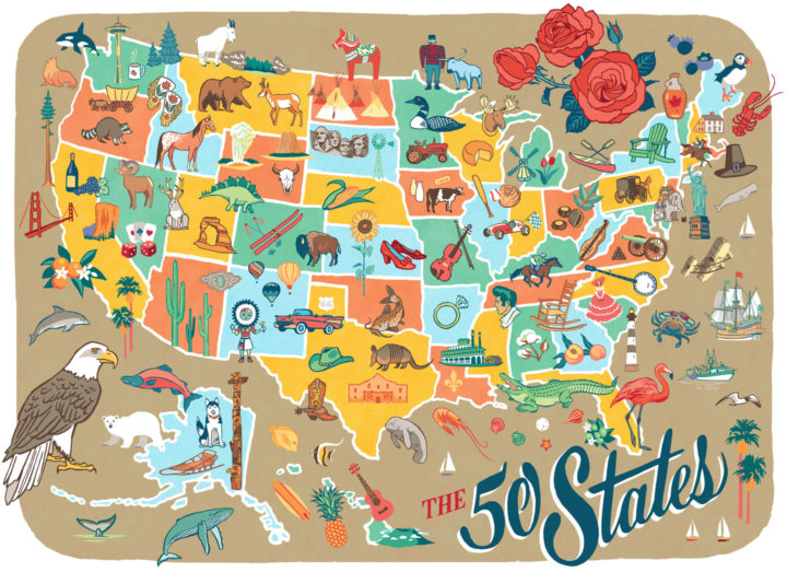
50 States pictorial map illustrated and hand-lettered by Chandler O'Leary

Rereading the map

I finished this map before the airwaves were inundated with red and blue election maps—and today it’s a good reminder that America is more than its electoral divisions. That there is good in every state, and that there is so much to love and celebrate in every nook and cranny of our nation. This is why I started the 50 States project three years ago, and I’m taking the fact that I happened to finish the series right before the most divisive election in living memory as a sign that I need to remember this fact going forward. After all, the real work of our country involves all of us.
 
Those of you who read this blog know that I express my love for every state—blue, red, purple, whatever—through my drawings. I will continue to do so, to feature the beauty and wonder and hilarity and kooky humor of every state. That is what will get me through the fear and sadness and anger I’m feeling now—and I hope it will help you in some small measure, as well. So the break I took from blogging to focus on my book is over; posting here starts back up again tomorrow.
 
In the meantime, you can celebrate all 50 States with me tonight at the Ted Sanford Gallery at Charles Wright Academy in University Place, WA, where the entire series is on display through November 29. From 5:30 to 6:30 tonight I’ll have a gallery reception and small pop-up shop. Let’s talk about the good that’s out there—from Paul Bunyan to Elvis to the World’s Largest Frying Pan, and everything in between, from sea to shining sea.
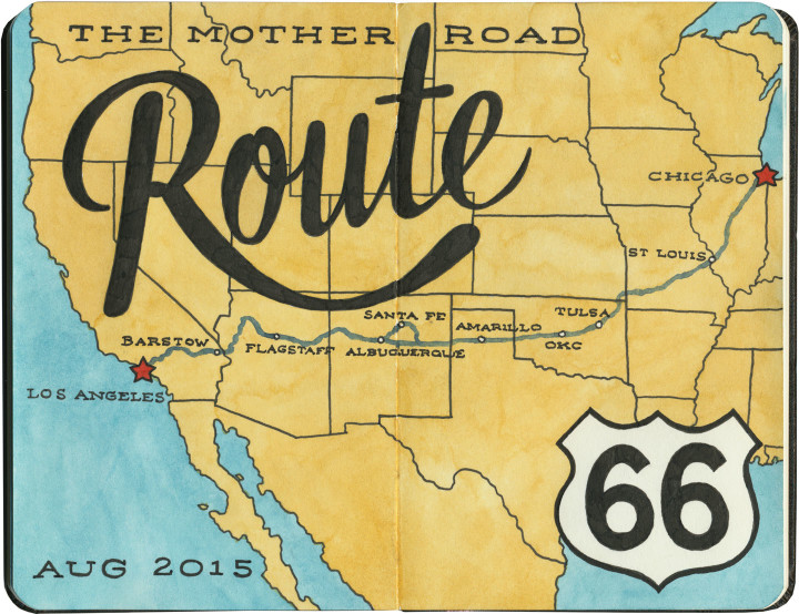
Route 66 sketch map by Chandler O'Leary

Mother Road, mother lode

Last summer the Tailor and I spent a couple of weeks traveling every inch of old Route 66. And then I kept pretty quiet about it, because I just had no idea how to organize and share the sheer number of sketches and stories I came away with afterward. There really is no “long story short” way to do this—like the Mother Road itself, there are too many branches and tangents for a single linear tale. So like I did for my Mission Mondays series, I’m going to break this down into 66 Fridays, starting today and running through spring of next year. (You can follow along by using the 66 Fridays tag.)

So each week for the next 66 weeks, I’m going to share a piece of Route 66—and like everything else on this blog (except the Mission series), those pieces will be in no particular order. There are a zillion books out there already that tell the Route 66 story from beginning to end (both in time and space), so that frees me to, er, paint a slightly different picture. I’ll be jumping around from state to state, highlighting my favorite landmarks and historical tidbits. With any luck, it’ll give you a good enough taste of the Mother Road that it’ll inspire you to explore it for yourself.

Route 66 sketch by Chandler O'Leary

A few notes:

• There’s a common perception that Route 66 is long gone, and that modern travelers can only drive bits of the route. That’s actually not true. While modern Interstate highways have replaced long chunks of the Mother Road in certain spots, it’s actually possible to drive over 80 percent of the original route—including the original road bed and even 90-year-old pavement in several places. Route 66 was officially decommissioned as a U.S. highway decades ago, but the old thread is still there, still nearly intact, just waiting for an adventurous traveler with a sharp eye to find it.

• We didn’t see everything there is to see on Route 66. Not even close. We spent nearly two weeks on the Mother Road, and by my estimate we would have needed a good month, at least, to really take it all in. Considering how much more there would have been to see years ago, before so many places closed down or fell into ruin, it all boggles my mind a bit. Nevertheless, this trip was a good first taste of the whole thing. I made the Tailor promise me that someday we’d do it all again, and take however much time we wanted.

• Even though we didn’t see everything along the way, we did our darndest to drive every inch of the route that remains—and that’s no small feat, considering how many tributaries, diversions, parallel routes, rerouted sections, poorly-marked bits and dead ends there are. I’d driven bits of 66 before, but never the whole stretch in one go. It feels like a real accomplishment that we did that.

• I hope you don’t hate vintage signs, because you can expect a lot of them in the coming months. I’ll try to keep the posts balanced between various subject matters, but I’m not gonna lie: there’s a metric ton of incredible vintage signage along Route 66, and I did my level best to draw all of it. I have whole sketchbooks just devoted to neon. I probably won’t show you everything, but you will see an awful lot of it.

Route 66 sketch by Chandler O'Leary

So buckle your seatbelts and pull out your paper maps—let’s get this show on the road, and embark upon the serious business of getting our kicks.

Save

Sketch map by Chandler O'Leary

Through the rear-view mirror

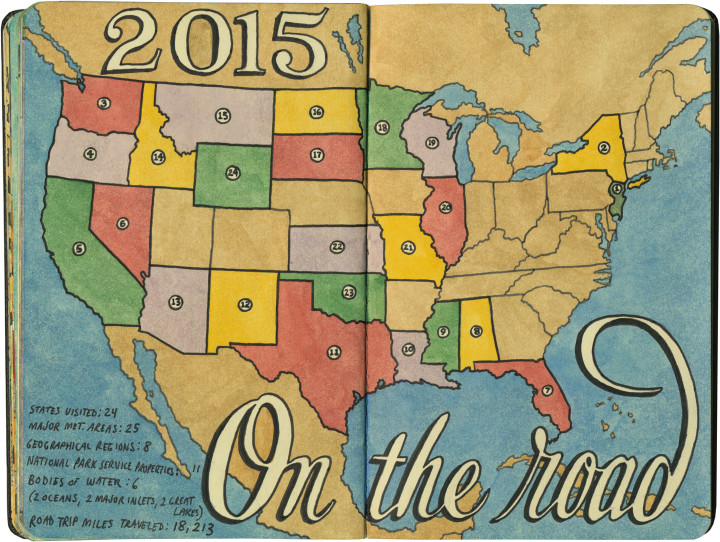
Since the year is about to end, I figured it was the perfect time to look back and see how far I’ve come this year. I did all my traveling in the first two-thirds of the year (the last third saw me stuck in the studio and chained to big projects and their deadlines, hence the light posting around here lately), but 2015 still smashed most of my travel records. I spent 65 days on the road this year, and I don’t think I’ve ever visited so many states in such a short time period. The best part of all: I’d do it all again tomorrow, if I could.

I don’t think 2016 is going to include quite so many travel plans, but keeping closer to home for now is fine by me: I have big plans for this blog, and they’ll keep me plenty busy. In the meantime, wishing you a happy new year, and safe journeys to wherever the road might take you.

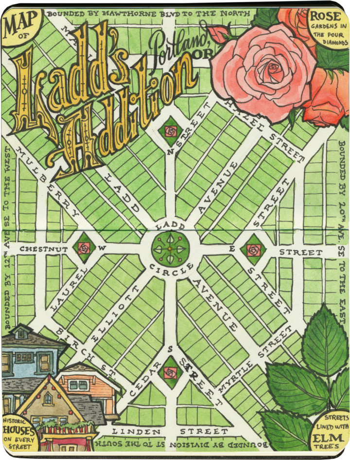
Ladd's Addition map sketch by Chandler O'Leary

Residential roses

June is the month of roses in the Pacific Northwest, and there’s no better place to see roses than the City of Roses. And there’s no better rose garden in the City of Roses than the diamond gardens in Ladd’s Addition. So in honor of my favorite Portland neighborhood, here are two midsummer sketches, done exactly three years apart.

Ladd’s Addition was the first planned residential development in the state of Oregon. Conceived in 1891 and mostly built between 1905 and 1930, the area is now a national historic district. In deliberate contravention of the city grid, the neighborhood is laid out in an “X” pattern with a circle park and rotary in the center. Where each diagonal street intersects one other at points north, south, east and west of the circle, there’s a small diamond-shaped garden that’s home to one of Portland’s many rose test gardens. And along every tree-lined and tree-named (though some have been rechristened in modern times; the map above shows their original names) street are many dozens of historic homes—many of which are unique or unusual examples of Craftsman-, Tudor- and Mission-style architecture.

Ladd's Addition rose garden sketch by Chandler O'Leary

Every part of this neighborhood is appealing to me—I’m a sucker for a good map, a Craftsman house and a pale peach rose. Put them all together, with a shady spot for me to sit and sketch, and I’m instantly in heaven.

California Missions map sketch by Chandler O'Leary

Mission: Impossible

This is the first installment of my Mission Mondays series, exploring all 21 Spanish Missions along the California coast. You can read a recap of all 21 missions and find a list of all 21 posts in the series at this link.

Remember earlier this year when I took my big California trip? Well, a work event made it possible to get down there, but my real goal for the trip was to visit all 21 Spanish missions along historic El Camino Real. Ever since my first mission visit two years ago, I had been dying to see them all in one fell swoop. It took me a little over a week to get to them all (which was actually very difficult—especially when you’re trying to allow enough time for even unfinished sketching; I’d have loved to take two weeks instead), and it felt like a real accomplishment to travel every inch of the old King’s Highway. Each mission is so different—unlike the National Parks system, these properties are affiliated with each other only in the historical sense (more on that later). So rather than try to choose a representive few sketches to show you, I thought I’d recreate my journey here. Since Memorial Day typically marks the unofficial start of summer, today seemed like a good day to start a series of Mission Mondays for the season ahead.

Before I begin in earnest, though: a couple of disclaimers. I’m not Catholic, so on my mission trip I was merely a secular tourist, not a religious pilgrim. However, to this day almost every mission is still an active, functioning church; so I did my best to be respectful of the sacred spaces I was visiting. Sometimes that meant refraining from going inside while a mass or other event was taking place—so I didn’t end up seeing the interiors of every single mission. Still, you’ll get the idea.

Here’s the other thing: I am well aware that as an area of interest, the Spanish missions are problematic. After all, these are the places where an encroaching culture subjugated and indoctrinated the Indigenous peoples of California. Thankfully, most of the missions now have updated interpretive exhibits that address this part of their history; if you’re interested in learning more about these places, I highly recommend seeking out that information. But since that story exists elsewhere, and is only one narrative of many, it’s not the one I’ll be telling here. As an artist, I’m most interested in the architecture and setting of these places—so that’s the story I’ll be telling through my sketches.

Detail of California Missions map sketch by Chandler O'Leary

Okay! Here we go. When visiting the 21 California missions, you’ll be tempted to go chronologically, in the order in which they were built. However, that’ll have you doubling back all over the state—most people just start at the bottom and work their way up. So let’s start in San Diego, at the southernmost mission in modern-day California. In fact, the adventure begins just a few miles from the Mexican border.

Mission San Diego de Alcala sketch by Chandler O'Leary

Mission San Diego de Alcalá also happens to be the oldest of the missions in “Alta California” (Upper California; the name dates back to when Spain controlled the southwest. Alta California was the northern half of the territory; Baja California is still intact as a state in Mexico, with 30 more missions of its own.). It’s also the one I was most looking forward to, since I’d never been that far south in California before.

Mission San Diego de Alcala sketch by Chandler O'Leary

It turns out I picked the right season to see it. It was mid-February, so it wasn’t hot yet (though still a pleasant 80 degrees), and the courtyard was ringed with blooming hot-pink bougainvillea.

Mission San Diego de Alcala sketch by Chandler O'Leary

The place had all the hallmarks I had come to recognize in most of the missions: high, white adobe walls, a pitched, wooden-and-tile roof, and at least one interior courtyard.

Mission San Diego de Alcala sketch by Chandler O'Leary

This one had a surprise extra, though: a modern chapel built with much older elements. This choir stall was originally built in Spain, seven hundred years ago—somehow it made the whole place feel like a slice of old Mexico City instead of San Diego.

Mission San Diego de Alcala sketch by Chandler O'Leary

I wandered through the complex as thoroughly as I could, but in the end I just kept coming back to the bells. Not every mission has a campanario (or campanile), but it’s the bells that I think of when I picture any mission. The bells are what inspired me to take this trip in the first place—and it felt good to have the image transformed from one in my head to one on paper.

Save

Save

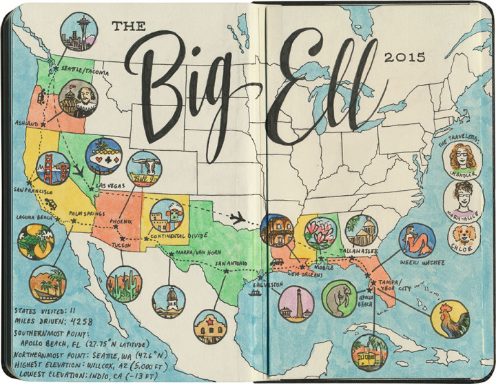
Road trip map sketch by Chandler O'Leary

The final tally

If you happen to follow along on Instagram or Facebook, you’ll know I’ve just returned from a 4000+ mile road trip across the south and west of the county. One of the things I like to do at the end of a trip (and the end of my sketchbook) is a map and recap of the journey. Of course, there are lots and lots of sketches of the details along the way (I expect you’ll see lots of those in the coming weeks), but sometimes it’s nice to step back and look at the big picture.

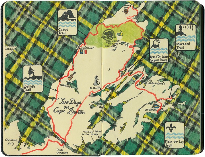
Cape Breton map sketch by Chandler O'Leary

Celtic Colours

Well, okay, my visit missed the actual Celtic Colours music festival by a couple of days (sad but true). But even a short two days on Cape Breton gave me a nice taste of the Celtic heritage of the island—

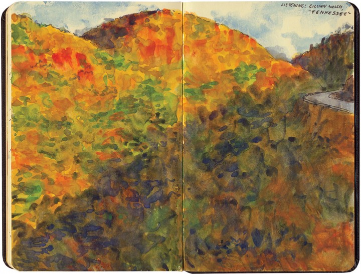
Cabot Trail sketch by Chandler O'Leary

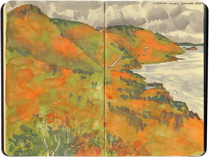
—as well as a panorama of stunning autumn color, absolutely everywhere I looked.

If that’s not a good consolation prize, I don’t know what is.

Cabot Trail sketch by Chandler O'Leary