Tag Archives: Oklahoma

Route 66 sketch by Chandler O'Leary

Faux-tem poles

This post is part of an ongoing series called 66 Fridays, which explores the wonders of old Route 66. Click on the preceding “66 Fridays” link to view all posts in the series, or visit the initial overview post here.

If you travel any length of Route 66, you can expect to see some fake teepees along the way. Totem poles, on the other hand, are a bit more of a surprise.

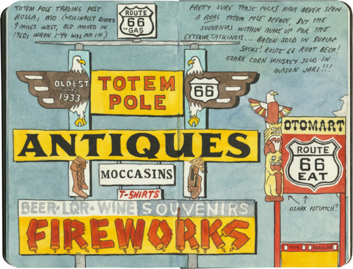
Well, I say totem poles, because they call them totem poles, but as you can probably guess by the fact that this sign sits in the middle of the Ozarks, this is the closest these things are going to get.

Route 66 sketch by Chandler O'Leary

Oklahoma’s version is even less like a real totem pole, and more like a giant muppety decoupaged Coke bottle. (It’s not even technically on Route 66, but a few miles down a side road.) Still, this thing is an icon of the Mother Road, and I’m glad to see it being kept in fine fettle for the next traveler who meanders down the road.

Save

Save

Save

Save

Save

Save

Potawatomi beadwork sketch by Chandler O'Leary

Glass pixels

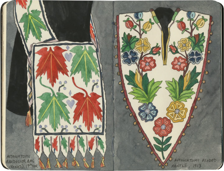
Whenever I’m in Tulsa I try to make time for the Gilcrease Museum, a place devoted to the art of the American West. Yet as much I love perusing the galleries of Russells and Remingtons and Catlins, what I’m really there for is the beadwork. The Gilcrease, whose namesake was himself a member of the Muscogee (Creek) Nation through his mother’s side, boasts a collection of around 25,000 ethnographic objects. Many of these are artistic pieces created by Plains peoples of the first half of the 19th century—a time of wealth and prosperity for many Indigenous nations, which generated some of the finest design and craftsmanship this continent has ever seen. The beadwork is my favorite because it still looks so fresh and contemporary. With each seed bead acting like a pixel on a screen, there are infinite possibilities for each hand-sewn grid of colors and shapes. And the glass beads will never fade the way prints or paintings will over time. Every bandolier bag, every moccassin seems as if the person who made it had just stepped out of the room—as if all I had to do was wait a moment to have a chat with them.

Yukon's Best Flour sketch by Chandler O'Leary

Flour flurry

This post is part of an ongoing series called 66 Fridays, which explores the wonders of old Route 66. Click on the preceding “66 Fridays” link to view all posts in the series, or visit the initial overview post here.

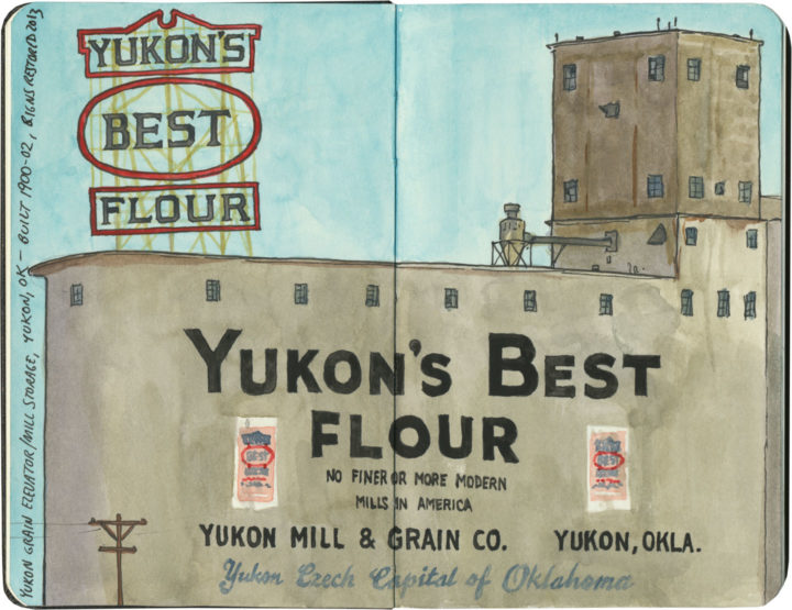
It’s not entirely clear to me why the founders of Yukon, OK named their town after the Yukon Gold Rush, nor why its county is called Canadian County. But on the day of our visit to the Yukon of Route 66, the only blizzard we might possibly have witnessed was one of enriched white flour.

Route 66 sketch by Chandler O'Leary

Fill ‘er up

This post is part of an ongoing series called 66 Fridays, which explores the wonders of old Route 66. Click on the preceding “66 Fridays” link to view all posts in the series, or visit the initial overview post here.

Polly want a pit stop?

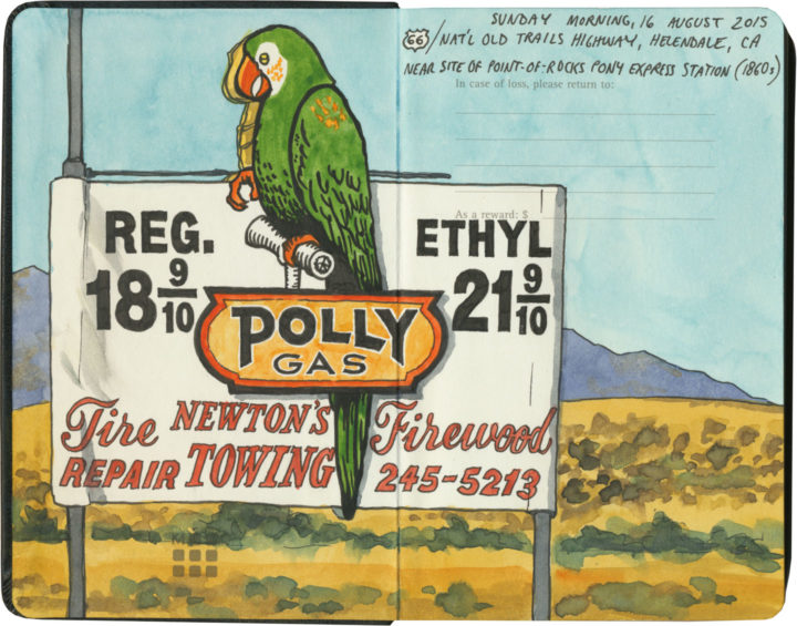
If you’re going to take a road trip, at some point you’re going to need to refuel. And nobody knows how to fill your tank like the folks on Route 66. Of course, since the route crosses a big swath of American oil country, you’ll know that the milk of the Mother Road is petroleum.

Route 66 sketch by Chandler O'Leary

Cuba, Missouri

The thing is, though, the designers and architects and advertisers and engineers responsible for putting gas stations all along the route got into the spirit of 66 in their own unique ways. Forget what you know about ugly garages lining Interstate exits—many of Route 66’s filling stations are downright works of art.

Route 66 sketch by Chandler O'Leary

Cuba, Missouri

And many of them look absolutely nothing like gas stations.

Interestingly, the Mother Road was built at a time when more and more Americans owned automobiles—all over the country there was an increasingly large demand for petrol. Filling stations moved into town centers and residential neighborhoods, and some oil companies wanted their fuel stops to blend in with the neighborhood architecture.

Route 66 sketch by Chandler O'Leary

Since American architecture is highly regional in nature, many of these “camoflaged” filling stations took on the look of their local culture—Spanish-Mission-style canopies in California, limestone façades in the Ozarks, clapboard farmhouse lookalikes in the Plains, etc. And then, of course, architectural tastes changed over the years, so you’ll find examples from the Victorian era to midcentury pop-Googie, and everything in between. (Not to mention the tradition of kitschy filling stations shaped like random objects or weird ho-made roadside giants.) Finally, each oil company wanted to attract customers away from the others, so they relied on creating distinctive architectural styles as a form of branding. The result is a veritable encyclopedia of diverse and spectacular specimens—and Route 66 might just have the best collection of all.

Route 66 sketch by Chandler O'Leary

Albuquerque, New Mexico

After a few hundred miles, we started getting really good at spotting the buildings that used to be filling stations (this is an obvious one, but many had been deeply camoflaged, or totally remade in some other image, or else fallen into ruin). And we also developed a knack for pegging which style belonged to which company (above is a classic 1930s Texaco design).

Route 66 sketch by Chandler O'Leary

Tulsa, Oklahoma

Then again, sometimes a building would throw us completely—the sealed-up garage bays hint at the Blue Dome’s history, but if I didn’t know better, I would have guessed this was once a Greek Orthodox church or something.

Route 66 sketch by Chandler O'Leary

Spencer, Missouri

The filling stations of Route 66 also serve as markers of time’s passage, and the rise and fall of communities along the way. This one is all that remains of a ghost town in Missouri that fell into disuse when the highway changed its route. (I’m not talking about the advent of the Interstate, either, although that’s a common story—this place lost its prime spot decades before that, when the 66 alignment was simply moved to a spot further south.)

Route 66 sketch by Chandler O'Leary

Ranco Cucamonga, California

While many petroleum relics have faded into oblivion, others are being brought back, at least in some form or other. Above is one of the oldest specimens we found (it actually predates the birth of Route 66 by nearly a decade). While part of the structure has been torn down, at least the main part of the station is getting a lovely facelift.

Route 66 sketch by Chandler O'Leary

Needles, California

It’s not just the oldest samples being preserved, either. This guy is only a little over fifty years old, but it, too, has been returned to its former glory.

Route 66 sketch by Chandler O'Leary

Normal, Illinois

For many old stations, however, the opposite is true. Countless specimens either sit empty, their original purpose unknown to the average passerby—or else they get cannibalized and transformed into some other creature, usually without any fanfare.

Route 66 sketch by Chandler O'Leary

Hydro, Oklahoma

These stories of disrepair and restoration interest me greatly, of course, but what really gets me is the story of each place: the whys and wherefores of each station, and the tastes and quirks of the people who either built or ran them.

Route 66 sketch by Chandler O'Leary

Cool Springs, Arizona

After all, Route 66 crosses through some seriously unpopulated territory. Many of these old filling stations were the only game in town—or in the most remote corners, something closer to the last chance for salvation.

Route 66 sketch by Chandler O'Leary

Commerce, Oklahoma

While others, meanwhile, live on in notoriety, attracting tourists to the spots where blood was shed or infamous characters once stood.

Route 66 sketch by Chandler O'Leary

Odell, Illinois

Still, most tell the story of perfectly ordinary people running perfectly ordinary businesses along one of the backbones of American travel and commerce. They might be extraordinary today, but usually that’s boils down to having somehow lasted long enough to stand out amongst more modern surroundings.

Route 66 sketch by Chandler O'Leary

Shamrock, Texas

I’m glad, at least, that I’m obviously not the only one who has noticed these things—that there is an army of conservators and historians and artists and boosters out there, preserving as many of these old filling stations as possible, and documenting the ones that can’t be saved.

I know that these days, oil companies have fallen out of public favor (heaven knows I have my own beef with the oil industry)—regardless of their nostalgia, these places are also reminders of American excess and the damaging effects of fossil fuels. Yet however we may be careening toward Peak Oil, these relics still have a place on the Mother Road—the path that might just traverse this country’s Peak History.

Save

Save

Save

Save

Save

Save

Save

Save

Roadside fortress

This post is part of an ongoing series called 66 Fridays, which explores the wonders of old Route 66. Click on the preceding “66 Fridays” link to view all posts in the series, or visit the initial overview post here.

Route 66 has ruined souvenir shops for me forever. I mean, I thought I had high standards after growing up on Wall Drug, but the Mother Road is home to all manner of souvenir shops housed in buildings ranging from interesting to downright nuts. Whether you’re buying snow globes in a Tipi or braving wild burros to get to your t-shirts, you’ll never have to worry about trying to find a postcard in a big box store on this road.

In keeping with tradition, Chandler, Oklahoma, sells its souvenirs in an honest-to-goodness fortress. Of course, the souvenirs weren’t what we came for—we came for the gorgeous Works Progress Administration (WPA) architecture and the top-notch museum and interpretive center inside. But you know, since we were already there and all, we figured it would just be wasteful not to stock up on shield-shaped fridge magnets and keychains at the same time…


Route 66 sketch by Chandler O'Leary

The proof is in the pavement

This post is part of an ongoing series called 66 Fridays, which explores the wonders of old Route 66. Click on the preceding “66 Fridays” link to view all posts in the series, or visit the initial overview post here.

It’s easy to take for granted the fact that the American West is crisscrossed with highways nowadays, but those highways didn’t get there by chance. If you look closely at the routes those highways take, you can give yourself an excellent crash course in history, both human and natural. Overland exploration, trade routes, desert basins, animal migration, continental drift…all these things and more are hinted at by the map sketched out by the U.S. highway system.

Let me explain what I mean. If you happened to grow up in the Midwest, chances are your mental map would be dictated by a grid that follows the cardinal directions. In the Great Plains, particularly, where the landscape is mostly flat, dividing property lines and town borders into a standard grid makes the most sense. Much of the United States west of the Appalachians is arranged this way, in fact, in a basic grid called the Range and Township system. The system overlays a simple framework of one-square-mile sections over the entire western two-thirds of the country, dividing the landscape into rangeland for farming and six-mile by six-mile townships. Interestingly enough, we have Thomas Jefferson to thank for this system, which he devised in 1785 as a way to manage the vast swaths of land that, after the Revolution (and some years later the Louisiana Purchase), now belonged to the U.S. His reasoning, I think, was both practical and lofty: as a farmer himself, he was looking for a workable alternative to the inherited system of Metes and Bounds, England’s age-old framework for managing farmland and water access. While that system worked for the colonies, each roughly comparable in size and topography to what they knew in the Old World, the old framework wasn’t scalable to the size of the new West—particularly when tracts of land were being sold off sight-unseen to settlers and prospectors. But beyond the practical logic, I think Jefferson had more philosophical motives behind his plan. This is the guy who designed Monticello, after all, a monument to neoclassical thinking and an homage to ancient Greece and Rome. The Range and Township system applied a sense of order—however illusory—to the uncharted wilds of the West. It brought rational thought and a sense of opportunity to an area associated with chaos and the fear of the unknown.
Route 66 sketch by Chandler O'Leary

If you’ve ever visited the Great Plains, you can still see Thomas Jefferson’s plan in evidence, from the straight-as-an-arrow farm roads in rural areas, to the faithful system of thoroughfares in cities like Tulsa or Dallas, where the roads always travel from A to B in a straight line, with traffic lights appearing like clockwork at precise one-mile increments, and tenth-of-a-mile residential blocks in between.

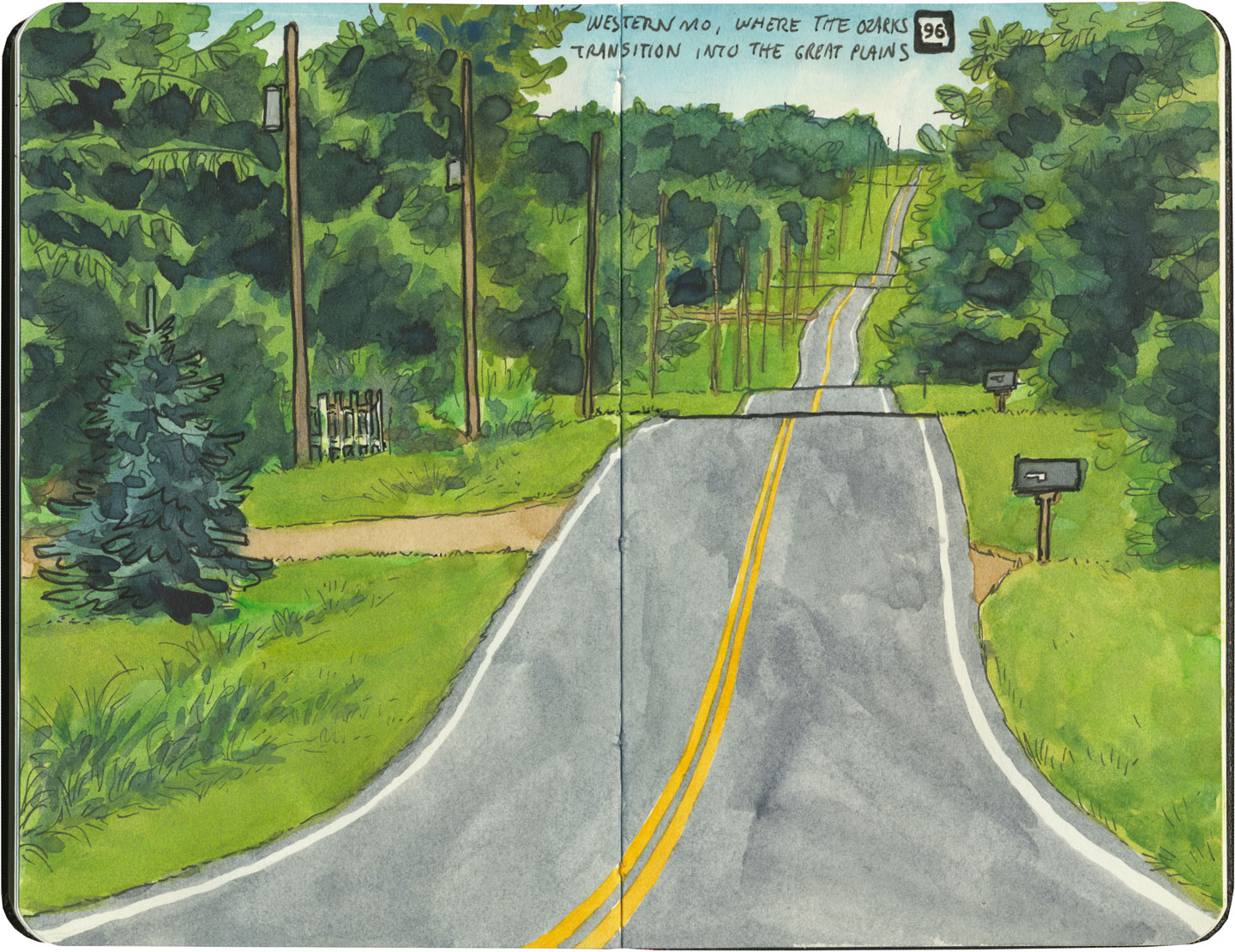
But here’s the problem: Thomas Jefferson never laid eyes on the West he gridded out like a piece of paper. He never saw nature’s rebuttal to rationality in the Rockies or the Colorado Plateau. It’s all well and good to have a sensible grid in a flat place, without major physical features to interrupt the plan. But in many parts of the West, Jefferson’s tidy squares becomes utterly useless. You can’t easily farm a quadrangle of land that’s bisected by a canyon, and you can’t run a road up and over a mountain. Travel in a straight line is impossible in many, many places. As everyone from Chief Joseph to Lewis and Clark to highway engineers could tell you, there are some places in the West where only one route overland is possible—or none at all.
Route 66 sketch by Chandler O'Leary

So if you look at a modern highway map of the western half of the United States, the limitations geography places on rationality are obvious. You can see precisely where the Corps of Discovery found their way to the Pacific Northwest, or where the stagecoaches hauled goods to Santa Fe, or how the Mormon pioneers tumbled out of the mountains to the Great Salt Lake, or the supply route linking the California Missions to Mexico. It’s all there, because centuries later we’re still traveling the exact same routes that humans always have, dodging mountains and following water to whatever their destinations were. The Conestoga wagons followed the game trails and trade routes of the various Indigenous peoples. The railroad followed the pioneers’ wagon tracks. The first pavement slabs paralleled the railroad grade, and modern Interstate freeways zoom right over many of those original roadbeds and trailways. Even the technology of conveyance was based on the older methods of travel—just look at the wheel base on a modern car, whose width matches that of railroad cars, themselves directly descended from the lineage of horse-drawn wagon measurements.

As you can probably guess by my long-winded introduction here, this stuff ties square in with Route 66 and the path it cuts to the Pacific.
Route 66 sketch by Chandler O'Leary

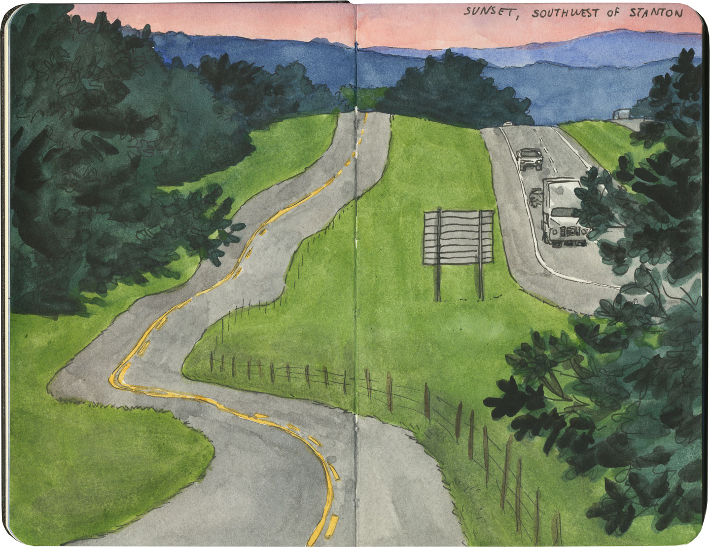
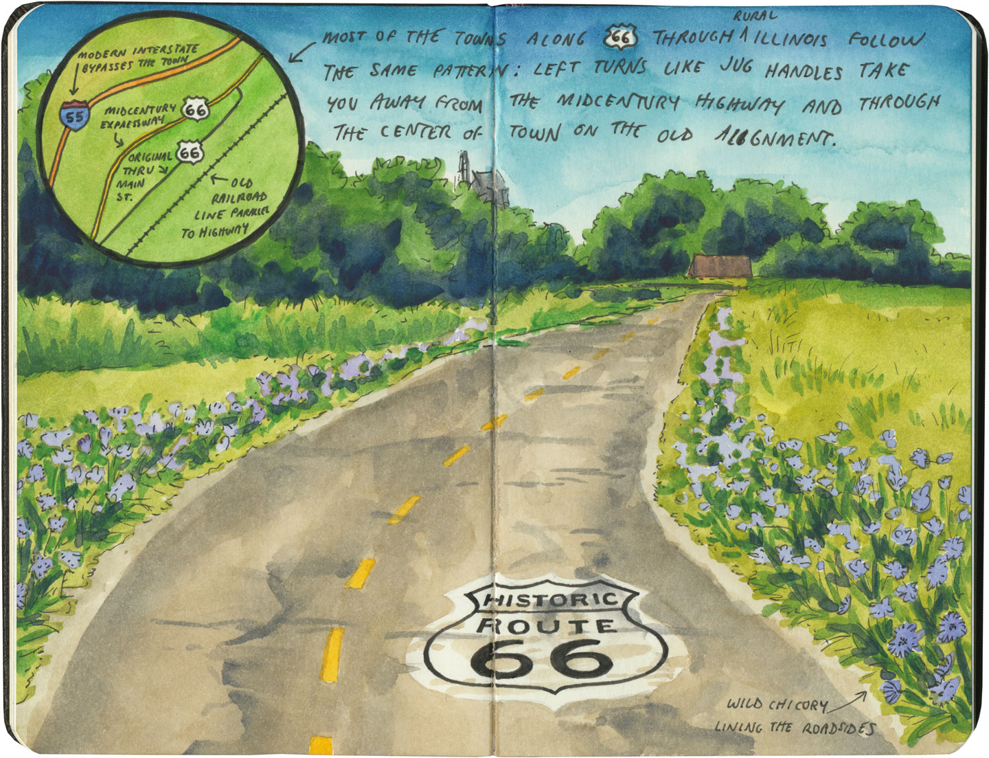
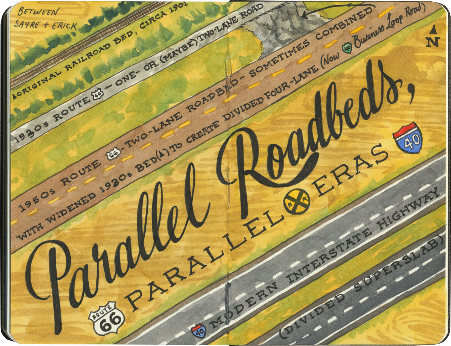
There are many places along Route 66 where you can see this progression of transportation history unfold before your very eyes. In flat places like central Illinois or eastern Oklahoma, there was no reason to reuse the same roadbed over and over again—they had all the land in the world at their disposal, and nothing to impede their path. So they simply built the new road alongside the old—over and over again.
Route 66 sketch by Chandler O'Leary

The result is a network of parallel lines, each wider than the last, each laid down at a different point in recent history. In these places, the land acts like a palimpsest, marked over and over again with new traceries of roadbeds, while the old ones, though crumbling in disrepair, still remain visible.

Route 66 sketch by Chandler O'Leary

Since Route 66 was decommissioned as an official national highway, there are places where it’s difficult to discern the original route. The old roadbed might be there, but the Mother Road can get lost amid a modern tangle of frontage roads, diversions, and replaced pavement.
Route 66 sketch by Chandler O'Leary

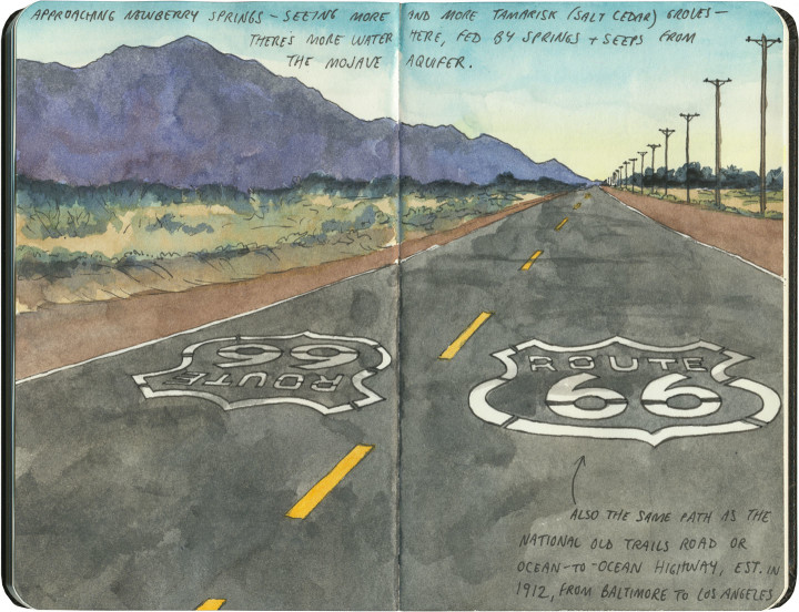
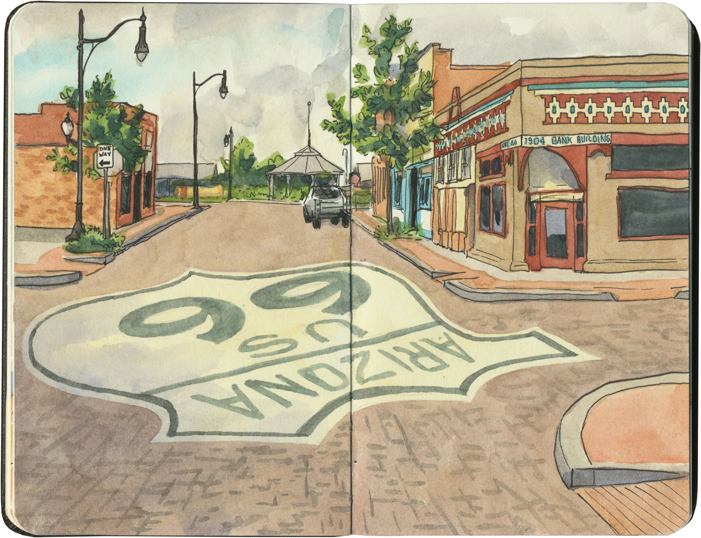
Part of the joy of traveling Route 66 is learning to recognize the old road. In some places, the path is lit up like a beacon with painted pavement and restored waymarking…

Route 66 sketch by Chandler O'Leary

…in others, tracing the original marks on the palimpsest becomes something of a quest.
Route 66 sketch by Chandler O'Leary

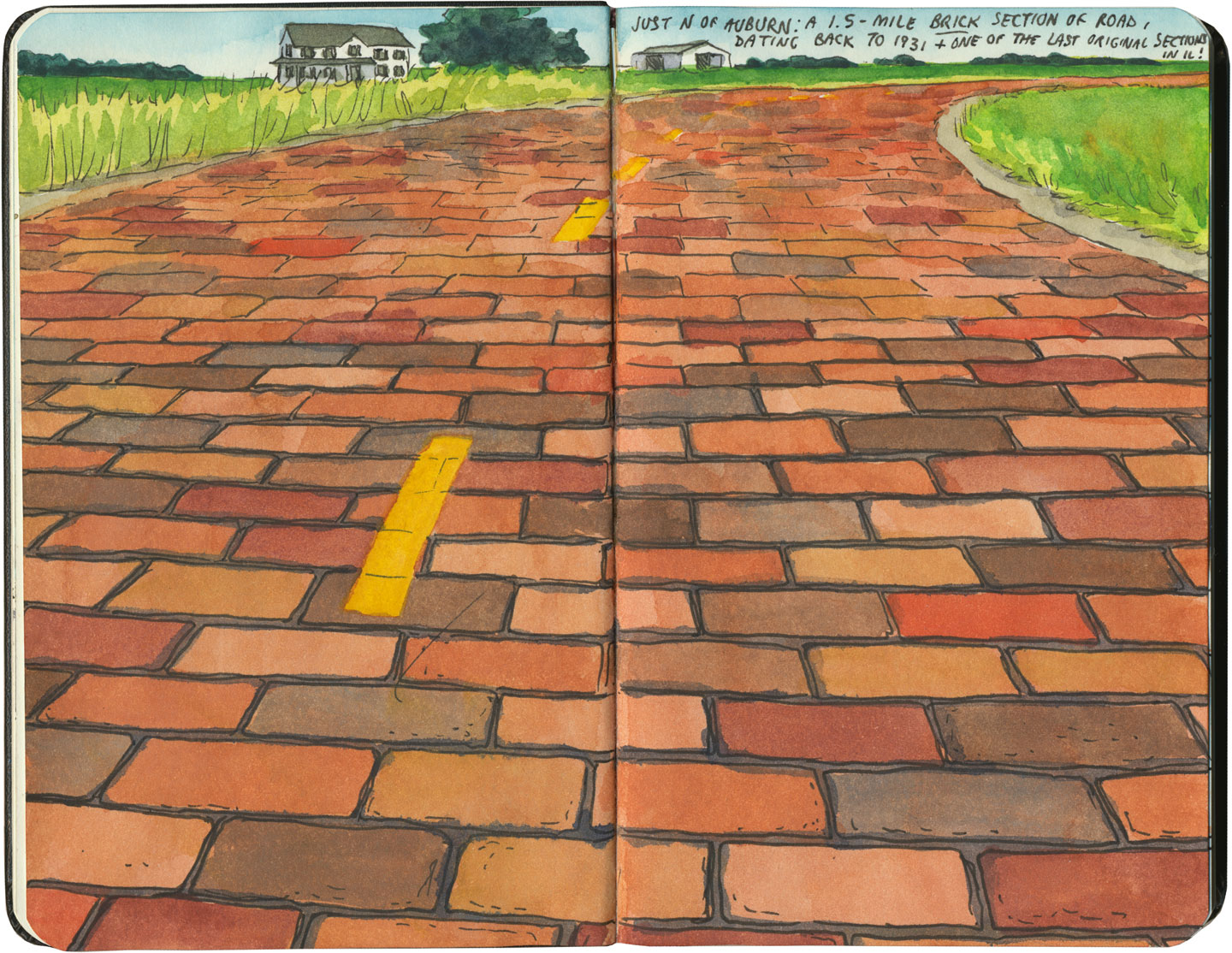
And then there are the places where the original pavement itself becomes the attraction along the way—like this gorgeous stretch of brick roadway in Illinois, paid for in the 1930s by a brick magnate and lovingly maintained as a curious relic of the past.
Route 66 sketch by Chandler O'Leary

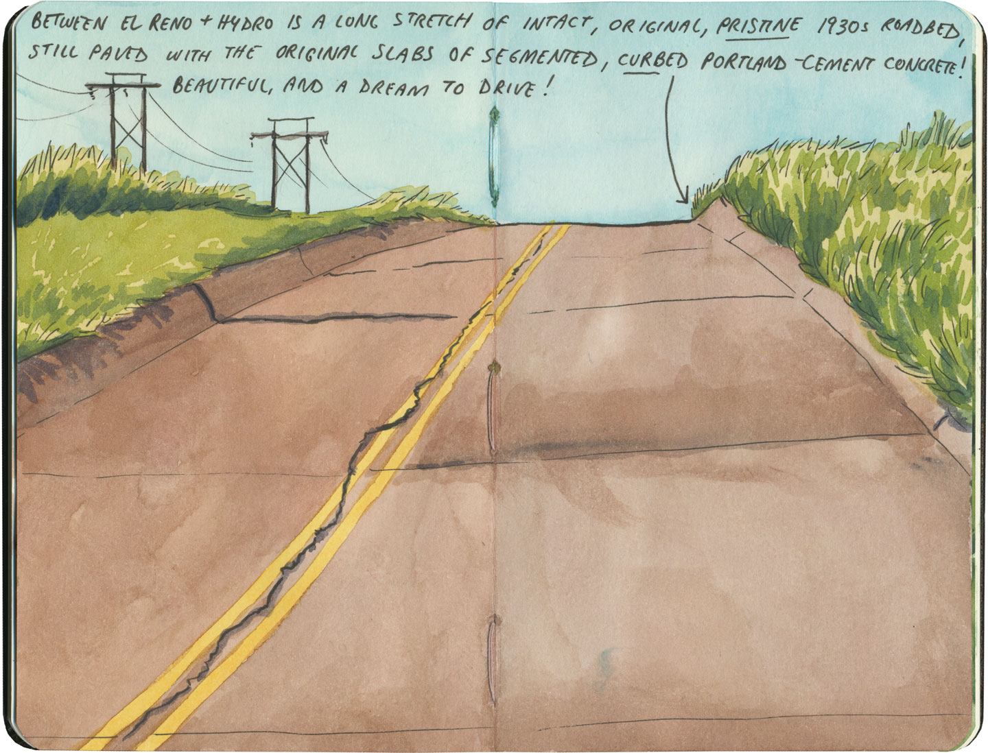
My favorite of all was the long section of 66 that traverses central Oklahoma: the combination of good craftsmanship and a remote locale has preserved the original roadbed impeccably. It sounds nerdy to say it out loud, but I dare any 66 enthusiast not to feel a thrill when seeing that curbed Portland cement.
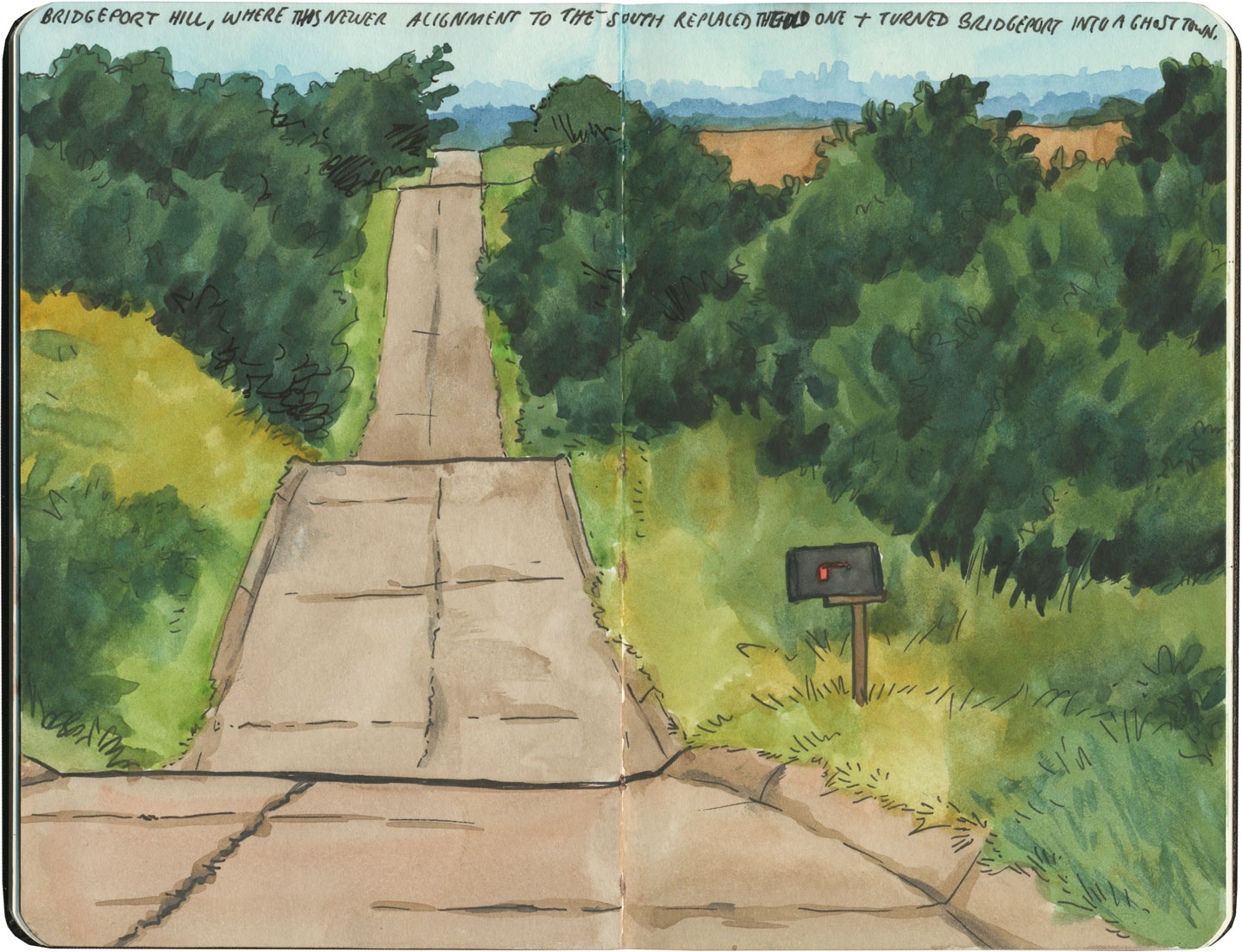
Route 66 sketch by Chandler O'Leary

By the end of our journey, we’d gotten really good at spotting the difference between old and new along the way. And whenever we lost the thread of the route (easily done, since there are so many alignments, many of which have been replaced or buried under modern roads), it became easier and easier to spot the hints that would lead us back to the Mother Road.
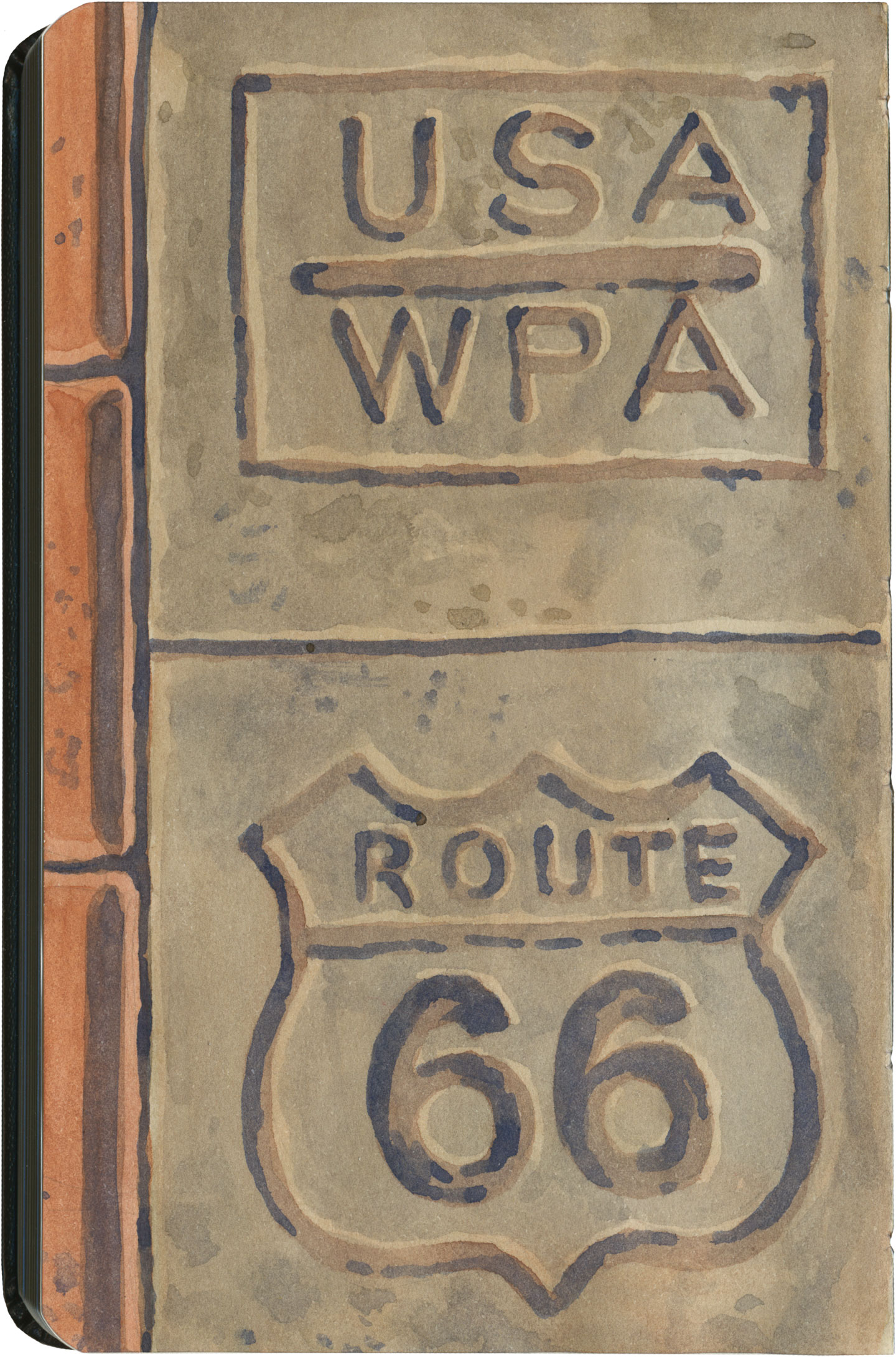
Route 66 sketch by Chandler O'Leary

What led me to travel Route 66 was a love of history and Americana, and a desire to travel a well-worn and well-loved path. I had no idea that it would be so much more—and something much closer to the feeling of solving a mystery. Beyond the fun of diners and neon, there’s a richer, subtler 66 to be discovered, if you’re willing to look a little deeper. All the clues are there—some of them stamped right into the pavement underfoot.

Save

Save

Save

Save

Save

Save

Save

Save

Save
Route 66 sketch by Chandler O'Leary

(Dairy) king of the road

This post is part of an ongoing series called 66 Fridays, which explores the wonders of old Route 66. Click on the preceding “66 Fridays” link to view all posts in the series, or visit the initial overview post here.

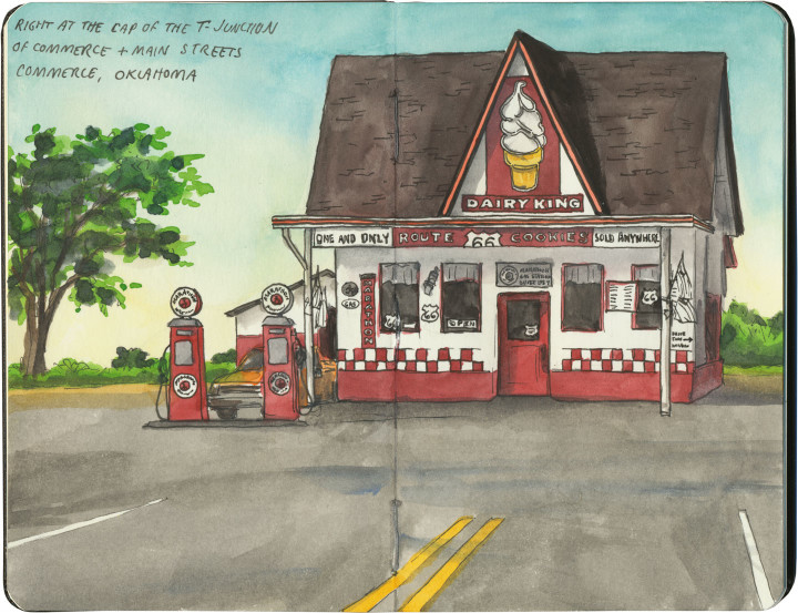
If you happen to drive Route 66 in the summer, like we did, you might just find yourself pulling into Commerce, OK at the hottest part of an absolutely scorching day. If that’s the case, this former filling station will appear on the horizon first like a desert mirage, and then like a beacon of hope.

Apparently the unique draw of the Dairy King is the legendary Route 66 cookie (yes, a cookie shaped like US Highway shields!), but I have to confess: sometimes all you want on a hundred-degree day is a little something frosty.

Route 66 sketch by Chandler O'Leary

Oklahoma Pantheon

This post is part of an ongoing series called 66 Fridays, which explores the wonders of old Route 66. Click on the preceding “66 Fridays” link to view all posts in the series, or visit the initial overview post here.

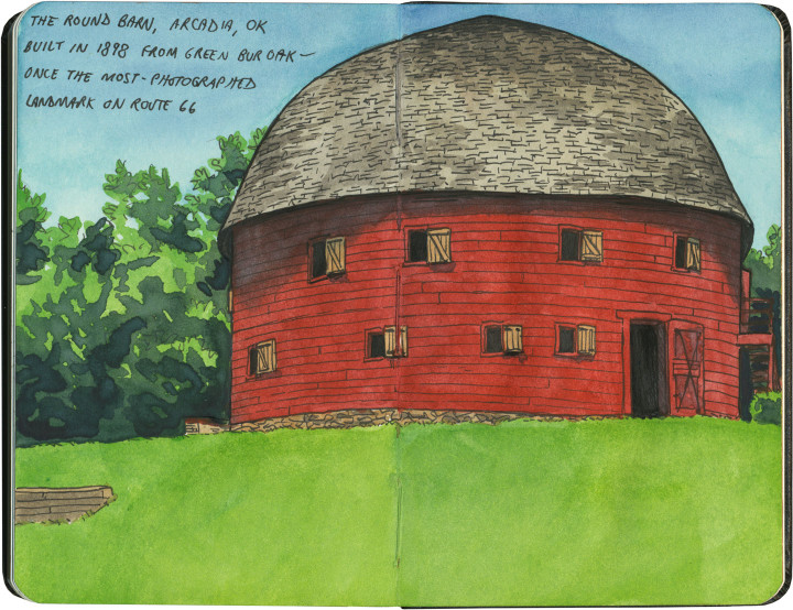
Last Friday’s post was a bit of a downer, I know. So today, as we move into the Sooner State, it seems like a good idea to visit a real beauty of the Mother Road: the Arcadia Round Barn. Built out of green wood carefully bent into precise curves, the barn is the only truly round (and not polygonal) barn in America. Its unique status and beautiful proportions made it the most photographed landmark on Route 66.

Route 66 sketch by Chandler O'Leary

It was hotter than blazes in the loft, but well worth suffering the heat. Because up there, surrounded by all that curved wood and perfect geometry, it felt more like the work of a Renaissance master than a humble farmer.

Save

Route 66 sketch map by Chandler O'Leary

Mother Road, mother lode

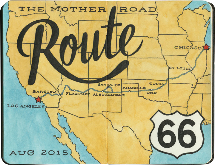
Last summer the Tailor and I spent a couple of weeks traveling every inch of old Route 66. And then I kept pretty quiet about it, because I just had no idea how to organize and share the sheer number of sketches and stories I came away with afterward. There really is no “long story short” way to do this—like the Mother Road itself, there are too many branches and tangents for a single linear tale. So like I did for my Mission Mondays series, I’m going to break this down into 66 Fridays, starting today and running through spring of next year. (You can follow along by using the 66 Fridays tag.)

So each week for the next 66 weeks, I’m going to share a piece of Route 66—and like everything else on this blog (except the Mission series), those pieces will be in no particular order. There are a zillion books out there already that tell the Route 66 story from beginning to end (both in time and space), so that frees me to, er, paint a slightly different picture. I’ll be jumping around from state to state, highlighting my favorite landmarks and historical tidbits. With any luck, it’ll give you a good enough taste of the Mother Road that it’ll inspire you to explore it for yourself.

Route 66 sketch by Chandler O'Leary

A few notes:

• There’s a common perception that Route 66 is long gone, and that modern travelers can only drive bits of the route. That’s actually not true. While modern Interstate highways have replaced long chunks of the Mother Road in certain spots, it’s actually possible to drive over 80 percent of the original route—including the original road bed and even 90-year-old pavement in several places. Route 66 was officially decommissioned as a U.S. highway decades ago, but the old thread is still there, still nearly intact, just waiting for an adventurous traveler with a sharp eye to find it.

• We didn’t see everything there is to see on Route 66. Not even close. We spent nearly two weeks on the Mother Road, and by my estimate we would have needed a good month, at least, to really take it all in. Considering how much more there would have been to see years ago, before so many places closed down or fell into ruin, it all boggles my mind a bit. Nevertheless, this trip was a good first taste of the whole thing. I made the Tailor promise me that someday we’d do it all again, and take however much time we wanted.

• Even though we didn’t see everything along the way, we did our darndest to drive every inch of the route that remains—and that’s no small feat, considering how many tributaries, diversions, parallel routes, rerouted sections, poorly-marked bits and dead ends there are. I’d driven bits of 66 before, but never the whole stretch in one go. It feels like a real accomplishment that we did that.

• I hope you don’t hate vintage signs, because you can expect a lot of them in the coming months. I’ll try to keep the posts balanced between various subject matters, but I’m not gonna lie: there’s a metric ton of incredible vintage signage along Route 66, and I did my level best to draw all of it. I have whole sketchbooks just devoted to neon. I probably won’t show you everything, but you will see an awful lot of it.

Route 66 sketch by Chandler O'Leary

So buckle your seatbelts and pull out your paper maps—let’s get this show on the road, and embark upon the serious business of getting our kicks.

Save
Blue Whale of Catoosa sketch by Chandler O'Leary

Feeling blue

I’m not sure if kids used to find this guy diverting or terrifying, but the Blue Whale of Catoosa is still just as memorable as he must have been in his heyday.

Blue Whale of Catoosa sketch by Chandler O'Leary
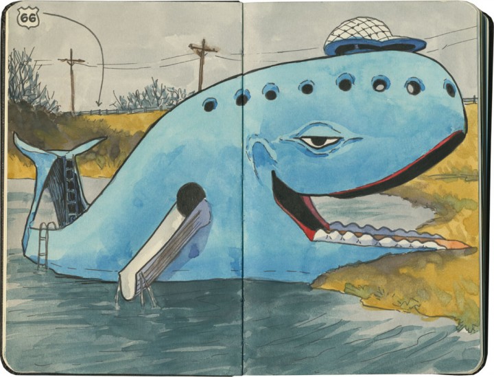
This spot was once a roadside swimmin’ hole along Route 66. These days it’s just a roadside monument, but that’s okay—it’s not like we were there at the right time of year.

Blue Whale of Catoosa sketch by Chandler O'Leary

It didn’t matter—all of a sudden, we felt like we were eight years old again.

Blue Whale of Catoosa sketch by Chandler O'Leary

* * *

Today is the last day to vote for the best Twine Ball! Hurry and cast your vote, and we’ll declare the winner on Facebook tomorrow!