Tag Archives: road

Seattle Viaduct sketch by Chandler O'Leary

The road overhead

We got stuck in some serious traffic on our way to the game yesterday, which had me wishing we had taken the Viaduct into town instead. That made me remember this sketch I did a couple of summers ago—one of several I’ve done over the years, knowing full well that the Viaduct’s days are numbered.

The Viaduct is an elevated section of Highway 99 that flows into downtown Seattle along the waterfront. It’s been the focus of controversy for years (crumbling infrastructure, real estate and tax feuds, voter indecision, construction fiascos, indefinite timelines, etc.), but whatever your opinion of it might be, it’s unquestionably a city icon. Personally, I’ll miss the experience of coming into the city by the Viaduct, with its spectacular views of the skyline and the Sound. And I already miss my trusty network of shortcuts, now blocked by the construction zone and the already partially-demolished highway. But whatever is coming, and whenever it does, I plan to have plenty of sketches under my belt by which to remember it.

California Missions map sketch by Chandler O'Leary

Mission: Impossible

This is the first installment of my Mission Mondays series, exploring all 21 Spanish Missions along the California coast. You can read a recap of all 21 missions and find a list of all 21 posts in the series at this link.

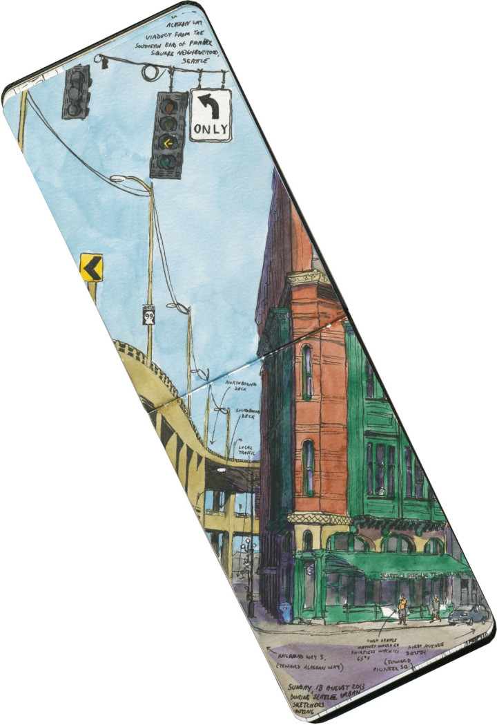
Remember earlier this year when I took my big California trip? Well, a work event made it possible to get down there, but my real goal for the trip was to visit all 21 Spanish missions along historic El Camino Real. Ever since my first mission visit two years ago, I had been dying to see them all in one fell swoop. It took me a little over a week to get to them all (which was actually very difficult—especially when you’re trying to allow enough time for even unfinished sketching; I’d have loved to take two weeks instead), and it felt like a real accomplishment to travel every inch of the old King’s Highway. Each mission is so different—unlike the National Parks system, these properties are affiliated with each other only in the historical sense (more on that later). So rather than try to choose a representive few sketches to show you, I thought I’d recreate my journey here. Since Memorial Day typically marks the unofficial start of summer, today seemed like a good day to start a series of Mission Mondays for the season ahead.

Before I begin in earnest, though: a couple of disclaimers. I’m not Catholic, so on my mission trip I was merely a secular tourist, not a religious pilgrim. However, to this day almost every mission is still an active, functioning church; so I did my best to be respectful of the sacred spaces I was visiting. Sometimes that meant refraining from going inside while a mass or other event was taking place—so I didn’t end up seeing the interiors of every single mission. Still, you’ll get the idea.

Here’s the other thing: I am well aware that as an area of interest, the Spanish missions are problematic. After all, these are the places where an encroaching culture subjugated and indoctrinated the Indigenous peoples of California. Thankfully, most of the missions now have updated interpretive exhibits that address this part of their history; if you’re interested in learning more about these places, I highly recommend seeking out that information. But since that story exists elsewhere, and is only one narrative of many, it’s not the one I’ll be telling here. As an artist, I’m most interested in the architecture and setting of these places—so that’s the story I’ll be telling through my sketches.

Detail of California Missions map sketch by Chandler O'Leary

Okay! Here we go. When visiting the 21 California missions, you’ll be tempted to go chronologically, in the order in which they were built. However, that’ll have you doubling back all over the state—most people just start at the bottom and work their way up. So let’s start in San Diego, at the southernmost mission in modern-day California. In fact, the adventure begins just a few miles from the Mexican border.

Mission San Diego de Alcala sketch by Chandler O'Leary

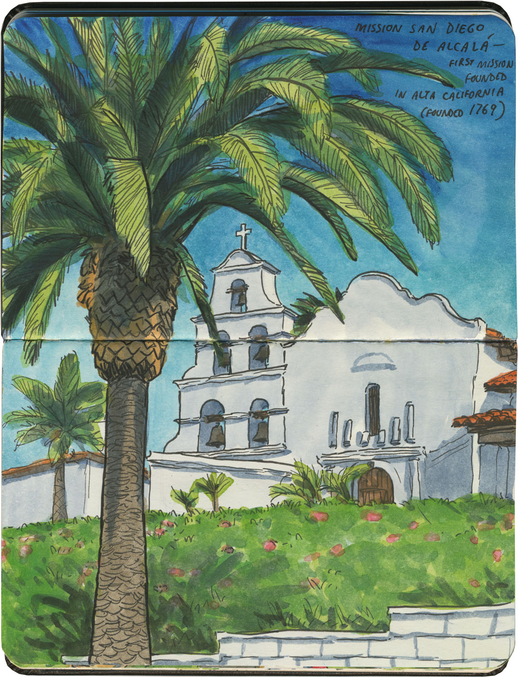
Mission San Diego de Alcalá also happens to be the oldest of the missions in “Alta California” (Upper California; the name dates back to when Spain controlled the southwest. Alta California was the northern half of the territory; Baja California is still intact as a state in Mexico, with 30 more missions of its own.). It’s also the one I was most looking forward to, since I’d never been that far south in California before.

Mission San Diego de Alcala sketch by Chandler O'Leary

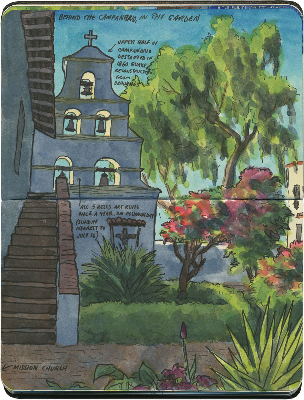
It turns out I picked the right season to see it. It was mid-February, so it wasn’t hot yet (though still a pleasant 80 degrees), and the courtyard was ringed with blooming hot-pink bougainvillea.

Mission San Diego de Alcala sketch by Chandler O'Leary

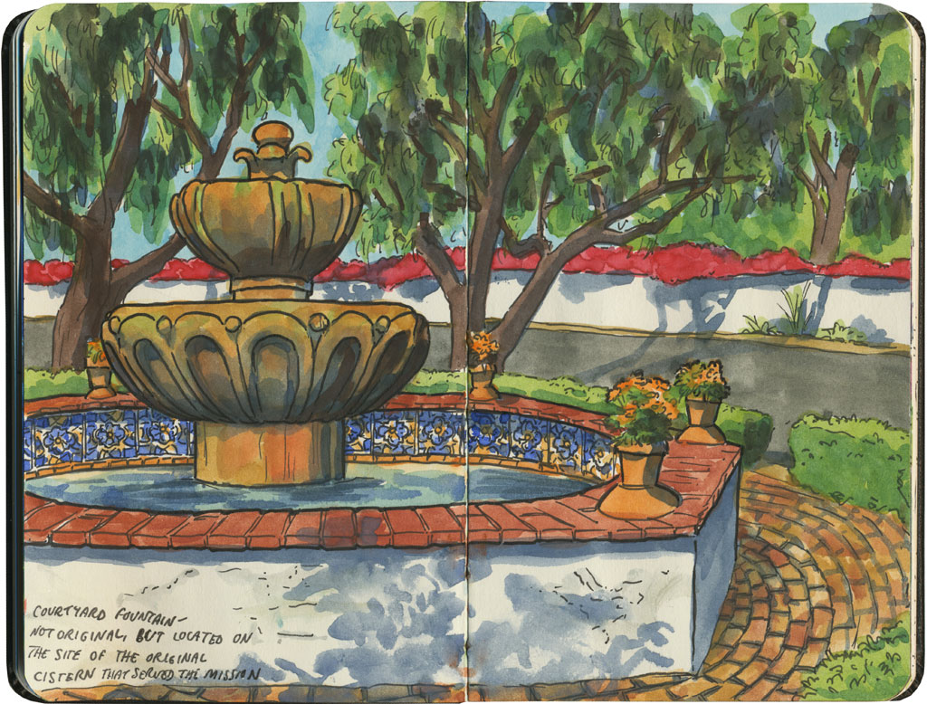
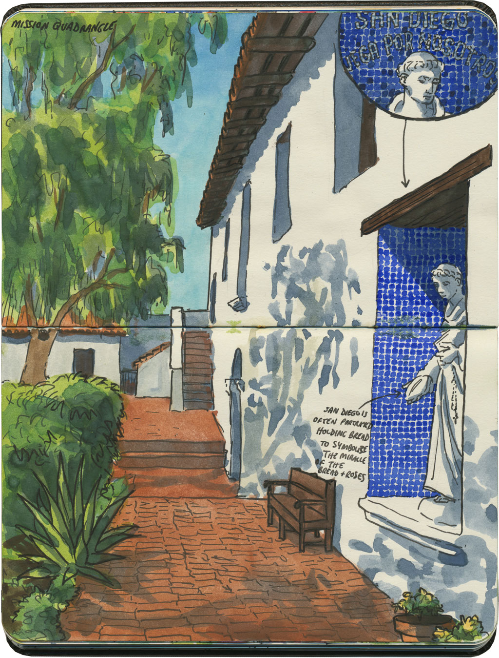
The place had all the hallmarks I had come to recognize in most of the missions: high, white adobe walls, a pitched, wooden-and-tile roof, and at least one interior courtyard.

Mission San Diego de Alcala sketch by Chandler O'Leary

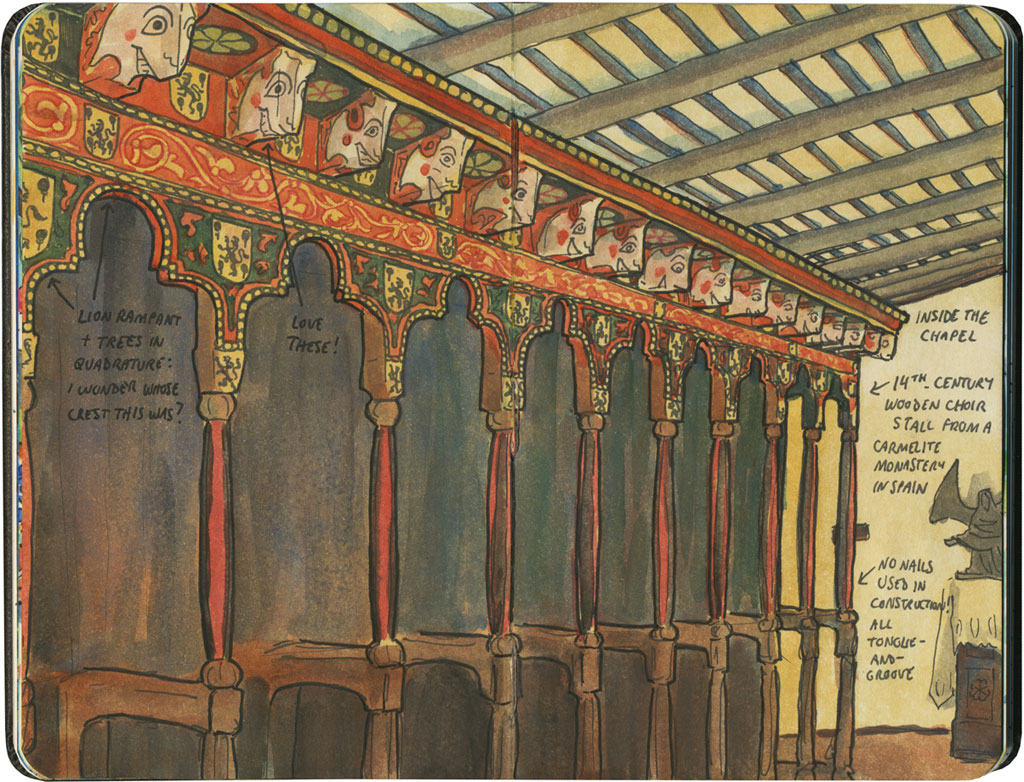
This one had a surprise extra, though: a modern chapel built with much older elements. This choir stall was originally built in Spain, seven hundred years ago—somehow it made the whole place feel like a slice of old Mexico City instead of San Diego.

Mission San Diego de Alcala sketch by Chandler O'Leary

I wandered through the complex as thoroughly as I could, but in the end I just kept coming back to the bells. Not every mission has a campanario (or campanile), but it’s the bells that I think of when I picture any mission. The bells are what inspired me to take this trip in the first place—and it felt good to have the image transformed from one in my head to one on paper.

Save

Save

Glacier National Park sketch by Chandler O'Leary

Engineered by mountain goats

When I’m planning a road trip, I try to avoid interstate highways whenever possible. When in doubt, state and U.S. highways are almost always a better choice—both for scenic drives and for interesting road vistas. But even better than that are the roads through most national parks—which are specifically designed to give visitors the most beautiful drive imaginable. And by that logic, Glacier National Park’s Going-to-the-Sun Road might just be the most spectacular ribbon of road in the whole country.

Glacier National Park sketch by Chandler O'Leary

Going-to-the-Sun Road is both a feat of engineering and a marvel of determined highway maintenance. It’s only open for a few months every year, and takes weeks to clear of snow before it opens in the summer. It’s also not for the faint of heart—I love mountain driving, but I don’t love heights, and even at our crawling pace, all those hairpin curves made my stomach plummet to the floor every few minutes.

Glacier National Park sketch by Chandler O'Leary

But oh—oh. I’d gather my courage and brave any precarious goat track for this. I’d cross a continent for a view like that.

And since our day at Glacier fell at the very end of a five-week cross-country trip–that’s precisely what we did.

Save

Rio Grande River Road sketch by Chandler O'Leary

The road less traveled

Since I’ve got a road theme going this week, I thought I’d spend the next couple of posts highlighting some of my very favorite squiggly lines on the map. Everyone seems to have California Highway One at the top of their road trip bucket list (for good reason!), but FM170 in West Texas deserves to be on that list, as well.

Rio Grande River Road sketch by Chandler O'Leary

The River Road isn’t nearly as well-known as the Pacific Highway because it’s in the absolute back of beyond. Whoever coined the term “middle of nowhere” probably had this place in mind—but as it’s right near a national park, it probably also escapes the notice of tourists wanting to take the faster state highway to and from the park.

Rio Grande River Road sketch by Chandler O'Leary

And that’s a shame, because this road is a gem. It winds right alongside the Rio Grande, through the Santa Elena and Colorado canyons, passing ghost towns and old Spanish missions along the way. In the 70-mile section we traveled that day, we only saw one other soul—and that was a local immigration cop parked along the roadside. We didn’t pass a single tourist along the way.

Rio Grande River Road sketch by Chandler O'Leary

I would have loved to drive this road (I have a thing for taking mountain curves with a stick shift!), but I wanted to spend the time drawing. So the Tailor, bless him, tackled the hair-raising turns, and didn’t bat an eye when I made him pull over about a hundred times for spectacular vistas.

Rio Grande River Road sketch by Chandler O'Leary

I can’t recommend this road enough. If you go, though, make sure you have plenty of drinking water, engine coolant, gasoline, and a fresh spare tire, just in case. If you break down, you’re going to need the tools and skills to get yourself back out again—this is the type of route that laughs at puny human concepts like mobile phone coverage (pro tip: there isn’t any) or roadside assistance. This is the kind of place that analog map freaks like me are talking about when we say GPS ain’t all it’s cracked up to be.

Rio Grande River Road sketch by Chandler O'Leary

But if you’ve got a paper map and a good sense of adventure, hit the road: because this is the place.

Save

Black Hills sketch by Chandler O'Leary

The road ahead

Tomorrow this little travel blog turns one year old. In that time, I’ve jumped around in time and place, in hopes of showing you as many different sketches as I could: country scenes, cityscapes, vintage kitsch, wildlife, you name it. But while I love me some roadside attractions, I must confess that my very favorite thing to draw might just be the road itself.

Wyoming road sketches by Chandler O'Leary

My sketchbooks are absolutely full of road sketches—either full scenes that I take time over, or little margin notes that I jot down quickly from the passenger seat as the car moves ahead. I just can’t get enough of them. I’m fascinated by how the road moves with the land, following hills and curves. As I race to put each vista down in the book, the actual road at my feet seems to transform into a painted line—tracing the landscape like a sketchbook drawing on the grandest scale imaginable.

Marin Headlands sketch by Chandler O'Leary

In the past year, I know I’ve shown you quite a few of these road drawings, but I’ve barely scratched the surface of what I have in my sketchbooks. And that’s because even after nearly a lifetime of taking road trips, and many years of drawing them, I still feel like I’m only just getting started.

So here’s to the next year of this blog, and to the road ahead. Thank you for coming along with me for the ride.

Colorado Front Range sketch by Chandler O'Leary

Front Range from the front seat

There are some roads I have traveled so often that I have permanently etched into my memory every landmark, every sign, every single geographical feature along the way. The seventy miles between Colorado Springs and Denver is one of those stretches. When I was a kid, I knew exactly how far we were from our destination by which butte we passed; the profiles of every mountain in every season; and which hill was next to appear on the horizon. Every time I go back, no matter how much farmland has been converted into brand new suburbs, the mountains never change—and my mental map gets retraced with the same lines. On this day, I sketched while the Tailor drove, but I just as easily could have done this from memory—laying out every hill and peak along the route on one long, continuous sheet of paper.

Amish buggy sketch by Chandler O'Leary

Buggy ride

Now, commuting by cowboy hearse or by dinghy might seem a little unusual to us, but for some people, just a family station wagon would be downright outlandish…

This sketch was a complete—and happy—accident. The Tailor and I happened to pass through Amish country on a Sunday, so I figured nobody would be out and about. We stopped just so I could draw a few farm scenes, but while I was at it these folks passed by.

All I can say is I’m glad I had a pencil on me (so I could jot down a rough sketch more quickly)—and that buggies move pretty slowly.

Moonrise sketch by Chandler O'Leary

Only a paper moon

It’s difficult enough to sketch from the passenger seat of a moving vehicle: keeping a steady hand, drawing quickly enough to keep pace with a changing landscape, etc. But when you throw in trying to sketch by moonlight… Well, I guess you just have to be willing to embrace imperfection—and wait until morning to see how everything came out.

Montana night sketch by Chandler O'Leary

San Francisco sketch by Chandler O'Leary

Rainbow road

Judging by the news lately, and all the dire terms like “polar vortex” being bandied about, I think it’s safe to say that most of the U.S. is still in the absolute dead of winter (including my neck of the woods). But I just can’t bear to post another sketch of icicles or snow. So instead I’m thinking back to one colorful California afternoon, with a rainbow of houses on my right, the Pacific on my left, and all kinds of evidence that spring lay just ahead.