Tag Archives: Route 66

Route 66 sketch by Chandler O'Leary

Rec-ommended

This post is part of an ongoing series called 66 Fridays, which explores the wonders of old Route 66. Click on the preceding “66 Fridays” link to view all posts in the series, or visit the initial overview post here.

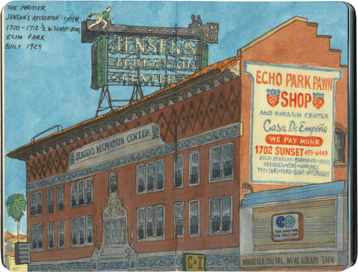
This beauty has stood proud over Sunset Boulevard since 1924, once advertising a bowling alley and billiards parlor. It was one of the very first mixed-use (residential and commercial) spaces in Los Angeles, but like so many other historic landmarks, it fell into disrepair over time.

Route 66 sketch by Chandler O'Leary

Fortunately, it was declared a Los Angeles Historical Cultural Monument in 1998, and carefully restored in the intervening years. The building was recently sold again, but thanks to its status, the Jensen’s bowler will continue throwing strike after strike, on into the future.

Big Texan sketch by Chandler O'Leary

Major beef

This post is part of an ongoing series called 66 Fridays, which explores the wonders of old Route 66. Click on the preceding “66 Fridays” link to view all posts in the series, or visit the initial overview post here.

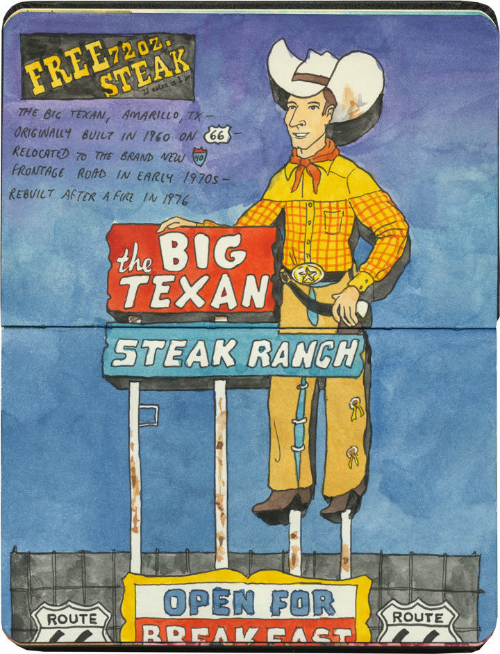
The Mother Road has no shortage of good steakhouses, but nothing quite matches the spectacle of the Big Texan in Amarillo.

Big Texan sketch by Chandler O'Leary

I mean, we know that everything is bigger in Texas, but this place aims to prove it (and proclaim it, if you look closely at the signage in the above sketch!).

Big Texan sketch by Chandler O'Leary

Even the swimming pool (yes, a steakhouse with a swimming pool…the place is also a motel) is a reminder of just where you stand.

Big Texan sketch by Chandler O'Leary

The main dining room is done in the grand tradition of Meat Halls of the American West

Big Texan sketch by Chandler O'Leary

…but the Tailor and I found ourselves seated in a cozy, quiet nook. Yet even here, we had that big steer head and hot pink flocked wallpaper to remind us that this is how Texas does quiet nooks.

And that is just fine and dandy with me, thank you very much.

Save

Missouri Hick BBQ sketch by Chandler O'Leary

Heckuva hick

This post is part of an ongoing series called 66 Fridays, which explores the wonders of old Route 66. Click on the preceding “66 Fridays” link to view all posts in the series, or visit the initial overview post here.

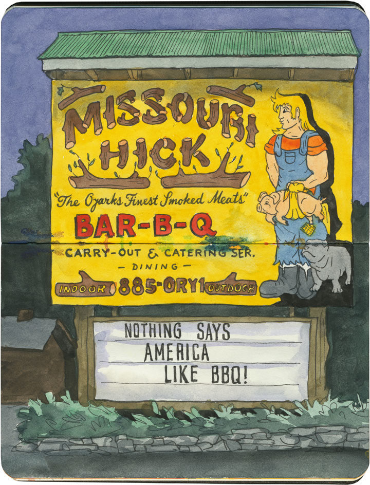
Unlike Bill Johnson’s in Phoenix or Frank’s in San Antonio, the Missouri Hick is still open for business.

Missouri Hick BBQ sketch by Chandler O'Leary

And hallelujah for that, because it’s hard to find better barbecue than this.

Missouri Hick BBQ sketch by Chandler O'Leary

Plus, I am a sucker for anywhere that takes local quirks, dials them up to eleven and turns them into decor.

Missouri Hick BBQ sketch by Chandler O'Leary

The place was just about empty, as we didn’t roll into town until just before closing time (we had come a long, long way since our early breakfast in Chicago that morning, and even our afternoon snack was hours in the past).

Missouri Hick BBQ sketch by Chandler O'Leary

But luckily for us, they were still happy to feed us—and we were more than happy to chow down.

Route 66 sketch by Chandler O'Leary

The tourist trade

This post is part of an ongoing series called 66 Fridays, which explores the wonders of old Route 66. Click on the preceding “66 Fridays” link to view all posts in the series, or visit the initial overview post here.

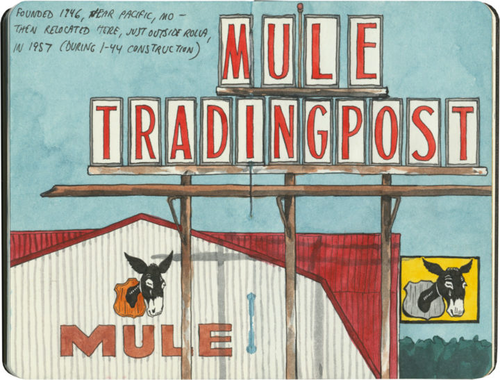
One of the grandest Route 66 traditions is the souvenir shop—or as it is more frequently named here, the trading post. And few Mother Road icons have such a long history. Starting as supply hubs and early post offices for fur traders, wagon trains, survey expeditions, gold prospectors and the like, trading posts were bastions of commerce and news in remote places.

The contemporary version of the trading post has sprung out of twentieth-century myths of the Old West: modern tourists wanted to experience a slice of the Pony Express, or send postcards from Boot Hill, or bring home a piece of Navajo jewelry—in air-conditioned comfort, of course.
Route 66 sketch by Chandler O'Leary

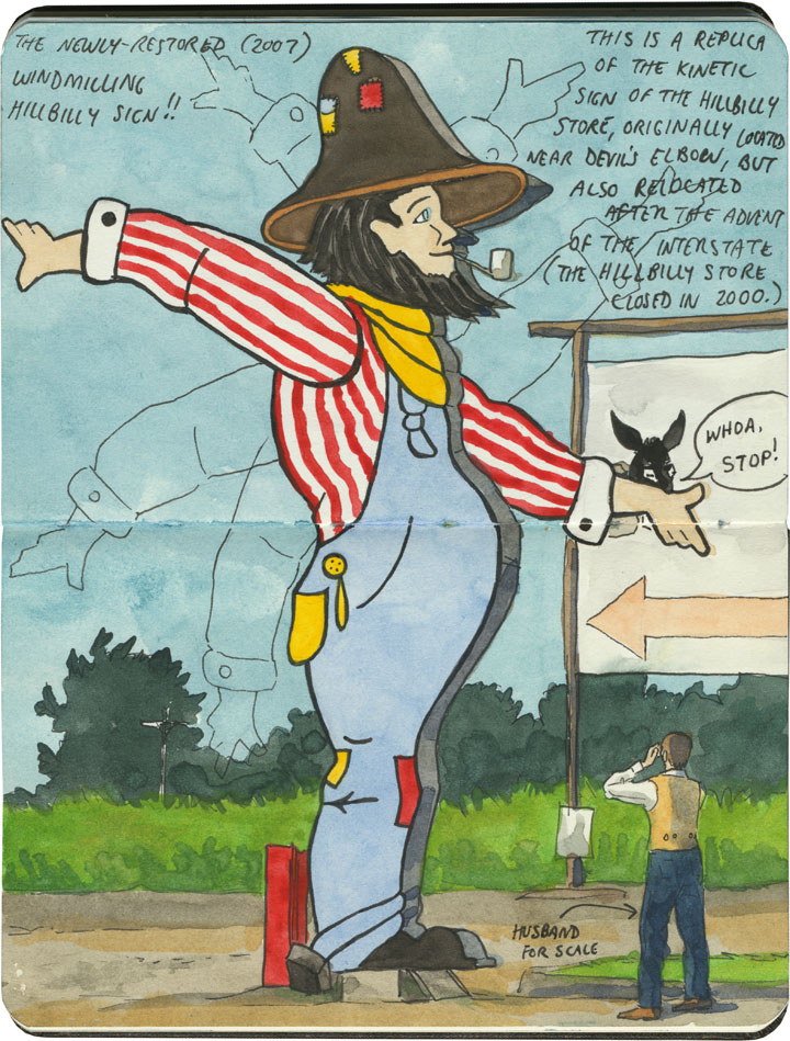
And nobody has cashed in on trading posts quite like Route 66: the Jackrabbit, the Continental Divide, Tee Pee Curios, the list goes on. On the Mother Road, the term “trading post” has become synonymous with “tourist trap”—many of these places combine commerce, entertainment and the flavor of the Wild West (or in the case above, the Hillbilly Ozarks). Far beyond a simple pit stop or junk store, some have more in common with theme parks.
Route 66 sketch by Chandler O'Leary

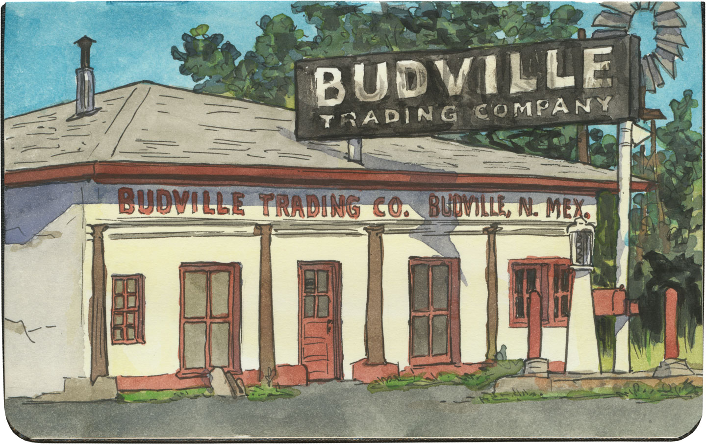
And while some have their roots in the actual Old West, many of these pit stops were built after Route 66 was run through. (Subsequently, in places where the modern Interstate diverted traffic away from 66, many of these trading posts are crumbling or closed altogether.)
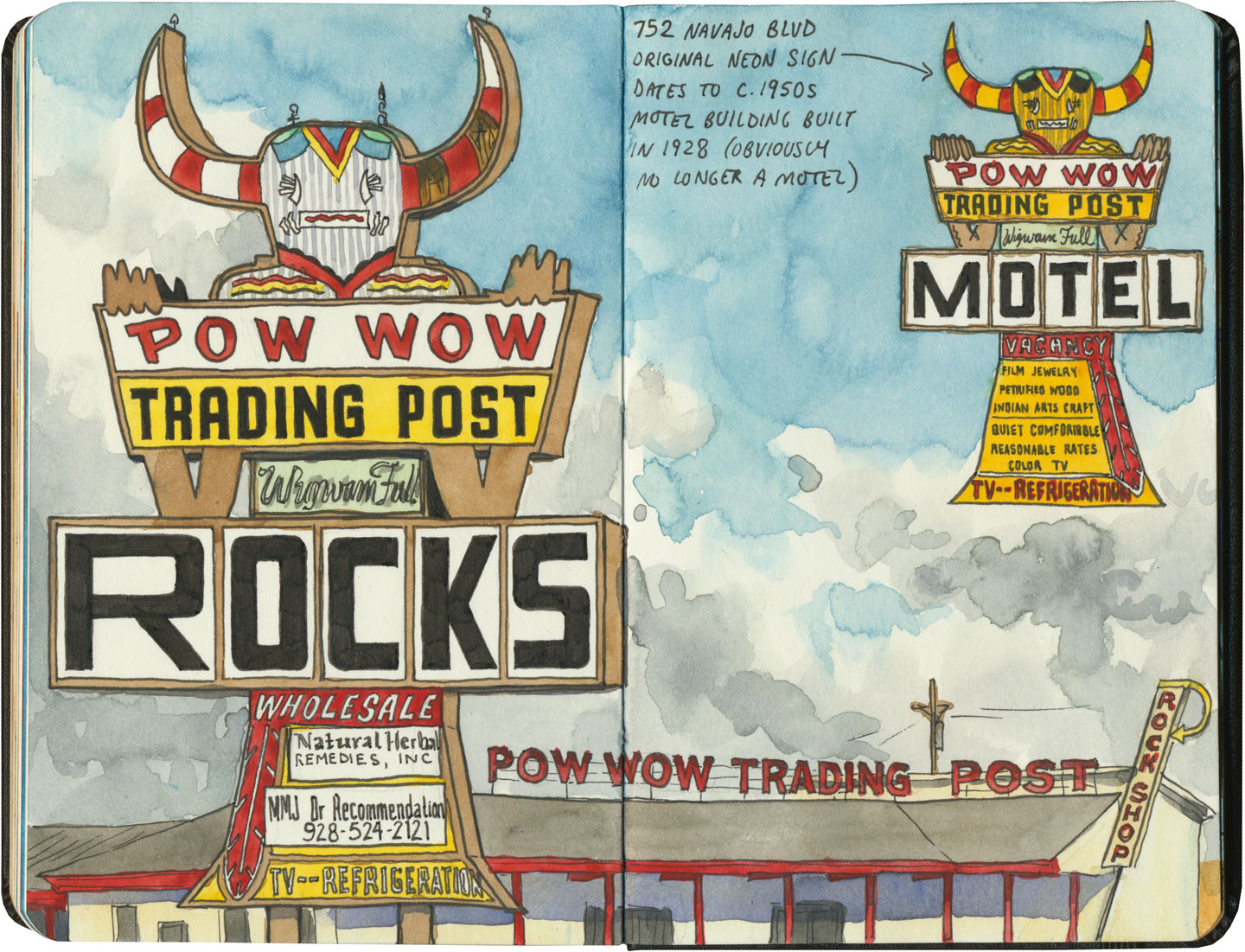
Route 66 sketch by Chandler O'Leary

Thanks to historical examples like Hudson’s Bay Company, or the Hubbell Trading Post on the Navajo Nation, which has operated on the pawn (barter) system since the 1870s, we tend to associate trading posts with Indian Country. Route 66 is a prime example: half of the route (over 1300 miles) crosses through Native America, connecting more than 25 Indigenous nations. And since the vast majority of the Mother Road’s trading posts (and nearly all of those west of the Texas-New Mexico line) deal in Native goods, it’s no wonder a road trip through the Southwest makes us think of kachinas and beadwork.
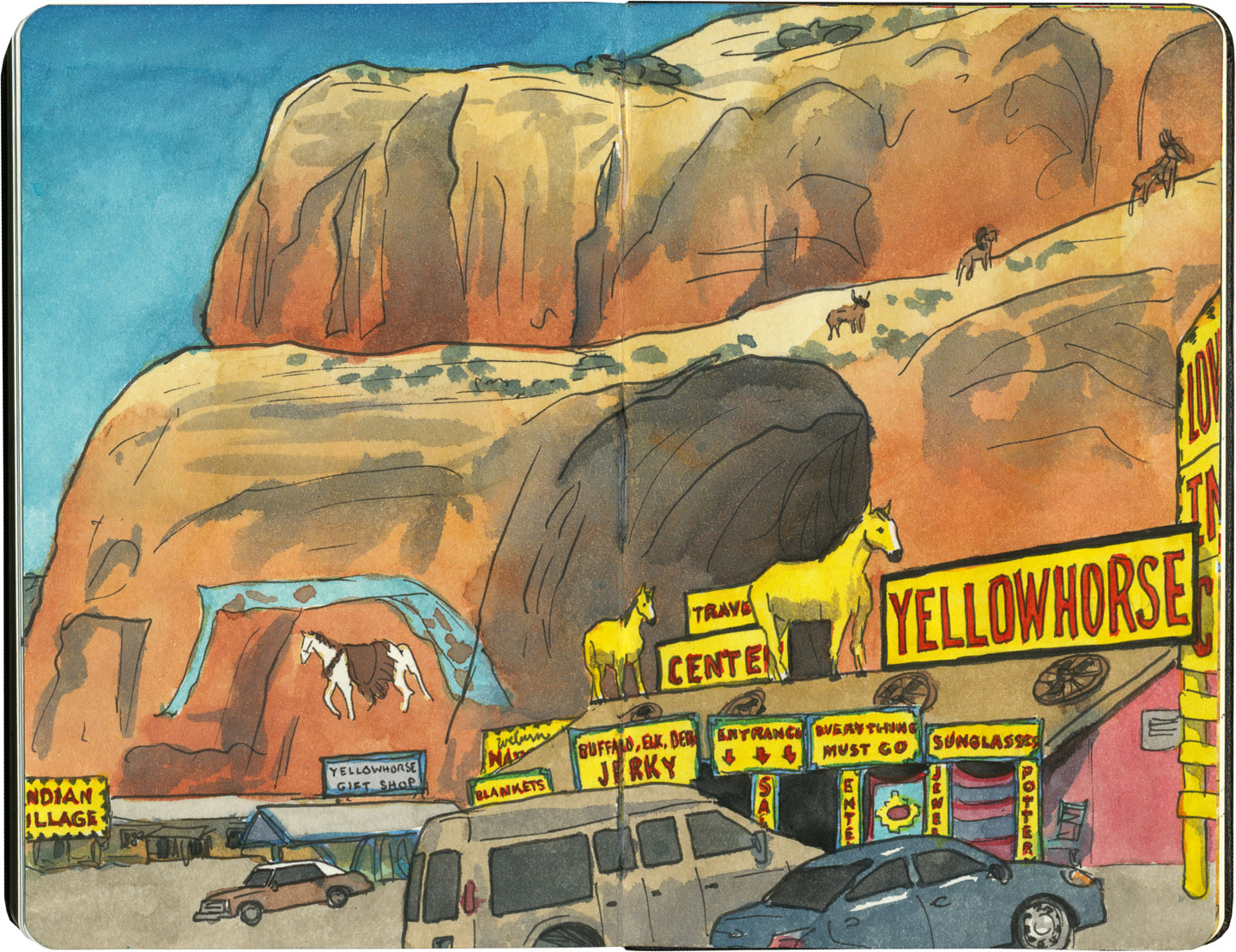
Route 66 sketch by Chandler O'Leary

Though many of these shops are run by white owners, some are owned and operated by tribal members themselves.
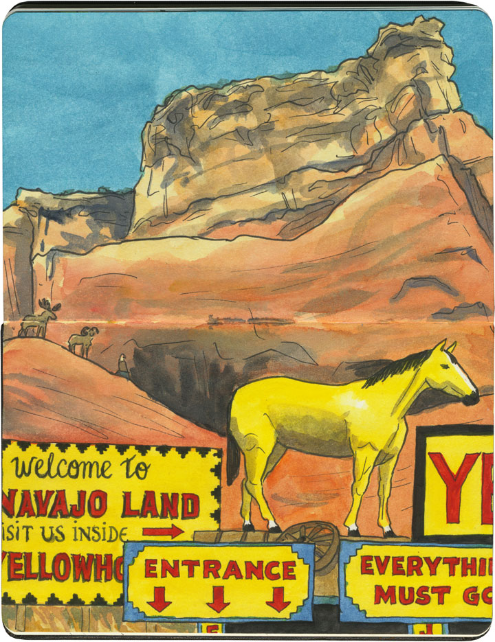
Route 66 sketch by Chandler O'Leary

Regardless of who owns them, the overall effect of these places can run the gamut between eye-frying…
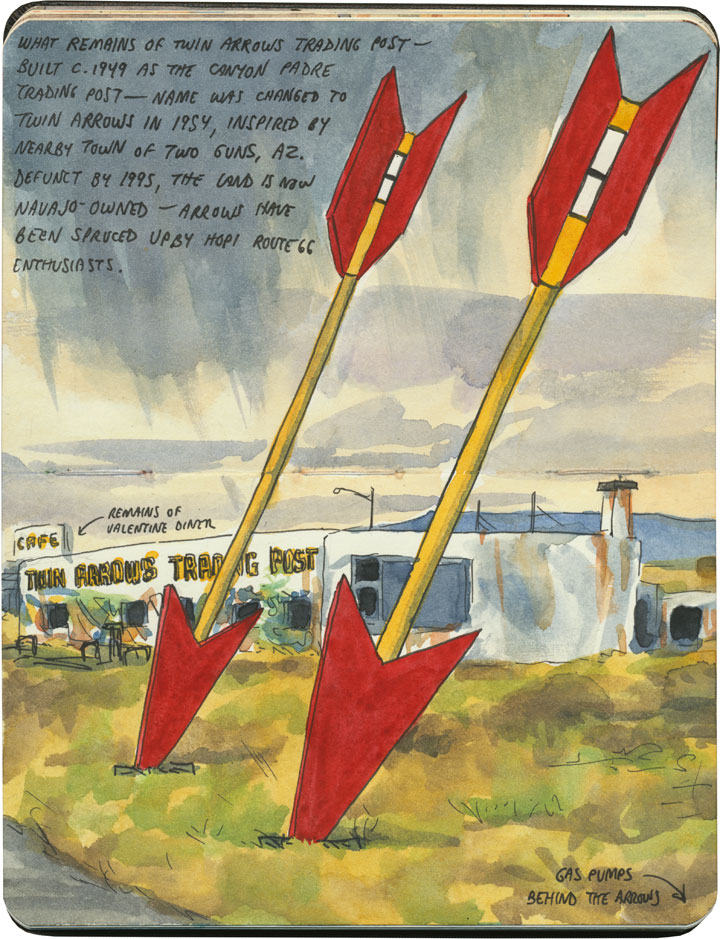
Route 66 sketch by Chandler O'Leary

…and downright melancholy.

Route 66 sketch by Chandler O'Leary

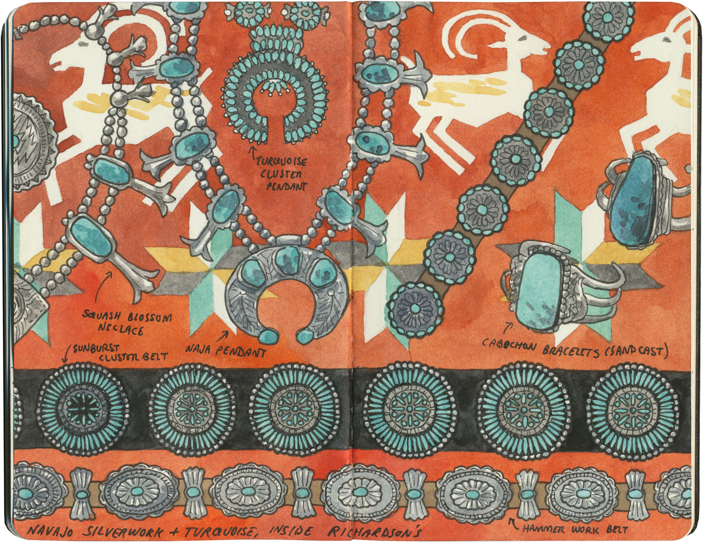
Gallup, New Mexico, has a little of both. Known as the “capital” of Indian Country, the town of 20,000 or so is the gateway to many American Indian nations, home to nearly a quarter of a million Indigenous people. As a result, Gallup is chock-a-block with trading posts and pawn shops, where local Navajo, Hopi, Zuni and others pawn their jewelry and other handmade goods in exchange for cash, staples or dry goods—and the shop owners then sell the jewelry to tourists. Nearly all of these shops are run either by white or, increasingly, Middle-Eastern owners.
Route 66 sketch by Chandler O'Leary

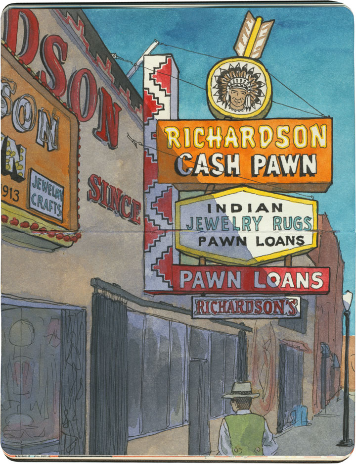
Gallup’s pawn shops have a controversial history, with some establishments accused of dealing in fake goods or cheating Indigenous makers out of a fair price for their work. So I did a little homework before we arrived, and chose Richardson’s as the place we’d visit. The shop has been in operation for over a hundred years, and though the Richardson family is white, they have a long reputation of being reputable dealers with a good relationship with the nations it represents. We marveled at the beauty on display there—some of the jewelry were incredible “old pawn” antique pieces.

Santa Fe sketch by Chandler O'Leary

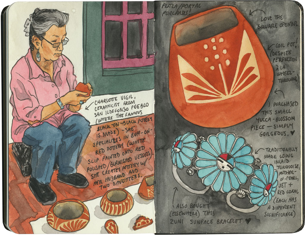
Still, my favorite trading experience on our Route 66 trip was when we had the chance to buy goods directly from the makers. In Santa Fe we shopped at the famous market at the Palace of the Governors, where artisans representing all of the region’s Indigenous cultures sell handmade jewelry, pottery, textiles, etc. at fair-trade prices. Each artist has to apply to the Native American Vendors Program to be included in the market, and the museum at the Palace of the Governors monitors each vendor to make sure the goods are authentic and the prices fair to the makers. (And bonus for history nerds like me: it’s really something to know you’re standing in the oldest continually-occupied public building in the country while you’re at it.)
Santa Fe sketch by Chandler O'Leary

In the end, I could only afford a couple of small items, but I was happy to know I was paying what they were actually worth (I don’t haggle, especially not with fellow artists), and that the proceeds would go directly to the maker. And best of all, I got to hear the stories behind each piece, from the person who made it.

That seems like a fair trade to me.

Save
Route 66 sketch by Chandler O'Leary

Faux-tem poles

This post is part of an ongoing series called 66 Fridays, which explores the wonders of old Route 66. Click on the preceding “66 Fridays” link to view all posts in the series, or visit the initial overview post here.

If you travel any length of Route 66, you can expect to see some fake teepees along the way. Totem poles, on the other hand, are a bit more of a surprise.

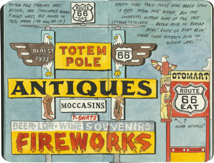
Well, I say totem poles, because they call them totem poles, but as you can probably guess by the fact that this sign sits in the middle of the Ozarks, this is the closest these things are going to get.

Route 66 sketch by Chandler O'Leary

Oklahoma’s version is even less like a real totem pole, and more like a giant muppety decoupaged Coke bottle. (It’s not even technically on Route 66, but a few miles down a side road.) Still, this thing is an icon of the Mother Road, and I’m glad to see it being kept in fine fettle for the next traveler who meanders down the road.

Save

Save

Save
Save

Save

Save

Wigwam Motel (Arizona) sketch by Chandler O'Leary

Wigwam-a-rama

This post is part of an ongoing series called 66 Fridays, which explores the wonders of old Route 66. Click on the preceding “66 Fridays” link to view all posts in the series, or visit the initial overview post here.

Route 66 wouldn’t be Route 66 without its bevy of American-Indian cultural appropriation kitsch. The sheer number of faux teepees, tomahawks, totems and trading posts along the Mother Road is staggering—the number of details they get wrong even more so (like, ahem, teepees in the desert Southwest). Still, these wrongheaded landmarks are a huge part of the route’s history, and I’d be remiss if I didn’t mention them here.

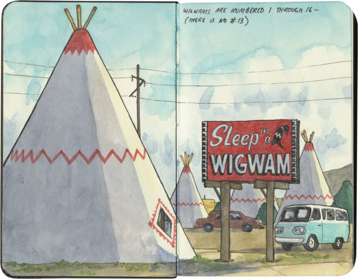
Most famous of all are the two (two, I say!) Wigwam Villages that still beckon travelers from the roadside—and these were actually part of a chain of seven motels that stretched from Florida to Kentucky to California in the 1940s and 50s.

Wigwam Motel (Arizona) sketch by Chandler O'Leary

The one in Holbrook, Arizona is the most well-kept of the two remaining villages, and is decked out with a ring of restored vintage cars and its original “Sleep in a Wigwam” billboard.

Wigwam Motel (California) sketch by Chandler O'Leary

Its sister site in California once displayed a much earthier sign: “Do It in a Teepee,” (actually, the sign is still there, just tucked away in the back of the property) which contributed to a seedy reputation that the current owners are trying hard to overcome.

Wigwam Motel (California) sketch by Chandler O'Leary

If these motels seem oddly familiar to you, imagine this sketch displaying a ring of giant traffic cones instead of teepees, and it’ll click: the San Bernardino Wigwam Village was the inspiration for the fictional Cozy Cone Motel in the Pixar film Cars.

I didn’t get a chance to “sleep in a wigwam” on this trip, but it’s just as well. As much as I love themed roadside kitsch, I don’t love cultural appropriation—particularly the American Indian variety.(Don’t even get me started on fashion models wearing war bonnets, or kid’s-room teepees at the Baby Gap.) Still, I’m glad to see these motels being preserved—Route 66 doesn’t need to lose any more of its landmarks.

Save

Save

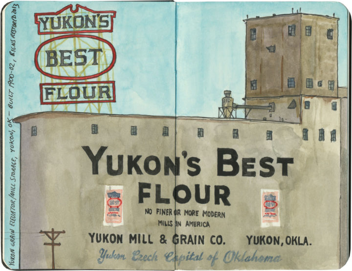
Yukon's Best Flour sketch by Chandler O'Leary

Flour flurry

This post is part of an ongoing series called 66 Fridays, which explores the wonders of old Route 66. Click on the preceding “66 Fridays” link to view all posts in the series, or visit the initial overview post here.

It’s not entirely clear to me why the founders of Yukon, OK named their town after the Yukon Gold Rush, nor why its county is called Canadian County. But on the day of our visit to the Yukon of Route 66, the only blizzard we might possibly have witnessed was one of enriched white flour.

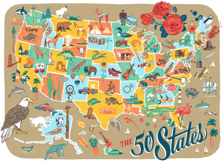
50 States pictorial map illustrated and hand-lettered by Chandler O'Leary

Rereading the map

I finished this map before the airwaves were inundated with red and blue election maps—and today it’s a good reminder that America is more than its electoral divisions. That there is good in every state, and that there is so much to love and celebrate in every nook and cranny of our nation. This is why I started the 50 States project three years ago, and I’m taking the fact that I happened to finish the series right before the most divisive election in living memory as a sign that I need to remember this fact going forward. After all, the real work of our country involves all of us.
 
Those of you who read this blog know that I express my love for every state—blue, red, purple, whatever—through my drawings. I will continue to do so, to feature the beauty and wonder and hilarity and kooky humor of every state. That is what will get me through the fear and sadness and anger I’m feeling now—and I hope it will help you in some small measure, as well. So the break I took from blogging to focus on my book is over; posting here starts back up again tomorrow.
 
In the meantime, you can celebrate all 50 States with me tonight at the Ted Sanford Gallery at Charles Wright Academy in University Place, WA, where the entire series is on display through November 29. From 5:30 to 6:30 tonight I’ll have a gallery reception and small pop-up shop. Let’s talk about the good that’s out there—from Paul Bunyan to Elvis to the World’s Largest Frying Pan, and everything in between, from sea to shining sea.
Route 66 sketch by Chandler O'Leary

Halfway there

This post is part of an ongoing series called 66 Fridays, which explores the wonders of old Route 66. Click on the preceding “66 Fridays” link to view all posts in the series, or visit the initial overview post here.

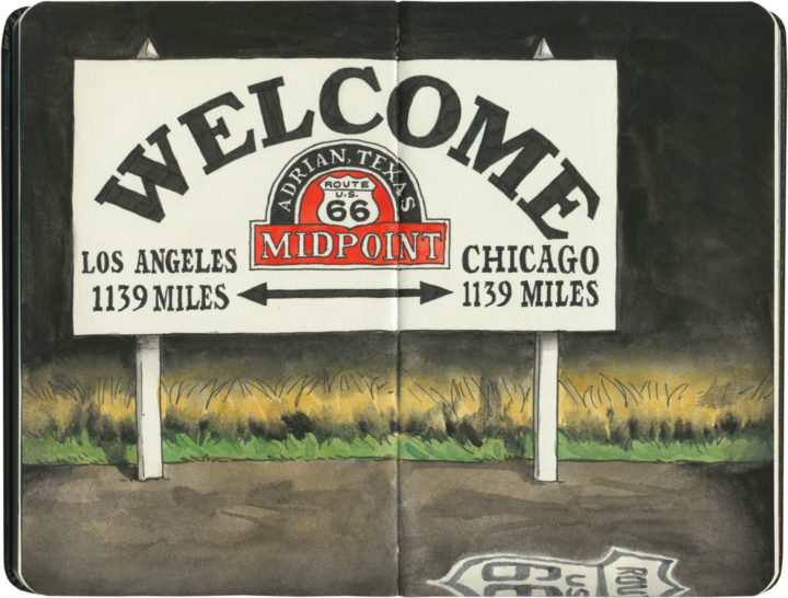
When I started my 66 Fridays series back at the turn of the new year, I knew I was in for a long road ahead. But here we are, 33 Fridays later, already at the halfway point of the series! I figured it was only fitting to pair this post with a sketch of the symbolic halfway point of the Mother Road. Since Route 66 has seen so many changes to its path over the years, it’s unlikely this sign marks the exact midpoint—but it hardly matters. I’m glad there’s a marker at all, wherever they ended up putting it.

Some of you may just be tuning in to this series now, so I figured a recap of where we’ve been so far was in order. Like everything else on this blog, my subjects jump around in space and time. So below is a list of all the Route 66 posts I’ve done so far, loosely grouped by category.

Posts about Route 66 itself:
Intro: Mother Road, Mother Lode
Chicago’s Eastern Terminus
Sundown Towns
Burma Shave
Filling Stations of 66
Suicide Bridge
Where 66 Intersects Itself
The history under your wheels

Route 66 Attractions:
Meramec Caverns Billboards
The Round Barn
The Leaning Tower
Wild Burros
Paul Bunyans
Mufflermen of the Mother Road
The Harvey House Empire
The Armory Museum
Dino Drive-Bys
Petrified Forest
The Continental Divide
Cadillac Ranch

The Mother Road in Lights:
Albuquerque’s Googie Marathon
The Dog House from Breaking Bad
The Aztec Hotel
The Munger Moss and its Antecedents
Air-Cooled Comfort
Tucumcari Tonite

Route 66 Roadside Eats:
Lou Mitchell’s
Ted Drewes
Dairy King
Chicago Dogs
Rod’s Steakhouse
New Mexico Cafes

Other Route 66 posts I’ve done (outside the 66 Fridays series):
Tulsa Googie
The Golden Driller
Old Town Ristras
The Blue Whale of Catoosa

Thank you for traveling along the Mother Road with me for so much of this year. And we still have many miles to cover—see you next Friday with the latest installment!

Route 66 sketch by Chandler O'Leary

Criss-cross corner

This post is part of an ongoing series called 66 Fridays, which explores the wonders of old Route 66. Click on the preceding “66 Fridays” link to view all posts in the series, or visit the initial overview post here.

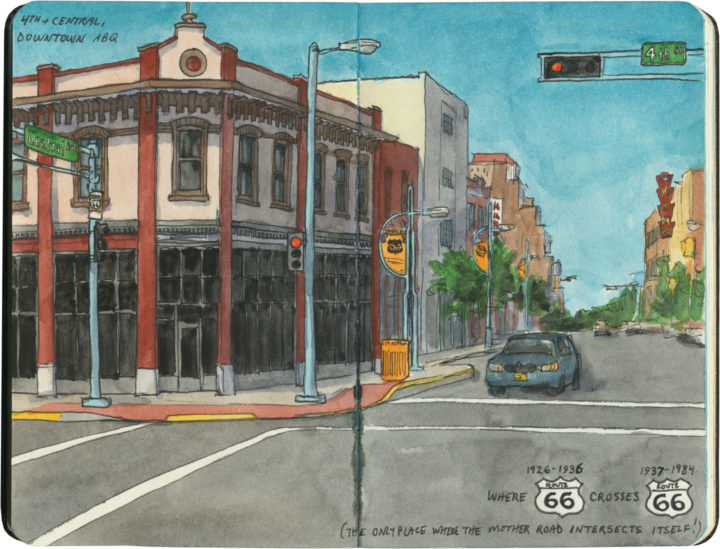
In downtown Albuquerque is an unassuming corner with a curious distinction. This is the place—the only place—where Route 66 intersects itself.

It’s not so unusual to have several Route 66-es in the same city—after all, Tulsa has at least three, and St. Louis changed the alignment of the route so many times I’ve lost track of the number. Yet nowhere else along the Mother Road do two different alignments actually cross each other. You see, when Route 66 was first established in New Mexico in 1926, the logical thing to do was to send the road through the capital city—so off to Santa Fe it went, and then it curved southward to come into Albuquerque from the north. At that time, there was no straight-line route across New Mexico, so travelers coming to Albuquerque from the east had no choice but to take that winding, partial-dirt, mountainous road through the capital first. But then, quite suddenly, all that changed: just a few years later, a new 66 cut an arrow-straight path into Albuquerque from the east and bypassed Santa Fe entirely. (And today many people have no idea that 66 ever went to Santa Fe at all.)

Like everything else along Route 66, there’s a story behind this. The short version is this: Arthur T. Hannett, who was governor of New Mexico when Route 66 was born, lost his reelection bid in 1926, and found himself with an axe to grind. Convinced he had been ousted by a conspiracy on the part of his political opponents at the state capitol, he hatched a scheme to reroute 66 away from Santa Fe in revenge.

The trouble was, he had only a little over a month before his successor would be sworn in. So he ordered nearly every piece of road-construction equipment in the northern half of the state to be diverted to his project, and made every construction worker he could get his hands on work nonstop to cut a new road bed from Santa Rosa to Albuquerque. The workers slept at the construction sites, toiled through snowstorms and skipped the holidays, and the new 69-mile road was completed in just 31 days. By the time the new governor, Richard Dillon, took office on January 1, 1927, it was too late. Despite opponents trying to block the project during those 31 days (including sabotage attempts where people put sand in the gas tanks of the construction equipment), nobody could deny the convenience of a straight, fully-paved road. The new route saved hours of driving, so before long, motorists were already using it heavily, leaving Santa Fe in the dust. It took another ten years before the road was paved all the way to the Texas border and the new section gained the official Route 66 designation, but by then it was already the main arterial across the state.

KiMo Theatre sketch by Chandler O'Leary

That story isn’t the only thing interesting about the corner of 4th and Central. That spot’s other claim to fame is what might just be Albuquerque’s best and most iconic building: the KiMo theatre.

KiMo Theatre sketch by Chandler O'Leary

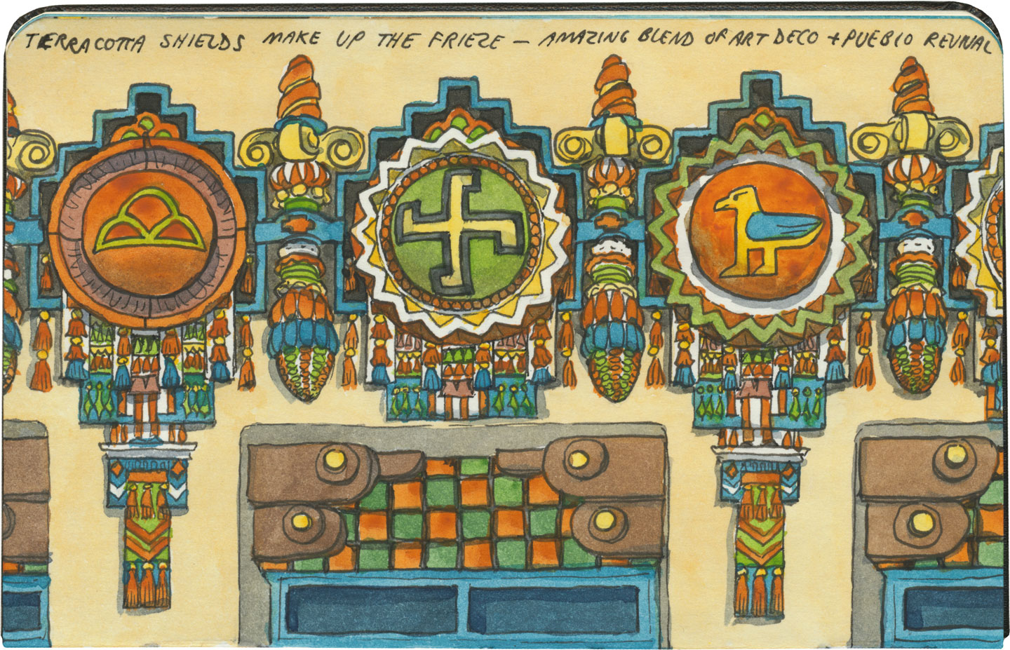
Built in 1927 in a spectacular blend of Art Deco and Pueblo Revival styles (who knew those two went together so well?!), the theater’s name translates to “mountain lion” in Tewa, the language spoken by many of the region’s Pueblo people. The KiMo narrowly escaped the wrecking ball in the late 1970s, when residents voted for the city to buy the building. After an extensive restoration completed in 2000, the KiMo is once again hosting public performances.KiMo Theatre sketch by Chandler O'Leary

Yes, that symbol above is what it looks like; and no, it doesn’t mean what you might think. The swastika is an ancient symbol that once had positive connotations in many cultures before Hitler twisted it to his own ends. To the Navajo it stood for the Whirling Log, a healing symbol, and to the Hopi (whose traditions the above design emulates) it represents spiritual wandering.

Oh, and hey: apparently the building is haunted. The theater staff leave appeasement offerings in a back stairwell and everything. The place was closed on the day we were there, so I couldn’t get a look at the inside, but you can bet I’ll be back. Neither angry ghosts or vengeful ex-governors can stop me.

Save