Tag Archives: southwest

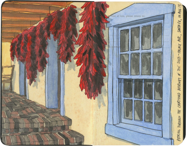
Santa Fe chili ristras sketch by Chandler O'Leary

Courtyard pantry

I live in the Pacific Northwest, where the weeks after daylight saving time ends can be pretty grim. To combat the dark gray days, I surround myself with color. On my studio table is a big bouquet of fall flowers in a bright yellow pitcher. In the root cellar are piles of rainbow root vegetables and parti-colored squash. And just like I’ve done before, I’m flipping through memories of red chili ristras and cheerful desert courtyards in my sketchbook, looking forward to the sun’s return.

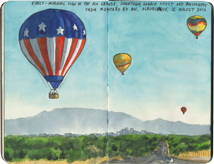
Albuquerque hot air balloons sketch by Chandler O'Leary

Hope floats

I spent the whole weekend digging through dozens of old sketchbooks, searching for something I could post as some sort of post-election metaphor. Something that stood for a new day, for rising above the hateful muck we’re all slogging through…something. Anything.

Welp. Yeah.

It’s corny, I know. On that morning last year I thought seriously about taking artistic license with the flag balloon, since overtly patriotic objects aren’t really my style. But for whatever reason, I reported it accurately, keeping it as-is. And now I’m clinging to it as an image, corny or not. I have a feeling that drawing is going to provide a lot of ballast for my little metaphorical balloon in the months and years ahead. Time to relight the fire, and—fair winds or foul—do everything I can to stay afloat.

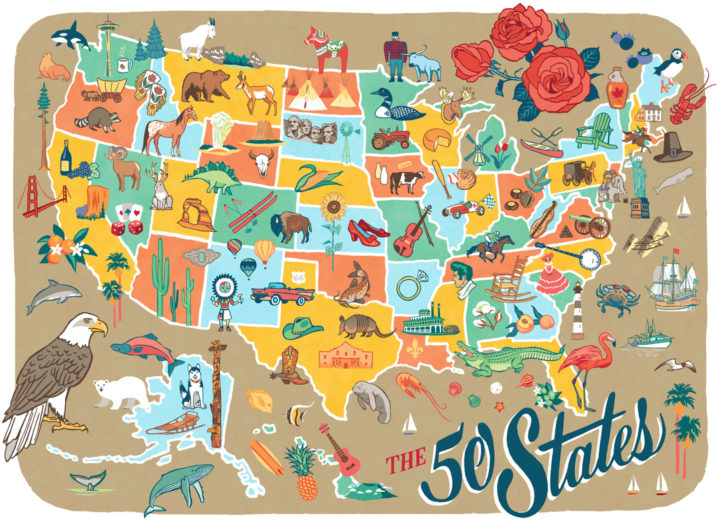
50 States pictorial map illustrated and hand-lettered by Chandler O'Leary

Rereading the map

I finished this map before the airwaves were inundated with red and blue election maps—and today it’s a good reminder that America is more than its electoral divisions. That there is good in every state, and that there is so much to love and celebrate in every nook and cranny of our nation. This is why I started the 50 States project three years ago, and I’m taking the fact that I happened to finish the series right before the most divisive election in living memory as a sign that I need to remember this fact going forward. After all, the real work of our country involves all of us.
 
Those of you who read this blog know that I express my love for every state—blue, red, purple, whatever—through my drawings. I will continue to do so, to feature the beauty and wonder and hilarity and kooky humor of every state. That is what will get me through the fear and sadness and anger I’m feeling now—and I hope it will help you in some small measure, as well. So the break I took from blogging to focus on my book is over; posting here starts back up again tomorrow.
 
In the meantime, you can celebrate all 50 States with me tonight at the Ted Sanford Gallery at Charles Wright Academy in University Place, WA, where the entire series is on display through November 29. From 5:30 to 6:30 tonight I’ll have a gallery reception and small pop-up shop. Let’s talk about the good that’s out there—from Paul Bunyan to Elvis to the World’s Largest Frying Pan, and everything in between, from sea to shining sea.
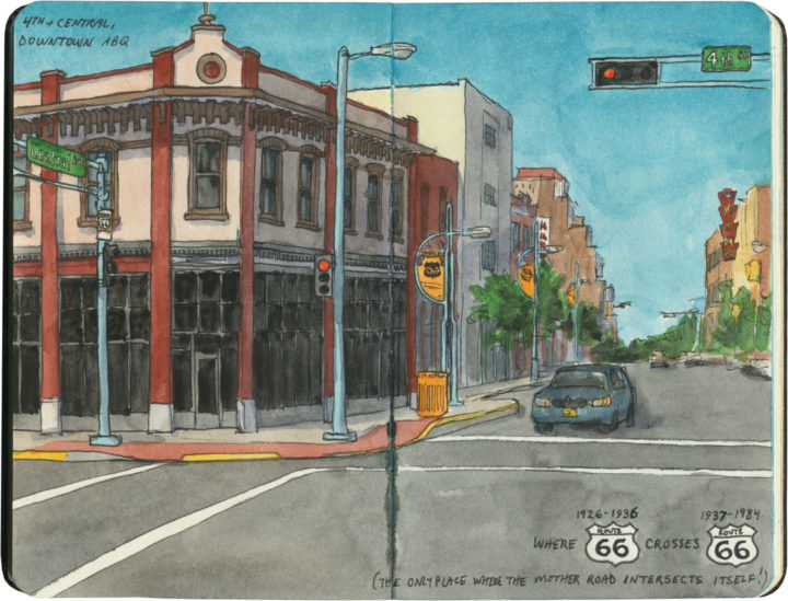
Route 66 sketch by Chandler O'Leary

Criss-cross corner

This post is part of an ongoing series called 66 Fridays, which explores the wonders of old Route 66. Click on the preceding “66 Fridays” link to view all posts in the series, or visit the initial overview post here.

In downtown Albuquerque is an unassuming corner with a curious distinction. This is the place—the only place—where Route 66 intersects itself.

It’s not so unusual to have several Route 66-es in the same city—after all, Tulsa has at least three, and St. Louis changed the alignment of the route so many times I’ve lost track of the number. Yet nowhere else along the Mother Road do two different alignments actually cross each other. You see, when Route 66 was first established in New Mexico in 1926, the logical thing to do was to send the road through the capital city—so off to Santa Fe it went, and then it curved southward to come into Albuquerque from the north. At that time, there was no straight-line route across New Mexico, so travelers coming to Albuquerque from the east had no choice but to take that winding, partial-dirt, mountainous road through the capital first. But then, quite suddenly, all that changed: just a few years later, a new 66 cut an arrow-straight path into Albuquerque from the east and bypassed Santa Fe entirely. (And today many people have no idea that 66 ever went to Santa Fe at all.)

Like everything else along Route 66, there’s a story behind this. The short version is this: Arthur T. Hannett, who was governor of New Mexico when Route 66 was born, lost his reelection bid in 1926, and found himself with an axe to grind. Convinced he had been ousted by a conspiracy on the part of his political opponents at the state capitol, he hatched a scheme to reroute 66 away from Santa Fe in revenge.

The trouble was, he had only a little over a month before his successor would be sworn in. So he ordered nearly every piece of road-construction equipment in the northern half of the state to be diverted to his project, and made every construction worker he could get his hands on work nonstop to cut a new road bed from Santa Rosa to Albuquerque. The workers slept at the construction sites, toiled through snowstorms and skipped the holidays, and the new 69-mile road was completed in just 31 days. By the time the new governor, Richard Dillon, took office on January 1, 1927, it was too late. Despite opponents trying to block the project during those 31 days (including sabotage attempts where people put sand in the gas tanks of the construction equipment), nobody could deny the convenience of a straight, fully-paved road. The new route saved hours of driving, so before long, motorists were already using it heavily, leaving Santa Fe in the dust. It took another ten years before the road was paved all the way to the Texas border and the new section gained the official Route 66 designation, but by then it was already the main arterial across the state.

KiMo Theatre sketch by Chandler O'Leary

That story isn’t the only thing interesting about the corner of 4th and Central. That spot’s other claim to fame is what might just be Albuquerque’s best and most iconic building: the KiMo theatre.

KiMo Theatre sketch by Chandler O'Leary

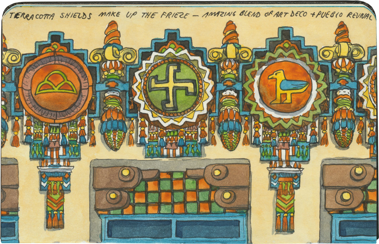
Built in 1927 in a spectacular blend of Art Deco and Pueblo Revival styles (who knew those two went together so well?!), the theater’s name translates to “mountain lion” in Tewa, the language spoken by many of the region’s Pueblo people. The KiMo narrowly escaped the wrecking ball in the late 1970s, when residents voted for the city to buy the building. After an extensive restoration completed in 2000, the KiMo is once again hosting public performances.KiMo Theatre sketch by Chandler O'Leary

Yes, that symbol above is what it looks like; and no, it doesn’t mean what you might think. The swastika is an ancient symbol that once had positive connotations in many cultures before Hitler twisted it to his own ends. To the Navajo it stood for the Whirling Log, a healing symbol, and to the Hopi (whose traditions the above design emulates) it represents spiritual wandering.

Oh, and hey: apparently the building is haunted. The theater staff leave appeasement offerings in a back stairwell and everything. The place was closed on the day we were there, so I couldn’t get a look at the inside, but you can bet I’ll be back. Neither angry ghosts or vengeful ex-governors can stop me.

Save

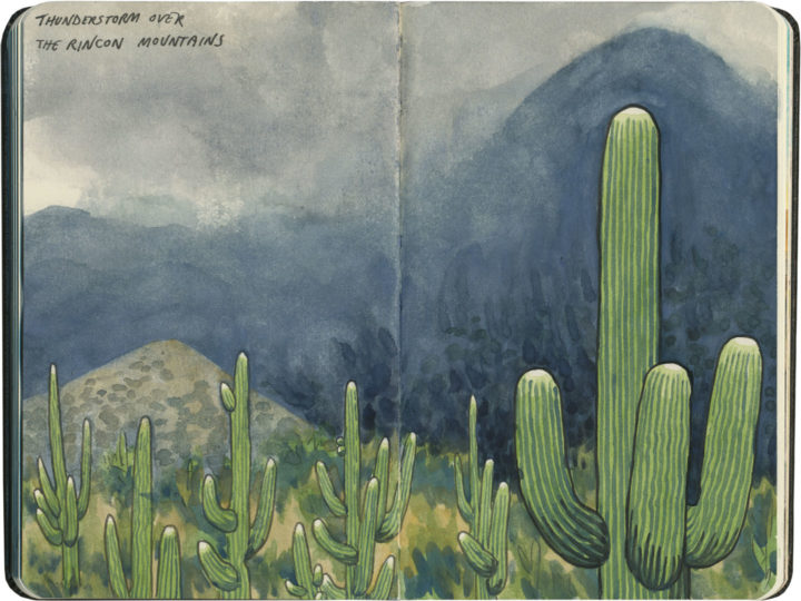
Saguaro National Park sketch by Chandler O'Leary

Alien forest

I visited Saguaro National Park for the first time last year, and between being a veteran national parks tourist and seeing a zillion photos of the place over the years, I thought I knew what to expect. Aaaand of course, I was way wrong. (No surprise there.)

For one thing, Mary-Alice and I arrived in the middle of a storm. No stereotypical desert scenes for me that day; instead, I got to add something far more dramatic to the ol’ sketchbook.

For another, I knew the park was quite close to the city of Tucson, but I didn’t know it was comprised of two distinct districts (Rincon Mountain and Tucson Mountain), each flanking the city from opposite sides. There wasn’t enough time to do both units in one afternoon, so we rearranged our schedule for the next day in order to fit in a tour of the western district.

Saguaro National Park sketch by Chandler O'Leary

Finally, I was shocked to discover that the place reminded me strongly of my home turf of the Pacific Northwest—at least, a bizarre, parallel-universe version thereof. It wasn’t just that the saguaros are incredibly tall. It was that there were so many of them, thick on the ground like the familiar conifer forests of Washington. Add to that the indigo hillsides I’d seen the night before, and the nebulous mists of that morning, and it was like standing in a dream-land version of home.

Save

Save

Save

Save

Save

Save

Harvey House map sketch by Chandler O'Leary

Harvey hospitality

This post is part of an ongoing series called 66 Fridays, which explores the wonders of old Route 66. Click on the preceding “66 Fridays” link to view all posts in the series, or visit the initial overview post here.

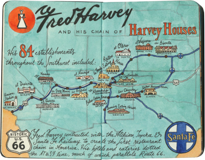
If you travel Route 66, you’re sure to come across the name of Fred Harvey. If you haven’t heard of him, you’re far from alone. Yet Harvey and his commercial empire had a lot to do with creating, collecting and curating that slice of Americana we call the Southwest.

If I were throw another name at you, though, I bet you’d be able to place it: Howard Johnson. That’s right, the hospitality magnate who, in the 1960s and 70s, controlled the largest restaurant chain in the United States. Well, I’m not knocking Johnson (or all that fabulous midcentury decor), but Harvey did it first, and best.

Harvey got his start in the late 1870s, when the West was still very much a wild place, and the railroads were busy cutting new paths over the old overland trade routes. Harvey was revolted by the food the railroad companies offered their passengers—he figured if eastern travelers could access the same quality of cuisine they’d find in a New York City restaurant, they’d get over their fear of “roughing it” and head West in style. His employer, the Burlington Railroad, turned him down, but the Atchison, Topeka & Santa Fe Railway saw merit in the idea. Harvey signed a contract with AT&SF, and the first American restaurant chain was born.

Grand Canyon sketch by Chandler O'Leary featuring El Tovar Hotel, a former Harvey House

Before long, Harvey had added hotels and tour services to his repertoire, and by the early twentieth century there were “Harvey Houses” scattered all over the Southwest. Some of his best-known properties still stand—including nearly all of the historic buildings that comprise the South Rim complex at the Grand Canyon.

Grand Canyon sketch by Chandler O'Leary featuring Hopi House, a former Harvey House

Early conservationists like Teddy Roosevelt were horrified by the prospect of commercializing the Grand Canyon, yet one could easily argue that if Fred Harvey hadn’t done it, someone else most assuredly would have (and they did! Google the mayhem that is Ralph Henry Cameron sometime, if you’re curious).

Grand Canyon sketch by Chandler O'Leary featuring Bright Angel Lodge, a former Harvey House

One vote in favor of Harvey was that each of his establishments was thoughtfully designed to be at once beautiful, well-made, reflective of its natural surroundings and sensitive to its area’s cultural heritage. (I’m sure that last box wasn’t checked as well as it might have been, but considering the era in which these places were designed, the fact that any cultural sensitivity came about at all is nothing short of astonishing.)

And we have one person to thank for much of that:

Harvey House and Mary Colter sketch by Chandler O'Leary

That’s right: Fred Harvey’s right-hand man was a woman. And it’s Mary Jane Colter’s style and sensibility that come through in the most memorable Harvey Houses. She is the one who created much of that unified “look” that we associate with the American Southwest. And that’s because she did her research—she looked at all the different regional architectural styles of the various Native cultures of the region, and blended them with the popular architectural styles of the day: Arts & Crafts, Mission, and various revivals of European and even North African traditions.

Colter went one step further, and did something that was way ahead of her time: she actually hired Native artists and craftspeople to complete many of the details on and in her buildings. She worked most often with Hopi painter Fred Kabotie, who contributed elements like the murals at the Painted Desert Inn and various interior details at Hopi House. In working with artists like Kabotie, Colter’s buildings have an authenticity to them that, along with their craftsmanship, elevates them way above your average tourist trap.

La Posada Harvey House sketch by Chandler O'Leary

I didn’t know any of this before my trip, nor had I ever heard of Fred Harvey before. Luckily for me, many of the surviving Harvey Houses are located along Route 66, so I had ample opportunity to find out—

Barstow Harvey House sketch by Chandler O'Leary

—and to gaze in wonder at so many architectural treasures still standing along the Mother Road.

Santa Fe sketch by Chandler O'Leary, featuring Hotel La Fonda, a former Harvey House

Most serendipitous for my Harvey education was our decision to drive the original (and less-traveled) pre-1937 alignment of Route 66, which took us to Santa Fe. For one thing, Santa Fe is home to the most magnificent example of extant Harvey Houses: Hotel La Fonda.

Santa Fe sketch by Chandler O'Leary, featuring Hotel La Fonda, a former Harvey House

The place is often nicknamed “the oldest hotel in the United States,” but that’s not exactly true. What is true is that an inn or fonda has stood continuously upon this location for over four hundred years. Harvey must have known that particular historical tidbit, because La Fonda doesn’t mess around. Every inch of the place is jam-packed with Harvey’s version of Southwest Americana.

Santa Fe sketch by Chandler O'Leary, featuring Hotel La Fonda, a former Harvey House

The hotel has been remade and renovated seemingly endlessly over the years, but you can still find traces of its history (and Mary Colter’s interior touches) everywhere.

Santa Fe sketch by Chandler O'Leary, featuring Hotel La Fonda, a former Harvey House

La Fonda is the place where you learn to recognize the Harvey style—where even if you don’t know the history behind any of it, you’ll still know it when you see it.

Harvey House artifacts sketch by Chandler O'Leary

The other thing Santa Fe gave me was a glimpse of Harvey’s empire on a micro scale, thanks to the New Mexico History Museum at the Palace of the Governors. Far beyond capitalizing on the idea of a hospitality chain, what Fred Harvey really understood was branding. And branding really isn’t even the right word here: while other hotels might have an “identity,” Harvey went way beyond that. For his employees, he created a culture. For his customers, he created something more akin to mythology.

For an amateur graphic design historian like me, I felt like I’d struck gold at the Palace of the Governors. Their Harvey House exhibit displayed the length, breadth and depth of Harvey branding—beyond any logo, their aesthetic covered everything from letterhead to jewelry to employee pamphlets. Harvey’s penchant for hiring professional artists paid off on every front: every last detail was carefully considered, equally beautiful, and a stand-alone work of art.

Harvey House artifacts sketch by Chandler O'Leary

And that brings me to the most famous and curious piece of Harvey branding: the Harvey Girl.* A living, breathing icon, the Harvey Girl became the very embodiment of the taming of the West.

Fred Harvey felt that while the romantic idea of the Wild West might be a draw to tourists, its rough-and-tumble connotations would be more of a hinderance than anything else, as wealthy customers viewed western travel as dangerous and uncomfortable. To counteract this notion, Harvey committed to hiring only educated young women from the East and Midwest to wait upon, entertain and guide his guests. The Harvey Girls had to adhere to strict codes of dress, conduct and morality; live in single-sex barracks run by middle-aged den mothers; and sign year-long contracts which forbade them to marry while employed by the Harvey Company. The idea of “civilizing” the West, one genteel lady at a time, was a smash hit, and the Harvey Girl became so iconic that Judy Garland even played one on the silver screen.

What really interests me, however, is that the Harvey Girls—and there were 100,000 of them in all—were the first female workforce in America. The guests may have seen them as mere waitresses, but in reality these were educated women who were responsible for far more than carrying trays or taking orders. Later, as automobiles became popular and Harvey started his Indian Detours auto tour service, Harvey Girls—renamed “Couriers” or even, ugh, Indian Maids—comprised the entire staff of tour guides. Most had college degrees, and each Courier was required to have a working knowledge of local history, botany, geology, archaeology, anthropology, geography, or any other subject the tourists might inquire about.

* Note: Much of my Harvey Girl information comes from Katrina Parks’s wonderful documentary, The Harvey Girls: Opportunity Bound. Excerpts from the documentary are included in the Harvey exhibit at the Palace of the Governors, and it is these that introduced me to Ms. Parks’s work. She is currently working on a new project called The Women on the Mother Road—her website features some of my Route 66 sketches, and I’m excited and honored to be included!

Petrified Forest National Park sketch by Chandler O'Leary featuring Painted Desert Inn, a former Harvey House

I tell you all of this to illustrate just how far-reaching Fred Harvey’s empire was, how much of modern American history was touched by his ideas. The Harvey Houses weren’t just another hotel chain—they were an astonishing and vast collective work of art. And they were an incredible economic engine that provided work to thousands of people—many of them highly skilled artists, designers, craftspeople, historians, scientists and anthropologists.

chandler_oleary_route66_az_harveyhouse_painteddesertinn_ceiling

The Harvey Company also employed many unskilled laborers, like the Civilian Conservation Corps (one of Franklin Roosevelt’s “Alphabet Soup” agencies founded during the Great Depression), who built and then painted this glass skylight at the Painted Desert Inn.

Petrified Forest National Park sketch by Chandler O'Leary featuring Painted Desert Inn, a former Harvey House

More than anything, I think it’s this constant mixing of things that marks Harvey’s legacy: east and west, Native and Anglo, public and private. (For instance, the hotels and restaurants themselves were funded by the private railroad company, but many of them were located on or near public lands, and many used government-funded labor to build them.) I don’t think Harvey gets much of the credit for it, but the WPA (Works Progress Administration, another Alphabet Soup agency) borrowed heavily from Harvey House ideas and aesthetics when they built the national park lodges in the 1920s and 30s.

And sadly, it’s no wonder: while the national park lodges still stand, protected on public land, very few Harvey Houses survive today, and even fewer are still hotels or restaurants. Many of them were demolished in the 1970s and 80s—an awful time to be an historic building—and still others hold on as empty shells, stripped of all their glory and slowly decaying.

Petrified Forest National Park sketch by Chandler O'Leary featuring Painted Desert Inn, a former Harvey House

Still, Route 66 is the best path to take to discover what’s left of Fred Harvey’s world. As you drive the Mother Road along the old Santa Fe railway, remember that somebody came before you—leaving the lights on and turning back the covers, all in hopes of making the West feel more welcoming.

Save

Save

Save

Save

Save

Save

Save

Save

Save

Save

Save

Save
Sunset Crater National Monument sketch by Chandler O'Leary

Sister sites

On our way up to the Grand Canyon for our second day at the park, the Tailor and I decided to swing through a trio of national monuments located a short detour away, just outside of Flagstaff, AZ. Since what is arguably the most famous national park lies just down the road, these sites tend to get overshadowed a bit. Yet all are worth a stop, and all are closely linked to one another.

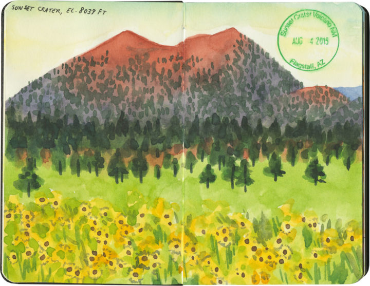
First up is Sunset Crater National Monument, a volcanic cinder cone and a landscape painter’s dream. The name, coined by John Wesley Powell, comes from the subtle gradation of reds and purples within the volcanic rock. Combined with the surrounding meadows that bloomed with wildflowers while we were there, the effect was stunning.

Walnut Canyon National Monument sketch by Chandler O'Leary

On the other side of Flagstaff lies Walnut Canyon National Monument. At first glance, this place appears to have little in common with Sunset Crater, but in fact the two are intrinsically connected. The people of the Sinagua culture had been living above the canyon rim since about the year 600, but after Sunset Crater erupted in about the year 1100, the population near the canyon grew rapidly as people fled the volcano. After that, the Sinagua began to settle inside the canyon itself, constructing cleverly-hidden cliff dwellings up and down the canyon’s walls (there are three sketched out in the drawing above—can you spot them?).

Wupatki National Monument sketch by Chandler O'Leary

I’ve saved the best for last: Wupatki National Monument. This site is located just a few miles north of Sunset Crater, and preserves entire pueblos built by the Sinagua. This sandstone city was built following the eruption of the cinder cone, after the deposit of volcanic ash made the area’s soil much more fertile. The Wupatki pueblo, pictured here, is the largest settlement within the national monument—this one apartment-building-like structure had 100 rooms and housed up to a hundred people (the entire settled region had several thousand Sinagua inhabitants).

Wupatki National Monument sketch by Chandler O'Leary

I’ve visited a lot of the ancient pueblo ruins of the Southwest, and I’m always drawn to the sophisticated architecture of each one. But so far I haven’t seen anything that provides as clear a picture of what life must have been like then as this place does. Walking through Wupatki really feels like one is trespassing through someone’s house—someone who might just return at any moment.

Save

Petrified Forest National Park sketch by Chandler O'Leary

Park rangers of the Mother Road

This post is part of an ongoing series called 66 Fridays, which explores the wonders of old Route 66. Click on the preceding “66 Fridays” link to view all posts in the series, or visit the initial overview post here.

The last post was a big fat tribute to the National Park Service, which celebrated its centennial yesterday. So it’s only fitting to spend today telling you about Petrified Forest National Park, which is the exact center of the Venn Diagram between the national parks and Route 66. In fact, it’s the only national park to contain a section of the original Mother Road.

Petrified Forest National Park sketch by Chandler O'Leary

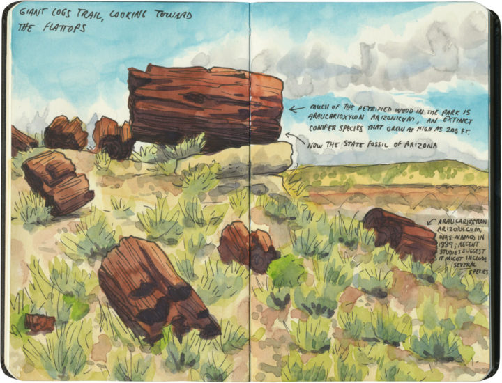
Of course, even if you didn’t know anything about Route 66, Petrified Forest is still infinitely worth visiting. There is the namesake petrified wood, of course, but it’s the landscapes that touched this artist’s soul.

Petrified Forest National Park sketch by Chandler O'Leary

Around every bend in the road was some new desert vista, each one vastly different than the one before. And with every passing cloud the light changed, essentially remaking the land in a totally new image, all within minutes.

Petrified Forest National Park and Route 66 sketch by Chandler O'Leary

And just when you’ve all but forgotten what brought you here, you crest a hill and see a telltale line of telephone poles, still marching westward to the horizon.

Save

Mt. Rainier National Park sketch by Chandler O'Leary

Our best idea

Mt. Rainier National Park, WA

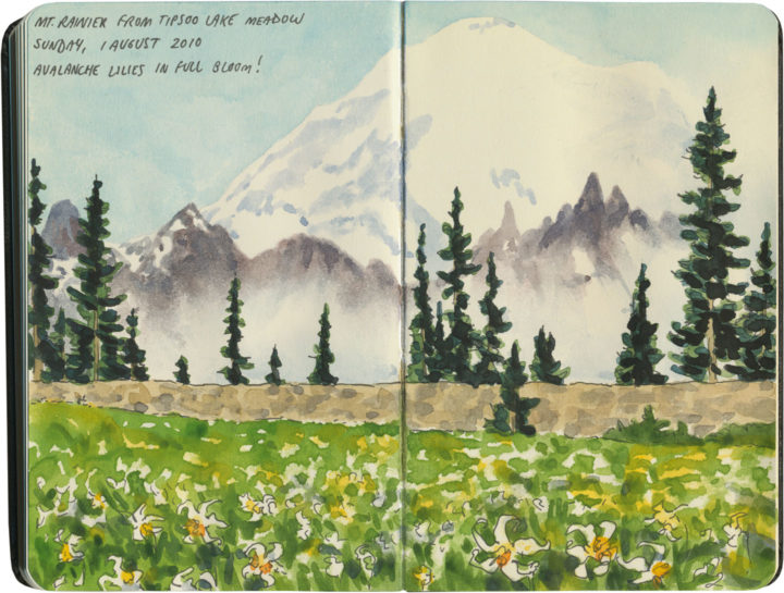
Tomorrow is the 100th birthday of the National Park Service. All of America seems to be celebrating right now, and rightly so. In my opinion, our wildest pockets are our true national treasures, and our national parks, as Wallace Stegner said, our best idea.

Olympic National Park sketch by Chandler O'Leary

Olympic National Park, WA

So since I’ve spent a good chunk of my sketching life in national parks both close to home…

Arches National Park sketch by Chandler O'Leary

Arches National Park, UT

…and far afield…

Crater Lake National Park sketch by Chandler O'Leary

Crater Lake National Park, OR

I figured I’d add my voice to the celebratory din, in the form of a little sketchbook retrospective.

Badlands National Park sketch by Chandler O'Leary

Badlands National Park, SD

Beyond the centennial itself, I’m always up for toasting the parks. Not only do I think park rangers are the best people on earth,

Redwood National Park sketch by Chandler O'Leary

Redwood National Park, CA

but I also sometimes think they’re the only thing standing between wildness and destruction.

Carlsbad Caverns National Park sketch by Chandler O'Leary

Carlsbad Caverns National Park, NM

And anyway, I’m not exaggerating when I say I’m a total park nut myself. It’s my goal to visit every NPS property before I die, including national parks, historic sites, national monuments, everything. (Actually, I’ve crossed a goodly chunk of them off the list already—

Guadalupe Mountains National Park sketch by Chandler O'Leary

Guadalupe Mountains National Park, TX

—and I even have the stamps to prove it.)

Olympic National Park sketch by Chandler O'Leary

Olympic National Park, WA

I know I have a long path ahead of me before I reach that goal,

Grand Canyon National Park sketch by Chandler O'Leary

Grand Canyon National Park, AZ

and getting there won’t be easy.

Big Bend National Park sketch by Chandler O'Leary

Big Bend National Park, TX

Yet I can’t tell you how grateful I am that the opportunity exists in the first place—

Rocky Mountain National Park sketch by Chandler O'Leary

Rocky Mountain National Park, CO

that so many people have fought to preserve these wild places, and won.

Saguaro National Park sketch by Chandler O'Leary

Saguaro National Park, AZ

Best of all is the feeling that no matter how long it might take me to get to each park with my sketchbook,

Glacier National Park sketch by Chandler O'Leary

Glacier National Park, MT

I know it’ll be there waiting for me, as close to unchanged as humanly possible. Thanks to the National Park Service, the window of opportunity remains open.

Save

Save

Save

Save

Save

Save

Save

Save
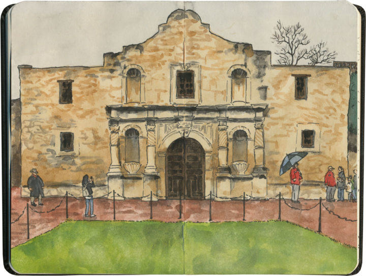
Alamo sketch by Chandler O'Leary

Remember the Alamo

It’s been awhile since I ran my Mission Mondays series, but I figured it was high time to add an honorary member to the list. Because after all, America’s collection of Spanish missions are not limited to California. And there’s probably no mission more famous than the Alamo.

Alamo sketch by Chandler O'Leary

I visited the Alamo last winter, on my first visit to San Antonio. After all those sunny days visiting California missions just a couple of weeks earlier, it was a surprise to find it cold and rainy deep in the heart o’ Texas.

Alamo sketch by Chandler O'Leary

Still, while the weather didn’t exactly provide a desert-southwest feel to the surroundings, it ended up creating a contemplative setting that somehow seemed more fitting for the Shrine of the Lone Star State.

Save