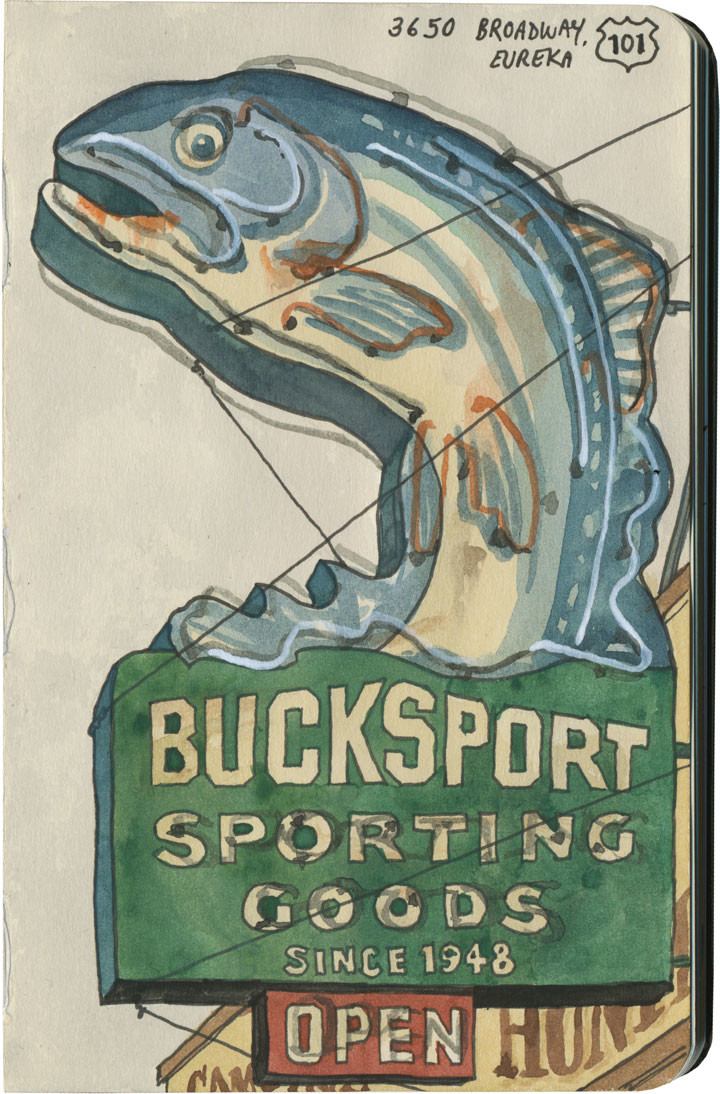
Take the leapEureka, CA

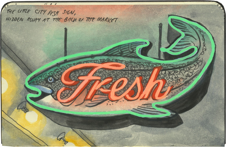
Fish sign sketch by Chandler O'Leary

I was really hoping I might have had a sketch of a neon leaping frog (or something similar) for today’s post, but no such luck. Still, a leaping trout ain’t too shabby.

Hope your extra day shines like a neon beacon…happy leap year!

Comments (0) Pin it!

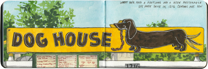
The tail wagging the dogAlbuquerque, NM

Route 66 sketch by Chandler O'Leary

This post is part of an ongoing series called 66 Fridays, which explores the wonders of old Route 66. Click on the preceding “66 Fridays” link to view all posts in the series, or visit the initial overview post here.

Those of you who are fans of the show Breaking Bad will recognize Fido here, but you might not know that this beauty has graced Route 66 for over half a century. But while the place is notable both for its television fame and the fact that you can get red or green New Mexico chili sauce on your dog, I was there purely for the neon.

For almost all of our Route 66 trip, I had to content myself with seeing most of the Mother Road’s neon during daylight hours only. But luckily for me, we stayed with friends in Albuquerque that night. I told them I was dying to see the Dog House at night, so after dinner we all made the trek back down to Central Avenue together.

Route 66 sketch by Chandler O'Leary

I couldn’t decide which stage of the neon motion to sketch, so I drew them all. And that led me to an idea I’d never tried before…

Animated Route 66 sketch by Chandler O'Leary

…just a wee bit of sketchbook animation. I think I might have stumbled upon something I’ll keep doing again and again. After all, there’s an awful lot of animated neon out there!

Comments (1) Pin it!

Lobsta letteringKittery, ME and Shediac, NB, Canada

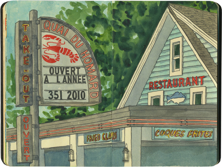
Lobster sign sketch by Chandler O'Leary

As you already know, I’m a big fan of francophone lobsters. Well, just down the street from the world’s largest homard is this lobsta joint, complete with excellent French lettering.

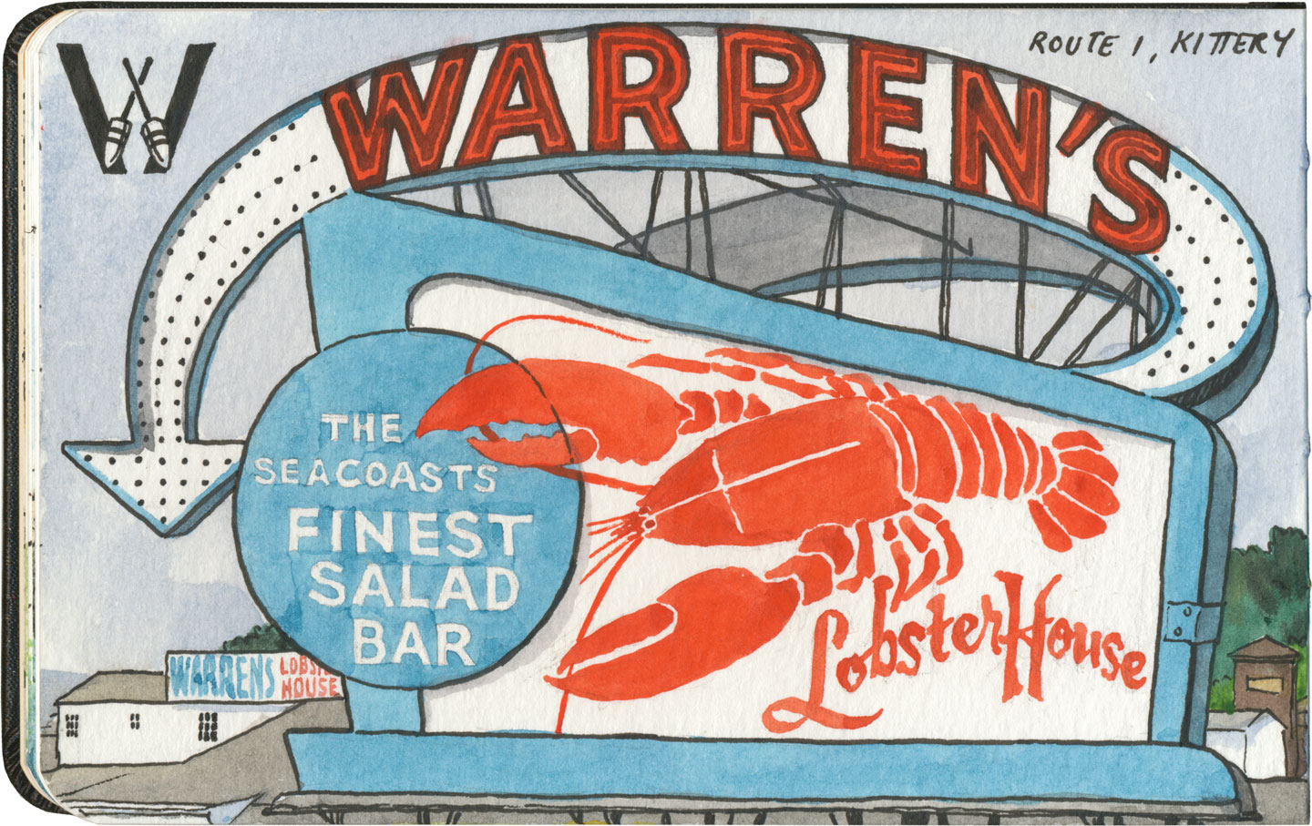
Lobster sign sketch by Chandler O'Leary

Not to be outdone by its Canadian cousin, New England’s got some great lobster neon, as well. In Kittery, Maine, just across the Piscataqua from Portsmouth, NH (home of that other bit of vintage nautical neon), is one of my favorite sea-creature signs. But I have to admit, I took a bit of artistic license with this one: I happen to have an old menu from Warren’s and the design of that thing puts even its own sign to shame. So I replaced certain bits of the sketch with some of my favorite elements from the menu.

(I should get my Artistic License laminated and keep it in my wallet—because I’m not afraid to use it!)

Comments (1) Pin it!

Somewhere to lean onGroom, TX

Route 66 sketch by Chandler O'Leary

This post is part of an ongoing series called 66 Fridays, which explores the wonders of old Route 66. Click on the preceding “66 Fridays” link to view all posts in the series, or visit the initial overview post here.

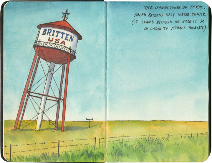
I crossed Texas twice last year: once at its widest point (where we logged over 900 Texas miles), and once across the Panhandle, which is where Route 66 cuts a literal straight and narrow path. One of the main Mother Road attractions to visit there is the “Leaning Tower of Texas,” a ho-made gravitational wonder in the middle of the neverending plain.

At least, it used to be in the middle of nowhere. Now it’s surrounded on three sides by other nearby giants: a bunch of those enormous modern windmills, and an awful 19-story cross that isn’t so much delightfully hokey as disgustingly hideous.

So I flashed my laminated Artistic License, faced east as to miss most of the horizon clutter, and edited out the rest. I regret nothing.

Llano Estacado sketch by Chandler O'Leary

After all, I was trying to capture the feeling of what it’s like to cross the Llano Estacado. Even today, when travelers have better navigational aids than makeshift stakes, it’s not hard to imagine how those first visitors must have felt.

Route 66 sketch by Chandler O'Leary

Or maybe modern technology has a different meaning here. Maybe the fenceposts and telephone poles and windmills that dot the landscape now are this era’s stakes, marching in steady progress across an otherwise unknowable vastness.
Comments (0) Pin it!

Arch-itectureBerkeley, CA

University of California sketch by Chandler O'Leary

I didn’t have a ton of time this day, as I was actually playing hooky on a lecture to do this sketch. So I didn’t have time to explore much of the Cal campus, but at least I stole a few moments to stand on the threshold and get something down on paper.

Comments (0) Pin it!

Oklahoma PantheonArcadia, OK

Route 66 sketch by Chandler O'Leary

This post is part of an ongoing series called 66 Fridays, which explores the wonders of old Route 66. Click on the preceding “66 Fridays” link to view all posts in the series, or visit the initial overview post here.

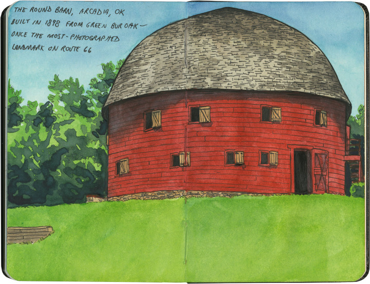
Last Friday’s post was a bit of a downer, I know. So today, as we move into the Sooner State, it seems like a good idea to visit a real beauty of the Mother Road: the Arcadia Round Barn. Built out of green wood carefully bent into precise curves, the barn is the only truly round (and not polygonal) barn in America. Its unique status and beautiful proportions made it the most photographed landmark on Route 66.

Route 66 sketch by Chandler O'Leary

It was hotter than blazes in the loft, but well worth suffering the heat. Because up there, surrounded by all that curved wood and perfect geometry, it felt more like the work of a Renaissance master than a humble farmer.

Save

Comments (0) Pin it!

Sunflower, sundownGalena, KS

Route 66 sketch by Chandler O'Leary

This post is part of an ongoing series called 66 Fridays, which explores the wonders of old Route 66. Click on the preceding “66 Fridays” link to view all posts in the series, or visit the initial overview post here.

Logically, if you were to plan a trip from Chicago to Los Angeles, the shortest route would have you traversing Kansas to get there. Yet Route 66 carves out just 13 miles of road in the state’s southeastern corner, and does the bulk of its crossing of the Great Plains through Oklahoma instead. Why, you ask? Well, that’s an interesting story. The man responsible for plotting the Mother Road’s path, Cyrus Avery, called Tulsa home. He wanted to show off his state in all its glory, so he made Route 66 both a tour guide and a monument to Oklahoma, with over 400 miles of pavement to draw travelers and tourist dollars there. Still, Kansas gets a small slice of the action, and this gorgeous early-1900s train station does the Sunflower State proud.

There’s something else about this sketch that needs some explaining. See those small figures flanking the front steps? Yes, those are lawn jockeys. I could have just left them out of the sketch entirely, since I personally find lawn jockeys offensive and I hate to single out Galena. But I didn’t, because they bring up an uncomfortable truth about travel Americana, and the Mother Road in particular.

While it’s easy to get wrapped up in the nostalgia of olde-tyme family road trips and midcentury diners along Route 66, that part of American history is really only quintessential to the white population of this country. Black Americans, in particular, didn’t travel Route 66 the way white ones did. In many places, it simply wasn’t safe for them to do so. These places had a name that most of the nostalgic Mother Road literature seems to have forgotten: sundown towns.

Sundown towns—communities that barred people of color from the town limits after dark—were by no means confined to the South, nor did they exclude only African-Americans (my own city of Tacoma, WA expelled its Chinese residents in 1885). Sundown towns could be found everywhere from Connecticut to California, and even as late as the 1960s there were thousands of them. Thankfully Galena, as far as I can tell, was not among them—I should make that clear, since I’m already featuring that town in this post. Yet sadly, there were many sundown towns along Route 66—particularly in Oklahoma, Illinois, Missouri and California. In fact, for thirty years Black travelers relied upon the advice in The Negro Motorist Green Book, a guidebook printed between 1936 and 1964, which outlined which routes, communities, services, restaurants and lodging were willing to serve road-trippers of color. The Green Book mostly sent travelers well away from Route 66 and its many Jim-Crow-era dangers.

This history is all but scrubbed from the modern remnants of the Mother Road. If I hadn’t seen those lawn jockeys, I might not have thought to look into it myself. Yet unfortunately, there is also some fresh modern racism along 66. (We were particularly horrified by the large number of Confederate flags we saw along the route, mostly in western Arizona.) You’ll never see a sketch of that sort of thing on this blog, but I feel it’s important to note that it’s out there, that the Mother Road is not all neon and nostalgia. After all, you know what they say about those who don’t learn from the past.


Comments (5) Pin it!
« Older Posts Newer Posts »