Eastern terminusChicago, IL

Route 66 sketch by Chandler O'Leary

This post is part of an ongoing series called 66 Fridays, which explores the wonders of old Route 66. Click on the preceding “66 Fridays” link to view all posts in the series, or visit the initial overview post here.

To help you keep your bearings in this 66 Fridays series, and to provide an overview of the route, the first few posts will go in geographical order. So let’s start at the very beginning, at the eastern terminus of the route.

American highways, in general, are measured from south to north, and from west to east. So in general, the “start” of any highway is technically its southern- or westernmost point, and the milemarkers count from there. But for our Route 66 trip we went from east to west. That’s because for that highway, at least, most travelers (from Dust Bowl migrants to pleasure cruisers) seemed to head that direction. All the Route 66 lore, from songs to stories, seems to be oriented that way, too. And besides, America is steeped in the tradition of heading West—to me, the East still feels like a beginning, and the West a promise of what lies ahead.

So that put the beginning of our journey at the beginning of the route: in downtown Chicago.

Chicago sketch by Chandler O'Leary

Route 66’s path through Chicago has changed somewhat over the years, but that’s a longer story than necessary for this post. To make things simpler, most travelers and historians count Michigan Avenue, between Adams and Jackson, as the eastern terminus of the Mother Road. (Adams is a one-way heading west, and Jackson is the same eastbound, hence the two intersections.) And there are no better guardians of the route than the bronze lions prowling in front of the Art Institute.

Chicago sketch by Chandler O'Leary

It’s even more fitting when you consider that the Art Institute was originally part of the 1893 World’s Columbian Exposition. A sort of World’s Fair, the Exposition marked 400 years since Christopher Columbus landed in the New World, and celebrated the rebirth of Chicago after the Great Fire of 1871. Most of the buildings erected for the Exposition were designed to be temporary, but the Art Institute was intended to occupy what was the World Congress Auxiliary Building at the fair, so that structure was made permanent.

Oh, and incidentally, the Art Institute of Chicago was originally called the Chicago Academy of Design, which was founded in 1866. Its address before the Great Chicago Fire? 66 West Adams Street.

Route 66 sketch by Chandler O'Leary

Somehow, then, it seems pretty perfect that an old WCE building, originally designed to promote westward exploration and new beginnings at the fair, marks the beginning of America’s best-known westward highway.

Comments (1) Pin it!

Mother Road, mother lodeRoute 66

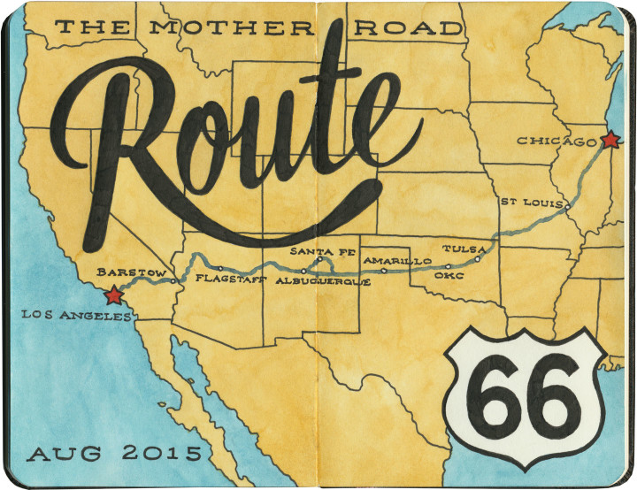
Route 66 sketch map by Chandler O'Leary

Last summer the Tailor and I spent a couple of weeks traveling every inch of old Route 66. And then I kept pretty quiet about it, because I just had no idea how to organize and share the sheer number of sketches and stories I came away with afterward. There really is no “long story short” way to do this—like the Mother Road itself, there are too many branches and tangents for a single linear tale. So like I did for my Mission Mondays series, I’m going to break this down into 66 Fridays, starting today and running through spring of next year. (You can follow along by using the 66 Fridays tag.)

So each week for the next 66 weeks, I’m going to share a piece of Route 66—and like everything else on this blog (except the Mission series), those pieces will be in no particular order. There are a zillion books out there already that tell the Route 66 story from beginning to end (both in time and space), so that frees me to, er, paint a slightly different picture. I’ll be jumping around from state to state, highlighting my favorite landmarks and historical tidbits. With any luck, it’ll give you a good enough taste of the Mother Road that it’ll inspire you to explore it for yourself.

Route 66 sketch by Chandler O'Leary

A few notes:

• There’s a common perception that Route 66 is long gone, and that modern travelers can only drive bits of the route. That’s actually not true. While modern Interstate highways have replaced long chunks of the Mother Road in certain spots, it’s actually possible to drive over 80 percent of the original route—including the original road bed and even 90-year-old pavement in several places. Route 66 was officially decommissioned as a U.S. highway decades ago, but the old thread is still there, still nearly intact, just waiting for an adventurous traveler with a sharp eye to find it.

• We didn’t see everything there is to see on Route 66. Not even close. We spent nearly two weeks on the Mother Road, and by my estimate we would have needed a good month, at least, to really take it all in. Considering how much more there would have been to see years ago, before so many places closed down or fell into ruin, it all boggles my mind a bit. Nevertheless, this trip was a good first taste of the whole thing. I made the Tailor promise me that someday we’d do it all again, and take however much time we wanted.

• Even though we didn’t see everything along the way, we did our darndest to drive every inch of the route that remains—and that’s no small feat, considering how many tributaries, diversions, parallel routes, rerouted sections, poorly-marked bits and dead ends there are. I’d driven bits of 66 before, but never the whole stretch in one go. It feels like a real accomplishment that we did that.

• I hope you don’t hate vintage signs, because you can expect a lot of them in the coming months. I’ll try to keep the posts balanced between various subject matters, but I’m not gonna lie: there’s a metric ton of incredible vintage signage along Route 66, and I did my level best to draw all of it. I have whole sketchbooks just devoted to neon. I probably won’t show you everything, but you will see an awful lot of it.

Route 66 sketch by Chandler O'Leary

So buckle your seatbelts and pull out your paper maps—let’s get this show on the road, and embark upon the serious business of getting our kicks.

Save

Comments (2) Pin it!

Through the rear-view mirror

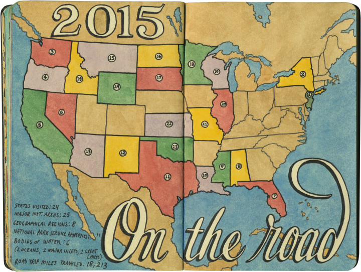
Sketch map by Chandler O'Leary

Since the year is about to end, I figured it was the perfect time to look back and see how far I’ve come this year. I did all my traveling in the first two-thirds of the year (the last third saw me stuck in the studio and chained to big projects and their deadlines, hence the light posting around here lately), but 2015 still smashed most of my travel records. I spent 65 days on the road this year, and I don’t think I’ve ever visited so many states in such a short time period. The best part of all: I’d do it all again tomorrow, if I could.

I don’t think 2016 is going to include quite so many travel plans, but keeping closer to home for now is fine by me: I have big plans for this blog, and they’ll keep me plenty busy. In the meantime, wishing you a happy new year, and safe journeys to wherever the road might take you.

Comments (2) Pin it!

Red and greenAlbuquerque, NM

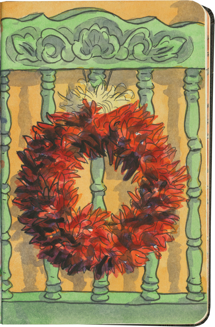
Chili ristra wreath sketch by Chandler O'Leary

If you find yourself in a New Mexico restaurant, your server will ask you if you want red or green chili sauce with your entrée. If you happen to want both, you can answer “Christmas,” and they’ll know what you mean.

Well, I didn’t happen to have a sketch of “Christmas” on a plate, but I figured this was the next best thing. Whether you’re in New Mexico or somewhere else this year, I wish you a very merry Christmas, indeed.

Comments (0) Pin it!

Like peas n’ carrotsWinter vegetables from Olympia and Puyallup Valley, WA

Food storage sketch by Chandler O'Leary

The air has gone from crisp to cold. The leaves are thinning on the trees. And apparently half the vegetables in Washington are currently in our root cellar. I think that means it’s November.

We’ve already dipped into the pumpkins for tomorrow’s festivities—and if you find yourself in the States at the moment, here’s wishing you a Happy Thanksgiving.

Comments (2) Pin it!

Mission: AccomplishedSonoma, CA

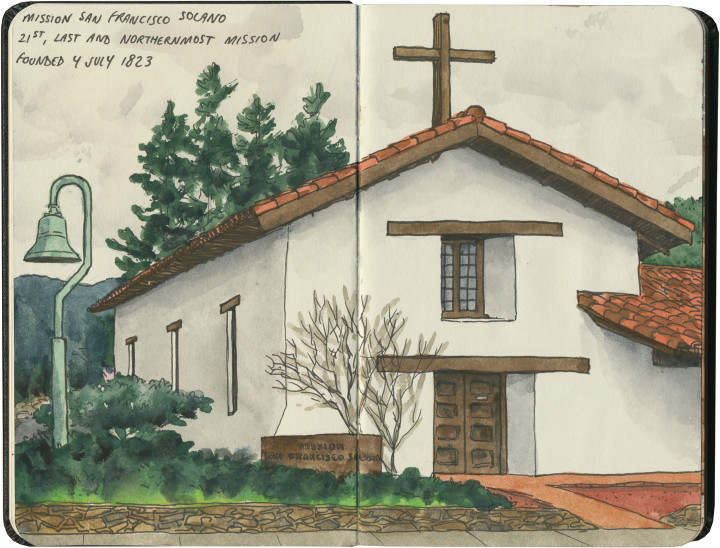
Mission San Francisco Solano sketch by Chandler O'Leary

This is the twenty-first and final installment of my Mission Mondays series, exploring all 21 Spanish Missions along the California coast. You can read more about this series, and see a sketch map of all the missions, at this post.

Here we are, at long last! The very last California mission, in all its (understated) glory.

Detail of California Missions map sketch by Chandler O'Leary

The northernmost mission in the Alta California system was also the very last one founded—fitting, since the while the missions in the middle are a jumble of out-of-sequence dates, the southernmost was also the first.

Mission San Francisco Solano sketch by Chandler O'Leary

Mission San Francisco Solano is located at the center of the town of Sonoma, California’s famous wine-country gem. In fact, the first vineyard in Sonoma Valley was planted by the mission priests, for producing their own sacramental wine. And every October there is still a “blessing of the grapes” ceremony on site.

Mission San Francisco Solano sketch by Chandler O'Leary

In 1835 the mission was deconsecrated, and Commander Mariano Vallejo turned much of the site into a military garrison to defend the interests of the newly-independent country of Mexico (Alta California was part of the Viceroyalty of New Spain until 1821, and wasn’t ceded to the U.S. until the 1848 Treaty of Guadalupe Hidalgo). In the intervening years, the property was abandoned, fell into serious disrepair, and over time was gradually restored.

Mission San Francisco Solano sketch by Chandler O'Leary

Today the mission is just one historic property among many in Sonoma, kitty-corner to the town plaza and surrounded by tidy streets and upscale shops. It’s hard to imagine what it must have been like before the valley was populated with modern residents and tourists—but it’s not hard to find the spirit of the place, and fall into a contemplative silence.

• • • • • • • • • • • • • • • • • • • • • • • • • • • • • • • • • • • • • • • • • • • • • • • • • • • • • •

That’s it! I hope you’ve enjoyed this virtual road trip with me. Now that we’ve visited all 21 missions, maybe it’s worth looking back at how far we’ve come. Here’s that map again:

California Missions map sketch by Chandler O'Leary

And a list of all the posts for each site:

MIssion San Diego de Alcalá
Mission San Luis Rey de Francia
Mission San Juan Capistrano
Mission San Gabriel Arcángel
Mission San Fernando Rey de España
Mission San Buenaventura
Mission Santa Barbara
Mission Santa Inés
Mission La Purísima Concepción
Mission San Luis Obispo de Tolosa
Mission San Miguel Arcángel
Mission San Antonio de Padua
Mission Nuestra Señora de la Soledad
Mission San Carlos Borroméo del Río Carmelo
Mission San Juan Bautista
Mission de la Exaltación de la Santa Cruz
Mission Santa Clara de Asís
Mission San José
Mission San Francisco de Asís
Mission San Rafael Arcángel
Mission San Francisco Solano

Because I love travel stats, here are a few:

Miles traveled: Well, not counting the 1200 miles between San Diego and my house, nor any of the non-mission-related side trips I took along the way, I drove approximately 925 miles just between the 21 missions (I know my map says 600 miles, but modern highway routes and some required back-and-forth affected the actual driving distance).

Time period in which missions were founded: Between 1769 (San Diego) and 1823 (San Francisco Solano).

Number of missions where all or most of the structure is a 20th-century replica: 7 (All but one of those are in the northern half of the chain.)

Number of missions that still have consecrated churches or chapels on site: 18 (La Purísima, Santa Cruz and San Francisco Solano do not.)

Number of times I didn’t see a mission from the inside: 5 (Two were closed when I got there, one was in the middle of mass, one had a wedding going on, and another was hosting a quinceañera.)

Most touristy: San Juan Capistrano had the gift shop and theme-town thing down, but I saw the greatest number of actual tourists at Santa Barbara. There were gobs and gobs of them.

Least touristy: San Antonio de Padua, where I was the only one there—though La Soledad was a close second, most likely because it’s literally in a farm field and nearly unmarked.

Most underrated: This one’s hard, because almost all of them are underrated in some way. But I’m going to go with San Miguel, because it’s such a stunning place, and the adjacent freeway just sends people flying right on by.

Best architecture: Tie between San Juan Capistrano and Mission Carmel, but with a special shout-out to the Moorish design of San Gabriel—and to the folks at Mission San Jose for being sticklers in choosing a period-authentic replica over a glitzy showpiece.

Overall favorite mission: La Purísima. Hands down. But the runner-up remains San Juan Bautista, which was my first love.

Final thoughts:

The thing that most struck me is the contrast between the missions—not only the various architectural styles, but the varying states of repair and disrepair. I would love to see an integrated system like the National Parks System has, encouraging tourists to visit all 21 missions and share a common pool of resources, staff and funding for upkeep and repairs.

Whatever system there may or may not be in future, it doesn’t change the fact that all of the missions are worth visiting and preserving. I’d do the whole trip again in a heartbeat—and I hope I get the chance to do just that, someday.

Comments (4) Pin it!

Pretty in pinkSan Rafael, CA

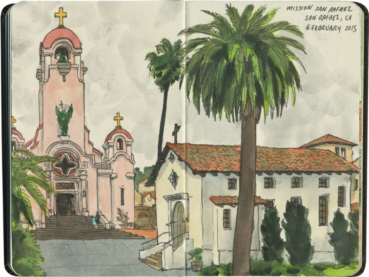
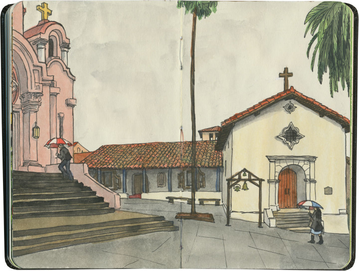
Mission San Rafael Arcángel sketch by Chandler O'Leary

This is the twentieth installment of my Mission Mondays series, exploring all 21 Spanish Missions along the California coast. You can read more about this series, and see a sketch map of all the missions, at this post.

This is yet another replica mission—making it compare less favorably to places like San Francisco or San Juan Capistrano, and one of the least visited in the chain. In fact, when I later had dinner with a local and told him what I’d done that day, he said, “Yeah, but it’s been totally rebuilt, so it hardly counts.” Well, fair enough. Still, I’m a completist, so here we are.

Detail of California Missions map sketch by Chandler O'Leary

Mission San Rafael Arcángel completes the trio of missions named for the three arcangels (Gabriel, Michael and Raphael). Originally it was built as an asistencia or sub-mission (there are still several sub-missions still standing, but I didn’t visit any of them—it was hard enough to get to the 21 main missions!), but it was “upgraded” to full mission status in 1822.

Mission San Rafael Arcángel sketch by Chandler O'Leary

The pink tower of St. Raphael’s Church is the most eye-catching feature of the complex, but what’s more interesting to me is that the mission served as (what would become) Marin County’s first hospital. Taking advantage of the superior air quality to that of San Francisco, San Rafael was organized as a sanitarium for the local Indigenous tribes.

Mission San Rafael Arcángel sketch by Chandler O'Leary

Sadly, there’s really no trace of the original mission left today—which makes the old wall at Santa Cruz seem like precious treasure. The current buildings are twentieth-century replicas, and not even the layout of the original complex has been preserved. So I can see where my local acquaintance was coming from, I guess. Still, I can’t write the place off entirely—whatever form it takes, it’s a link to California’s past.

Mission San Rafael Arcángel sketch by Chandler O'Leary

As far as I’m concerned, it still counts.

Comments (2) Pin it!

Sturdy GertieTacoma, WA

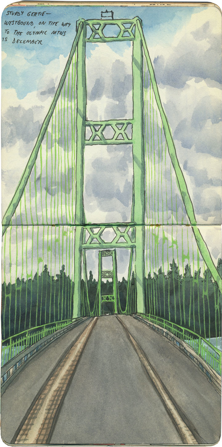
Tacoma Narrows Bridge sketch by Chandler O'Leary

Seventy-five years ago today, the original Tacoma Narrows Bridge collapsed in a spectacular tangle of twisted cables and swaying concrete. You can actually watch “Galloping Gertie” meet her doom on film (complete with cheeseball movie reel narration, sped-up footage and sound effects), readily accessible thanks to the magic of the internet.

The only casualty was a dog. But the collapse was an incredibly high-profile event—and not just because at the time, the Tacoma Narrows Bridge was the third-longest suspension bridge in the world. You see, it had been designed by famous engineers, including lead designer Leon Moisseiff (co-designer of the Manhattan Bridge) and consulting engineer Joseph B. Strauss (chief engineer of the Golden Gate Bridge). These guys were leading scientists who applied cutting-edge theories in physics to their work—but even they had never encountered what would come to be known as “aeroelastic flutter.” The conditions were just right, and that was it. (Though I’m sure I’m not the first to add that people should listen when we say it gets windy here in November.)

Thanks to the interruption of World War II, it took a decade for the bridge to be redesigned and rebuilt. “Sturdy Gertie” opened in 1950, and westbound traffic still travels over that span today. Luckily for us (and knock on wood), Gertie’s plenty solid this time around. No galloping from this baby, please and thank you.

Comments (0) Pin it!

Little GiantSan Francisco, CA

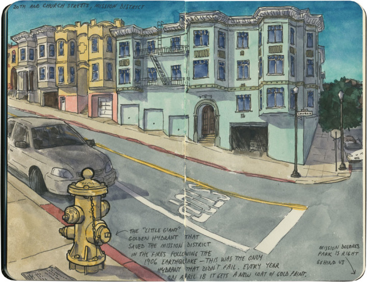
San Francisco sketch by Chandler O'Leary

Just a couple of blocks from Mission Dolores is a tiny, inanimate hero—one that saved the Mission District from ruin over a century ago. The story of San Francisco’s 1906 earthquake is a famous one, but not everyone knows that it’s actually the fire which immediately followed that did most of the damage. With the water mains broken by the quake, most of the city’s hydrants ran dry, allowing the fire to take out whole neighborhoods. In the end 80 percent of the city was destroyed.

In the Mission District, just one hydrant was miraculously still working: the one at 20th and Church Streets. The problem was that the hydrant was perched near the top of the hill, high above the horse-drawn fire wagons stationed along Market Street. The exhausted horses couldn’t pull the wagons up to the hydrant—so the hundreds of refugees gathered across the street in Dolores Park pitched in to help, pulling and pushing the wagons uphill by hand. The entire neighborhood fought the flames when they reached 20th Street, and after a seven hour battle, the Mission District declared victory. And to this day, every April 18 at 5:12 am (the date and time of the 1906 quake), the descendants of those who were there meet to give the “Little Giant” a fresh coat of gold paint.

It’s a great story, full of swashbuckling detail—much of which I’ve had to leave out for the sake of brevity. So I’ll just leave you with my favorite part of the tale: with the water mains and every neighboring hydrant broken, nobody could ever explain where the water came from that kept the Little Giant up and running.

Comments (2) Pin it!

Pillar of the communitySan Francisco, CA

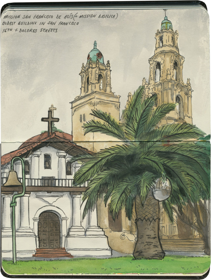
Mission San Francisco de Asís sketch by Chandler O'Leary

This is the nineteenth installment of my Mission Mondays series, exploring all 21 Spanish Missions along the California coast. You can read more about this series, and see a sketch map of all the missions, at this post.

Mission San Francisco de Asís (or Mission Dolores, if you prefer the nickname) is the centerpiece and namesake of San Francisco’s Mission neighborhood. Yet the mission itself, tucked away on a residential block, behind towering palms and ficus trees, seems to get lost amid all the trendy restaurants and busy hipsters flooding the rest of the neighborhood. It’s even overshadowed by the tall spires of the basilica next door—many people don’t even know that the squat adobe building is the actual mission, not the towering cathedral.

Detail of California Missions map sketch by Chandler O'Leary

As an aside, I did this one out of order… as I happened to be in the Bay Area at the beginning of my trip, rather than the end, I did the last three missions first, in reverse order.

Mission San Francisco de Asís sketch by Chandler O'Leary

This is one mission I knew well—at least from the outside. Every time I’m in San Francisco, I end up with errands to run, or people to see, or at least a route that takes me through this neighborhood. So Mission Dolores has gone from familiar landmark to old friend. The interior was a mystery to me, though, and it took all of three seconds to know I’d found a hidden gem. I stepped one foot inside—

Mission San Francisco de Asís sketch by Chandler O'Leary

—and that ceiling just took my breath away.

Mission San Francisco de Asís sketch by Chandler O'Leary

The mission chapel is no longer a consecrated church, but it still deserves plenty of reverence. After all, Mission Dolores is the oldest intact building in San Francisco—which, considering the devastation of the 1906 earthquake (not to mention all those other destroyed missions), is really saying something.

Mission San Francisco de Asís sketch by Chandler O'Leary

So if you find yourself in San Francisco, on your way to Tartine (come on, I know I’m not the only one), stop here first. I promise it’ll be worth the detour—and I can’t think of a better place to pay homage to the City by the Bay.

Comments (0) Pin it!
« Older Posts Newer Posts »