Tag Archives: west

Mt. Rainier National Park sketch by Chandler O'Leary

Our best idea

Mt. Rainier National Park, WA

Tomorrow is the 100th birthday of the National Park Service. All of America seems to be celebrating right now, and rightly so. In my opinion, our wildest pockets are our true national treasures, and our national parks, as Wallace Stegner said, our best idea.

Olympic National Park sketch by Chandler O'Leary

Olympic National Park, WA

So since I’ve spent a good chunk of my sketching life in national parks both close to home…

Arches National Park sketch by Chandler O'Leary

Arches National Park, UT

…and far afield…

Crater Lake National Park sketch by Chandler O'Leary

Crater Lake National Park, OR

I figured I’d add my voice to the celebratory din, in the form of a little sketchbook retrospective.

Badlands National Park sketch by Chandler O'Leary

Badlands National Park, SD

Beyond the centennial itself, I’m always up for toasting the parks. Not only do I think park rangers are the best people on earth,

Redwood National Park sketch by Chandler O'Leary

Redwood National Park, CA

but I also sometimes think they’re the only thing standing between wildness and destruction.

Carlsbad Caverns National Park sketch by Chandler O'Leary

Carlsbad Caverns National Park, NM

And anyway, I’m not exaggerating when I say I’m a total park nut myself. It’s my goal to visit every NPS property before I die, including national parks, historic sites, national monuments, everything. (Actually, I’ve crossed a goodly chunk of them off the list already—

Guadalupe Mountains National Park sketch by Chandler O'Leary

Guadalupe Mountains National Park, TX

—and I even have the stamps to prove it.)

Olympic National Park sketch by Chandler O'Leary

Olympic National Park, WA

I know I have a long path ahead of me before I reach that goal,

Grand Canyon National Park sketch by Chandler O'Leary

Grand Canyon National Park, AZ

and getting there won’t be easy.

Big Bend National Park sketch by Chandler O'Leary

Big Bend National Park, TX

Yet I can’t tell you how grateful I am that the opportunity exists in the first place—

Rocky Mountain National Park sketch by Chandler O'Leary

Rocky Mountain National Park, CO

that so many people have fought to preserve these wild places, and won.

Saguaro National Park sketch by Chandler O'Leary

Saguaro National Park, AZ

Best of all is the feeling that no matter how long it might take me to get to each park with my sketchbook,

Glacier National Park sketch by Chandler O'Leary

Glacier National Park, MT

I know it’ll be there waiting for me, as close to unchanged as humanly possible. Thanks to the National Park Service, the window of opportunity remains open.

Save

Save

Save

Save

Save

Save

Save

Save

Route 66 sketch by Chandler O'Leary

A flash of intuition

This post is part of an ongoing series called 66 Fridays, which explores the wonders of old Route 66. Click on the preceding “66 Fridays” link to view all posts in the series, or visit the initial overview post here.

There are few Route 66 landmarks more iconic than the art installation known as Cadillac Ranch, so the Tailor and I were really looking forward to seeing it in person. Unfortunately, however, long before we reached Amarillo we knew we’d lose the race for daylight. To make matters worse, a big thunderstorm was rapidly approaching from the west, the intermittent flashes of lightning coming ever closer, ever more quickly. Not exactly ideal weather to go fumbling around in the dark in search of roadside attractions. After all, it’s not like Cadillac Ranch is in the center of town—it’s out in the middle of an unmarked field, and I had a sneaking suspicion there were no floodlights trained on those cars.

The Tailor really wanted to stop anyway, and said, “Surely it’s lit after dark. It’s so famous!” I told him I didn’t think so—according to our maps we were within spitting distance of it, and there was nothing but inky black out there. Besides, the Texas Panhandle is so flat that if it were lit at all, we would have seen it from miles away.

I’m sorry to say I was right about that: it’s not lit. At all. It’s not marked in any way—at least, not by any method that could be discerned by headlight. We drove back and forth a few times on the mile-long stretch of beat-up frontage road to which I’d narrowed down the location, while I peered through the passenger-side window into the darkness, hoping a flash of lightning might give us a clue. Finally I broke down and, for the one and only time on our entire Route 66 trip, consulted the GPS map on my phone to see if we’d found the right place. With the one available bar of mobile service, our insistence on paper maps was at least vindicated: we had gotten the location precisely right.

“This is the spot, ” I said. “Can’t see anything, but we’re looking right at it.”

“Wait,” he answered, “maybe we’ll catch a glimpse of it in the storm.”

We waited. A few heartbeats of silence.

And then: CRACK.

Route 66 sketch by Chandler O'Leary

A fork of lightning, directly in front of us, not half a mile ahead. The flash illuminated ten unmistakeable silhouettes for a split second that felt like an eternity.

We looked at each other and simultaneously burst into nervous cackling, our eyes wide, the hairs on the napes of our necks standing on end.

Save

Deadwood sketch by Chandler O'Leary

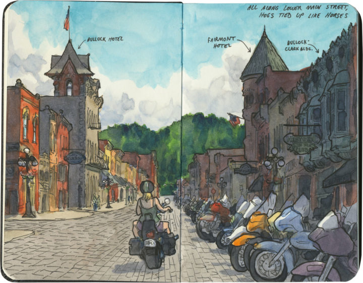
Hitching posts for Harleys

I’ve mentioned before that I always seem to end up in the Black Hills right in the middle of the Sturgis Rally. Well, last summer I didn’t just sneak by on the highway—I jumped right into the fray. My destination wasn’t Sturgis proper, but rather nearby Deadwood, that infamously lawless frontier town of yore. I hadn’t been since I was a tiny child, so I figured it was high time I stopped by again.

And when I got there, I had a good long chuckle. Because somehow seeing all those motorcycles lined up like horses at their hitching posts, and all the weather-beaten wild-west road warriors who belonged to them… Well, somehow the scene fit the setting better than any costumed reenactor could have done.

Route 66 sketch by Chandler O'Leary

Bridge over troubled water

This post is part of an ongoing series called 66 Fridays, which explores the wonders of old Route 66. Click on the preceding “66 Fridays” link to view all posts in the series, or visit the initial overview post here.

Route 66 was commissioned during something of a golden age of American infrastructure design. Thanks to various building booms and organizations like the WPA, the highway is studded with functional architecture that is also incredibly beautiful. One shining example is the magnificent Colorado Street Bridge in Pasadena.

Curving gracefully across the Arroyo Seco that divides Los Angeles from its inner-ring suburbs, the bridge was once the tallest concrete span on earth. Sadly, this may be what inspired the bridge’s more well-known moniker: Suicide Bridge. Over a hundred suicides have taken place there over the years—the vast majority of them during the Great Depression. With so many deaths to its name, the bridge also has a reputation for ghost sightings and other haunted tales.

I knew none of this on the day I crossed (and sketched) the Arroyo. To me, the bridge was just a stunning welcome to Los Angeles, the last major city on Route 66. I guess it’s a fitting way to cross over into the City of Angels.

Route 66 sketch by Chandler O'Leary

Fill ‘er up

This post is part of an ongoing series called 66 Fridays, which explores the wonders of old Route 66. Click on the preceding “66 Fridays” link to view all posts in the series, or visit the initial overview post here.

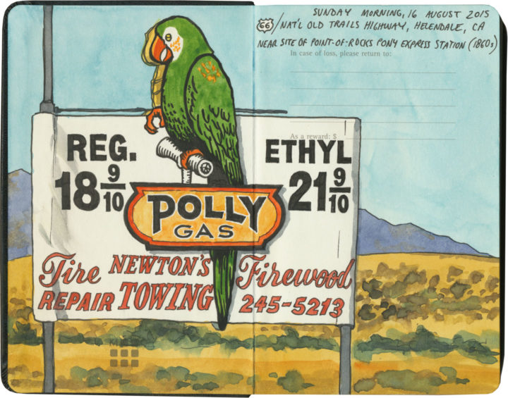
Polly want a pit stop?

If you’re going to take a road trip, at some point you’re going to need to refuel. And nobody knows how to fill your tank like the folks on Route 66. Of course, since the route crosses a big swath of American oil country, you’ll know that the milk of the Mother Road is petroleum.

Route 66 sketch by Chandler O'Leary

Cuba, Missouri

The thing is, though, the designers and architects and advertisers and engineers responsible for putting gas stations all along the route got into the spirit of 66 in their own unique ways. Forget what you know about ugly garages lining Interstate exits—many of Route 66’s filling stations are downright works of art.

Route 66 sketch by Chandler O'Leary

Cuba, Missouri

And many of them look absolutely nothing like gas stations.

Interestingly, the Mother Road was built at a time when more and more Americans owned automobiles—all over the country there was an increasingly large demand for petrol. Filling stations moved into town centers and residential neighborhoods, and some oil companies wanted their fuel stops to blend in with the neighborhood architecture.

Route 66 sketch by Chandler O'Leary

Since American architecture is highly regional in nature, many of these “camoflaged” filling stations took on the look of their local culture—Spanish-Mission-style canopies in California, limestone façades in the Ozarks, clapboard farmhouse lookalikes in the Plains, etc. And then, of course, architectural tastes changed over the years, so you’ll find examples from the Victorian era to midcentury pop-Googie, and everything in between. (Not to mention the tradition of kitschy filling stations shaped like random objects or weird ho-made roadside giants.) Finally, each oil company wanted to attract customers away from the others, so they relied on creating distinctive architectural styles as a form of branding. The result is a veritable encyclopedia of diverse and spectacular specimens—and Route 66 might just have the best collection of all.

Route 66 sketch by Chandler O'Leary

Albuquerque, New Mexico

After a few hundred miles, we started getting really good at spotting the buildings that used to be filling stations (this is an obvious one, but many had been deeply camoflaged, or totally remade in some other image, or else fallen into ruin). And we also developed a knack for pegging which style belonged to which company (above is a classic 1930s Texaco design).

Route 66 sketch by Chandler O'Leary

Tulsa, Oklahoma

Then again, sometimes a building would throw us completely—the sealed-up garage bays hint at the Blue Dome’s history, but if I didn’t know better, I would have guessed this was once a Greek Orthodox church or something.

Route 66 sketch by Chandler O'Leary

Spencer, Missouri

The filling stations of Route 66 also serve as markers of time’s passage, and the rise and fall of communities along the way. This one is all that remains of a ghost town in Missouri that fell into disuse when the highway changed its route. (I’m not talking about the advent of the Interstate, either, although that’s a common story—this place lost its prime spot decades before that, when the 66 alignment was simply moved to a spot further south.)

Route 66 sketch by Chandler O'Leary

Ranco Cucamonga, California

While many petroleum relics have faded into oblivion, others are being brought back, at least in some form or other. Above is one of the oldest specimens we found (it actually predates the birth of Route 66 by nearly a decade). While part of the structure has been torn down, at least the main part of the station is getting a lovely facelift.

Route 66 sketch by Chandler O'Leary

Needles, California

It’s not just the oldest samples being preserved, either. This guy is only a little over fifty years old, but it, too, has been returned to its former glory.

Route 66 sketch by Chandler O'Leary

Normal, Illinois

For many old stations, however, the opposite is true. Countless specimens either sit empty, their original purpose unknown to the average passerby—or else they get cannibalized and transformed into some other creature, usually without any fanfare.

Route 66 sketch by Chandler O'Leary

Hydro, Oklahoma

These stories of disrepair and restoration interest me greatly, of course, but what really gets me is the story of each place: the whys and wherefores of each station, and the tastes and quirks of the people who either built or ran them.

Route 66 sketch by Chandler O'Leary

Cool Springs, Arizona

After all, Route 66 crosses through some seriously unpopulated territory. Many of these old filling stations were the only game in town—or in the most remote corners, something closer to the last chance for salvation.

Route 66 sketch by Chandler O'Leary

Commerce, Oklahoma

While others, meanwhile, live on in notoriety, attracting tourists to the spots where blood was shed or infamous characters once stood.

Route 66 sketch by Chandler O'Leary

Odell, Illinois

Still, most tell the story of perfectly ordinary people running perfectly ordinary businesses along one of the backbones of American travel and commerce. They might be extraordinary today, but usually that’s boils down to having somehow lasted long enough to stand out amongst more modern surroundings.

Route 66 sketch by Chandler O'Leary

Shamrock, Texas

I’m glad, at least, that I’m obviously not the only one who has noticed these things—that there is an army of conservators and historians and artists and boosters out there, preserving as many of these old filling stations as possible, and documenting the ones that can’t be saved.

I know that these days, oil companies have fallen out of public favor (heaven knows I have my own beef with the oil industry)—regardless of their nostalgia, these places are also reminders of American excess and the damaging effects of fossil fuels. Yet however we may be careening toward Peak Oil, these relics still have a place on the Mother Road—the path that might just traverse this country’s Peak History.

Save

Save

Save

Save

Save

Save

Save

Save

Cabazon dinosaurs sketch by Chandler O'Leary

Dino you are, but what am I?

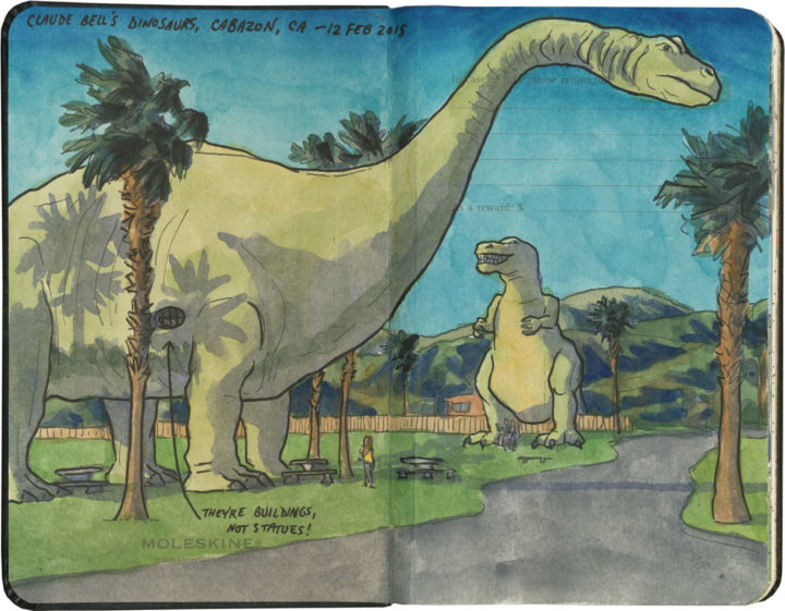
Now, I’ve seen a lot of roadside dinosaurs in my day, but for me, nothing can top the iconic giants of Cabazon, CA. For one thing, unlike some others that come to mind, these guys are beautifully crafted and amazingly realistic (and no wonder: their designer, Claude Bell, created all the statuary at Knott’s Berry Farm in the 1940s and 50s).

Cabazon dinosaurs sketch by Chandler O'Leary

For another, these dinosaurs are no mere statues: like their distant cousin Lucy, they’re buildings. And since they now house a bizarre creationist museum and gift shop (which I could not bring myself to pay money to support by entering), I think that now officially qualifies them not just as dinosaurs, but also as ducks!

Cabazon dinosaurs sketch by Chandler O'Leary

Best of all, these dinos were prominently featured in the cult classic and ultimate road trip movie, Pee Wee’s Big Adventure. When I finally got here last year, it felt like completing a pilgrimage.

And yes, of course I did the Pee Wee laugh when I got there! You don’t even have to ask.

Save

Save

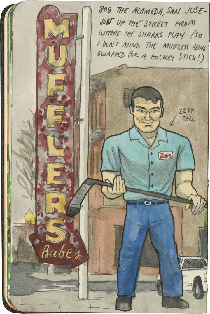
Muffler Man sketch by Chandler O'Leary

Slapshot statue

San Jose’s Muffler Man might not be the most unusual fiberglass specimen out there, but he’ll always have a place in my heart for combining my favorite type of roadside attraction with my favorite sport. Heck, the Muffler Man’s standard pose is perfect form for holding a hockey stick: top hand pointing down, bottom hand pointing up. If that’s not a sign this guy is just my type, I don’t know what is. Now if only I could find a Paul Bunyan goalie somewhere…

Route 66 sketch by Chandler O'Leary

The proof is in the pavement

This post is part of an ongoing series called 66 Fridays, which explores the wonders of old Route 66. Click on the preceding “66 Fridays” link to view all posts in the series, or visit the initial overview post here.

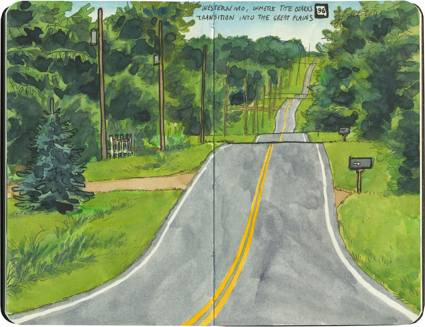
It’s easy to take for granted the fact that the American West is crisscrossed with highways nowadays, but those highways didn’t get there by chance. If you look closely at the routes those highways take, you can give yourself an excellent crash course in history, both human and natural. Overland exploration, trade routes, desert basins, animal migration, continental drift…all these things and more are hinted at by the map sketched out by the U.S. highway system.

Let me explain what I mean. If you happened to grow up in the Midwest, chances are your mental map would be dictated by a grid that follows the cardinal directions. In the Great Plains, particularly, where the landscape is mostly flat, dividing property lines and town borders into a standard grid makes the most sense. Much of the United States west of the Appalachians is arranged this way, in fact, in a basic grid called the Range and Township system. The system overlays a simple framework of one-square-mile sections over the entire western two-thirds of the country, dividing the landscape into rangeland for farming and six-mile by six-mile townships. Interestingly enough, we have Thomas Jefferson to thank for this system, which he devised in 1785 as a way to manage the vast swaths of land that, after the Revolution (and some years later the Louisiana Purchase), now belonged to the U.S. His reasoning, I think, was both practical and lofty: as a farmer himself, he was looking for a workable alternative to the inherited system of Metes and Bounds, England’s age-old framework for managing farmland and water access. While that system worked for the colonies, each roughly comparable in size and topography to what they knew in the Old World, the old framework wasn’t scalable to the size of the new West—particularly when tracts of land were being sold off sight-unseen to settlers and prospectors. But beyond the practical logic, I think Jefferson had more philosophical motives behind his plan. This is the guy who designed Monticello, after all, a monument to neoclassical thinking and an homage to ancient Greece and Rome. The Range and Township system applied a sense of order—however illusory—to the uncharted wilds of the West. It brought rational thought and a sense of opportunity to an area associated with chaos and the fear of the unknown.
Route 66 sketch by Chandler O'Leary

If you’ve ever visited the Great Plains, you can still see Thomas Jefferson’s plan in evidence, from the straight-as-an-arrow farm roads in rural areas, to the faithful system of thoroughfares in cities like Tulsa or Dallas, where the roads always travel from A to B in a straight line, with traffic lights appearing like clockwork at precise one-mile increments, and tenth-of-a-mile residential blocks in between.

But here’s the problem: Thomas Jefferson never laid eyes on the West he gridded out like a piece of paper. He never saw nature’s rebuttal to rationality in the Rockies or the Colorado Plateau. It’s all well and good to have a sensible grid in a flat place, without major physical features to interrupt the plan. But in many parts of the West, Jefferson’s tidy squares becomes utterly useless. You can’t easily farm a quadrangle of land that’s bisected by a canyon, and you can’t run a road up and over a mountain. Travel in a straight line is impossible in many, many places. As everyone from Chief Joseph to Lewis and Clark to highway engineers could tell you, there are some places in the West where only one route overland is possible—or none at all.
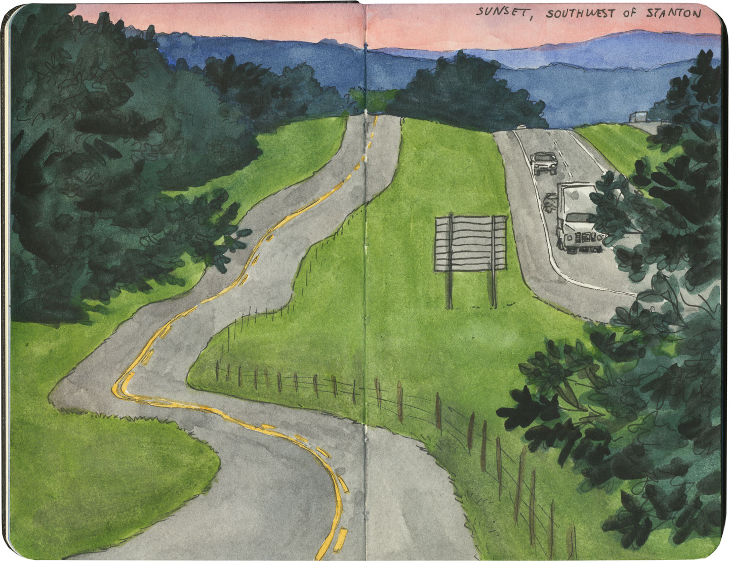
Route 66 sketch by Chandler O'Leary

So if you look at a modern highway map of the western half of the United States, the limitations geography places on rationality are obvious. You can see precisely where the Corps of Discovery found their way to the Pacific Northwest, or where the stagecoaches hauled goods to Santa Fe, or how the Mormon pioneers tumbled out of the mountains to the Great Salt Lake, or the supply route linking the California Missions to Mexico. It’s all there, because centuries later we’re still traveling the exact same routes that humans always have, dodging mountains and following water to whatever their destinations were. The Conestoga wagons followed the game trails and trade routes of the various Indigenous peoples. The railroad followed the pioneers’ wagon tracks. The first pavement slabs paralleled the railroad grade, and modern Interstate freeways zoom right over many of those original roadbeds and trailways. Even the technology of conveyance was based on the older methods of travel—just look at the wheel base on a modern car, whose width matches that of railroad cars, themselves directly descended from the lineage of horse-drawn wagon measurements.

As you can probably guess by my long-winded introduction here, this stuff ties square in with Route 66 and the path it cuts to the Pacific.
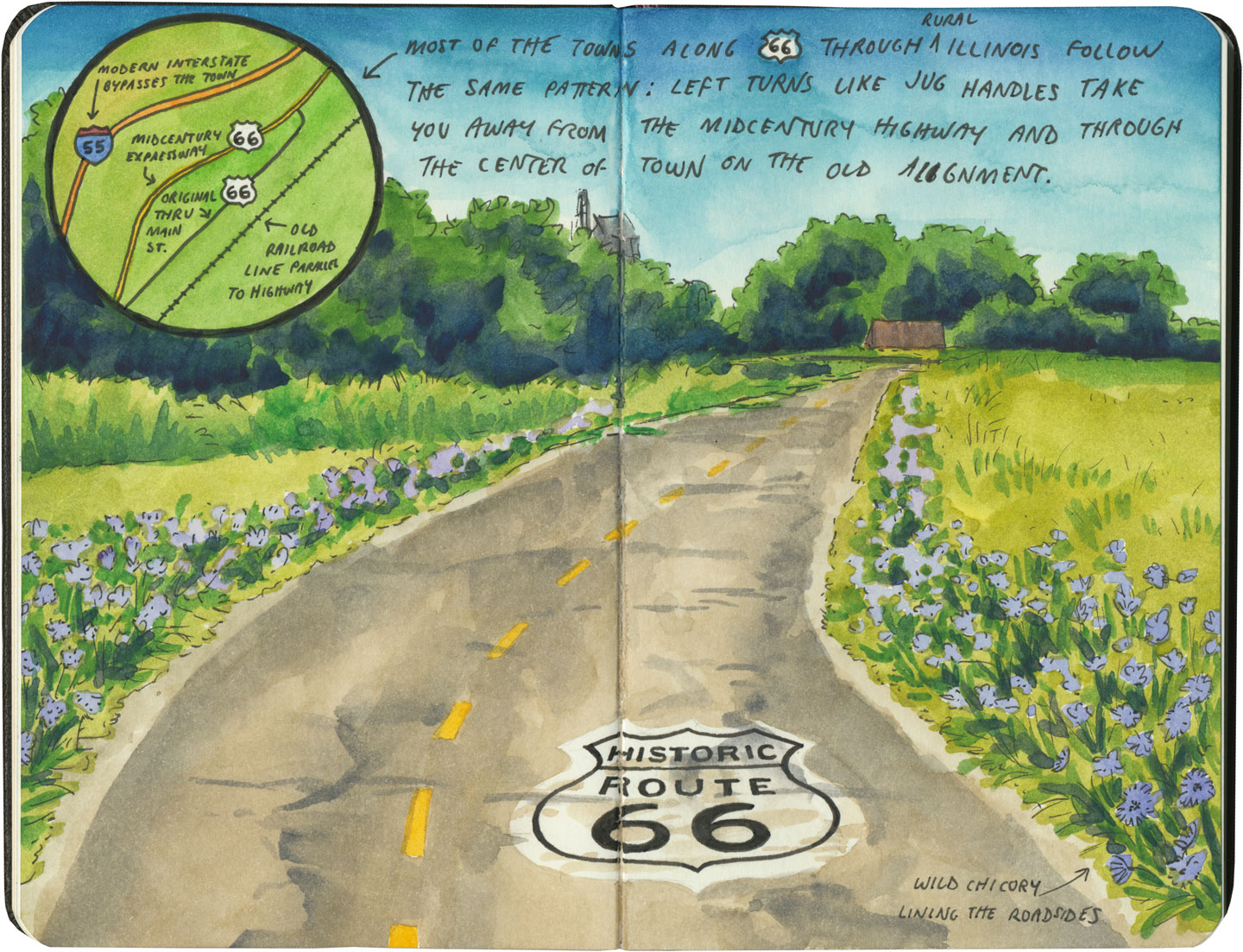
Route 66 sketch by Chandler O'Leary

There are many places along Route 66 where you can see this progression of transportation history unfold before your very eyes. In flat places like central Illinois or eastern Oklahoma, there was no reason to reuse the same roadbed over and over again—they had all the land in the world at their disposal, and nothing to impede their path. So they simply built the new road alongside the old—over and over again.
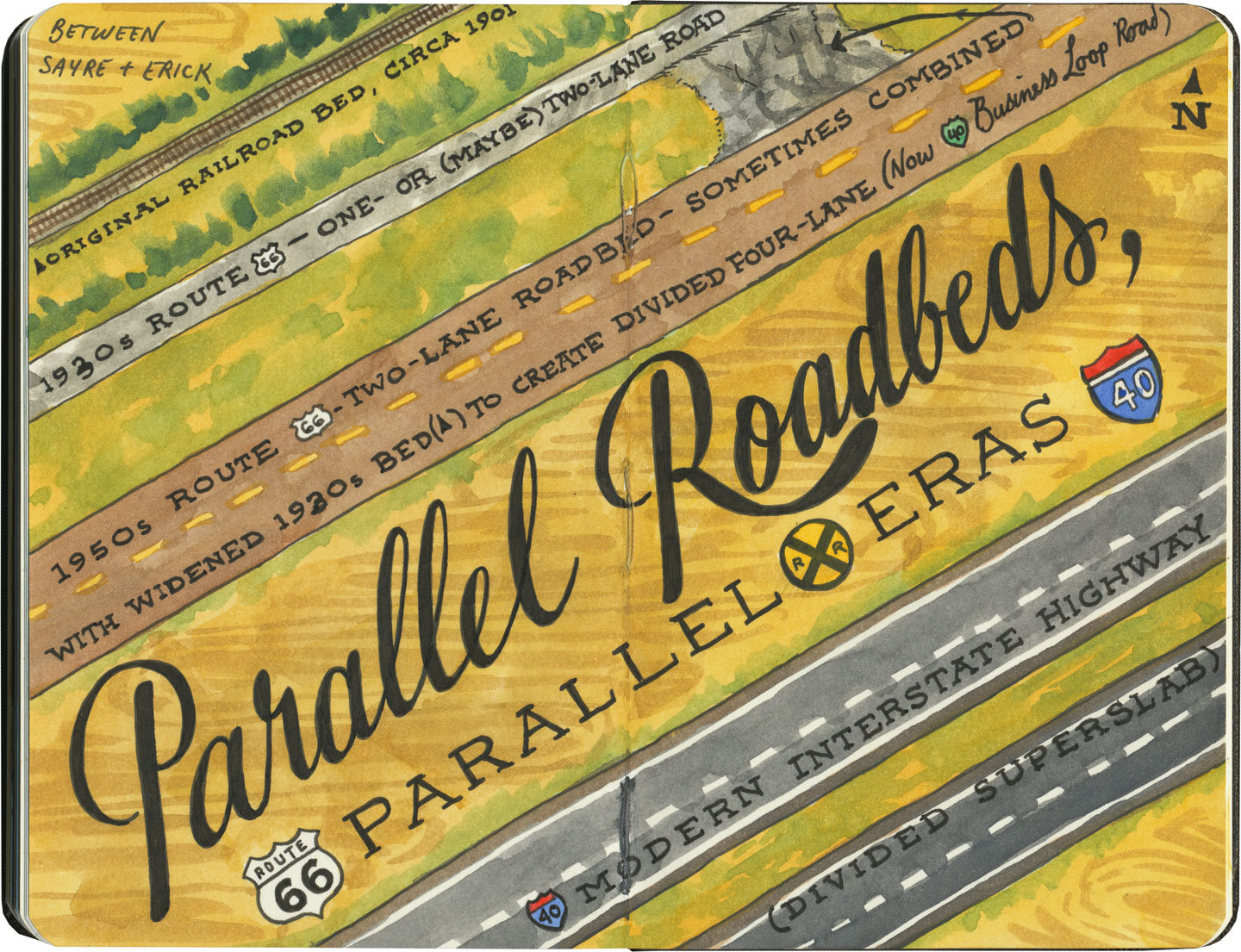
Route 66 sketch by Chandler O'Leary

The result is a network of parallel lines, each wider than the last, each laid down at a different point in recent history. In these places, the land acts like a palimpsest, marked over and over again with new traceries of roadbeds, while the old ones, though crumbling in disrepair, still remain visible.

Route 66 sketch by Chandler O'Leary

Since Route 66 was decommissioned as an official national highway, there are places where it’s difficult to discern the original route. The old roadbed might be there, but the Mother Road can get lost amid a modern tangle of frontage roads, diversions, and replaced pavement.
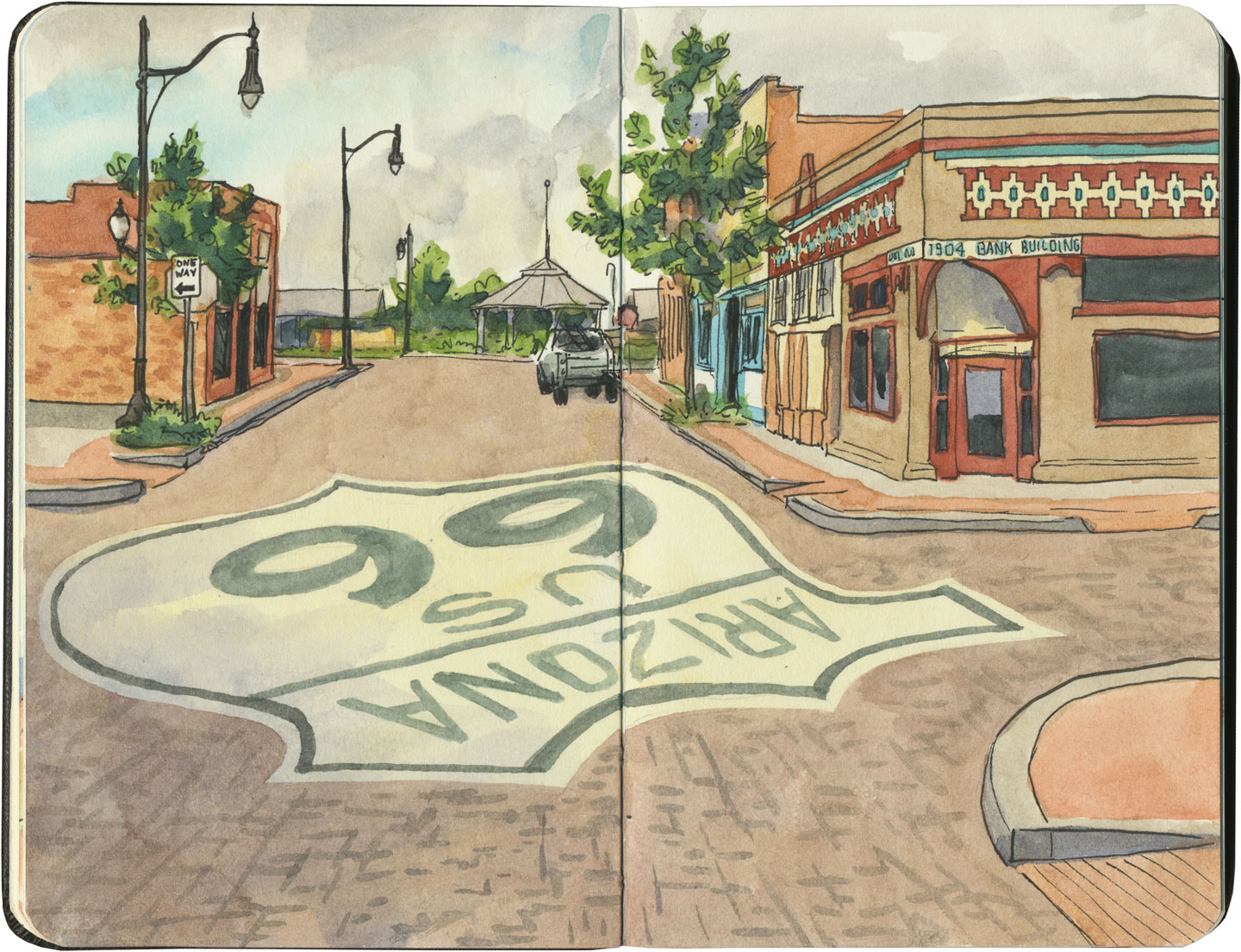
Route 66 sketch by Chandler O'Leary

Part of the joy of traveling Route 66 is learning to recognize the old road. In some places, the path is lit up like a beacon with painted pavement and restored waymarking…

Route 66 sketch by Chandler O'Leary

…in others, tracing the original marks on the palimpsest becomes something of a quest.
Route 66 sketch by Chandler O'Leary

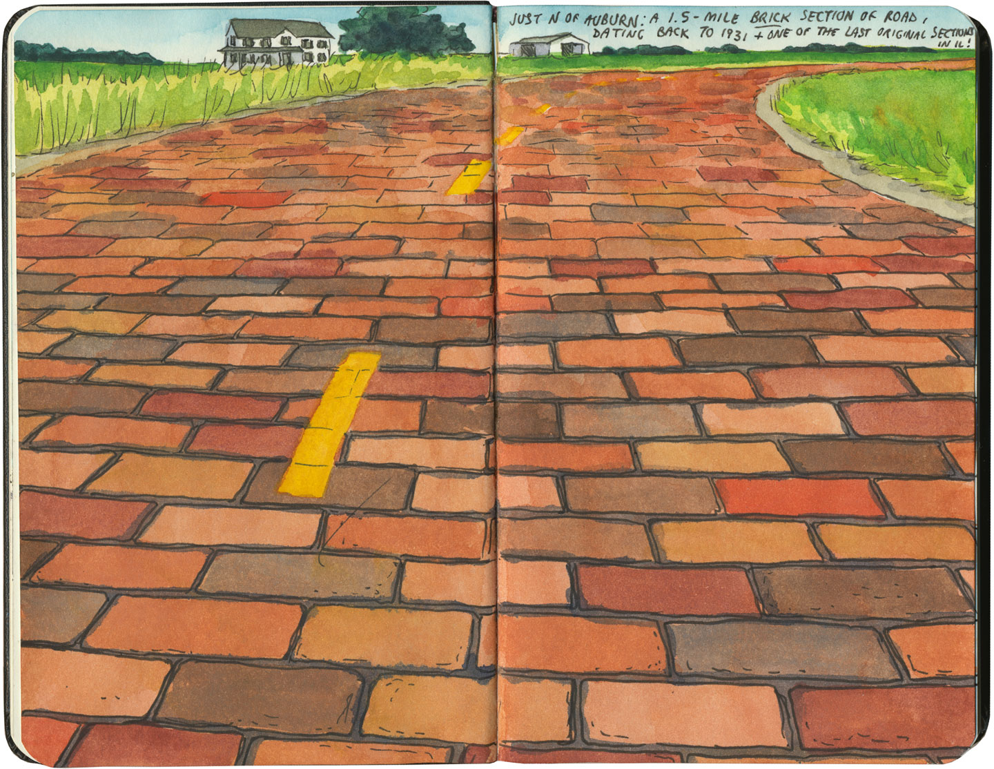
And then there are the places where the original pavement itself becomes the attraction along the way—like this gorgeous stretch of brick roadway in Illinois, paid for in the 1930s by a brick magnate and lovingly maintained as a curious relic of the past.
Route 66 sketch by Chandler O'Leary

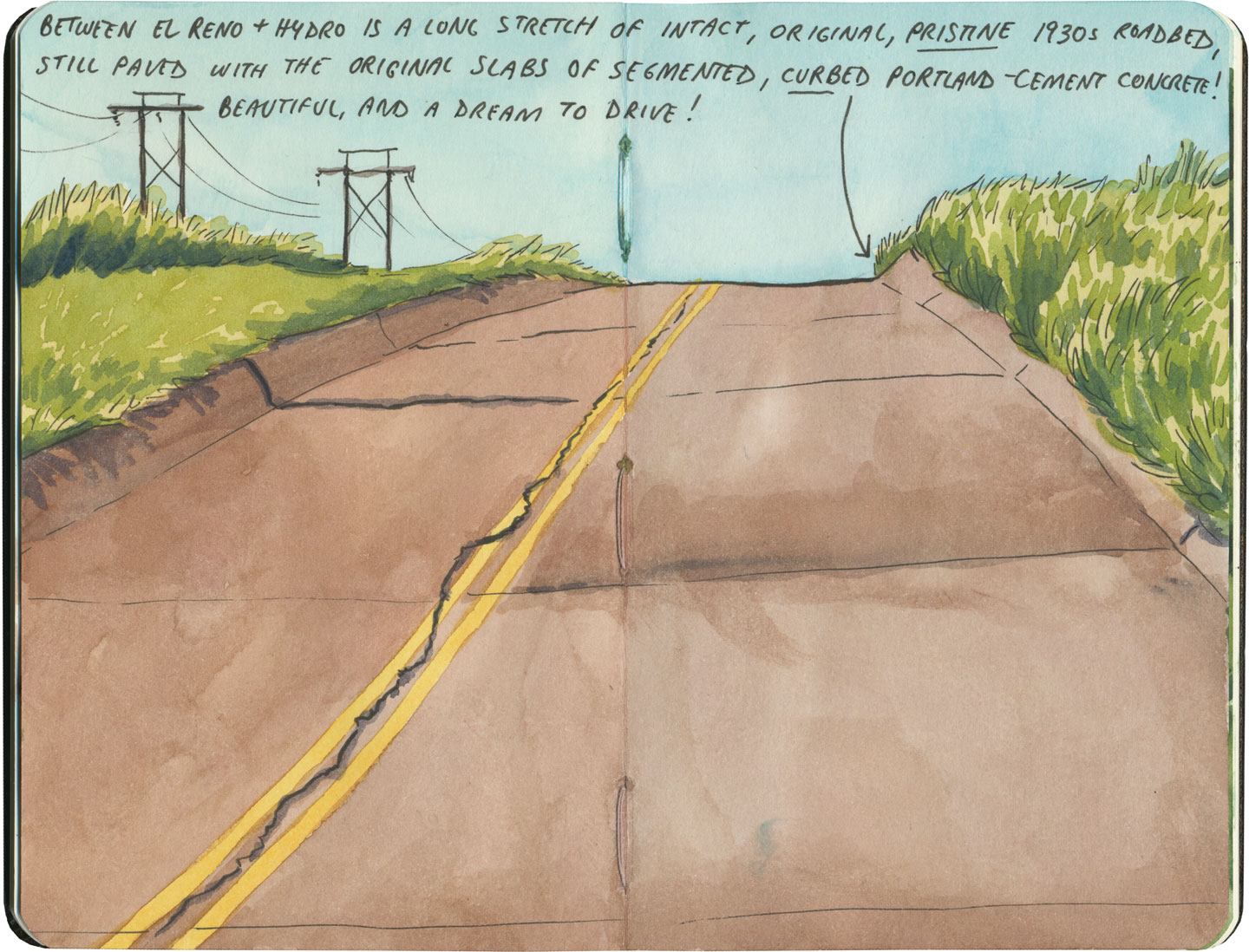
My favorite of all was the long section of 66 that traverses central Oklahoma: the combination of good craftsmanship and a remote locale has preserved the original roadbed impeccably. It sounds nerdy to say it out loud, but I dare any 66 enthusiast not to feel a thrill when seeing that curbed Portland cement.
Route 66 sketch by Chandler O'Leary

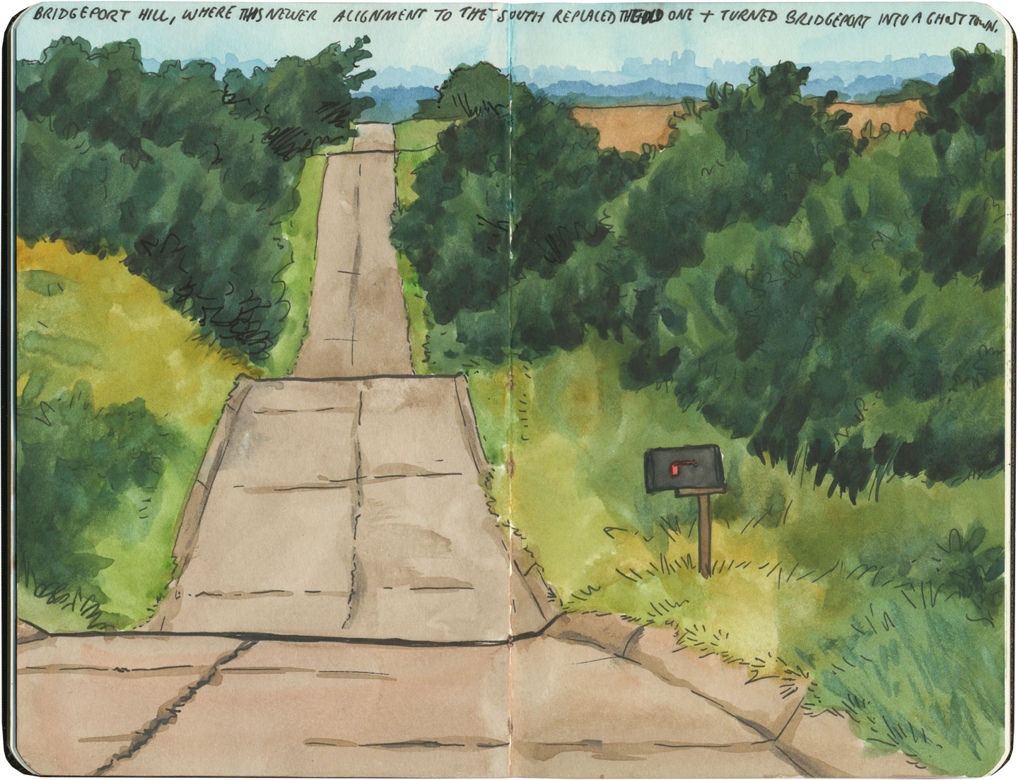
By the end of our journey, we’d gotten really good at spotting the difference between old and new along the way. And whenever we lost the thread of the route (easily done, since there are so many alignments, many of which have been replaced or buried under modern roads), it became easier and easier to spot the hints that would lead us back to the Mother Road.
Route 66 sketch by Chandler O'Leary

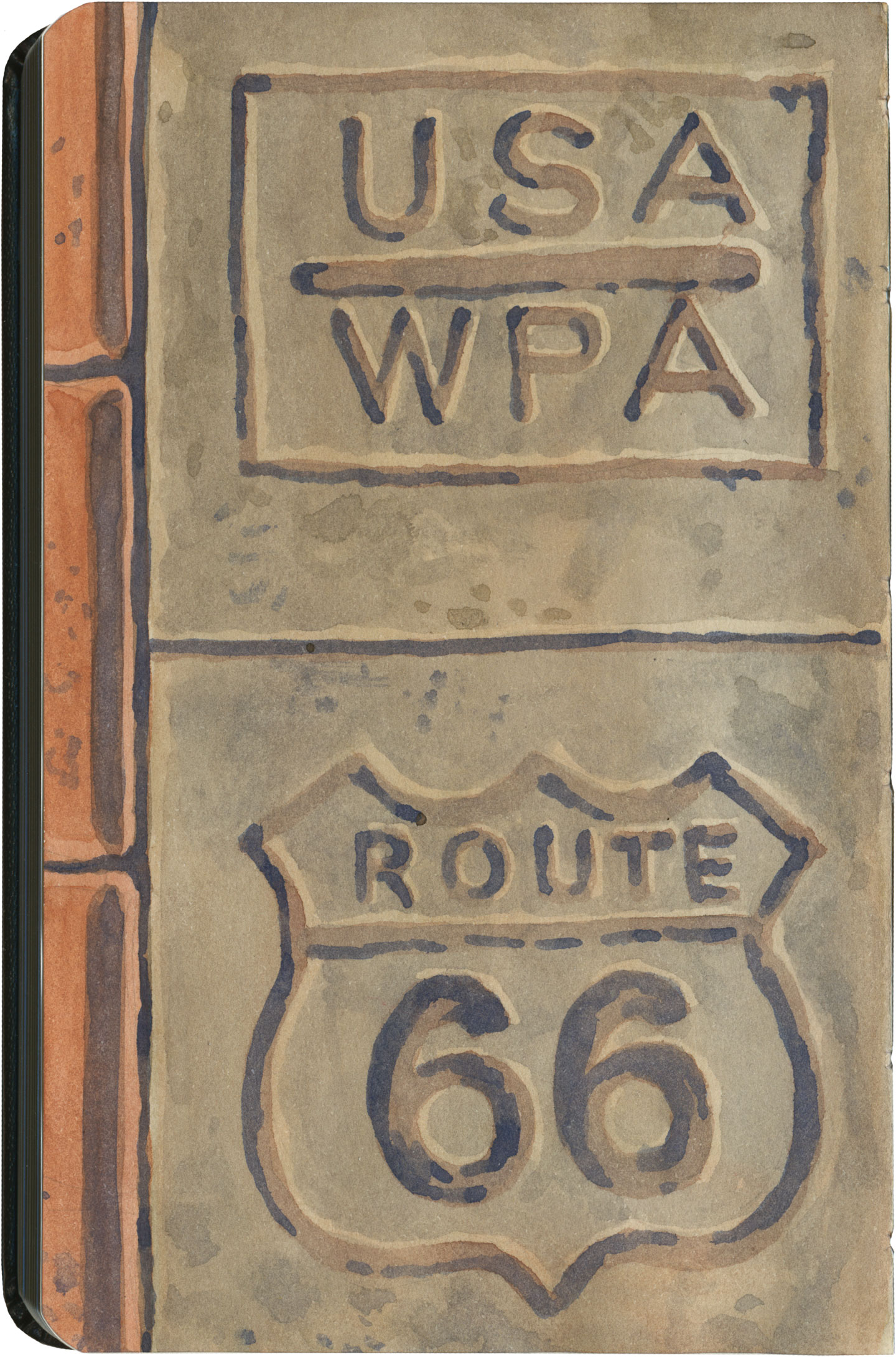
What led me to travel Route 66 was a love of history and Americana, and a desire to travel a well-worn and well-loved path. I had no idea that it would be so much more—and something much closer to the feeling of solving a mystery. Beyond the fun of diners and neon, there’s a richer, subtler 66 to be discovered, if you’re willing to look a little deeper. All the clues are there—some of them stamped right into the pavement underfoot.

Save

Save

Save

Save

Save

Save

Save

Save

Save
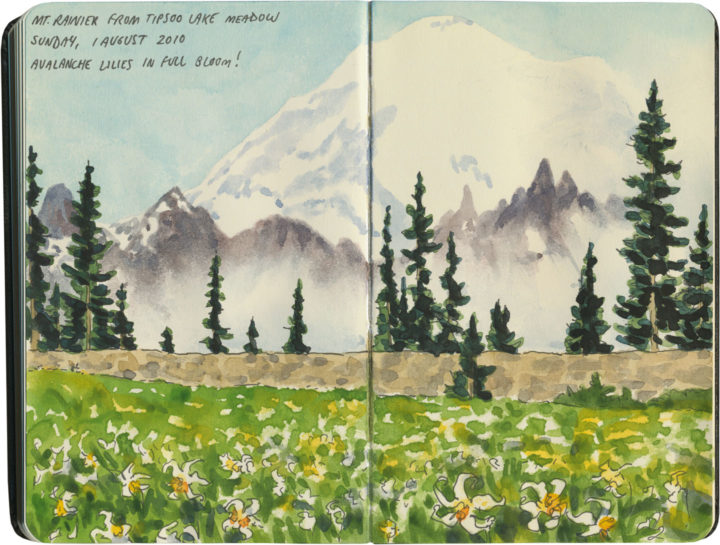
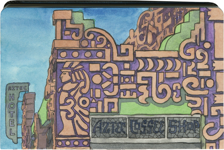
Route 66 sketch by Chandler O'Leary

Roadside ziggurat

This post is part of an ongoing series called 66 Fridays, which explores the wonders of old Route 66. Click on the preceding “66 Fridays” link to view all posts in the series, or visit the initial overview post here.

Here’s a unique one. If you drive Route 66 through the seemingly unending sprawl of greater Los Angeles, you’ll pass an ornate oddment around the halfway point of the Valley. The place is called the Aztec Hotel, and it’s apparently one of the best (and only) still-standing examples of Mayan-Revival architecture.
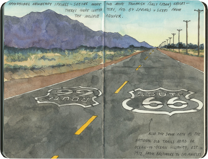
Did you know that was a thing? Me, neither.

Route 66 sketch by Chandler O'Leary

Nevermind that the Aztecs and Mayans were two completely different cultures, and the implications of approximating either or both in America—whatever your opinion of the genre, the Aztec Hotel’s unique relief work is quite a beauty. And amazingly, the “Mayan” style dovetails beautifully with the Art Deco era in which this place was built.

The Aztec is currently closed, but rumor has it that the building is owned by a Chinese investor, who is supposedly fixing the place up with plans to reopen in the near future. I really hope that’s the case, because based on vintage photos I’ve seen of the interior, I’m dying to get in there with my sketchbook.