Tag Archives: road

Grand Staircase-Escalante National Monument sketch by Chandler O'Leary

Twists and turns

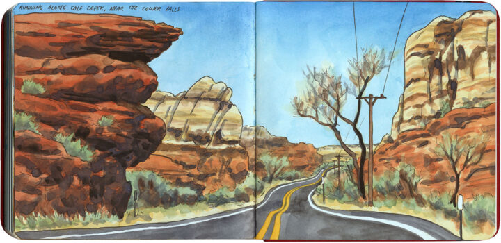
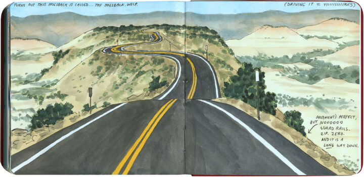
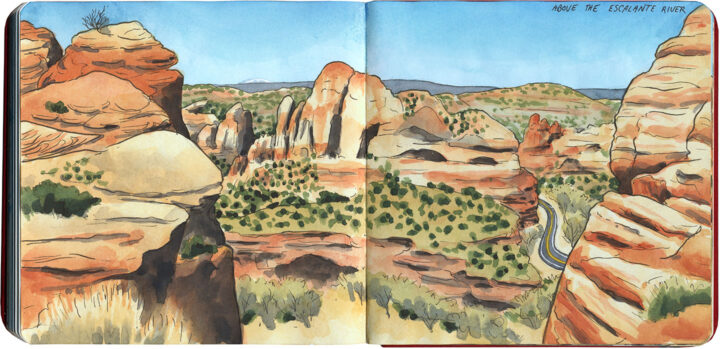
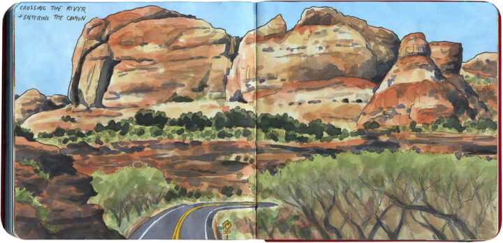
Well, it wasn’t the Loneliest Road, but I certainly had a lonely-road solo drive on the day before I crossed Nevada. I was in southeastern Utah, and I wanted to tick another highway off my road-trip bucket list: State Route 12, which cuts through part of the mostly-wilderness, sprawling, painted-desert expanse of Grand Staircase-Escalante National Monument. The highway itself, completed in 1940 by CCC road builders, is legendary—but because of its remote location, I had never managed to get there on one of my previous Southwest trips.

Grand Staircase-Escalante National Monument sketch by Chandler O'Leary

I knew the drive would have spectacular scenery,

Grand Staircase-Escalante National Monument sketch by Chandler O'Leary

and the squiggles on the map promised a fun challenge of curving blacktop.

Grand Staircase-Escalante National Monument sketch by Chandler O'Leary

And I’ve done enough winding desert drives in the Southwest to expect surprises along the way—

Sheep on Utah highway sketch by Chandler O'Leary

—but the road pulled a few fast ones on me, all the same.

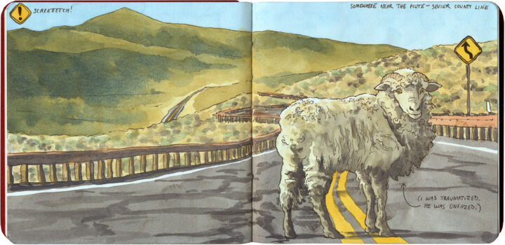
I rounded a blind curve to find this fella standing calmly on the yellow line. I screeched to a halt (and thus vindicated myself for sticking to the speed limit), stopping just a foot or two from him, and he didn’t even flinch. Didn’t even move—he made me go around to continue on my way, while he stared me down.

Still, once my heart rate returned to normal, I tried to remind myself that maybe he wasn’t interrupting my solo road trip—maybe I was interrupting his.

The Loneliest Road sketch by Chandler O'Leary

The Loneliest Road

If you’re looking for a truly solo road trip experience, look no farther than the Loneliest Road: US Highway 50, where it crosses Nevada. The mostly two-lane road traverses the Great Basin desert, which consists of basin-and-range topography: wide, flat, parched valleys punctuated by parallel mountain ranges.

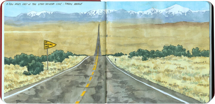
I wasn’t alone for the whole trip; the secret is definitely out about the Loneliest Road (thanks to Nevada tourism plugging it as a destination all its own), and there were other lookie-loos like me, as well as the occasional long-haul trucker. But because of the geography, what that translated to was little knots of traffic stuck behind trucks on the mountain passes, and then long, long stretches of empty road, like in the above drawing.

The Loneliest Road sketch by Chandler O'Leary

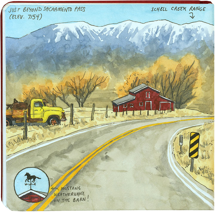
I lost count of the number of historic barns and rusted vintage pickups along the way, but that wasn’t unexpected…

The Loneliest Road sketch by Chandler O'Leary

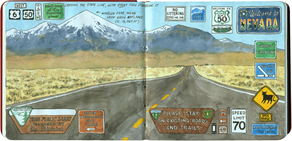
What I didn’t expect was having so much roadside reading material! I love documenting my trips through found signage, but I think this place set a record for the most verbage in one, otherwise empty, place.

Landslide sketch by Chandler O'Leary

The long detour

I spent nearly all of April breaking in my new car with a 6500-mile road trip up and down the West Coast. I’ve done many similar trips in the past, but this one had a completely different feel to it. And that’s because the severe drought—which for more than seven years had parched California and gifted me with suspiciously perfect weather and unusually good road conditions—was over.

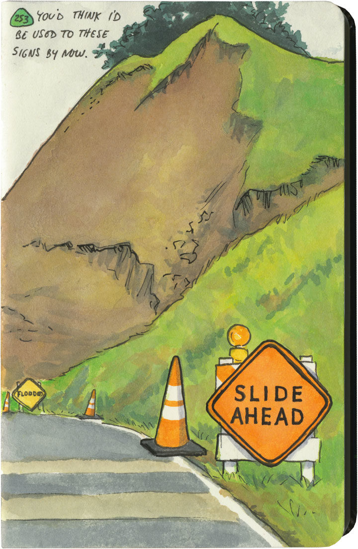
This year, California had just come out of one of its wettest winters on record. All that rain after such a long drought had brutal effects on hillsides and roadbeds all over the state. I quickly became accustomed to seeing signs like this one everywhere I went—to the point where I lost count of the number of detours, patched pavement, and in-progress landslides along my route. Over and over again I either had to make adjustments to my plans (I had to cut the Big Sur Coast out entirely, since Highway One has been closed there since February), or else take extra time to pick my way over some truly scary patches of pavement.

Landslide sketch by Chandler O'Leary

The state of affairs was so unpredictable that I got in the habit of checking road conditions on my phone a day or two ahead of each day’s planned route. On one cursory inspection, I stopped dead, my eyes widening at what I saw: Highway 101, my route through the redwoods, which happens to be the only route through the redwoods, was closed. Completely closed. No detour, the warning said.

No detour.

By this time I was familiar with the Norcal Coast—I knew that it’s pretty darn audacious of Highway 101 even to be there, what with the mountains that squeeze right up to the rugged, rain-soaked coastline. I remember driving through there in the past, marveling at the engineering required to put a road there in the first place, and being thankful that nothing had blocked my way and left me up the proverbial creek—yet I never actually looked at a map to see what kind of workaround a closure would require. Well I was about to find out.

Luckily, this little monkey wrench couldn’t have happened on a better day. This happened to be the shortest day of the trip, with just over 100 miles between hotels. And I only had one real plan for the day: to explore the Lost Coast, that rugged swath of coastline traversed only by primitive roads, where tourists feared to tread.

Nevermind—a massive rockslide just north of Leggett put paid to that plan. I still needed to get to Ferndale, though, if I wanted to honor my reservation that night and make it to the next leg of the trip. And since there was “no detour,” I scoured my maps to see just what that would mean.

Landslide detour map sketch by Chandler O'Leary

Uh, yeah. This is what it means. It means crossing back east over the mountains on State Route 20, then a trek up through nearly the entire length of the Sacramento Valley (that little Highway 99 jog was just a break to save my sanity), then back over the mountains to 101 again on State Route 36. There are no east-west highways between 20 and 36, either. This was my route, the new plan. I added up the mileage of what I’d have to do the next day: nearly 400 miles.

I set an early alarm, asked the universe to refrain from any more surprises, and went to bed.

Landslide detour sketch by Chandler O'Leary

The next day was was both beautiful and harrowing. I got to see a broad swath of the state I’d never experienced before. And I also got hit with some home truths about this modern life we all take for granted—how easy it would be for nature to knock it all right out. As I wound my way over mountain pass after mountain pass, the roads got scarier and scarier. There were places where it was obvious the hillsides were trying their best to slough off their ribbon of road—and I just hoped the mountains wouldn’t win the fight on that particular day. The very worst came near the very end, a ten-mile stretch of obviously temporary, hastily repaired state highway. The pavement was so precarious, so narrow, that they didn’t bother with a yellow stripe. And at least half of the curves were completely blind, making it necessary to do that horn-honking oh-god-oh-god-here-I-come ritual before each one.

Landslide detour sketch by Chandler O'Leary

Now, don’t get me wrong—I love mountain driving. I love curvy roads. And I love unexpected adventures. And my desire for it all is darn near insatiable. But by about the ninth hour of tortuous highway and the almost total lack of towns, services or cell signal, I’d all but lost interest in the adventure of it all. I just wanted to get there in one piece.

Lost Coast road sketch by Chandler O'Leary

When I finally did, I ended up a stone’s throw from the other end of that Lost Coast road that had been the original plan. I’d been to this spot before, and had always found that Capetown-Petrolia sign enticing and mysterious—what lay down that road, beyond that dark wall of trees?

This time, though, at the sight of all the warning signs they’d erected here (Chains required! No motorhomes! No services!), I just started laughing. Because after the day I’d just had, I could not have cared less. My curiosity had gone on strike—and in its place was a powerful desire to crawl right into bed.


Save

Save

Save

Save

Save

Save

Save

Save

Save

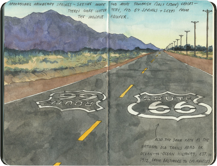
Route 66 sketch by Chandler O'Leary

Halfway there

This post is part of an ongoing series called 66 Fridays, which explores the wonders of old Route 66. Click on the preceding “66 Fridays” link to view all posts in the series, or visit the initial overview post here.

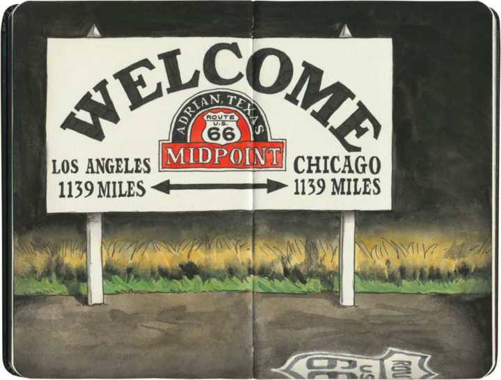
When I started my 66 Fridays series back at the turn of the new year, I knew I was in for a long road ahead. But here we are, 33 Fridays later, already at the halfway point of the series! I figured it was only fitting to pair this post with a sketch of the symbolic halfway point of the Mother Road. Since Route 66 has seen so many changes to its path over the years, it’s unlikely this sign marks the exact midpoint—but it hardly matters. I’m glad there’s a marker at all, wherever they ended up putting it.

Some of you may just be tuning in to this series now, so I figured a recap of where we’ve been so far was in order. Like everything else on this blog, my subjects jump around in space and time. So below is a list of all the Route 66 posts I’ve done so far, loosely grouped by category.

Posts about Route 66 itself:
Intro: Mother Road, Mother Lode
Chicago’s Eastern Terminus
Sundown Towns
Burma Shave
Filling Stations of 66
Suicide Bridge
Where 66 Intersects Itself
The history under your wheels

Route 66 Attractions:
Meramec Caverns Billboards
The Round Barn
The Leaning Tower
Wild Burros
Paul Bunyans
Mufflermen of the Mother Road
The Harvey House Empire
The Armory Museum
Dino Drive-Bys
Petrified Forest
The Continental Divide
Cadillac Ranch

The Mother Road in Lights:
Albuquerque’s Googie Marathon
The Dog House from Breaking Bad
The Aztec Hotel
The Munger Moss and its Antecedents
Air-Cooled Comfort
Tucumcari Tonite

Route 66 Roadside Eats:
Lou Mitchell’s
Ted Drewes
Dairy King
Chicago Dogs
Rod’s Steakhouse
New Mexico Cafes

Other Route 66 posts I’ve done (outside the 66 Fridays series):
Tulsa Googie
The Golden Driller
Old Town Ristras
The Blue Whale of Catoosa

Thank you for traveling along the Mother Road with me for so much of this year. And we still have many miles to cover—see you next Friday with the latest installment!

Route 66 sketch by Chandler O'Leary

Criss-cross corner

This post is part of an ongoing series called 66 Fridays, which explores the wonders of old Route 66. Click on the preceding “66 Fridays” link to view all posts in the series, or visit the initial overview post here.

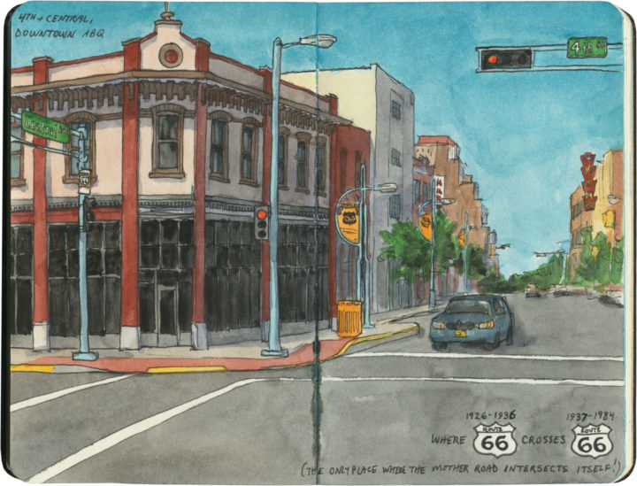
In downtown Albuquerque is an unassuming corner with a curious distinction. This is the place—the only place—where Route 66 intersects itself.

It’s not so unusual to have several Route 66-es in the same city—after all, Tulsa has at least three, and St. Louis changed the alignment of the route so many times I’ve lost track of the number. Yet nowhere else along the Mother Road do two different alignments actually cross each other. You see, when Route 66 was first established in New Mexico in 1926, the logical thing to do was to send the road through the capital city—so off to Santa Fe it went, and then it curved southward to come into Albuquerque from the north. At that time, there was no straight-line route across New Mexico, so travelers coming to Albuquerque from the east had no choice but to take that winding, partial-dirt, mountainous road through the capital first. But then, quite suddenly, all that changed: just a few years later, a new 66 cut an arrow-straight path into Albuquerque from the east and bypassed Santa Fe entirely. (And today many people have no idea that 66 ever went to Santa Fe at all.)

Like everything else along Route 66, there’s a story behind this. The short version is this: Arthur T. Hannett, who was governor of New Mexico when Route 66 was born, lost his reelection bid in 1926, and found himself with an axe to grind. Convinced he had been ousted by a conspiracy on the part of his political opponents at the state capitol, he hatched a scheme to reroute 66 away from Santa Fe in revenge.

The trouble was, he had only a little over a month before his successor would be sworn in. So he ordered nearly every piece of road-construction equipment in the northern half of the state to be diverted to his project, and made every construction worker he could get his hands on work nonstop to cut a new road bed from Santa Rosa to Albuquerque. The workers slept at the construction sites, toiled through snowstorms and skipped the holidays, and the new 69-mile road was completed in just 31 days. By the time the new governor, Richard Dillon, took office on January 1, 1927, it was too late. Despite opponents trying to block the project during those 31 days (including sabotage attempts where people put sand in the gas tanks of the construction equipment), nobody could deny the convenience of a straight, fully-paved road. The new route saved hours of driving, so before long, motorists were already using it heavily, leaving Santa Fe in the dust. It took another ten years before the road was paved all the way to the Texas border and the new section gained the official Route 66 designation, but by then it was already the main arterial across the state.

KiMo Theatre sketch by Chandler O'Leary

That story isn’t the only thing interesting about the corner of 4th and Central. That spot’s other claim to fame is what might just be Albuquerque’s best and most iconic building: the KiMo theatre.

KiMo Theatre sketch by Chandler O'Leary

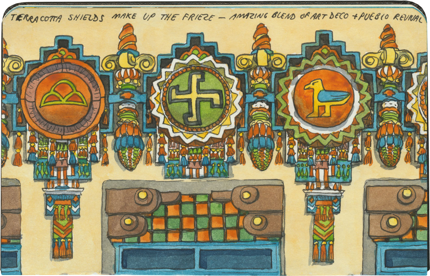
Built in 1927 in a spectacular blend of Art Deco and Pueblo Revival styles (who knew those two went together so well?!), the theater’s name translates to “mountain lion” in Tewa, the language spoken by many of the region’s Pueblo people. The KiMo narrowly escaped the wrecking ball in the late 1970s, when residents voted for the city to buy the building. After an extensive restoration completed in 2000, the KiMo is once again hosting public performances.KiMo Theatre sketch by Chandler O'Leary

Yes, that symbol above is what it looks like; and no, it doesn’t mean what you might think. The swastika is an ancient symbol that once had positive connotations in many cultures before Hitler twisted it to his own ends. To the Navajo it stood for the Whirling Log, a healing symbol, and to the Hopi (whose traditions the above design emulates) it represents spiritual wandering.

Oh, and hey: apparently the building is haunted. The theater staff leave appeasement offerings in a back stairwell and everything. The place was closed on the day we were there, so I couldn’t get a look at the inside, but you can bet I’ll be back. Neither angry ghosts or vengeful ex-governors can stop me.

Save

Theodore Roosevelt National Park sketch by Chandler O'Leary

Butte-iful

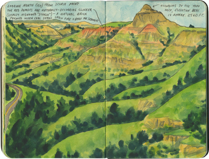
Like Saguaro, Theodore Roosevelt National Park is divided into two separate units. Unlike Saguaro, the North Dakota badlands are an old, familiar haunt of mine. Greener and less weathered than their craggy South Dakota siblings, these buttes have a similar mystery to them, all the same. It’s not hard to see why they were dear to Teddy Roosevelt’s heart—just as they’re dear to mine.

Route 66 Burma Shave sketch by Chandler O'Leary

Roadside rhymes

This post is part of an ongoing series called 66 Fridays, which explores the wonders of old Route 66. Click on the preceding “66 Fridays” link to view all posts in the series, or visit the initial overview post here.

Some years back I lamented missing the era of the Burma Shave ad, but on Route 66, I finally got my chance to see what it must have been like. These signs are replicas rather than originals, and some of them are more than a little ho-made

Route 66 Burma Shave sketch by Chandler O'Leary

…but it doesn’t matter. The effect, I imagine, is the same. Like the Meramec Caverns signs, the Burma Shave ads permeated American road trip culture from the mid-1920s through the mid-60s, providing lots of inexpensive exposure for the company and roadside fun for travelers as they “sang along” with the five- or six-sign rhyming slogans. Even the Tailor and I found ourselves reciting the limerick-like slogans aloud as we drove by.

Route 66 Burma Shave sketch by Chandler O'Leary

It just seems fitting that we’d find the quintessential billboards on the quintessential road trip. If you’re going to have any Burma Shave remnants out there along the roadside, they just belong on the Mother Road.

Save

Save

Save

Save

Save

Route 66 sketch by Chandler O'Leary

The proof is in the pavement

This post is part of an ongoing series called 66 Fridays, which explores the wonders of old Route 66. Click on the preceding “66 Fridays” link to view all posts in the series, or visit the initial overview post here.

It’s easy to take for granted the fact that the American West is crisscrossed with highways nowadays, but those highways didn’t get there by chance. If you look closely at the routes those highways take, you can give yourself an excellent crash course in history, both human and natural. Overland exploration, trade routes, desert basins, animal migration, continental drift…all these things and more are hinted at by the map sketched out by the U.S. highway system.

Let me explain what I mean. If you happened to grow up in the Midwest, chances are your mental map would be dictated by a grid that follows the cardinal directions. In the Great Plains, particularly, where the landscape is mostly flat, dividing property lines and town borders into a standard grid makes the most sense. Much of the United States west of the Appalachians is arranged this way, in fact, in a basic grid called the Range and Township system. The system overlays a simple framework of one-square-mile sections over the entire western two-thirds of the country, dividing the landscape into rangeland for farming and six-mile by six-mile townships. Interestingly enough, we have Thomas Jefferson to thank for this system, which he devised in 1785 as a way to manage the vast swaths of land that, after the Revolution (and some years later the Louisiana Purchase), now belonged to the U.S. His reasoning, I think, was both practical and lofty: as a farmer himself, he was looking for a workable alternative to the inherited system of Metes and Bounds, England’s age-old framework for managing farmland and water access. While that system worked for the colonies, each roughly comparable in size and topography to what they knew in the Old World, the old framework wasn’t scalable to the size of the new West—particularly when tracts of land were being sold off sight-unseen to settlers and prospectors. But beyond the practical logic, I think Jefferson had more philosophical motives behind his plan. This is the guy who designed Monticello, after all, a monument to neoclassical thinking and an homage to ancient Greece and Rome. The Range and Township system applied a sense of order—however illusory—to the uncharted wilds of the West. It brought rational thought and a sense of opportunity to an area associated with chaos and the fear of the unknown.
Route 66 sketch by Chandler O'Leary

If you’ve ever visited the Great Plains, you can still see Thomas Jefferson’s plan in evidence, from the straight-as-an-arrow farm roads in rural areas, to the faithful system of thoroughfares in cities like Tulsa or Dallas, where the roads always travel from A to B in a straight line, with traffic lights appearing like clockwork at precise one-mile increments, and tenth-of-a-mile residential blocks in between.

But here’s the problem: Thomas Jefferson never laid eyes on the West he gridded out like a piece of paper. He never saw nature’s rebuttal to rationality in the Rockies or the Colorado Plateau. It’s all well and good to have a sensible grid in a flat place, without major physical features to interrupt the plan. But in many parts of the West, Jefferson’s tidy squares becomes utterly useless. You can’t easily farm a quadrangle of land that’s bisected by a canyon, and you can’t run a road up and over a mountain. Travel in a straight line is impossible in many, many places. As everyone from Chief Joseph to Lewis and Clark to highway engineers could tell you, there are some places in the West where only one route overland is possible—or none at all.
Route 66 sketch by Chandler O'Leary

So if you look at a modern highway map of the western half of the United States, the limitations geography places on rationality are obvious. You can see precisely where the Corps of Discovery found their way to the Pacific Northwest, or where the stagecoaches hauled goods to Santa Fe, or how the Mormon pioneers tumbled out of the mountains to the Great Salt Lake, or the supply route linking the California Missions to Mexico. It’s all there, because centuries later we’re still traveling the exact same routes that humans always have, dodging mountains and following water to whatever their destinations were. The Conestoga wagons followed the game trails and trade routes of the various Indigenous peoples. The railroad followed the pioneers’ wagon tracks. The first pavement slabs paralleled the railroad grade, and modern Interstate freeways zoom right over many of those original roadbeds and trailways. Even the technology of conveyance was based on the older methods of travel—just look at the wheel base on a modern car, whose width matches that of railroad cars, themselves directly descended from the lineage of horse-drawn wagon measurements.

As you can probably guess by my long-winded introduction here, this stuff ties square in with Route 66 and the path it cuts to the Pacific.
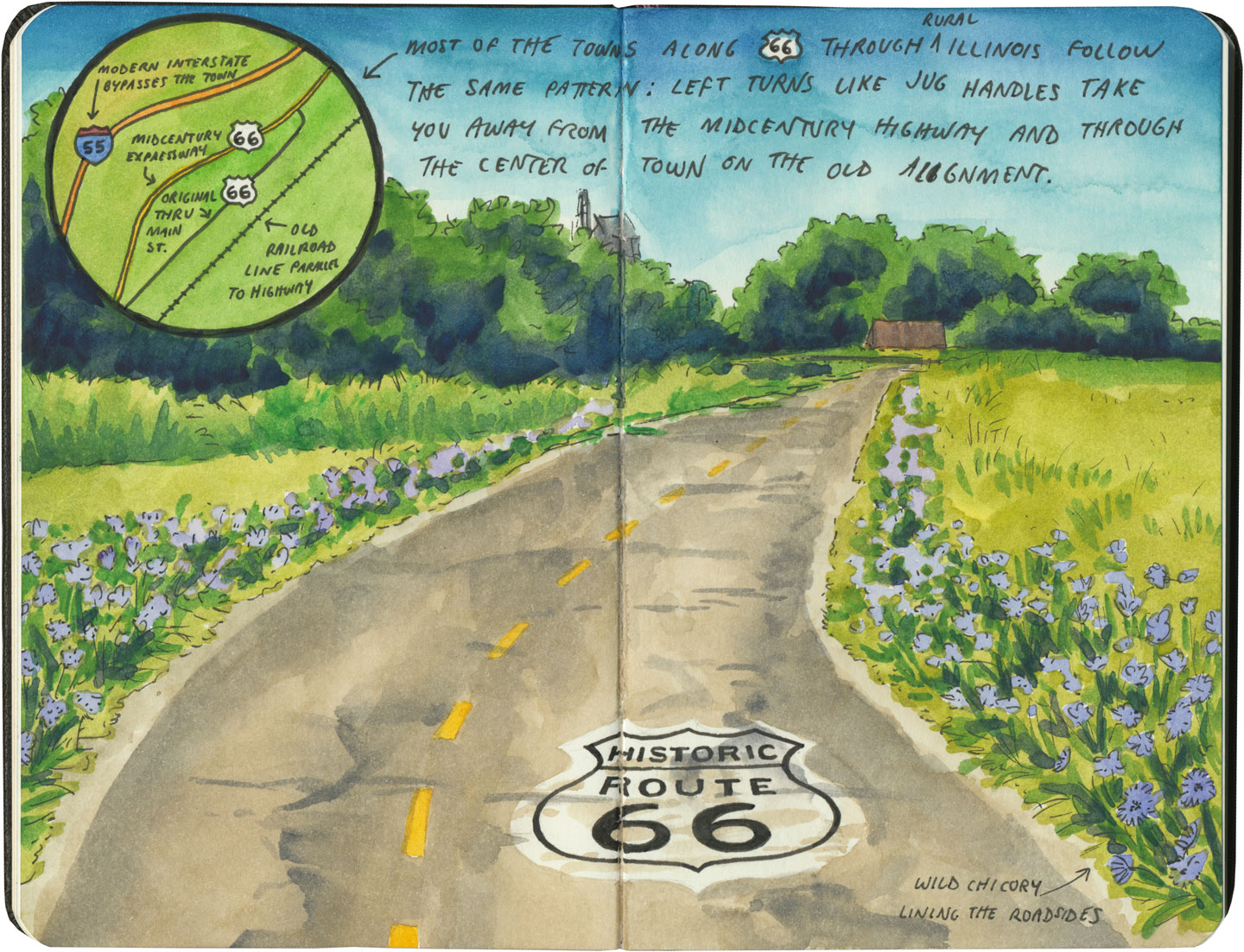
Route 66 sketch by Chandler O'Leary

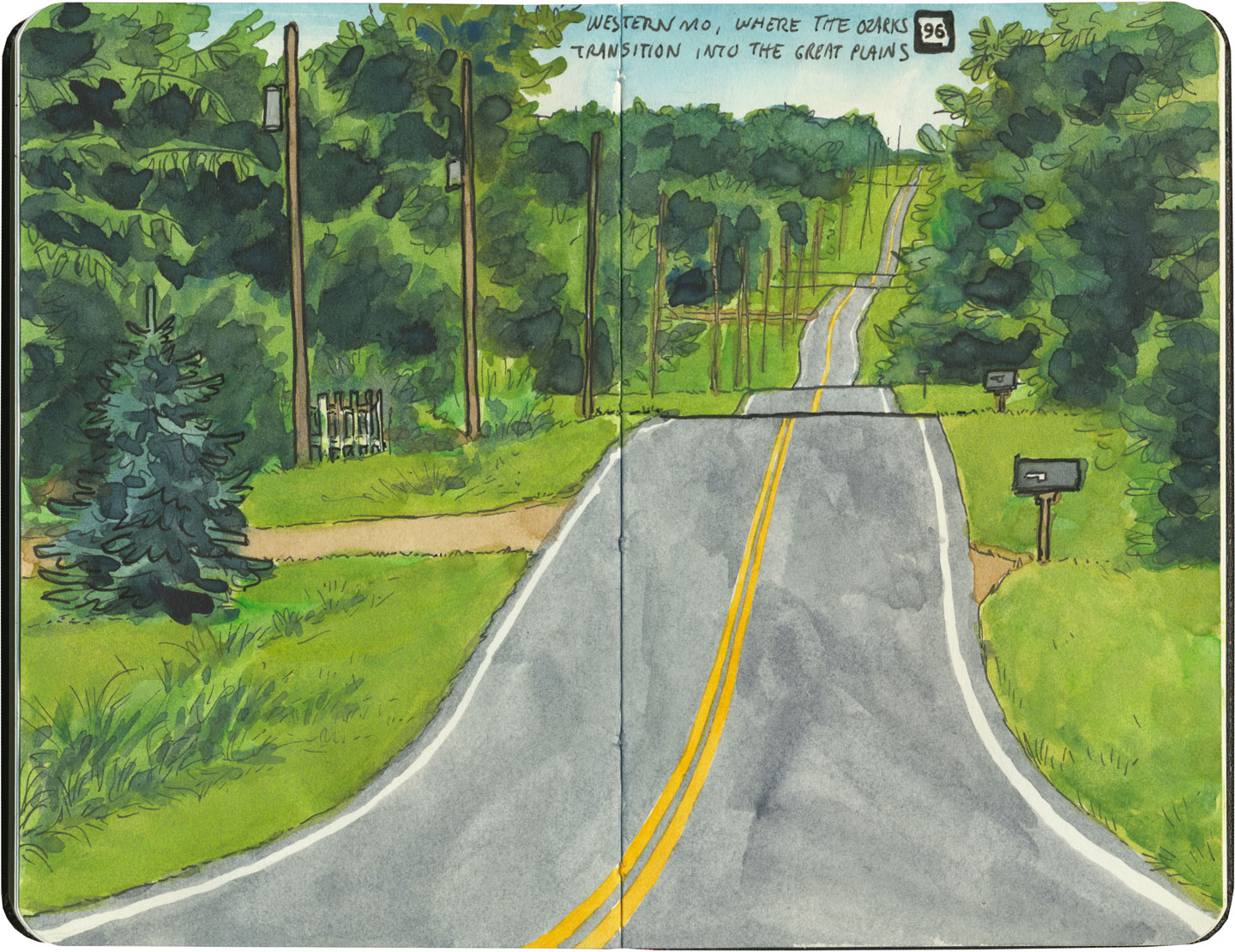
There are many places along Route 66 where you can see this progression of transportation history unfold before your very eyes. In flat places like central Illinois or eastern Oklahoma, there was no reason to reuse the same roadbed over and over again—they had all the land in the world at their disposal, and nothing to impede their path. So they simply built the new road alongside the old—over and over again.
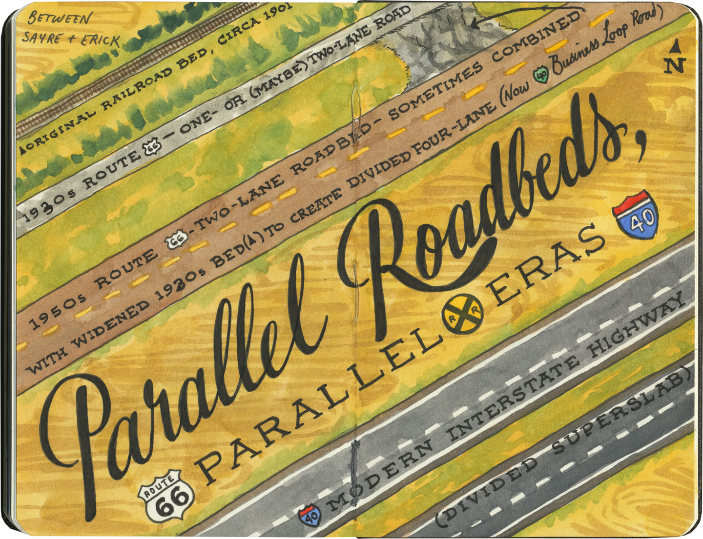
Route 66 sketch by Chandler O'Leary

The result is a network of parallel lines, each wider than the last, each laid down at a different point in recent history. In these places, the land acts like a palimpsest, marked over and over again with new traceries of roadbeds, while the old ones, though crumbling in disrepair, still remain visible.

Route 66 sketch by Chandler O'Leary

Since Route 66 was decommissioned as an official national highway, there are places where it’s difficult to discern the original route. The old roadbed might be there, but the Mother Road can get lost amid a modern tangle of frontage roads, diversions, and replaced pavement.
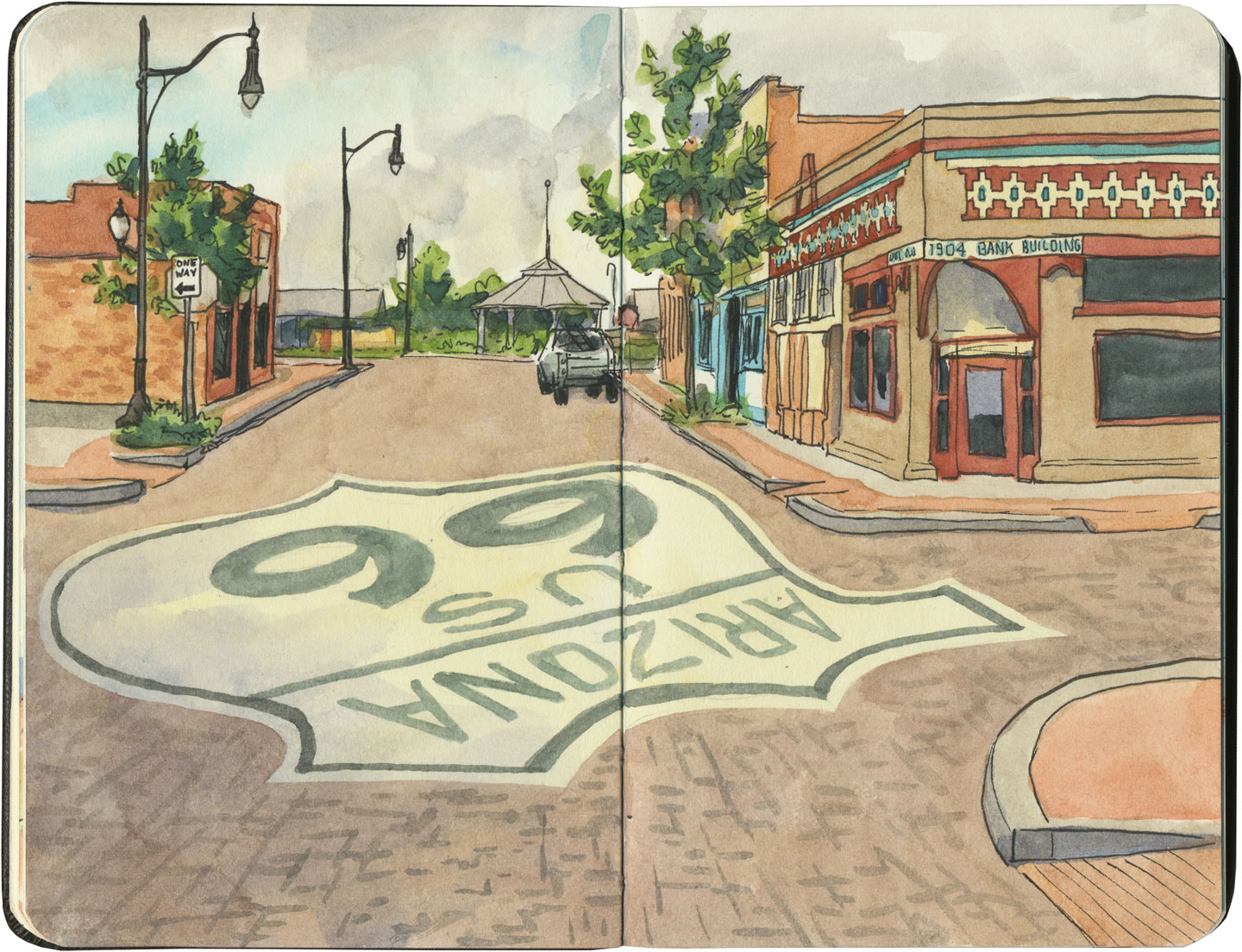
Route 66 sketch by Chandler O'Leary

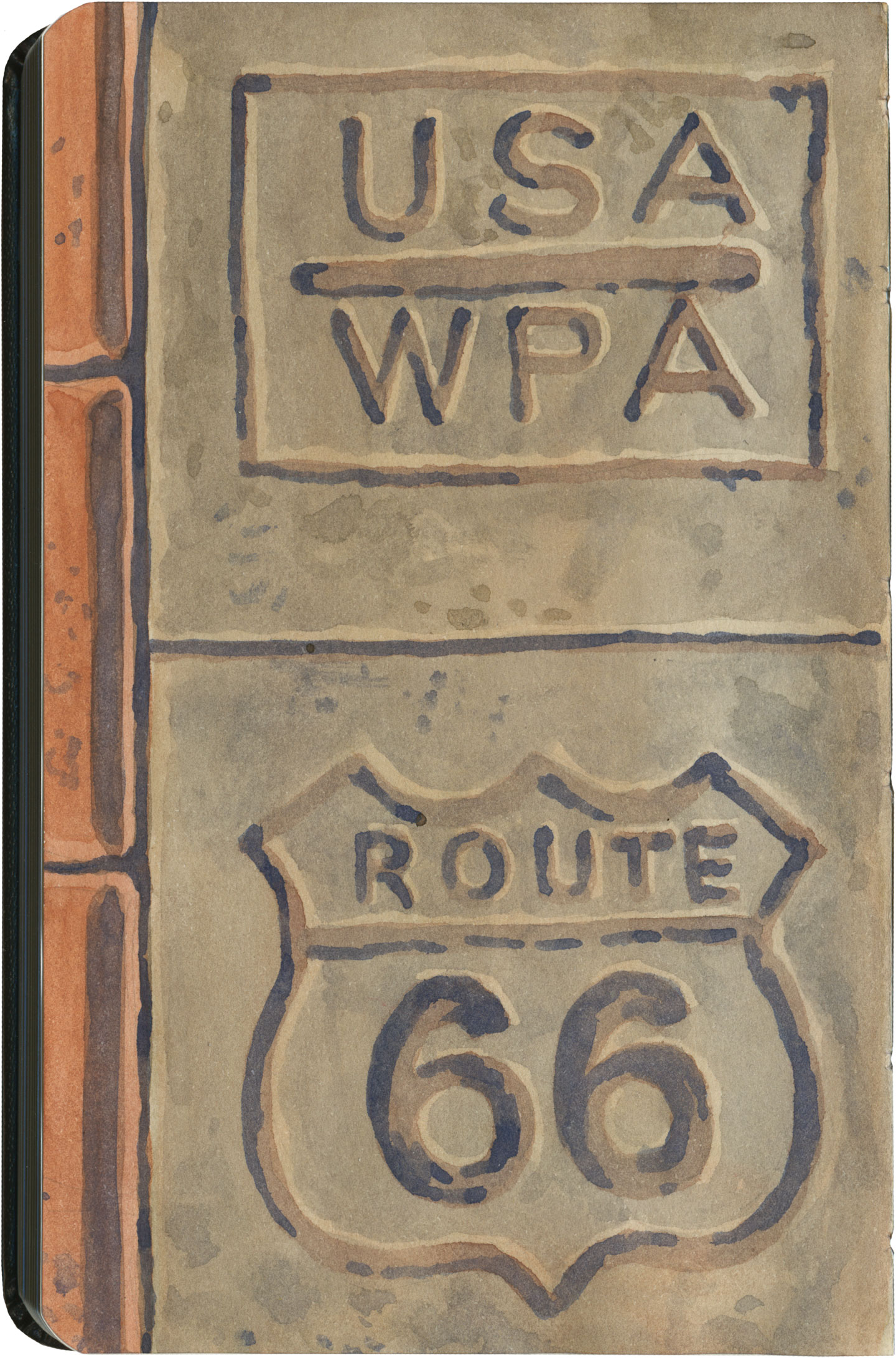
Part of the joy of traveling Route 66 is learning to recognize the old road. In some places, the path is lit up like a beacon with painted pavement and restored waymarking…

Route 66 sketch by Chandler O'Leary

…in others, tracing the original marks on the palimpsest becomes something of a quest.
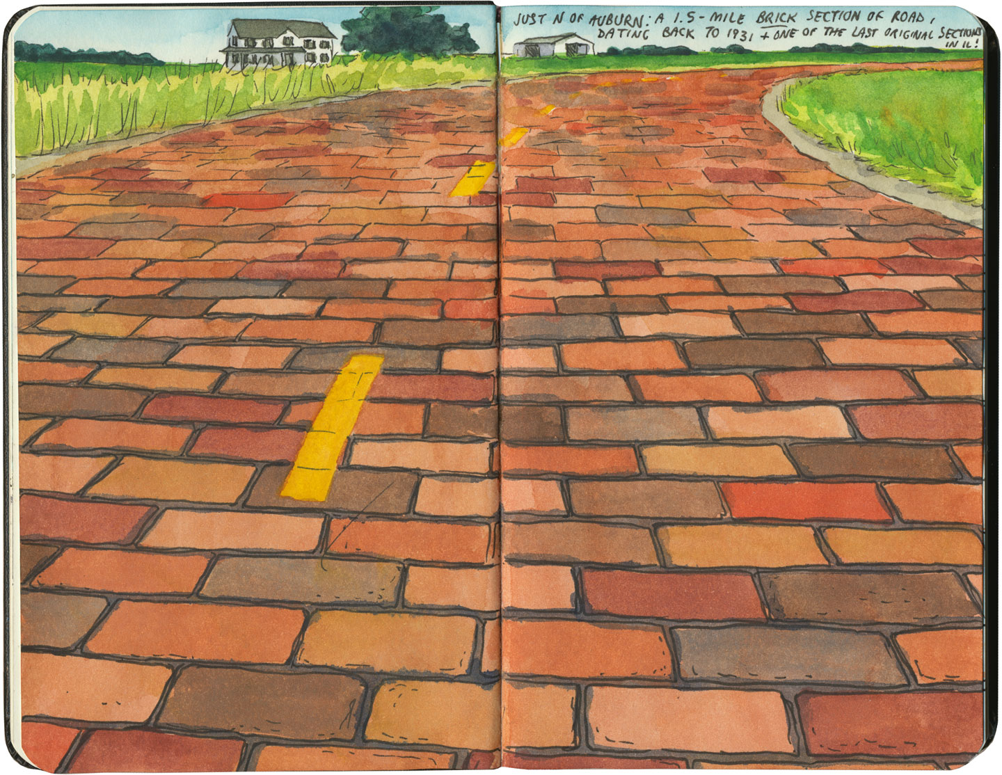
Route 66 sketch by Chandler O'Leary

And then there are the places where the original pavement itself becomes the attraction along the way—like this gorgeous stretch of brick roadway in Illinois, paid for in the 1930s by a brick magnate and lovingly maintained as a curious relic of the past.
Route 66 sketch by Chandler O'Leary

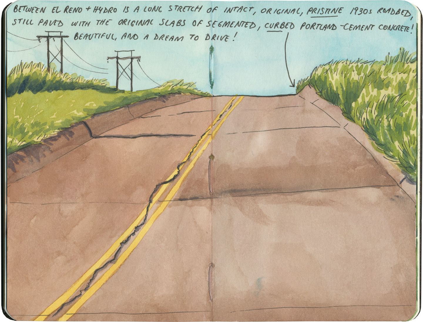
My favorite of all was the long section of 66 that traverses central Oklahoma: the combination of good craftsmanship and a remote locale has preserved the original roadbed impeccably. It sounds nerdy to say it out loud, but I dare any 66 enthusiast not to feel a thrill when seeing that curbed Portland cement.
Route 66 sketch by Chandler O'Leary

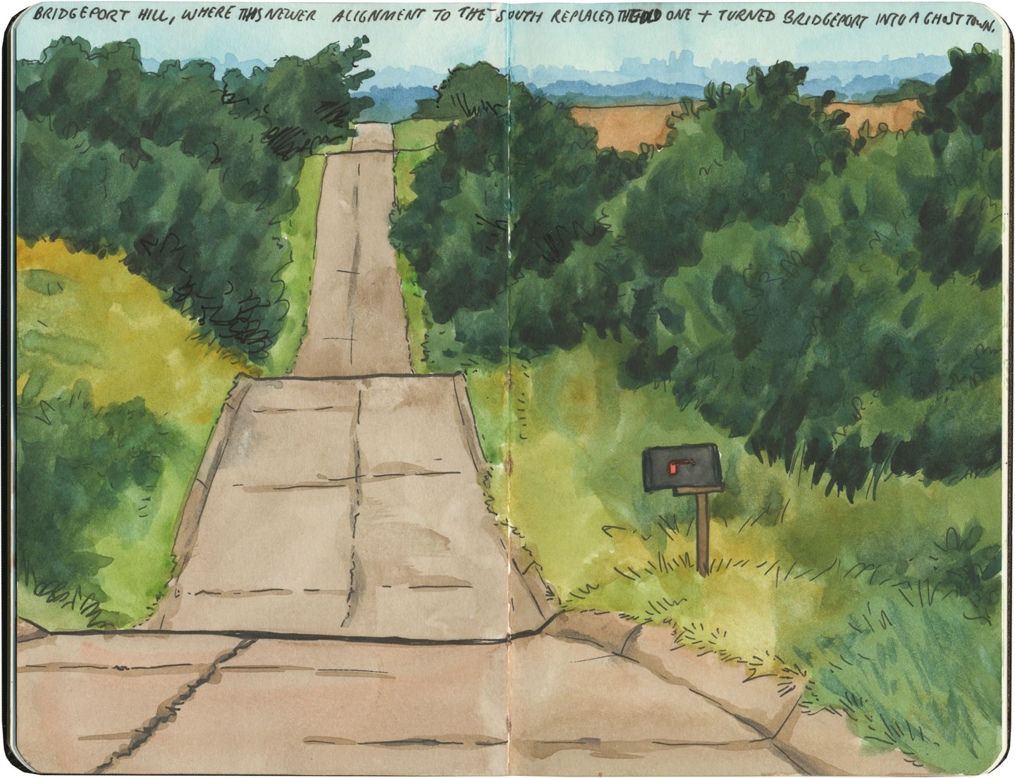
By the end of our journey, we’d gotten really good at spotting the difference between old and new along the way. And whenever we lost the thread of the route (easily done, since there are so many alignments, many of which have been replaced or buried under modern roads), it became easier and easier to spot the hints that would lead us back to the Mother Road.
Route 66 sketch by Chandler O'Leary

What led me to travel Route 66 was a love of history and Americana, and a desire to travel a well-worn and well-loved path. I had no idea that it would be so much more—and something much closer to the feeling of solving a mystery. Beyond the fun of diners and neon, there’s a richer, subtler 66 to be discovered, if you’re willing to look a little deeper. All the clues are there—some of them stamped right into the pavement underfoot.

Save

Save

Save

Save

Save

Save

Save

Save

Save
Route 66 sketch by Chandler O'Leary

Somewhere to lean on

This post is part of an ongoing series called 66 Fridays, which explores the wonders of old Route 66. Click on the preceding “66 Fridays” link to view all posts in the series, or visit the initial overview post here.

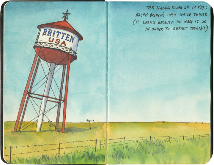
I crossed Texas twice last year: once at its widest point (where we logged over 900 Texas miles), and once across the Panhandle, which is where Route 66 cuts a literal straight and narrow path. One of the main Mother Road attractions to visit there is the “Leaning Tower of Texas,” a ho-made gravitational wonder in the middle of the neverending plain.

At least, it used to be in the middle of nowhere. Now it’s surrounded on three sides by other nearby giants: a bunch of those enormous modern windmills, and an awful 19-story cross that isn’t so much delightfully hokey as disgustingly hideous.

So I flashed my laminated Artistic License, faced east as to miss most of the horizon clutter, and edited out the rest. I regret nothing.

Llano Estacado sketch by Chandler O'Leary

After all, I was trying to capture the feeling of what it’s like to cross the Llano Estacado. Even today, when travelers have better navigational aids than makeshift stakes, it’s not hard to imagine how those first visitors must have felt.

Route 66 sketch by Chandler O'Leary
Or maybe modern technology has a different meaning here. Maybe the fenceposts and telephone poles and windmills that dot the landscape now are this era’s stakes, marching in steady progress across an otherwise unknowable vastness.

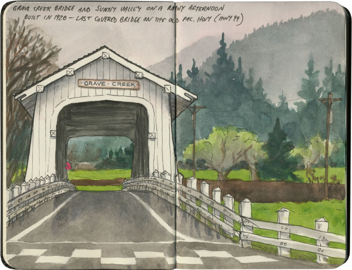
Covered bridge sketch by Chandler O'Leary

New England transplant

You wouldn’t normally think of the Pacific Northwest as covered bridge country, but we do have a few here. Southern Oregon is home to a real beauty, and the last covered bridge still standing along old Highway 99. Of course, the rainy Northwest weather and towering conifers gave it away, but otherwise, the place made me feel like I was standing in a Vermont mountain glen.