Secret enclaveMinneapolis, MN

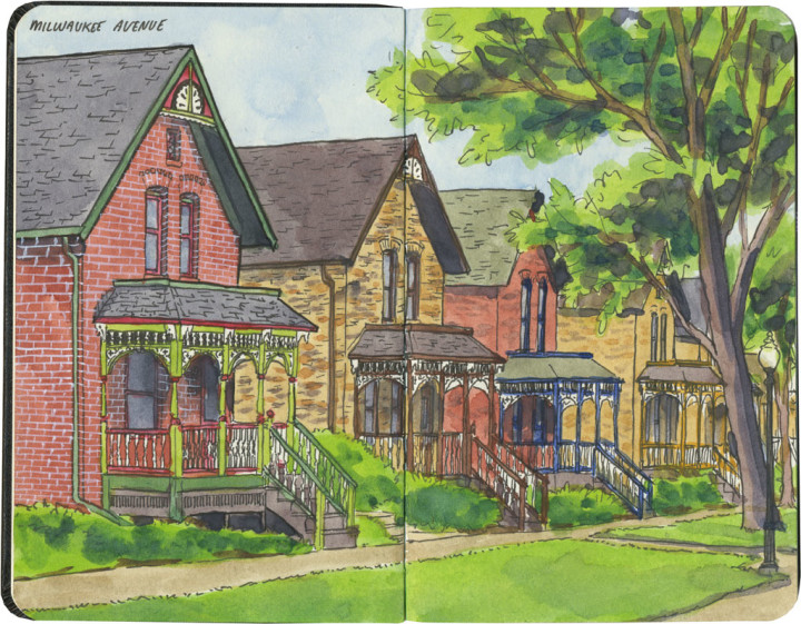
Milwaukee Avenue sketch by Chandler O'Leary

Revisiting Ladd’s Addition last week reminded me of another favorite neighborhood of mine. Well, not so much a neighborhood as two perfect blocks: Minneapolis’s Milwaukee Avenue.

Today Milwaukee Avenue is a two-block stretch of pedestrian-only street: originally named 22 1/2 Street, to the unwitting eye it just looks like an alley between 22nd and 23rd. It opens onto the busy Franklin Avenue to the north, but the entrance there is overgrown with shrubbery, so it’s easy to overlook and pass right by. In fact, like Salmon Beach in my own town, I’ve met locals who have lived in the Twin Cities for years and never knew it was there.

If you do know where to look, or you happen to stumble upon one of the entrances, finding Milwaukee Avenue is like stepping into a tiny, different world. To me, it always felt like walking onto the set of an old movie like To Kill a Mockingbird. (I always half expected to meet Boo Radley sitting on a porch somewhere.) And if the street has that movie-set feeling of being slightly artificial, well, that’s because it is.

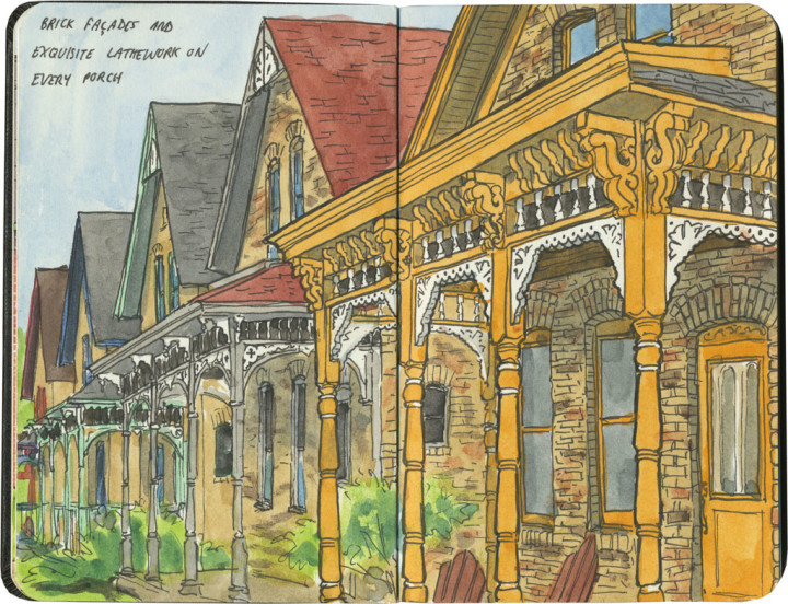
Milwaukee Avenue sketch by Chandler O'Leary

Milwaukee Avenue started as a row of low-income immigrant housing in the 1880s. Like Ladd’s Addition, it was a planned neighborhood, but to keep them affordable the houses were nearly identical and constructed inexpensively (but well) with brick veneer over timber frames.

The neighborhood started falling into disrepair in the Great Depression, and by the late 1950s the houses were in shambles. Most had no indoor plumbing, and had been modified with ho-made repairs to the point that they bore almost no resemblance to what you see in the sketches above. In 1970 the City of Minneapolis made plans to demolish the whole enclave, but when the residents got wind of it, they took action on their own. In secret they applied to the National Register of Historic Places, and were approved as an historic district in 1974—suddenly the City couldn’t touch them.

Not every house survived the restoration (nine were so far gone they had to be razed), but the ones that did were outfitted with proper plumbing, new foundations and a host of repairs. The one-way street was turned into a tree-lined pedestrian mall. And best of all, the beautiful, original lathework porches, gone from pretty much every structure by then, were replicated and put back in place. So what you see now is a strange and lovely hybrid between historic relic and reimagined replica.

So if you ever find yourself in the Twin Cities, take a stroll down Milwaukee Avenue and transport yourself to a small, private universe. Just be warned that when you step back out onto Franklin Avenue, and the modern world assaults your senses once more, you’ll find yourself looking back over your shoulder with longing.

Comments (0) Pin it!

Residential rosesPortland, OR

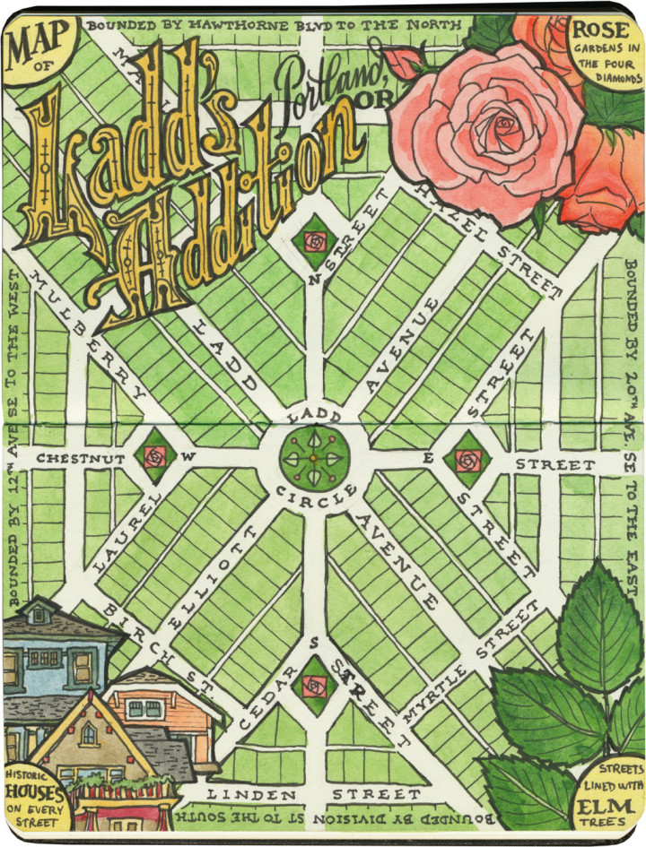
Ladd's Addition map sketch by Chandler O'Leary

June is the month of roses in the Pacific Northwest, and there’s no better place to see roses than the City of Roses. And there’s no better rose garden in the City of Roses than the diamond gardens in Ladd’s Addition. So in honor of my favorite Portland neighborhood, here are two midsummer sketches, done exactly three years apart.

Ladd’s Addition was the first planned residential development in the state of Oregon. Conceived in 1891 and mostly built between 1905 and 1930, the area is now a national historic district. In deliberate contravention of the city grid, the neighborhood is laid out in an “X” pattern with a circle park and rotary in the center. Where each diagonal street intersects one other at points north, south, east and west of the circle, there’s a small diamond-shaped garden that’s home to one of Portland’s many rose test gardens. And along every tree-lined and tree-named (though some have been rechristened in modern times; the map above shows their original names) street are many dozens of historic homes—many of which are unique or unusual examples of Craftsman-, Tudor- and Mission-style architecture.

Ladd's Addition rose garden sketch by Chandler O'Leary

Every part of this neighborhood is appealing to me—I’m a sucker for a good map, a Craftsman house and a pale peach rose. Put them all together, with a shady spot for me to sit and sketch, and I’m instantly in heaven.

Comments (0) Pin it!

Splendor and sequinsMission Hills, Los Angeles, CA

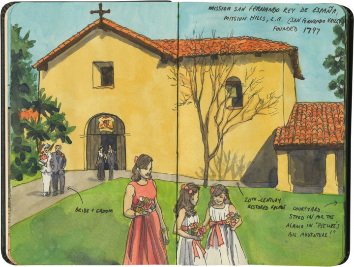
Mission San Fernando Rey de España sketch by Chandler O'Leary

This is the fifth installment of my Mission Mondays series, exploring all 21 Spanish Missions along the California coast. You can read more about this series, and see a sketch map of all the missions, at this post.

Last week we visited one of the more unassuming missions in the chain. Just over in the next valley is another complex seemingly forgotten by your average mission tourist: Mission San Fernando Rey de España.

Detail of California Missions map sketch by Chandler O'Leary

Mission San Fernando is also part of the greater Los Angeles area, tucked away in a residential neighborhood in the northern end of the San Fernando Valely. Compared with its brother on the other side of the city, Mission San Fernando is a little better looked after, with tidier grounds and neatly restored buildings. Most of San Gabriel’s architecture is original—crumbling, but authentic. San Fernando’s is pristine, but largely modern (at least on the surface). The restoration seems to have made it lose something: that feel of great age, of venerable history.

Mission San Fernando Rey de España sketch by Chandler O'Leary

Still, the property is gorgeous. And when I saw what was going on inside the grounds, I couldn’t help but smile. I was there on a busy Saturday, which I only remembered was Valentine’s Day when I arrived and saw teenage girls everywhere in frilly dresses, waiting for their quinceañeras to start. There were a bunch of brides milling around as well, but next to the teens in their bright pink confections they were positively drab. Some of the quinceañera gowns reminded me of puffed-up peacock feathers…

Mission San Fernando Rey de España sketch by Chandler O'Leary

…until I rounded a corner and came upon an actual peacock.

I guess this is the perfect illustration of why I went on this trek to visit all 21 missions. I came to see the architecture, but what really charmed me were the slices of real life going on within the walls. And actually taking the time to explore each mission showed me that even the most unassuming of them had plenty of surprises in store for me.

Comments (1) Pin it!

Porch perchOrcas Island, WA

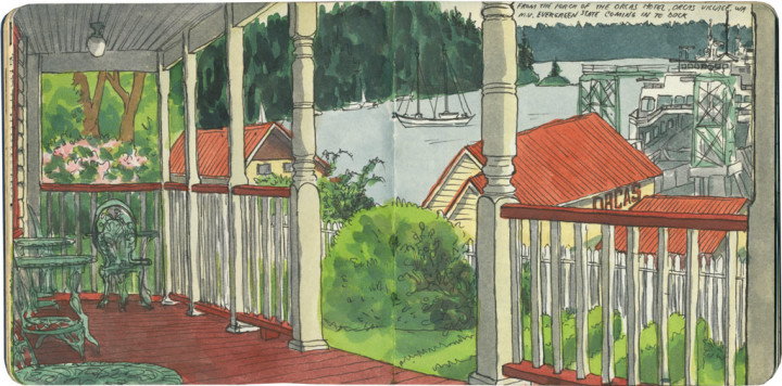
Orcas Island sketch by Chandler O'Leary

Sometimes one’s point of view can make or break a picture. The jury is still out on this one, as far as I’m concerned. This was such a weird vantage point for sketching—between the location high up on a hill, the wide-angle view of the rest of the porch, the water and ferry landing below, and the islands off in the distance, everything was just…odd. Unsettling. I spent a long time on this one, using every art-school trick I knew to check and re-check that my perspective was correct. It was…for the most part. But the drawing still feels like something M.C. Escher would have come up with.

Comments (3) Pin it!

City of archangelsGreater Los Angeles, CA

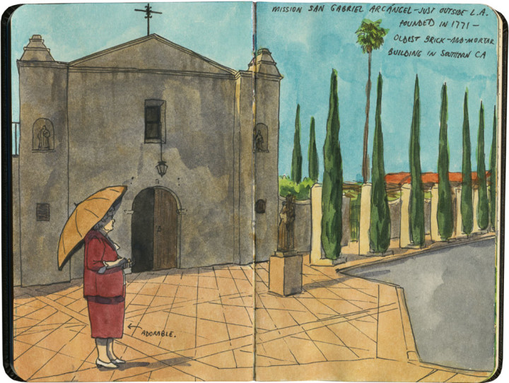
Mission San Gabriel Arcángel sketch by Chandler O'Leary

This is the fourth installment of my Mission Mondays series, exploring all 21 Spanish Missions along the California coast. You can read more about this series, and see a sketch map of all the missions, at this post.

Last week we visited one of the most famous, most visited and most photographed missions in the California chain. Mission San Gabriel is…well…less well known.

Detail of California Missions map sketch by Chandler O'Leary

In fact, if I hadn’t specifically been on a mission to see all the missions, I would have breezed right by this one, without ever knowing it was here. Mission San Gabriel is not a state park (many missions are), not a tourist destination, not something I’d ever even heard mentioned before, not even in context with El Camino Real as a whole. It’s not even in Los Angeles proper, but tucked away in the enclave of San Gabriel—which is thought of as the birthplace of Los Angeles itself.

Mission San Gabriel Arcángel sketch by Chandler O'Leary

To the folks for whom this is their neighborhood church, I’m sure Mission San Gabriel is beloved—it is the oldest surviving brick-and-mortar building in Southern California, after all, and a beautiful example of a rare Moorish style of architecture. But this where the lack of an overall system for preserving the missions is really obvious—and sorely lacking. While places like San Carlos Borromeo and San Juan Capistrano get all the attention and money for upkeep, the smaller missions like San Gabriel are scraping to get by, and it shows. Maintaining an historic building is a constant battle anyway, but when you add in things like the baking sun, an active earthquake zone, and a much more modest neighborhood (as opposed to the wealthy towns like Santa Barbara and Carmel) every tourist dollar really counts. So I’d love to see some sort of connected system for the preservation and management of the missions—something like the California state park system or, more grandly, the National Park Service. I know that increased tourism would be a headache for an active church like this one, but spreading the wealth and visitors more equally among all 21 missions would be worth it, if you ask me.

Mission San Gabriel Arcángel sketch by Chandler O'Leary

Still, while San Gabriel might not have the flash and splendor of some of the more well-known missions, there’s a lot to love here. The details, in particular, had me enchanted—as did the fact that I was the only tourist there. Everyone else was a parishioner, and obviously intimately familiar with the place: to them, Mission San Gabriel is not a vacation spot—it’s home.

Comments (0) Pin it!

Hole in oneUniversity Place, WA

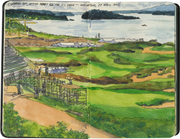
Chambers Bay golf course sketch by Chandler O'Leary

Since I was thinking about examples of American ruins at the time, my plan was to head across town to sketch the remains of the old sand and gravel quarry at the site of the Chambers Bay golf course. But when I got there, the trail that leads to the ruins was closed while they set up for this year’s U.S. Open golf tournament.

I’m no expert on golf, but it’s been fun to learn more about the Chambers Bay course in the run-up to the event. The course is both public and brand new—just eight years old—which makes it an unusual choice for the U.S. Open. But it’s an absolute marvel of design and difficulty. Chambers Bay is many times larger than a traditional Scottish links-style course; the combination of sheer size, rugged terrain, tricky fescue-and-heather landscaping, and the strong winds that sweep through the Tacoma Narrows make this course one of the most challenging and unpredictable in the entire world. Add to that the stunning panoramic views of Puget Sound and the islands, and it’s no wonder the USGA thought the world would want to feast their eyes on Chambers Bay.

The tournament opens on Monday, and thanks to the expensive tickets and the maelstrom of golfers, spectators, media and security descending upon my town, the likes of me won’t be able to get anywhere near Chambers Bay. But that’s okay—I got to have a front row seat for the transformation. When it’s all over, there won’t be any ruins left behind to commemorate the event—there won’t be any trace left at all. All the more reason to have the evidence recorded in my sketchbook.

Comments (0) Pin it!

Living rubbleWashburn A mill complex, Minneapolis, MN

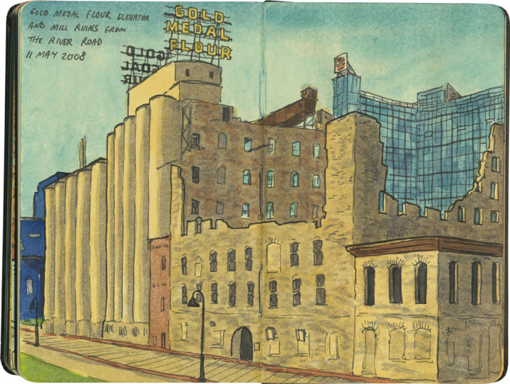
Minneapolis mill ruins sketch by Chandler O'Leary

Visiting the ruins at Mission San Juan Capistrano reminded me that at least in this country, it’s not the sort of thing one can see every day. Living in Europe for a time gave me a taste for ruined architecture, but it’s not something you often find in the States.

One could argue our civilization isn’t old enough to have archeological sites around every corner, but I don’t think that’s it. For one thing, there has been human culture here for thousands of years, and in some places, like the Southwest, there is plenty of archeological evidence to tour and visit. For another, the Civil War, natural disasters, isolated acts of violence, and countless ordinary accidents have given us plenty of rubble of our own. No, here it’s more of a cultural mindset: when buildings are destroyed, we Americans have an instinct to rebuild, restore or replace them. It really goes against the grain to let architectural remains stay in their ruined state, and learn to appreciate them as they are.

Minneapolis mill ruins sketch by Chandler O'Leary

That’s why I love the mill ruins of Minneapolis. Beyond being simply beautiful in their own right, the shells of destroyed buildings are also steeped in stories. Rather than putting up some plaque to commemorate the city’s past as a flour milling town, you can actually stand in a remnant of that past. Instead of repurposing every scrap of real estate for modern, practical use, this parcel of land has been preserved as a museum, just the way it is. And best of all, the ruins sit among specimens of both restored historic buildings and brand new ultra-modern architecture—and they fit in just fine, part of the fabric and story of the city as a whole.

Comments (1) Pin it!

American ruinsSan Juan Capistrano, CA

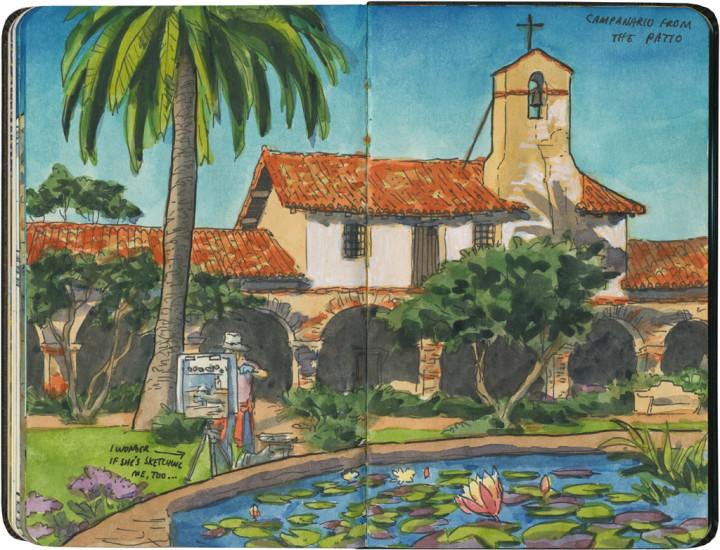
Mission San Juan Capistrano sketch by Chandler O'Leary

This is the third installment of my Mission Mondays series, exploring all 21 Spanish Missions along the California coast. You can read more about this series, and see a sketch map of all the missions, at this post.

San Juan Capistrano is the jewel of the missions—seriously, it’s hard to think of a more beautiful place in all of California. I ended up finishing off the whole rest of my sketchbook there, because every time I blocked out a rough composition, I’d look in another direction and see something else I just had to draw.

Detail of California Missions map sketch by Chandler O'Leary

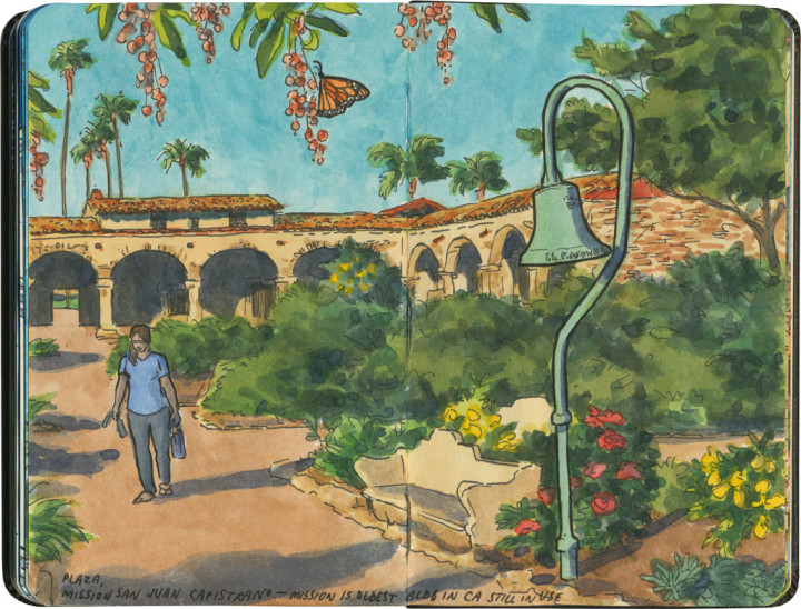
Founded in 1776, Mission San Juan Capistrano contains the oldest building in California still in use. But the thing everyone comes to see is the large portion of the complex that lies in ruin.

Mission San Juan Capistrano sketch by Chandler O'Leary

If you come to the mission from the north, the first thing you’ll see is the relatively brand-new mission basilica. The building is gorgeous, but was only built in 1986. Still, it follows the design of the original mission church—

Mission San Juan Capistrano sketch by Chandler O'Leary

—which is on the the other end of the property, and looks like this. The church was built in 1806, and flattened six years later by an earthquake. The ruins are where the famous swallows nest and return each year—though these days, that’s not so true anymore. I was there a month too soon anyway, so I saw a grand total of one swallow. But thanks to recent factors like increased development in the town and possibly climate change, the huge flocks just aren’t coming anymore. In the past 20 years or so, only a few birds have been coming home to roost each spring.

Mission San Juan Capistrano sketch by Chandler O'Leary

Hearing about the swallows was certainly a disappointment, but I was too enamored of the buildings themselves to be sad for long. What they most reminded me of was my time living in Italy. The cloister archways were one thing, but seeing the ruined stone church transported me right back to the Roman Forum.

Mission San Juan Capistrano sketch by Chandler O'Leary

The other thing that reminded me of Rome was the light—it was the kind of place where the “magic hour” seemed to last all afternoon.

Mission San Juan Capistrano sketch by Chandler O'Leary

I picked a good day to visit, too—despite the perfect weather, I was there in the off-season.
Mission San Juan Capistrano sketch by Chandler O'Leary

So even though I’m sure the place is packed to the gills during swallow season, there were only a handful of visitors there with me that day.

Mission San Juan Capistrano sketch by Chandler O'Leary

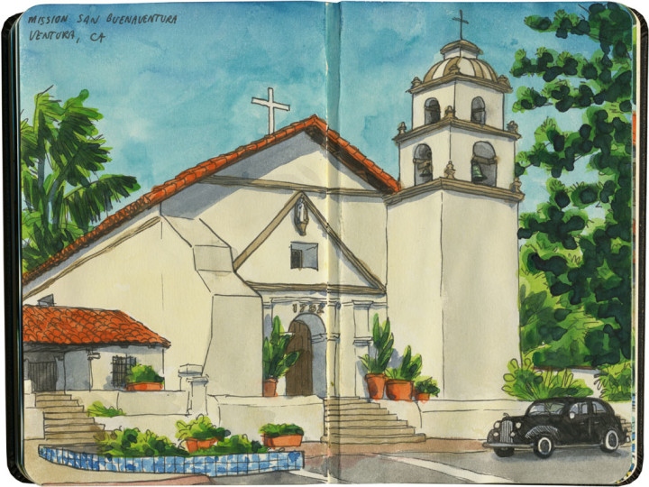
So that allowed me to choose whatever vantage point I wanted, and spent plenty of uninterrupted time sketching—just me, the mission, and all that Mediterranean light.
Comments (1) Pin it!

Goonie weekendAstoria and Cannon Beach, OR

Old Clatsop County Jail sketch by Chandler O'Leary

I’m a bit of a movie nut—especially for anything shot on location. I’m a sucker for films that center around real places—and Astoria, OR has featured prominently in so many movies that the entire town has become a cinema icon. This Sunday marks the 30th anniversary of the release of the 1980s free-range-kid classic, The Goonies, so I thought I’d celebrate by posting my Goonie sketches from a few years ago.

First up is the most well-known location in town, and the one that’s easiest to find: the old Clatsop County Jail from the hilarious jailbreak scene. This building is so iconic that it’s now home to a museum centered around the movies filmed in Oregon.

Goonies house sketch by Chandler O'Leary

Next up is Mikey and Brand’s house (with a glimpse of Data’s place next door). This house looks almost exactly the same as it does in the film—at least from what I could see below. I have a feeling the current owners put up with a lot of well-meaning trespassing from Goonies fans, so I wanted to be respectful of their property and stay on the sidewalk below. Oh, and incidentally, this house is literally around the corner from the school featured prominently in Kindergarten Cop (yes, I’ve sketched that, too—that’s a post for another day).

Cannon Beach sketch by Chandler O'Leary

Finally, no Goonies pilgrimage would be complete without a side trip to Ecola State Park, about a half hour south of Astoria. This is the spot where the gangster hideout was, where the kids entered the underground path to pirate treasure. From here you can spy (through the holes in a 1632 Spanish doubloon, of course) Cannon Beach below, and the silhouetted bulk of Haystack Rock—which you might recognize as the seastack that looms above the final scenes in the film.

This weekend Astoria is having a big 30th anniversary celebration, but I won’t be able to get down there for the event. So instead, you can bet the Tailor and I are going to pop up some popcorn, fire up the DVD player, and have ourselves a blast from the past.

Comments (1) Pin it!
« Older Posts Newer Posts »