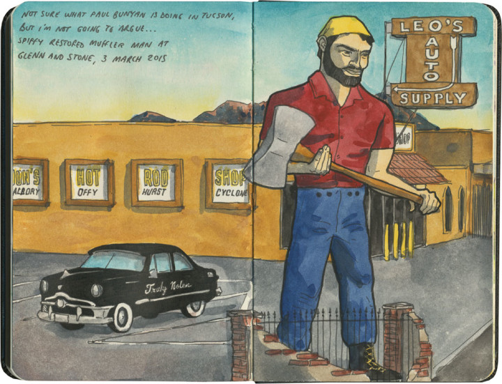
Tag Archives: AZ

Route 66 sketch by Chandler O'Leary

Fill ‘er up

This post is part of an ongoing series called 66 Fridays, which explores the wonders of old Route 66. Click on the preceding “66 Fridays” link to view all posts in the series, or visit the initial overview post here.

Polly want a pit stop?

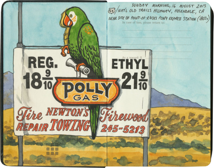
If you’re going to take a road trip, at some point you’re going to need to refuel. And nobody knows how to fill your tank like the folks on Route 66. Of course, since the route crosses a big swath of American oil country, you’ll know that the milk of the Mother Road is petroleum.

Route 66 sketch by Chandler O'Leary

Cuba, Missouri

The thing is, though, the designers and architects and advertisers and engineers responsible for putting gas stations all along the route got into the spirit of 66 in their own unique ways. Forget what you know about ugly garages lining Interstate exits—many of Route 66’s filling stations are downright works of art.

Route 66 sketch by Chandler O'Leary

Cuba, Missouri

And many of them look absolutely nothing like gas stations.

Interestingly, the Mother Road was built at a time when more and more Americans owned automobiles—all over the country there was an increasingly large demand for petrol. Filling stations moved into town centers and residential neighborhoods, and some oil companies wanted their fuel stops to blend in with the neighborhood architecture.

Route 66 sketch by Chandler O'Leary

Since American architecture is highly regional in nature, many of these “camoflaged” filling stations took on the look of their local culture—Spanish-Mission-style canopies in California, limestone façades in the Ozarks, clapboard farmhouse lookalikes in the Plains, etc. And then, of course, architectural tastes changed over the years, so you’ll find examples from the Victorian era to midcentury pop-Googie, and everything in between. (Not to mention the tradition of kitschy filling stations shaped like random objects or weird ho-made roadside giants.) Finally, each oil company wanted to attract customers away from the others, so they relied on creating distinctive architectural styles as a form of branding. The result is a veritable encyclopedia of diverse and spectacular specimens—and Route 66 might just have the best collection of all.

Route 66 sketch by Chandler O'Leary

Albuquerque, New Mexico

After a few hundred miles, we started getting really good at spotting the buildings that used to be filling stations (this is an obvious one, but many had been deeply camoflaged, or totally remade in some other image, or else fallen into ruin). And we also developed a knack for pegging which style belonged to which company (above is a classic 1930s Texaco design).

Route 66 sketch by Chandler O'Leary

Tulsa, Oklahoma

Then again, sometimes a building would throw us completely—the sealed-up garage bays hint at the Blue Dome’s history, but if I didn’t know better, I would have guessed this was once a Greek Orthodox church or something.

Route 66 sketch by Chandler O'Leary

Spencer, Missouri

The filling stations of Route 66 also serve as markers of time’s passage, and the rise and fall of communities along the way. This one is all that remains of a ghost town in Missouri that fell into disuse when the highway changed its route. (I’m not talking about the advent of the Interstate, either, although that’s a common story—this place lost its prime spot decades before that, when the 66 alignment was simply moved to a spot further south.)

Route 66 sketch by Chandler O'Leary

Ranco Cucamonga, California

While many petroleum relics have faded into oblivion, others are being brought back, at least in some form or other. Above is one of the oldest specimens we found (it actually predates the birth of Route 66 by nearly a decade). While part of the structure has been torn down, at least the main part of the station is getting a lovely facelift.

Route 66 sketch by Chandler O'Leary

Needles, California

It’s not just the oldest samples being preserved, either. This guy is only a little over fifty years old, but it, too, has been returned to its former glory.

Route 66 sketch by Chandler O'Leary

Normal, Illinois

For many old stations, however, the opposite is true. Countless specimens either sit empty, their original purpose unknown to the average passerby—or else they get cannibalized and transformed into some other creature, usually without any fanfare.

Route 66 sketch by Chandler O'Leary

Hydro, Oklahoma

These stories of disrepair and restoration interest me greatly, of course, but what really gets me is the story of each place: the whys and wherefores of each station, and the tastes and quirks of the people who either built or ran them.

Route 66 sketch by Chandler O'Leary

Cool Springs, Arizona

After all, Route 66 crosses through some seriously unpopulated territory. Many of these old filling stations were the only game in town—or in the most remote corners, something closer to the last chance for salvation.

Route 66 sketch by Chandler O'Leary

Commerce, Oklahoma

While others, meanwhile, live on in notoriety, attracting tourists to the spots where blood was shed or infamous characters once stood.

Route 66 sketch by Chandler O'Leary

Odell, Illinois

Still, most tell the story of perfectly ordinary people running perfectly ordinary businesses along one of the backbones of American travel and commerce. They might be extraordinary today, but usually that’s boils down to having somehow lasted long enough to stand out amongst more modern surroundings.

Route 66 sketch by Chandler O'Leary

Shamrock, Texas

I’m glad, at least, that I’m obviously not the only one who has noticed these things—that there is an army of conservators and historians and artists and boosters out there, preserving as many of these old filling stations as possible, and documenting the ones that can’t be saved.

I know that these days, oil companies have fallen out of public favor (heaven knows I have my own beef with the oil industry)—regardless of their nostalgia, these places are also reminders of American excess and the damaging effects of fossil fuels. Yet however we may be careening toward Peak Oil, these relics still have a place on the Mother Road—the path that might just traverse this country’s Peak History.
Save

Save

Save

Save

Save

Save

Save

Save

Route 66 sketch by Chandler O'Leary

Extinct but very much alive

This post is part of an ongoing series called 66 Fridays, which explores the wonders of old Route 66. Click on the preceding “66 Fridays” link to view all posts in the series, or visit the initial overview post here.

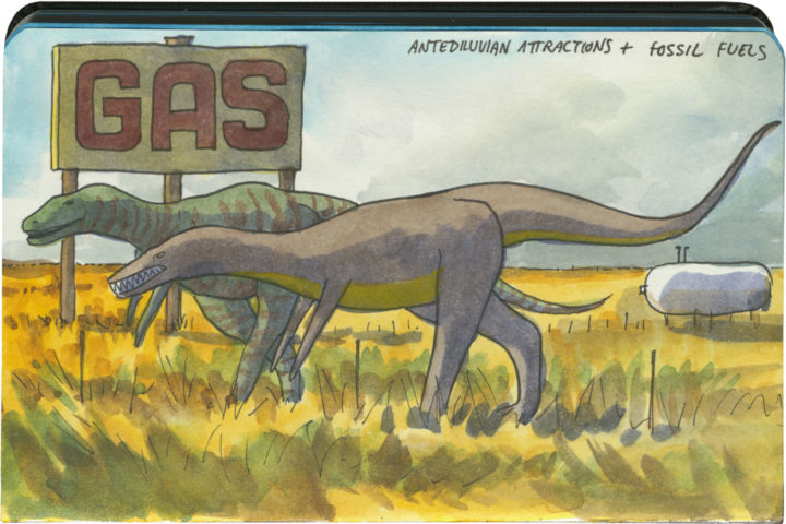
Unlike the Columbia River Gorge and the Oregon Coast, the section of Route 66 that crosses eastern Arizona is actually a place known to contain real, no-kidding dinosaur fossils. (And unique ones, to boot: there’s a large concentration of Triassic-era early dinosaur species here.)

Route 66 sketch by Chandler O'Leary

Unsurprisingly, the Mother Road in that part of the state is positively crowded with roadside attractions that fill the dinosaur niche—most of them centered around the town of Holbrook. No matter what kind of concrete dinosaur you’re into, Holbrook has something for everyone. The prehistoric portrayals range from cartoony…

Route 66 sketch by Chandler O'Leary

…to surprisingly realistic…

Route 66 sketch by Chandler O'Leary

…to absurd…

Route 66 sketch by Chandler O'Leary

…to downright hilarous.

Amazingingly (and unlike many Route 66 landmarks), every dino-themed attraction here is still in business, still trapping tourists. May they live long and prosper—while they keep drawing crowds, I’ll keep drawing pictures.

Save

Save

Save

Route 66 Burma Shave sketch by Chandler O'Leary

Roadside rhymes

This post is part of an ongoing series called 66 Fridays, which explores the wonders of old Route 66. Click on the preceding “66 Fridays” link to view all posts in the series, or visit the initial overview post here.

Some years back I lamented missing the era of the Burma Shave ad, but on Route 66, I finally got my chance to see what it must have been like. These signs are replicas rather than originals, and some of them are more than a little ho-made

Route 66 Burma Shave sketch by Chandler O'Leary

…but it doesn’t matter. The effect, I imagine, is the same. Like the Meramec Caverns signs, the Burma Shave ads permeated American road trip culture from the mid-1920s through the mid-60s, providing lots of inexpensive exposure for the company and roadside fun for travelers as they “sang along” with the five- or six-sign rhyming slogans. Even the Tailor and I found ourselves reciting the limerick-like slogans aloud as we drove by.

Route 66 Burma Shave sketch by Chandler O'Leary

It just seems fitting that we’d find the quintessential billboards on the quintessential road trip. If you’re going to have any Burma Shave remnants out there along the roadside, they just belong on the Mother Road.

Save

Save

Save

Save

Save

Route 66 sketch by Chandler O'Leary

Cutting-edge comfort

This post is part of an ongoing series called 66 Fridays, which explores the wonders of old Route 66. Click on the preceding “66 Fridays” link to view all posts in the series, or visit the initial overview post here.

In its heyday, Route 66 was a symbol of American prosperity, modernity, technology and personal freedom—not just because of the rise of the middle class in that era, but also thanks to all the new technologies that allowed more and more people to live in relative comfort. In the post-war 1920s people started buying big-ticket items on credit; after World War II, good jobs were abundant and people had even more disposable income. In both eras, many families owned their own automobiles for the first time: suddenly people had both the means and the tools to take vacations in far-off places, and Route 66 showed them the way.

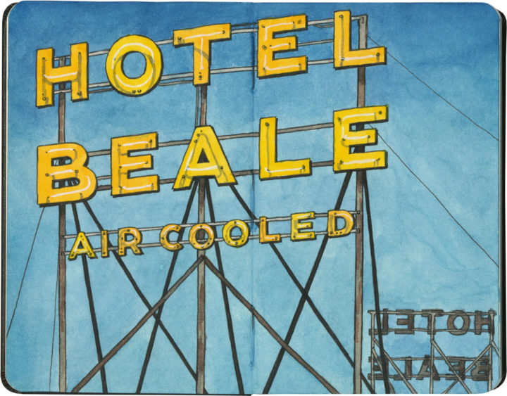
And the Mother Road was lined from toe to tip with modern notions and attractions. Neon tubes, a recent invention, lined every urban commercial strip along the way. Budget-minded travelers could stay in newfangled motor hotels, and even park their cars in garages attached to their rooms. But perhaps the most important invention, the key to the Mother Road’s success, was the advent of air conditioning.

Like most vacationers do today, Route 66 road trippers tended to take their vacations in the summer. And 66 cuts its path through a part of the country with some seriously warm climates. August in the Ozarks is hot and sticky, but summer in the Sun Belt can be downright dangerous. Air conditioning became widely available in the late 1920s, just as the first alignments of 66 were being laid out. The technology wasn’t just convenient for hotels or restaurants looking for a perk to advertise; it was downright revolutionary, in that it allowed the entire American Southwest to be opened up for large-scale development.

Of course, the Southwest is littered with examples of the downsides of said development, but now that I’ve traveled Route 66 at the very zenith of a scorcher of a summer, the logic of advertising “air cooled” rooms is plain as day. I can now attest to the gratitude one feels when stepping into an icy-cool room after a day spent in 115-degree heat. And neon signs like this one, advertising such a technological miracle, shimmer like desert mirages promising an oasis just ahead.

Route 66 sketch by Chandler O'Leary

Lumberjacks of 66

This post is part of an ongoing series called 66 Fridays, which explores the wonders of old Route 66. Click on the preceding “66 Fridays” link to view all posts in the series, or visit the initial overview post here.

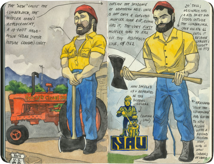
Since Route 66 passes through the Great Plains and the Desert Southwest, and not at all through the North Woods, it’s not a highway that brings thoughts of Paul Bunyan to mind. Yet there are a handful of Pauls along the Mother Road, if you know where to look.

The most well-known can be found in Flagstaff (where logging actually does happen): a trio (including a set of identical-twin Muffler Men) of big brothers in matching outfits. The guy on the left of the above sketch is hand-hewn out of wood, fittingly, but to me the most interesting specimen is the one on the right half of that spread. That Muffler Man happens to be, rumor has it, the very first one ever rolled off the assembly line. Today the aforementioned wooden statue stands in his place on Route 66, and the Muffler Man now stands near his twin on the Northern Arizona University campus.

Route 66 sketch by Chandler O'Leary

The other Paul Bunyan is an oddity, indeed. He stands high above Central Avenue (the more modern alignment of 66) in Albuquerque, keeping watch beside what is now a Vietnamese Cafe. Sadly, this Paul has recently been rendered limbless…but it’s not like he needed to do a lot of logging in Albuquerque anyway.

Save

Save

Save

Route 66 sketch by Chandler O'Leary

The proof is in the pavement

This post is part of an ongoing series called 66 Fridays, which explores the wonders of old Route 66. Click on the preceding “66 Fridays” link to view all posts in the series, or visit the initial overview post here.

It’s easy to take for granted the fact that the American West is crisscrossed with highways nowadays, but those highways didn’t get there by chance. If you look closely at the routes those highways take, you can give yourself an excellent crash course in history, both human and natural. Overland exploration, trade routes, desert basins, animal migration, continental drift…all these things and more are hinted at by the map sketched out by the U.S. highway system.

Let me explain what I mean. If you happened to grow up in the Midwest, chances are your mental map would be dictated by a grid that follows the cardinal directions. In the Great Plains, particularly, where the landscape is mostly flat, dividing property lines and town borders into a standard grid makes the most sense. Much of the United States west of the Appalachians is arranged this way, in fact, in a basic grid called the Range and Township system. The system overlays a simple framework of one-square-mile sections over the entire western two-thirds of the country, dividing the landscape into rangeland for farming and six-mile by six-mile townships. Interestingly enough, we have Thomas Jefferson to thank for this system, which he devised in 1785 as a way to manage the vast swaths of land that, after the Revolution (and some years later the Louisiana Purchase), now belonged to the U.S. His reasoning, I think, was both practical and lofty: as a farmer himself, he was looking for a workable alternative to the inherited system of Metes and Bounds, England’s age-old framework for managing farmland and water access. While that system worked for the colonies, each roughly comparable in size and topography to what they knew in the Old World, the old framework wasn’t scalable to the size of the new West—particularly when tracts of land were being sold off sight-unseen to settlers and prospectors. But beyond the practical logic, I think Jefferson had more philosophical motives behind his plan. This is the guy who designed Monticello, after all, a monument to neoclassical thinking and an homage to ancient Greece and Rome. The Range and Township system applied a sense of order—however illusory—to the uncharted wilds of the West. It brought rational thought and a sense of opportunity to an area associated with chaos and the fear of the unknown.

Route 66 sketch by Chandler O'Leary

If you’ve ever visited the Great Plains, you can still see Thomas Jefferson’s plan in evidence, from the straight-as-an-arrow farm roads in rural areas, to the faithful system of thoroughfares in cities like Tulsa or Dallas, where the roads always travel from A to B in a straight line, with traffic lights appearing like clockwork at precise one-mile increments, and tenth-of-a-mile residential blocks in between.

But here’s the problem: Thomas Jefferson never laid eyes on the West he gridded out like a piece of paper. He never saw nature’s rebuttal to rationality in the Rockies or the Colorado Plateau. It’s all well and good to have a sensible grid in a flat place, without major physical features to interrupt the plan. But in many parts of the West, Jefferson’s tidy squares becomes utterly useless. You can’t easily farm a quadrangle of land that’s bisected by a canyon, and you can’t run a road up and over a mountain. Travel in a straight line is impossible in many, many places. As everyone from Chief Joseph to Lewis and Clark to highway engineers could tell you, there are some places in the West where only one route overland is possible—or none at all.

Route 66 sketch by Chandler O'Leary

So if you look at a modern highway map of the western half of the United States, the limitations geography places on rationality are obvious. You can see precisely where the Corps of Discovery found their way to the Pacific Northwest, or where the stagecoaches hauled goods to Santa Fe, or how the Mormon pioneers tumbled out of the mountains to the Great Salt Lake, or the supply route linking the California Missions to Mexico. It’s all there, because centuries later we’re still traveling the exact same routes that humans always have, dodging mountains and following water to whatever their destinations were. The Conestoga wagons followed the game trails and trade routes of the various Indigenous peoples. The railroad followed the pioneers’ wagon tracks. The first pavement slabs paralleled the railroad grade, and modern Interstate freeways zoom right over many of those original roadbeds and trailways. Even the technology of conveyance was based on the older methods of travel—just look at the wheel base on a modern car, whose width matches that of railroad cars, themselves directly descended from the lineage of horse-drawn wagon measurements.

As you can probably guess by my long-winded introduction here, this stuff ties square in with Route 66 and the path it cuts to the Pacific.

Route 66 sketch by Chandler O'Leary

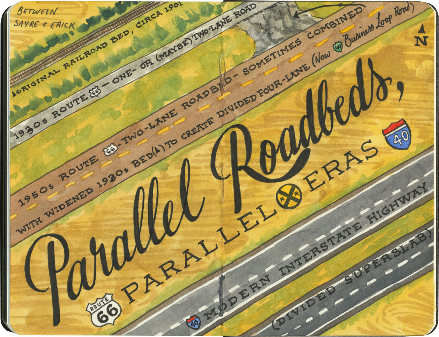
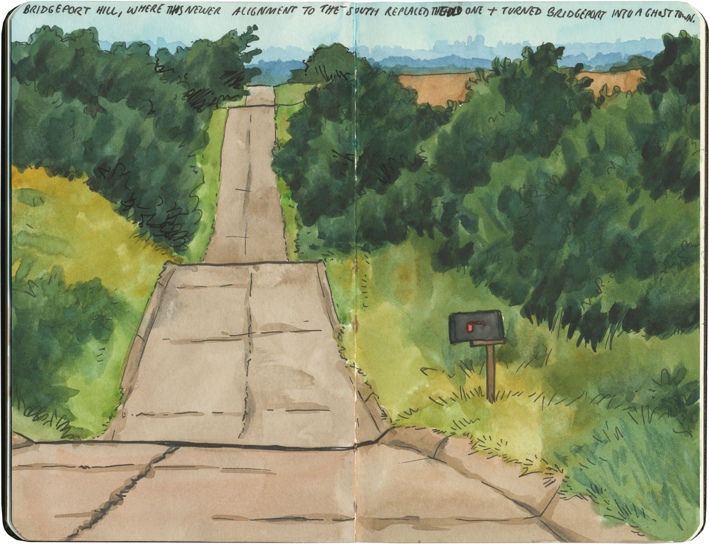
There are many places along Route 66 where you can see this progression of transportation history unfold before your very eyes. In flat places like central Illinois or eastern Oklahoma, there was no reason to reuse the same roadbed over and over again—they had all the land in the world at their disposal, and nothing to impede their path. So they simply built the new road alongside the old—over and over again.

Route 66 sketch by Chandler O'Leary

The result is a network of parallel lines, each wider than the last, each laid down at a different point in recent history. In these places, the land acts like a palimpsest, marked over and over again with new traceries of roadbeds, while the old ones, though crumbling in disrepair, still remain visible.
Route 66 sketch by Chandler O'Leary

Since Route 66 was decommissioned as an official national highway, there are places where it’s difficult to discern the original route. The old roadbed might be there, but the Mother Road can get lost amid a modern tangle of frontage roads, diversions, and replaced pavement.

Route 66 sketch by Chandler O'Leary

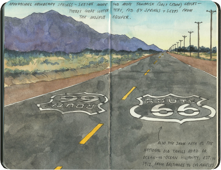
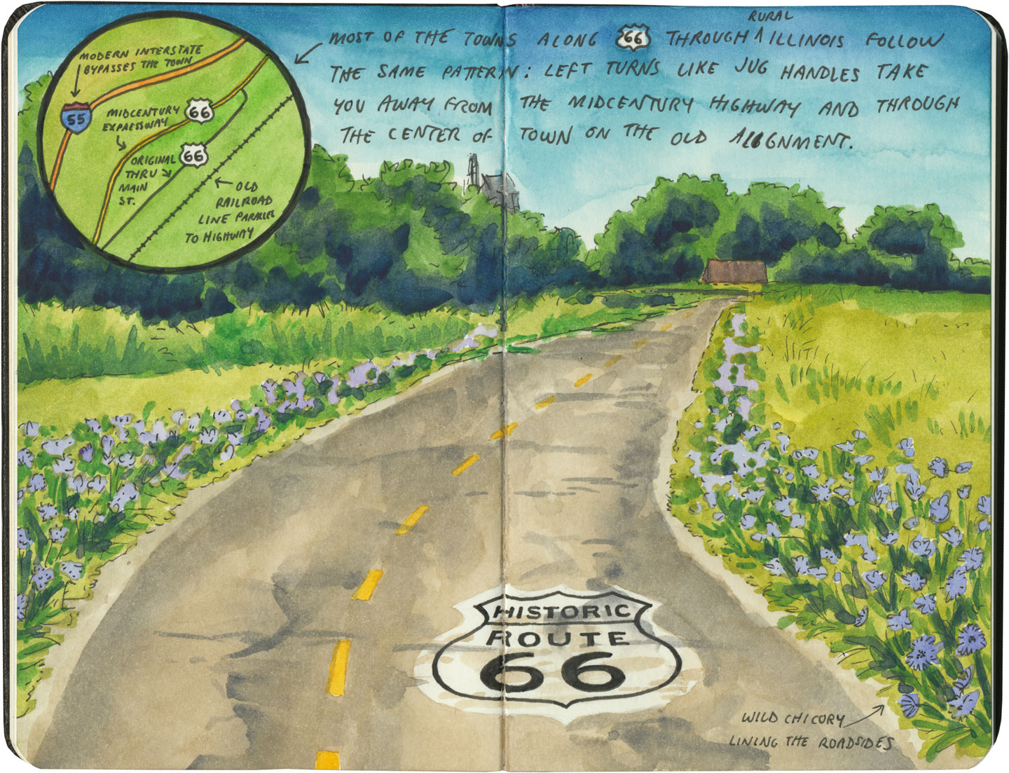
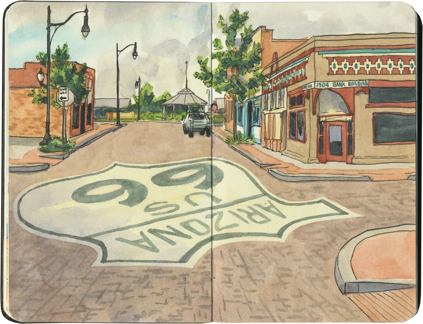
Part of the joy of traveling Route 66 is learning to recognize the old road. In some places, the path is lit up like a beacon with painted pavement and restored waymarking…

Route 66 sketch by Chandler O'Leary

…in others, tracing the original marks on the palimpsest becomes something of a quest.

Route 66 sketch by Chandler O'Leary

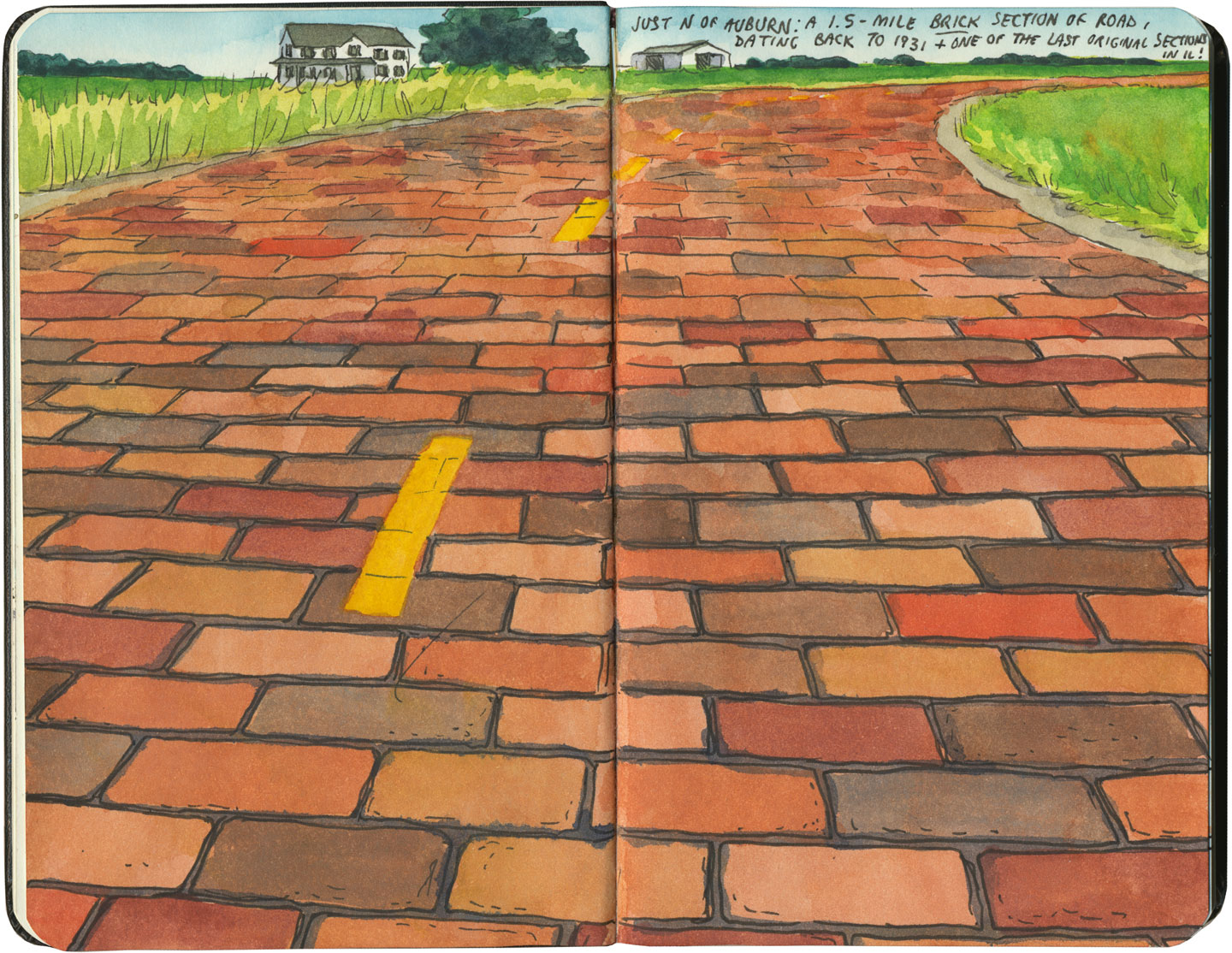
And then there are the places where the original pavement itself becomes the attraction along the way—like this gorgeous stretch of brick roadway in Illinois, paid for in the 1930s by a brick magnate and lovingly maintained as a curious relic of the past.

Route 66 sketch by Chandler O'Leary

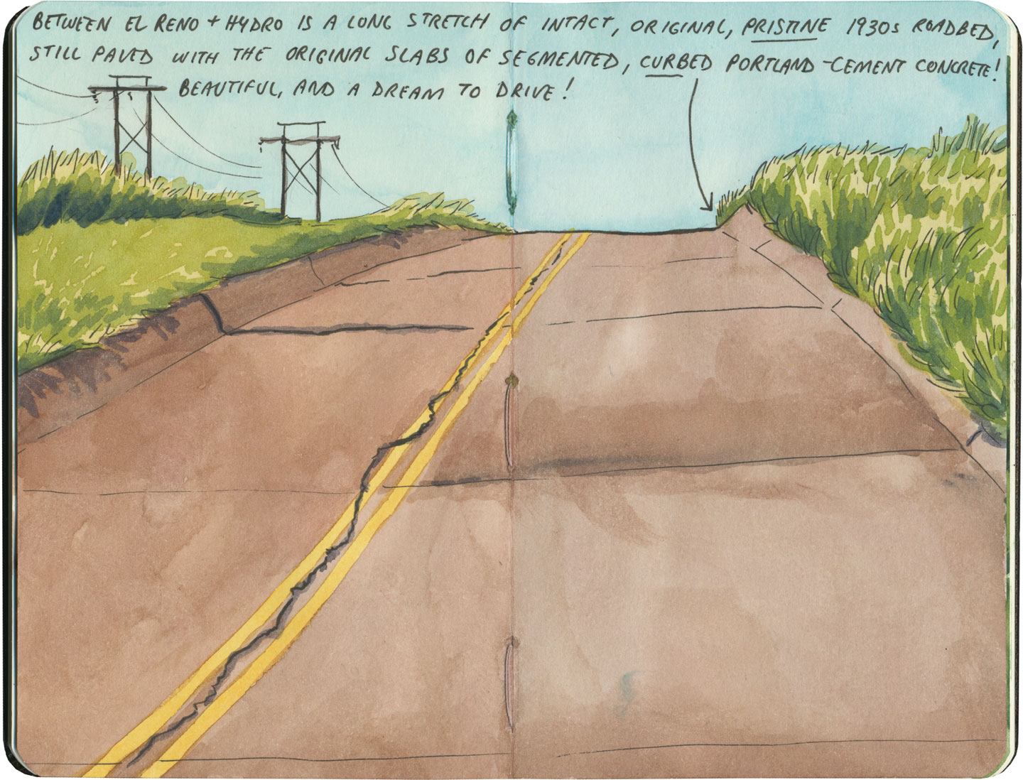
My favorite of all was the long section of 66 that traverses central Oklahoma: the combination of good craftsmanship and a remote locale has preserved the original roadbed impeccably. It sounds nerdy to say it out loud, but I dare any 66 enthusiast not to feel a thrill when seeing that curbed Portland cement.

Route 66 sketch by Chandler O'Leary

By the end of our journey, we’d gotten really good at spotting the difference between old and new along the way. And whenever we lost the thread of the route (easily done, since there are so many alignments, many of which have been replaced or buried under modern roads), it became easier and easier to spot the hints that would lead us back to the Mother Road.

Route 66 sketch by Chandler O'Leary

What led me to travel Route 66 was a love of history and Americana, and a desire to travel a well-worn and well-loved path. I had no idea that it would be so much more—and something much closer to the feeling of solving a mystery. Beyond the fun of diners and neon, there’s a richer, subtler 66 to be discovered, if you’re willing to look a little deeper. All the clues are there—some of them stamped right into the pavement underfoot.
Save

Save

Save

Save

Save

Save

Save

Save

Save

Route 66 sketch by Chandler O'Leary

Ranch to table

This post is part of an ongoing series called 66 Fridays, which explores the wonders of old Route 66. Click on the preceding “66 Fridays” link to view all posts in the series, or visit the initial overview post here.

When it comes to road food along Route 66, sometimes a hot dog just doesn’t cut the mustard. When you’re traversing the Wild West, sometimes you just want a darn steak already. If a slab o’ steer is your cuppa tea, there’s no better place than Rod’s Steakhouse in Williams, Arizona.
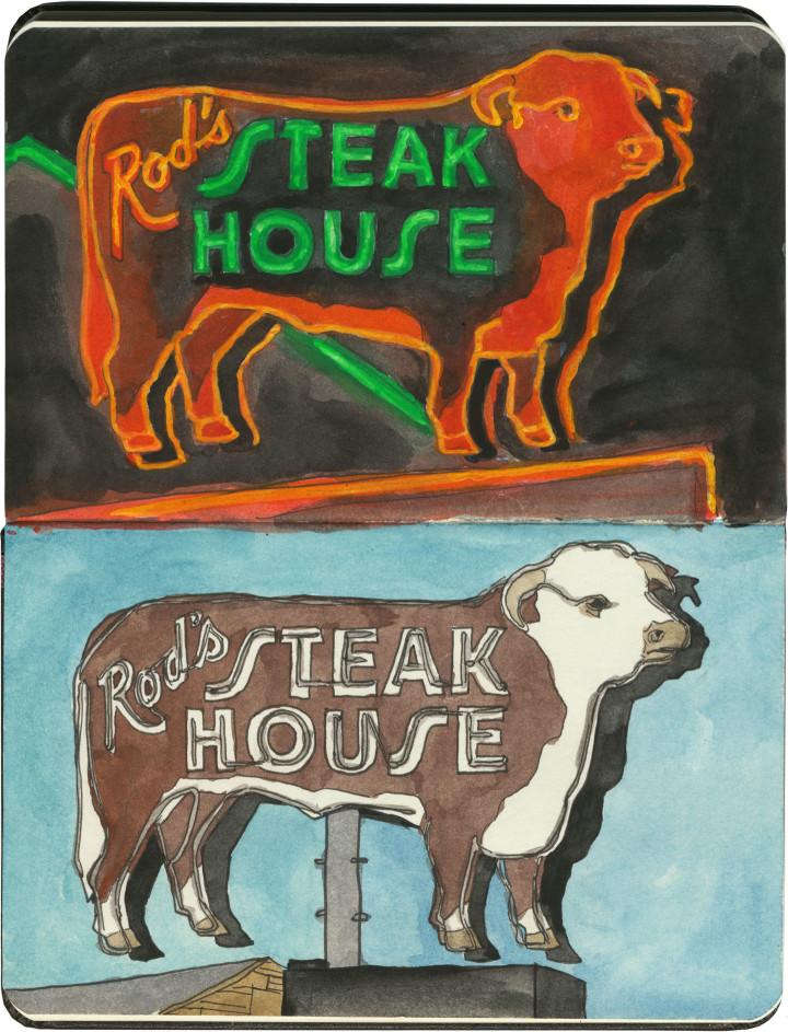
We stayed three nights in a motel kitty-corner from Rod’s, so I ended up spending a lot of time staring at that neon sign—no complaints here, it’s a real beauty. What you couldn’t see from the motel was that the steer sign was just the tip of the fluorescent iceberg:

Route 66 sketch by Chandler O'Leary

A whole block of gorgeous neon! They had me at hello.

Route 66 sketch by Chandler O'Leary

So on our last night in Williams, we sat down for a steak dinner. Between the neon signs and the juxtaposition of cowboy decor and scores of Italian and French tourists, I was already in heaven. But you should have seen the rapture when I saw what was waiting at the table:

Route 66 sketch by Chandler O'Leary

Die-cut menus and vintage custom china pattern? Swoon.

I mean, yeah. The steak was great, too—actually, my rib eye was downright perfect. But no matter how unforgettable the meal, it’s the visual details I’ll always remember.

Route 66 sketch by Chandler O'Leary

Burro borough

This post is part of an ongoing series called 66 Fridays, which explores the wonders of old Route 66. Click on the preceding “66 Fridays” link to view all posts in the series, or visit the initial overview post here.

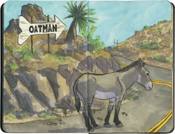
I think this is the closest I’ve yet come to experiencing the phenomenon of the sacred cow. In Oatman, Arizona, they have sacred donkeys.

Well, if not exactly sacred…then, I’d imagine, lucrative.

Route 66 sketch by Chandler O'Leary

Oatman is something of a living ghost town: what’s left is a relic of the gold rush, a dessicated hamlet tucked away in the craggy, bare mountains of western Arizona. The place is so unbelievably remote, it’s a wonder that any highway reached it at all, let alone the Mother Road.

At the time of the gold rush, prospectors brought burros with them to do the heavy lifting for them. Far more hardy than your average horse, the donkeys could tough it out in such an inhospitable place. The ore veins dried up during the Great Depression, and at the start of World War II, the mines were formally closed as nonessential to the war effort. The last few miners turned their beasts of burden loose onto the surrounding hills, and left town for good.

The burros, being burros, thrived on their hardscrabble existence, and before long had produced an entire population of feral donkeys. Their sleek, well-fed descendants roam the streets of Oatman today, stalling traffic (such as there is) and biting the fingers of unwary tourists.

Route 66 sketch by Chandler O'Leary

You have to hand it to Oatman: someone there saw the potential for a feral donkey to become a serious—and sacred—cash cow.

I’m a little ashamed to say I didn’t part with any tourist cash in Oatman. I didn’t even get out of the car. It was 116 degrees Fahrenheit outside, and while I’ll do almost anything for a good tourist trap, frying like an egg isn’t on the list. But then again, stubborn as I may be, I’m no burro—just a pale Irish gal from a cold, rainy climate.

Maybe I’ll visit in the winter next time, and buy an extra t-shirt as penance.

Route 66 sketch map by Chandler O'Leary

Mother Road, mother lode

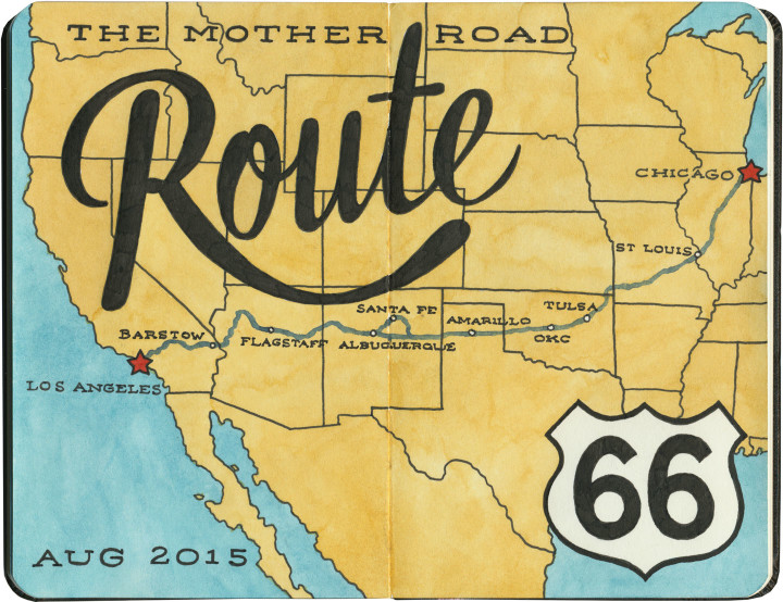
Last summer the Tailor and I spent a couple of weeks traveling every inch of old Route 66. And then I kept pretty quiet about it, because I just had no idea how to organize and share the sheer number of sketches and stories I came away with afterward. There really is no “long story short” way to do this—like the Mother Road itself, there are too many branches and tangents for a single linear tale. So like I did for my Mission Mondays series, I’m going to break this down into 66 Fridays, starting today and running through spring of next year. (You can follow along by using the 66 Fridays tag.)

So each week for the next 66 weeks, I’m going to share a piece of Route 66—and like everything else on this blog (except the Mission series), those pieces will be in no particular order. There are a zillion books out there already that tell the Route 66 story from beginning to end (both in time and space), so that frees me to, er, paint a slightly different picture. I’ll be jumping around from state to state, highlighting my favorite landmarks and historical tidbits. With any luck, it’ll give you a good enough taste of the Mother Road that it’ll inspire you to explore it for yourself.

Route 66 sketch by Chandler O'Leary

A few notes:

• There’s a common perception that Route 66 is long gone, and that modern travelers can only drive bits of the route. That’s actually not true. While modern Interstate highways have replaced long chunks of the Mother Road in certain spots, it’s actually possible to drive over 80 percent of the original route—including the original road bed and even 90-year-old pavement in several places. Route 66 was officially decommissioned as a U.S. highway decades ago, but the old thread is still there, still nearly intact, just waiting for an adventurous traveler with a sharp eye to find it.

• We didn’t see everything there is to see on Route 66. Not even close. We spent nearly two weeks on the Mother Road, and by my estimate we would have needed a good month, at least, to really take it all in. Considering how much more there would have been to see years ago, before so many places closed down or fell into ruin, it all boggles my mind a bit. Nevertheless, this trip was a good first taste of the whole thing. I made the Tailor promise me that someday we’d do it all again, and take however much time we wanted.

• Even though we didn’t see everything along the way, we did our darndest to drive every inch of the route that remains—and that’s no small feat, considering how many tributaries, diversions, parallel routes, rerouted sections, poorly-marked bits and dead ends there are. I’d driven bits of 66 before, but never the whole stretch in one go. It feels like a real accomplishment that we did that.

• I hope you don’t hate vintage signs, because you can expect a lot of them in the coming months. I’ll try to keep the posts balanced between various subject matters, but I’m not gonna lie: there’s a metric ton of incredible vintage signage along Route 66, and I did my level best to draw all of it. I have whole sketchbooks just devoted to neon. I probably won’t show you everything, but you will see an awful lot of it.

Route 66 sketch by Chandler O'Leary

So buckle your seatbelts and pull out your paper maps—let’s get this show on the road, and embark upon the serious business of getting our kicks.

Save

Muffler Man sketch by Chandler O'Leary

A landmark day

It’s hard to imagine that much time has passed already, but today this blog turns two years old. (Last year’s anniversary post is here.) In the past 24 months you’ve crisscrossed the continent with me, pinballing back and forth from place to place, landmark to landmark. So I figured there was no better way to mark the occasion than with two icons of both Americana and road trip culture, all rolled into one figure: a Muffler Man in the guise of Paul Bunyan.

Here’s to the next year, and the next bend in the road. May there always be Muffler Men there to guide my path, and more American legends to share and sketch. Thank you to everyone who reads and every fellow traveler, in this virtual world and in the real one.