Tag Archives: Great Plains

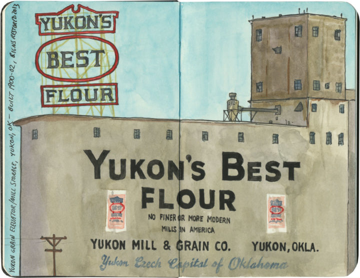
Yukon's Best Flour sketch by Chandler O'Leary

Flour flurry

This post is part of an ongoing series called 66 Fridays, which explores the wonders of old Route 66. Click on the preceding “66 Fridays” link to view all posts in the series, or visit the initial overview post here.

It’s not entirely clear to me why the founders of Yukon, OK named their town after the Yukon Gold Rush, nor why its county is called Canadian County. But on the day of our visit to the Yukon of Route 66, the only blizzard we might possibly have witnessed was one of enriched white flour.

Route 66 sketch by Chandler O'Leary

Halfway there

This post is part of an ongoing series called 66 Fridays, which explores the wonders of old Route 66. Click on the preceding “66 Fridays” link to view all posts in the series, or visit the initial overview post here.

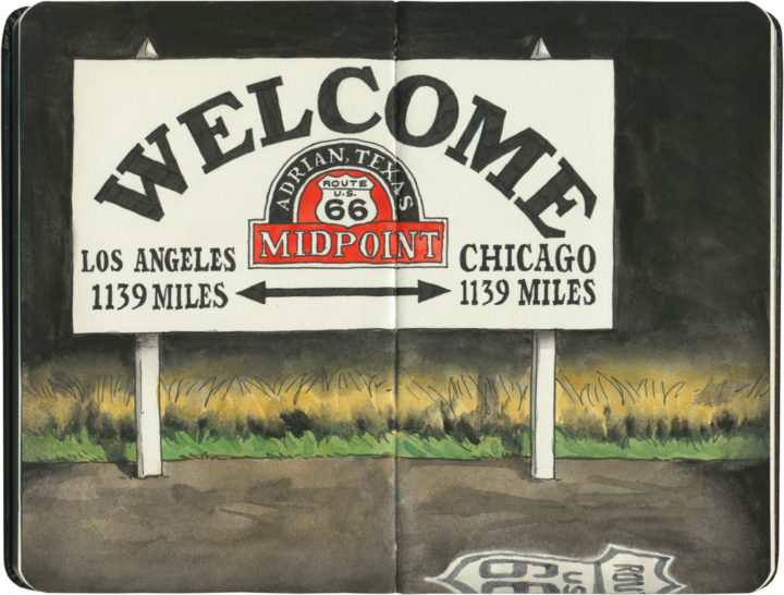
When I started my 66 Fridays series back at the turn of the new year, I knew I was in for a long road ahead. But here we are, 33 Fridays later, already at the halfway point of the series! I figured it was only fitting to pair this post with a sketch of the symbolic halfway point of the Mother Road. Since Route 66 has seen so many changes to its path over the years, it’s unlikely this sign marks the exact midpoint—but it hardly matters. I’m glad there’s a marker at all, wherever they ended up putting it.

Some of you may just be tuning in to this series now, so I figured a recap of where we’ve been so far was in order. Like everything else on this blog, my subjects jump around in space and time. So below is a list of all the Route 66 posts I’ve done so far, loosely grouped by category.

Posts about Route 66 itself:
Intro: Mother Road, Mother Lode
Chicago’s Eastern Terminus
Sundown Towns
Burma Shave
Filling Stations of 66
Suicide Bridge
Where 66 Intersects Itself
The history under your wheels

Route 66 Attractions:
Meramec Caverns Billboards
The Round Barn
The Leaning Tower
Wild Burros
Paul Bunyans
Mufflermen of the Mother Road
The Harvey House Empire
The Armory Museum
Dino Drive-Bys
Petrified Forest
The Continental Divide
Cadillac Ranch

The Mother Road in Lights:
Albuquerque’s Googie Marathon
The Dog House from Breaking Bad
The Aztec Hotel
The Munger Moss and its Antecedents
Air-Cooled Comfort
Tucumcari Tonite

Route 66 Roadside Eats:
Lou Mitchell’s
Ted Drewes
Dairy King
Chicago Dogs
Rod’s Steakhouse
New Mexico Cafes

Other Route 66 posts I’ve done (outside the 66 Fridays series):
Tulsa Googie
The Golden Driller
Old Town Ristras
The Blue Whale of Catoosa

Thank you for traveling along the Mother Road with me for so much of this year. And we still have many miles to cover—see you next Friday with the latest installment!

Route 66 sketch by Chandler O'Leary

A flash of intuition

This post is part of an ongoing series called 66 Fridays, which explores the wonders of old Route 66. Click on the preceding “66 Fridays” link to view all posts in the series, or visit the initial overview post here.

There are few Route 66 landmarks more iconic than the art installation known as Cadillac Ranch, so the Tailor and I were really looking forward to seeing it in person. Unfortunately, however, long before we reached Amarillo we knew we’d lose the race for daylight. To make matters worse, a big thunderstorm was rapidly approaching from the west, the intermittent flashes of lightning coming ever closer, ever more quickly. Not exactly ideal weather to go fumbling around in the dark in search of roadside attractions. After all, it’s not like Cadillac Ranch is in the center of town—it’s out in the middle of an unmarked field, and I had a sneaking suspicion there were no floodlights trained on those cars.

The Tailor really wanted to stop anyway, and said, “Surely it’s lit after dark. It’s so famous!” I told him I didn’t think so—according to our maps we were within spitting distance of it, and there was nothing but inky black out there. Besides, the Texas Panhandle is so flat that if it were lit at all, we would have seen it from miles away.

I’m sorry to say I was right about that: it’s not lit. At all. It’s not marked in any way—at least, not by any method that could be discerned by headlight. We drove back and forth a few times on the mile-long stretch of beat-up frontage road to which I’d narrowed down the location, while I peered through the passenger-side window into the darkness, hoping a flash of lightning might give us a clue. Finally I broke down and, for the one and only time on our entire Route 66 trip, consulted the GPS map on my phone to see if we’d found the right place. With the one available bar of mobile service, our insistence on paper maps was at least vindicated: we had gotten the location precisely right.

“This is the spot, ” I said. “Can’t see anything, but we’re looking right at it.”

“Wait,” he answered, “maybe we’ll catch a glimpse of it in the storm.”

We waited. A few heartbeats of silence.

And then: CRACK.

Route 66 sketch by Chandler O'Leary

A fork of lightning, directly in front of us, not half a mile ahead. The flash illuminated ten unmistakeable silhouettes for a split second that felt like an eternity.

We looked at each other and simultaneously burst into nervous cackling, our eyes wide, the hairs on the napes of our necks standing on end.

Save

Corn Palace sketch by Chandler O'Leary

New kid on the cob

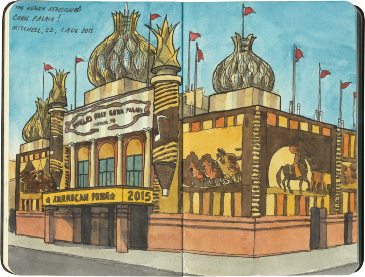
Last year I had the chance to revisit South Dakota’s world-famous Corn Palace for the first time in nearly a decade, and I had quite a surprise waiting for me. It’s common knowledge that the maize museum gets all new corn mosaics every year—but today’s Corn Palace has had more than a simple facelift. If you click that link above, you’ll see what I mean—they didn’t just replace the corn, but put in new turrets and onion domes, as well.

Personally, I think this change is a huge improvement. No longer a simple brick building with plastic domes stuck on it, these new additions are far better-crafted, hearkening back to the palace’s glory days of elaborate Victorian turrets and exotic canopies. Plus, the corn murals were real beauties last year—the icing on the, er, cornbread. All I can do is raise a cob in salute—bravo, Mitchell!

Route 66 sketch by Chandler O'Leary

Fill ‘er up

This post is part of an ongoing series called 66 Fridays, which explores the wonders of old Route 66. Click on the preceding “66 Fridays” link to view all posts in the series, or visit the initial overview post here.

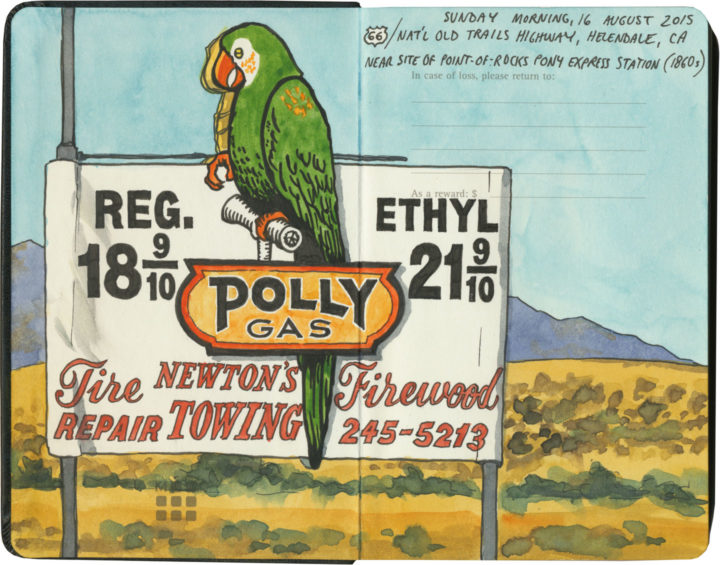
Polly want a pit stop?

If you’re going to take a road trip, at some point you’re going to need to refuel. And nobody knows how to fill your tank like the folks on Route 66. Of course, since the route crosses a big swath of American oil country, you’ll know that the milk of the Mother Road is petroleum.

Route 66 sketch by Chandler O'Leary

Cuba, Missouri

The thing is, though, the designers and architects and advertisers and engineers responsible for putting gas stations all along the route got into the spirit of 66 in their own unique ways. Forget what you know about ugly garages lining Interstate exits—many of Route 66’s filling stations are downright works of art.

Route 66 sketch by Chandler O'Leary

Cuba, Missouri

And many of them look absolutely nothing like gas stations.

Interestingly, the Mother Road was built at a time when more and more Americans owned automobiles—all over the country there was an increasingly large demand for petrol. Filling stations moved into town centers and residential neighborhoods, and some oil companies wanted their fuel stops to blend in with the neighborhood architecture.

Route 66 sketch by Chandler O'Leary

Since American architecture is highly regional in nature, many of these “camoflaged” filling stations took on the look of their local culture—Spanish-Mission-style canopies in California, limestone façades in the Ozarks, clapboard farmhouse lookalikes in the Plains, etc. And then, of course, architectural tastes changed over the years, so you’ll find examples from the Victorian era to midcentury pop-Googie, and everything in between. (Not to mention the tradition of kitschy filling stations shaped like random objects or weird ho-made roadside giants.) Finally, each oil company wanted to attract customers away from the others, so they relied on creating distinctive architectural styles as a form of branding. The result is a veritable encyclopedia of diverse and spectacular specimens—and Route 66 might just have the best collection of all.

Route 66 sketch by Chandler O'Leary

Albuquerque, New Mexico

After a few hundred miles, we started getting really good at spotting the buildings that used to be filling stations (this is an obvious one, but many had been deeply camoflaged, or totally remade in some other image, or else fallen into ruin). And we also developed a knack for pegging which style belonged to which company (above is a classic 1930s Texaco design).

Route 66 sketch by Chandler O'Leary

Tulsa, Oklahoma

Then again, sometimes a building would throw us completely—the sealed-up garage bays hint at the Blue Dome’s history, but if I didn’t know better, I would have guessed this was once a Greek Orthodox church or something.

Route 66 sketch by Chandler O'Leary

Spencer, Missouri

The filling stations of Route 66 also serve as markers of time’s passage, and the rise and fall of communities along the way. This one is all that remains of a ghost town in Missouri that fell into disuse when the highway changed its route. (I’m not talking about the advent of the Interstate, either, although that’s a common story—this place lost its prime spot decades before that, when the 66 alignment was simply moved to a spot further south.)

Route 66 sketch by Chandler O'Leary

Ranco Cucamonga, California

While many petroleum relics have faded into oblivion, others are being brought back, at least in some form or other. Above is one of the oldest specimens we found (it actually predates the birth of Route 66 by nearly a decade). While part of the structure has been torn down, at least the main part of the station is getting a lovely facelift.

Route 66 sketch by Chandler O'Leary

Needles, California

It’s not just the oldest samples being preserved, either. This guy is only a little over fifty years old, but it, too, has been returned to its former glory.

Route 66 sketch by Chandler O'Leary

Normal, Illinois

For many old stations, however, the opposite is true. Countless specimens either sit empty, their original purpose unknown to the average passerby—or else they get cannibalized and transformed into some other creature, usually without any fanfare.

Route 66 sketch by Chandler O'Leary

Hydro, Oklahoma

These stories of disrepair and restoration interest me greatly, of course, but what really gets me is the story of each place: the whys and wherefores of each station, and the tastes and quirks of the people who either built or ran them.

Route 66 sketch by Chandler O'Leary

Cool Springs, Arizona

After all, Route 66 crosses through some seriously unpopulated territory. Many of these old filling stations were the only game in town—or in the most remote corners, something closer to the last chance for salvation.

Route 66 sketch by Chandler O'Leary

Commerce, Oklahoma

While others, meanwhile, live on in notoriety, attracting tourists to the spots where blood was shed or infamous characters once stood.

Route 66 sketch by Chandler O'Leary

Odell, Illinois

Still, most tell the story of perfectly ordinary people running perfectly ordinary businesses along one of the backbones of American travel and commerce. They might be extraordinary today, but usually that’s boils down to having somehow lasted long enough to stand out amongst more modern surroundings.

Route 66 sketch by Chandler O'Leary

Shamrock, Texas

I’m glad, at least, that I’m obviously not the only one who has noticed these things—that there is an army of conservators and historians and artists and boosters out there, preserving as many of these old filling stations as possible, and documenting the ones that can’t be saved.

I know that these days, oil companies have fallen out of public favor (heaven knows I have my own beef with the oil industry)—regardless of their nostalgia, these places are also reminders of American excess and the damaging effects of fossil fuels. Yet however we may be careening toward Peak Oil, these relics still have a place on the Mother Road—the path that might just traverse this country’s Peak History.

Save

Save

Save

Save

Save

Save

Save

Save
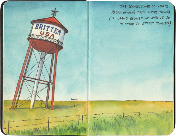
Route 66 sketch by Chandler O'Leary

Somewhere to lean on

This post is part of an ongoing series called 66 Fridays, which explores the wonders of old Route 66. Click on the preceding “66 Fridays” link to view all posts in the series, or visit the initial overview post here.

I crossed Texas twice last year: once at its widest point (where we logged over 900 Texas miles), and once across the Panhandle, which is where Route 66 cuts a literal straight and narrow path. One of the main Mother Road attractions to visit there is the “Leaning Tower of Texas,” a ho-made gravitational wonder in the middle of the neverending plain.

At least, it used to be in the middle of nowhere. Now it’s surrounded on three sides by other nearby giants: a bunch of those enormous modern windmills, and an awful 19-story cross that isn’t so much delightfully hokey as disgustingly hideous.

So I flashed my laminated Artistic License, faced east as to miss most of the horizon clutter, and edited out the rest. I regret nothing.

Llano Estacado sketch by Chandler O'Leary

After all, I was trying to capture the feeling of what it’s like to cross the Llano Estacado. Even today, when travelers have better navigational aids than makeshift stakes, it’s not hard to imagine how those first visitors must have felt.

Route 66 sketch by Chandler O'Leary

Or maybe modern technology has a different meaning here. Maybe the fenceposts and telephone poles and windmills that dot the landscape now are this era’s stakes, marching in steady progress across an otherwise unknowable vastness.