Tag Archives: mountains

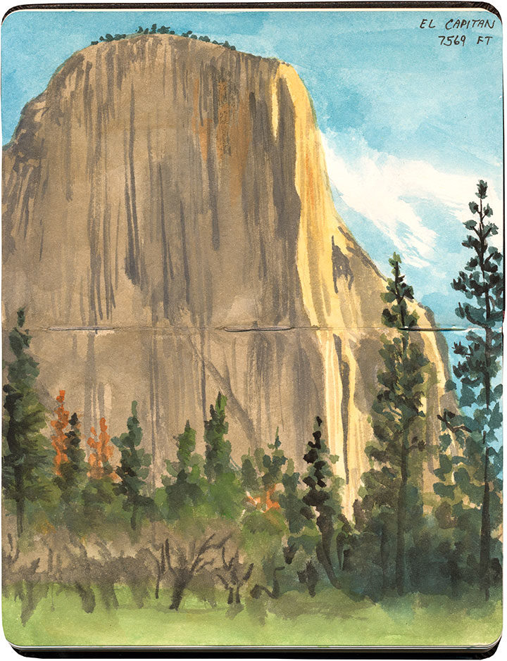
El Capitan at Yosemite National Park sketch by Chandler O'Leary

Summer of Solitude

Even though parks and other road-trip destinations are beginning to open back up, my family and I are choosing to extend our self-quarantine for as long as we can, to help minimize the risk of spreading the virus. But that doesn’t mean I can’t host a virtual summer road trip instead! Since so many of my past road trips have been solitary, this summer I’m going to post a series of some of my favorite solo road trip moments—times when it felt like I was the only traveler for hundreds of miles—and tag the posts with #SummerofSolitude.

Since Memorial Day weekend is the traditional start of the summer road trip season, I’m going to start with an unlikely place to find a bit of solitude: Yosemite National Park. I visited in the shoulder season, when the high country roads were still packed in with snow, but even in the winter, it’s hard to find a quiet moment in Yosemite Valley. Still, I hit the jackpot that day. I spent the previous night in nearby Mariposa, and headed for the park at first light. So when I reached El Capitan and laid eyes on it for the first time, I had a big head start on the other tourists. I had plenty of time to sit and draw and listen to the birds waking up. It felt like such a luxury to get a whole sketch done before I saw another human. By midday the park was pretty crowded, but I’ll never forget the feeling of having Yosemite all to myself.

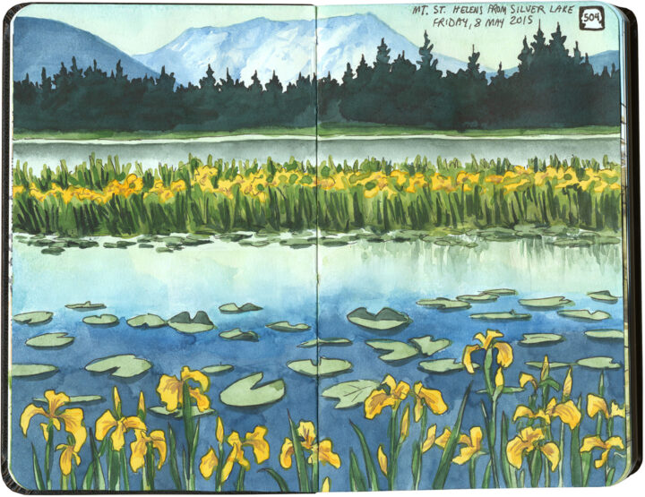
Mount Saint Helens sketch by Chandler O'Leary

Quarantesima from quarantine

Sorry about the non-English post title—I realize it may need a bit of explaining. Italian is my other language, and since we’ve all heard the word “quarantine” a zillion times lately, this title just popped into my head. “Quarantine” comes from the Italian word quarantena, which means a period of forty days. It comes from the fourteenth century, when the city of Venice weathered the Black Death by making merchants wait outside the city for forty days before they could enter, to make sure they weren’t infected with the plague. Well, since our modern collective quarantine efforts are preventing me from visiting Mt. St. Helens for its quarantesima (fortieth) anniversary today, this seemed fitting—if a bit too on-the-nose.

So instead I’ll post a sketch I did around the thirty-fifth anniversary of the eruption (the same day I did the final sketch in this post). I remember marveling at the time that a scene so peaceful could belie such destruction in the recent past (and, certainly, the future to come)—and that seems just a little too on-the-nose right now, too. So instead I’ll just focus my thoughts on the pretty mountain, the pretty lake, the pretty wild irises, and the memory of a pretty perfect morning.

Landslide sketch by Chandler O'Leary

The long detour

I spent nearly all of April breaking in my new car with a 6500-mile road trip up and down the West Coast. I’ve done many similar trips in the past, but this one had a completely different feel to it. And that’s because the severe drought—which for more than seven years had parched California and gifted me with suspiciously perfect weather and unusually good road conditions—was over.

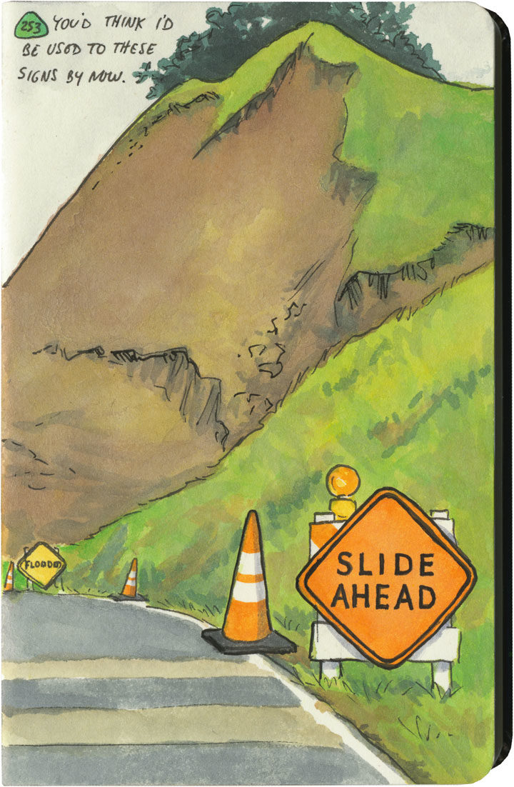
This year, California had just come out of one of its wettest winters on record. All that rain after such a long drought had brutal effects on hillsides and roadbeds all over the state. I quickly became accustomed to seeing signs like this one everywhere I went—to the point where I lost count of the number of detours, patched pavement, and in-progress landslides along my route. Over and over again I either had to make adjustments to my plans (I had to cut the Big Sur Coast out entirely, since Highway One has been closed there since February), or else take extra time to pick my way over some truly scary patches of pavement.

Landslide sketch by Chandler O'Leary

The state of affairs was so unpredictable that I got in the habit of checking road conditions on my phone a day or two ahead of each day’s planned route. On one cursory inspection, I stopped dead, my eyes widening at what I saw: Highway 101, my route through the redwoods, which happens to be the only route through the redwoods, was closed. Completely closed. No detour, the warning said.

No detour.

By this time I was familiar with the Norcal Coast—I knew that it’s pretty darn audacious of Highway 101 even to be there, what with the mountains that squeeze right up to the rugged, rain-soaked coastline. I remember driving through there in the past, marveling at the engineering required to put a road there in the first place, and being thankful that nothing had blocked my way and left me up the proverbial creek—yet I never actually looked at a map to see what kind of workaround a closure would require. Well I was about to find out.

Luckily, this little monkey wrench couldn’t have happened on a better day. This happened to be the shortest day of the trip, with just over 100 miles between hotels. And I only had one real plan for the day: to explore the Lost Coast, that rugged swath of coastline traversed only by primitive roads, where tourists feared to tread.

Nevermind—a massive rockslide just north of Leggett put paid to that plan. I still needed to get to Ferndale, though, if I wanted to honor my reservation that night and make it to the next leg of the trip. And since there was “no detour,” I scoured my maps to see just what that would mean.

Landslide detour map sketch by Chandler O'Leary

Uh, yeah. This is what it means. It means crossing back east over the mountains on State Route 20, then a trek up through nearly the entire length of the Sacramento Valley (that little Highway 99 jog was just a break to save my sanity), then back over the mountains to 101 again on State Route 36. There are no east-west highways between 20 and 36, either. This was my route, the new plan. I added up the mileage of what I’d have to do the next day: nearly 400 miles.

I set an early alarm, asked the universe to refrain from any more surprises, and went to bed.

Landslide detour sketch by Chandler O'Leary

The next day was was both beautiful and harrowing. I got to see a broad swath of the state I’d never experienced before. And I also got hit with some home truths about this modern life we all take for granted—how easy it would be for nature to knock it all right out. As I wound my way over mountain pass after mountain pass, the roads got scarier and scarier. There were places where it was obvious the hillsides were trying their best to slough off their ribbon of road—and I just hoped the mountains wouldn’t win the fight on that particular day. The very worst came near the very end, a ten-mile stretch of obviously temporary, hastily repaired state highway. The pavement was so precarious, so narrow, that they didn’t bother with a yellow stripe. And at least half of the curves were completely blind, making it necessary to do that horn-honking oh-god-oh-god-here-I-come ritual before each one.

Landslide detour sketch by Chandler O'Leary

Now, don’t get me wrong—I love mountain driving. I love curvy roads. And I love unexpected adventures. And my desire for it all is darn near insatiable. But by about the ninth hour of tortuous highway and the almost total lack of towns, services or cell signal, I’d all but lost interest in the adventure of it all. I just wanted to get there in one piece.

Lost Coast road sketch by Chandler O'Leary

When I finally did, I ended up a stone’s throw from the other end of that Lost Coast road that had been the original plan. I’d been to this spot before, and had always found that Capetown-Petrolia sign enticing and mysterious—what lay down that road, beyond that dark wall of trees?

This time, though, at the sight of all the warning signs they’d erected here (Chains required! No motorhomes! No services!), I just started laughing. Because after the day I’d just had, I could not have cared less. My curiosity had gone on strike—and in its place was a powerful desire to crawl right into bed.


Save

Save

Save

Save

Save

Save

Save

Save

Save
Albuquerque hot air balloons sketch by Chandler O'Leary

Hope floats

I spent the whole weekend digging through dozens of old sketchbooks, searching for something I could post as some sort of post-election metaphor. Something that stood for a new day, for rising above the hateful muck we’re all slogging through…something. Anything.

Welp. Yeah.

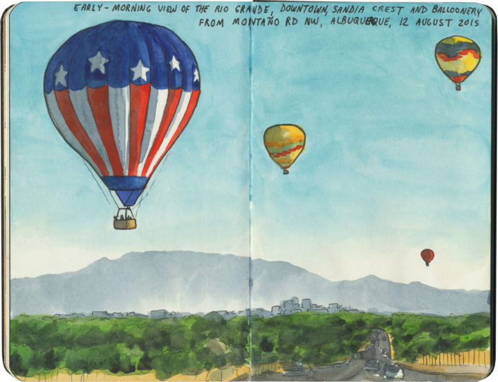
It’s corny, I know. On that morning last year I thought seriously about taking artistic license with the flag balloon, since overtly patriotic objects aren’t really my style. But for whatever reason, I reported it accurately, keeping it as-is. And now I’m clinging to it as an image, corny or not. I have a feeling that drawing is going to provide a lot of ballast for my little metaphorical balloon in the months and years ahead. Time to relight the fire, and—fair winds or foul—do everything I can to stay afloat.

Saguaro National Park sketch by Chandler O'Leary

Alien forest

I visited Saguaro National Park for the first time last year, and between being a veteran national parks tourist and seeing a zillion photos of the place over the years, I thought I knew what to expect. Aaaand of course, I was way wrong. (No surprise there.)

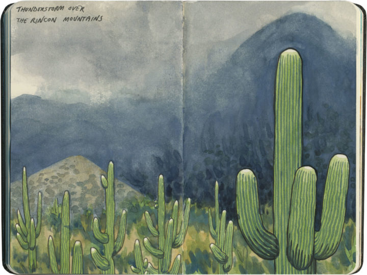
For one thing, Mary-Alice and I arrived in the middle of a storm. No stereotypical desert scenes for me that day; instead, I got to add something far more dramatic to the ol’ sketchbook.

For another, I knew the park was quite close to the city of Tucson, but I didn’t know it was comprised of two distinct districts (Rincon Mountain and Tucson Mountain), each flanking the city from opposite sides. There wasn’t enough time to do both units in one afternoon, so we rearranged our schedule for the next day in order to fit in a tour of the western district.

Saguaro National Park sketch by Chandler O'Leary

Finally, I was shocked to discover that the place reminded me strongly of my home turf of the Pacific Northwest—at least, a bizarre, parallel-universe version thereof. It wasn’t just that the saguaros are incredibly tall. It was that there were so many of them, thick on the ground like the familiar conifer forests of Washington. Add to that the indigo hillsides I’d seen the night before, and the nebulous mists of that morning, and it was like standing in a dream-land version of home.

Save

Save

Save

Save

Save

Save

Sunset Crater National Monument sketch by Chandler O'Leary

Sister sites

On our way up to the Grand Canyon for our second day at the park, the Tailor and I decided to swing through a trio of national monuments located a short detour away, just outside of Flagstaff, AZ. Since what is arguably the most famous national park lies just down the road, these sites tend to get overshadowed a bit. Yet all are worth a stop, and all are closely linked to one another.

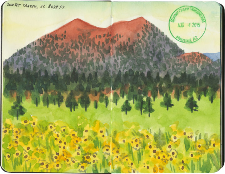
First up is Sunset Crater National Monument, a volcanic cinder cone and a landscape painter’s dream. The name, coined by John Wesley Powell, comes from the subtle gradation of reds and purples within the volcanic rock. Combined with the surrounding meadows that bloomed with wildflowers while we were there, the effect was stunning.

Walnut Canyon National Monument sketch by Chandler O'Leary

On the other side of Flagstaff lies Walnut Canyon National Monument. At first glance, this place appears to have little in common with Sunset Crater, but in fact the two are intrinsically connected. The people of the Sinagua culture had been living above the canyon rim since about the year 600, but after Sunset Crater erupted in about the year 1100, the population near the canyon grew rapidly as people fled the volcano. After that, the Sinagua began to settle inside the canyon itself, constructing cleverly-hidden cliff dwellings up and down the canyon’s walls (there are three sketched out in the drawing above—can you spot them?).

Wupatki National Monument sketch by Chandler O'Leary

I’ve saved the best for last: Wupatki National Monument. This site is located just a few miles north of Sunset Crater, and preserves entire pueblos built by the Sinagua. This sandstone city was built following the eruption of the cinder cone, after the deposit of volcanic ash made the area’s soil much more fertile. The Wupatki pueblo, pictured here, is the largest settlement within the national monument—this one apartment-building-like structure had 100 rooms and housed up to a hundred people (the entire settled region had several thousand Sinagua inhabitants).

Wupatki National Monument sketch by Chandler O'Leary

I’ve visited a lot of the ancient pueblo ruins of the Southwest, and I’m always drawn to the sophisticated architecture of each one. But so far I haven’t seen anything that provides as clear a picture of what life must have been like then as this place does. Walking through Wupatki really feels like one is trespassing through someone’s house—someone who might just return at any moment.

Save

Mt. Rainier National Park sketch by Chandler O'Leary

Our best idea

Mt. Rainier National Park, WA

Tomorrow is the 100th birthday of the National Park Service. All of America seems to be celebrating right now, and rightly so. In my opinion, our wildest pockets are our true national treasures, and our national parks, as Wallace Stegner said, our best idea.

Olympic National Park sketch by Chandler O'Leary

Olympic National Park, WA

So since I’ve spent a good chunk of my sketching life in national parks both close to home…

Arches National Park sketch by Chandler O'Leary

Arches National Park, UT

…and far afield…

Crater Lake National Park sketch by Chandler O'Leary

Crater Lake National Park, OR

I figured I’d add my voice to the celebratory din, in the form of a little sketchbook retrospective.

Badlands National Park sketch by Chandler O'Leary

Badlands National Park, SD

Beyond the centennial itself, I’m always up for toasting the parks. Not only do I think park rangers are the best people on earth,

Redwood National Park sketch by Chandler O'Leary

Redwood National Park, CA

but I also sometimes think they’re the only thing standing between wildness and destruction.

Carlsbad Caverns National Park sketch by Chandler O'Leary

Carlsbad Caverns National Park, NM

And anyway, I’m not exaggerating when I say I’m a total park nut myself. It’s my goal to visit every NPS property before I die, including national parks, historic sites, national monuments, everything. (Actually, I’ve crossed a goodly chunk of them off the list already—

Guadalupe Mountains National Park sketch by Chandler O'Leary

Guadalupe Mountains National Park, TX

—and I even have the stamps to prove it.)

Olympic National Park sketch by Chandler O'Leary

Olympic National Park, WA

I know I have a long path ahead of me before I reach that goal,

Grand Canyon National Park sketch by Chandler O'Leary

Grand Canyon National Park, AZ

and getting there won’t be easy.

Big Bend National Park sketch by Chandler O'Leary

Big Bend National Park, TX

Yet I can’t tell you how grateful I am that the opportunity exists in the first place—

Rocky Mountain National Park sketch by Chandler O'Leary

Rocky Mountain National Park, CO

that so many people have fought to preserve these wild places, and won.

Saguaro National Park sketch by Chandler O'Leary

Saguaro National Park, AZ

Best of all is the feeling that no matter how long it might take me to get to each park with my sketchbook,

Glacier National Park sketch by Chandler O'Leary

Glacier National Park, MT

I know it’ll be there waiting for me, as close to unchanged as humanly possible. Thanks to the National Park Service, the window of opportunity remains open.

Save

Save

Save

Save

Save

Save

Save

Save
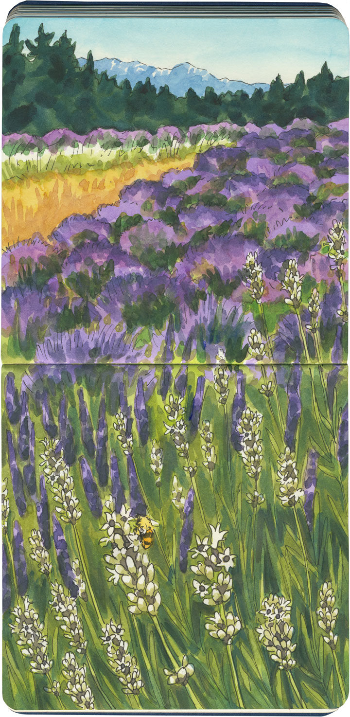
Pelindaba Lavender Farm sketch by Chandler O'Leary

Purple haze

Here in the Northwest, we’re in the thick of my favorite season right now. I don’t mean summer, per se, but lavender season. Our climate is pretty much perfectly suited to growing lavender, so other than maybe the south of France, there’s no better place to stand on a purple hillside, awash in scent.

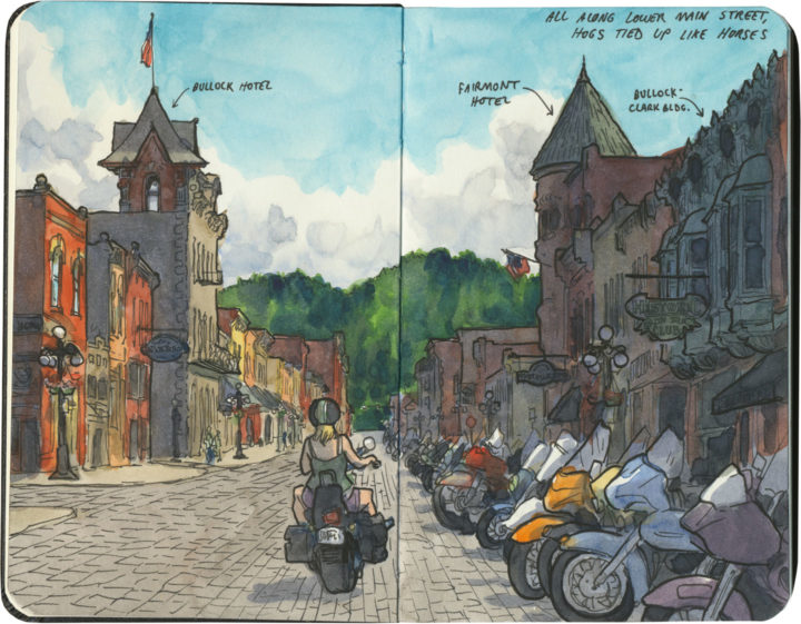
Deadwood sketch by Chandler O'Leary

Hitching posts for Harleys

I’ve mentioned before that I always seem to end up in the Black Hills right in the middle of the Sturgis Rally. Well, last summer I didn’t just sneak by on the highway—I jumped right into the fray. My destination wasn’t Sturgis proper, but rather nearby Deadwood, that infamously lawless frontier town of yore. I hadn’t been since I was a tiny child, so I figured it was high time I stopped by again.

And when I got there, I had a good long chuckle. Because somehow seeing all those motorcycles lined up like horses at their hitching posts, and all the weather-beaten wild-west road warriors who belonged to them… Well, somehow the scene fit the setting better than any costumed reenactor could have done.

San Francisco Bay area sketch by Chandler O'Leary

The long view

On the morning I did this sketch, I was supposed to be sitting in a darkened lecture hall, listening to a bunch of scholars talk about art. But I just couldn’t do it. On a day like that, it seemed criminal to pass up such a beautiful place. So I jumped in the car and drove in the opposite direction—in the same time it would have taken me to get to the auditorium, I had reached the top of the world.

Posting this sketch has me remembering that I do this a lot. I have a long history of throwing the itinerary out the window and going off on my own to explore instead. And I gotta say: every single time, without fail, it’s been precisely the right choice to make.