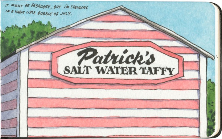
On the day I was here, the calendar said it was winter. But between the warm sun, the blue sky, the sea air and the festive stripes, I could have sworn it was the perfect summer day.
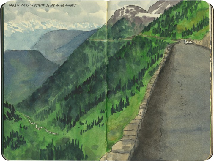
When I’m planning a road trip, I try to avoid interstate highways whenever possible. When in doubt, state and U.S. highways are almost always a better choice—both for scenic drives and for interesting road vistas. But even better than that are the roads through most national parks—which are specifically designed to give visitors the most beautiful drive imaginable. And by that logic, Glacier National Park’s Going-to-the-Sun Road might just be the most spectacular ribbon of road in the whole country.
Going-to-the-Sun Road is both a feat of engineering and a marvel of determined highway maintenance. It’s only open for a few months every year, and takes weeks to clear of snow before it opens in the summer. It’s also not for the faint of heart—I love mountain driving, but I don’t love heights, and even at our crawling pace, all those hairpin curves made my stomach plummet to the floor every few minutes.
But oh—oh. I’d gather my courage and brave any precarious goat track for this. I’d cross a continent for a view like that.
And since our day at Glacier fell at the very end of a five-week cross-country trip–that’s precisely what we did.
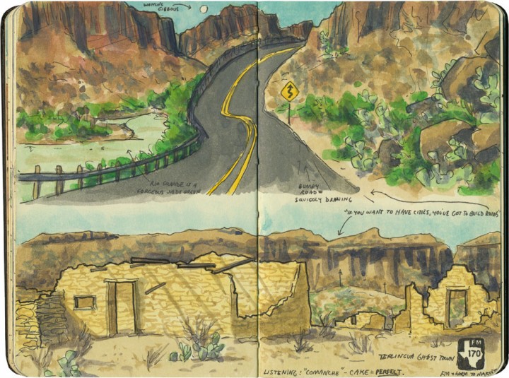
Since I’ve got a road theme going this week, I thought I’d spend the next couple of posts highlighting some of my very favorite squiggly lines on the map. Everyone seems to have California Highway One at the top of their road trip bucket list (for good reason!), but FM170 in West Texas deserves to be on that list, as well.
The River Road isn’t nearly as well-known as the Pacific Highway because it’s in the absolute back of beyond. Whoever coined the term “middle of nowhere” probably had this place in mind—but as it’s right near a national park, it probably also escapes the notice of tourists wanting to take the faster state highway to and from the park.
And that’s a shame, because this road is a gem. It winds right alongside the Rio Grande, through the Santa Elena and Colorado canyons, passing ghost towns and old Spanish missions along the way. In the 70-mile section we traveled that day, we only saw one other soul—and that was a local immigration cop parked along the roadside. We didn’t pass a single tourist along the way.
I would have loved to drive this road (I have a thing for taking mountain curves with a stick shift!), but I wanted to spend the time drawing. So the Tailor, bless him, tackled the hair-raising turns, and didn’t bat an eye when I made him pull over about a hundred times for spectacular vistas.
I can’t recommend this road enough. If you go, though, make sure you have plenty of drinking water, engine coolant, gasoline, and a fresh spare tire, just in case. If you break down, you’re going to need the tools and skills to get yourself back out again—this is the type of route that laughs at puny human concepts like mobile phone coverage (pro tip: there isn’t any) or roadside assistance. This is the kind of place that analog map freaks like me are talking about when we say GPS ain’t all it’s cracked up to be.
But if you’ve got a paper map and a good sense of adventure, hit the road: because this is the place.
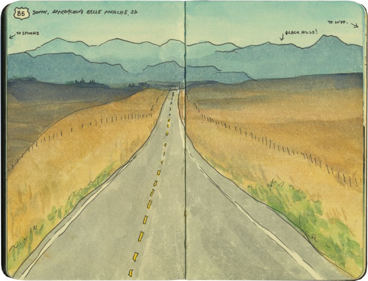
Tomorrow this little travel blog turns one year old. In that time, I’ve jumped around in time and place, in hopes of showing you as many different sketches as I could: country scenes, cityscapes, vintage kitsch, wildlife, you name it. But while I love me some roadside attractions, I must confess that my very favorite thing to draw might just be the road itself.
My sketchbooks are absolutely full of road sketches—either full scenes that I take time over, or little margin notes that I jot down quickly from the passenger seat as the car moves ahead. I just can’t get enough of them. I’m fascinated by how the road moves with the land, following hills and curves. As I race to put each vista down in the book, the actual road at my feet seems to transform into a painted line—tracing the landscape like a sketchbook drawing on the grandest scale imaginable.
In the past year, I know I’ve shown you quite a few of these road drawings, but I’ve barely scratched the surface of what I have in my sketchbooks. And that’s because even after nearly a lifetime of taking road trips, and many years of drawing them, I still feel like I’m only just getting started.
So here’s to the next year of this blog, and to the road ahead. Thank you for coming along with me for the ride.
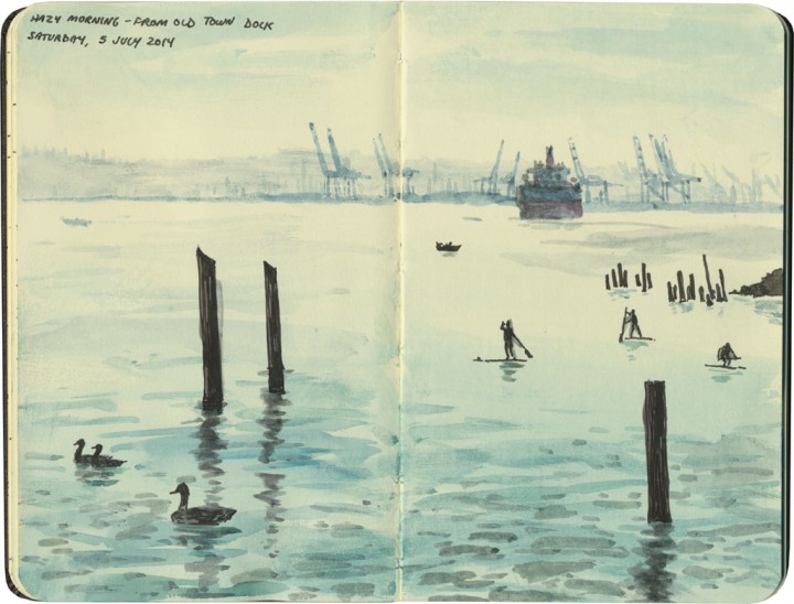
Right around the Fourth of July, it’s like someone flips a switch around here, and the dry season begins. Then the stereotypical Northwest rain goes away, and nearly every day is clear, dry and balmy. You can bet that this is when I do the most sketching around my town—and you can probably guess what I’ll be doing this weekend!

There was one other time that my sketching had the benefit of a supermoon. Last summer I spent a morning with some fellow sketchers under the ferry landing in Edmonds, WA. This is one of a few spots along Puget Sound where the tide goes out far enough to expose more than just a strip of beach. You can actually walk under the ferry dock at low tide—but you have to be quick, because it’s a very short time before the pilings are submerged again.
Well, the supermoon took care of that for us, pulling the tide out so far that the clay beds were exposed for several hours.
It also attracted hordes of beachcombers, who added an extra fun element to my drawings. But the real reason we were there was the same for all of us: discovering that the rocks and pilings were just teeming with marine life.
So thanks to the supermoon, I had plenty of time to sketch as much as I pleased—as well as the chance to discover that if you stand there long enough, sooner or later a burrowing clam will squirt your feet with arcs of seawater.
(Note to self: bring galoshes next time.)
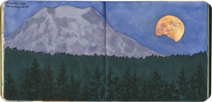
I had other plans for today’s post, but I had a surprise on Saturday evening that changed all of that. I spent the day on the Oregon coast, and arrived on the home stretch just as the last light was fading. As I neared the Nisqually Delta, I looked east out of habit, where I knew I’d see Mt. Rainier above the ridge. The moon was just on its way up, but this time it was no ordinary moonrise. The full moon that night was a supermoon—where the full moon coincides with the point on its orbit where it is closest to Earth.
The result was jaw-dropping—I had just enough time and presence of mind to take the next exit, head to the nearest uphill spot, pull over, and jot down a quick sketch with my pencil. When I got home (and had access to a proper lamp!), I filled in the color.
It’ll never match what I saw that night. But at the very least, it’ll always remind me of the moment—and how lucky I was to be able to witness it.
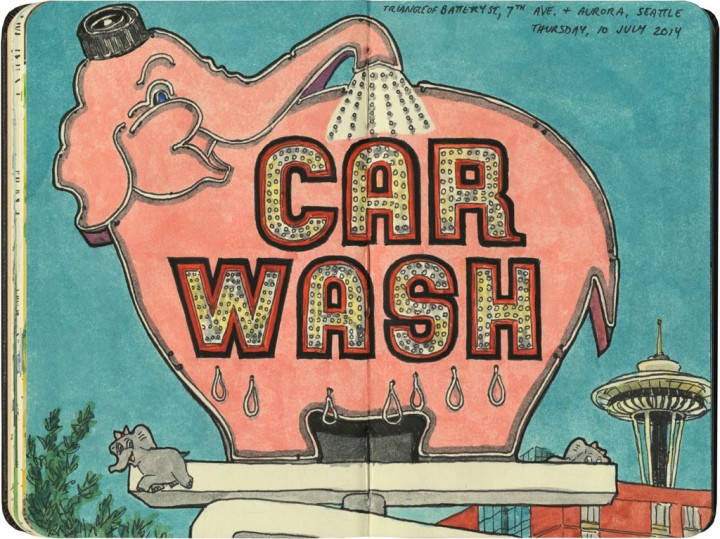
If the Yoken’s whale is the queen of the east coast’s Route 1, then the Elephant Carwash sign surely must rule Highway 99 in the west. The restaurant inside the Space Needle can eat its heart out—this jumbo gal is my favorite spinning landmark in the Emerald City.
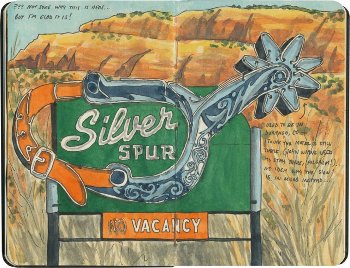
I really have no idea why this sign isn’t where it’s supposed to be (in Durango, CO), and why we stumbled upon it at Hole n’ the Rock instead. But since Durango wasn’t on the list for that trip, and I never would have made this sketch otherwise, you won’t find me complaining!