Author Archives: Chandler O'Leary

Cabbage field sketch by Chandler O'Leary

Cabbage patch kid

Farmland in the Puyallup Valley is becoming a precious commodity, as suburban and industrial development threaten the small vegetable farms that still cling to the valley floor. Yet for now, at least, I can still count on finding a view like this just a few minutes’ drive from my house. May it ever be so.

Yukon's Best Flour sketch by Chandler O'Leary

Flour flurry

This post is part of an ongoing series called 66 Fridays, which explores the wonders of old Route 66. Click on the preceding “66 Fridays” link to view all posts in the series, or visit the initial overview post here.

It’s not entirely clear to me why the founders of Yukon, OK named their town after the Yukon Gold Rush, nor why its county is called Canadian County. But on the day of our visit to the Yukon of Route 66, the only blizzard we might possibly have witnessed was one of enriched white flour.

World's largest pecan sketch by Chandler O'Leary

World’s largest pie filling

Just in case you were worried about making enough pecan pie for the holiday this year, I think I know where there’s a good supply. To all my readers in the United States, wishing you a happy Thanksgiving! Now if you’ll excuse me, there’s a slice of pie with my name on it…

Palouse (autumn) sketch by Chandler O'Leary

Green to gold

Earlier this year I received a grant to travel to the Palouse region of southeastern Washington and sketch the changing seasons there. I’m sure I’ll be posting more about this in future, as there’s a lot to say and one post can’t possibly hold it all. But just as my sketching trips were my introduction to the region, this post will act as a gateway, with more to come later.

Palouse wheat field (spring) sketch by Chandler O'Leary

What first attracted me to the Palouse was learning about its vast, treeless, otherworldly hills—not your average rolling hills of wheat, but enormous 300-foot-tall landmasses, each carpeted in endless grain, with thin ribbons of road snaking between and around them. You already know that I have a thing for treeless landscapes, and lots of experience sketching them—but despite weeks of research and poring over very detailed maps in my gazzetteer, I just wasn’t prepared for what I’d see in person.

Palouse wheat field (autumn) sketch by Chandler O'Leary

And I figured out pretty quickly that no matter what drawings I managed to make, I was pretty much destined to fail from the outset. It’s just not possible to do this place justice, to get it down on paper with any measure of accuracy or truth. The scale alone is utterly mind-boggling—and then there’s the fact that around every curve is another perfect composition, just taunting me and my puny, weak, human artistic limitations.

Palouse barn (spring) sketch by Chandler O'Leary

Still, it was thrilling to take a stab at it—over and over again, with the luxury of plenty of time to keep trying. In the end I spent two weeks there (one week in May, when the crops were young and green, and another at harvest time in late August) and logged a total of over 4000 miles of road.

Palouse barn (autumn) sketch by Chandler O'Leary

And best of all, I can’t wait to go back—heck, I can’t wait to polish off this big pile of unfinished sketches I have waiting for me in my studio. The Palouse is a place that gets under your skin and lodges there forever. The only cure is to keep revisiting it again and again, both in the flesh and in memory. So don’t be surprised if you see a lot more wheat sketches in future: I’m just getting started.

Save

Santa Fe chili ristras sketch by Chandler O'Leary

Courtyard pantry

I live in the Pacific Northwest, where the weeks after daylight saving time ends can be pretty grim. To combat the dark gray days, I surround myself with color. On my studio table is a big bouquet of fall flowers in a bright yellow pitcher. In the root cellar are piles of rainbow root vegetables and parti-colored squash. And just like I’ve done before, I’m flipping through memories of red chili ristras and cheerful desert courtyards in my sketchbook, looking forward to the sun’s return.

Albuquerque hot air balloons sketch by Chandler O'Leary

Hope floats

I spent the whole weekend digging through dozens of old sketchbooks, searching for something I could post as some sort of post-election metaphor. Something that stood for a new day, for rising above the hateful muck we’re all slogging through…something. Anything.

Welp. Yeah.

It’s corny, I know. On that morning last year I thought seriously about taking artistic license with the flag balloon, since overtly patriotic objects aren’t really my style. But for whatever reason, I reported it accurately, keeping it as-is. And now I’m clinging to it as an image, corny or not. I have a feeling that drawing is going to provide a lot of ballast for my little metaphorical balloon in the months and years ahead. Time to relight the fire, and—fair winds or foul—do everything I can to stay afloat.

50 States pictorial map illustrated and hand-lettered by Chandler O'Leary

Rereading the map

I finished this map before the airwaves were inundated with red and blue election maps—and today it’s a good reminder that America is more than its electoral divisions. That there is good in every state, and that there is so much to love and celebrate in every nook and cranny of our nation. This is why I started the 50 States project three years ago, and I’m taking the fact that I happened to finish the series right before the most divisive election in living memory as a sign that I need to remember this fact going forward. After all, the real work of our country involves all of us.
 
Those of you who read this blog know that I express my love for every state—blue, red, purple, whatever—through my drawings. I will continue to do so, to feature the beauty and wonder and hilarity and kooky humor of every state. That is what will get me through the fear and sadness and anger I’m feeling now—and I hope it will help you in some small measure, as well. So the break I took from blogging to focus on my book is over; posting here starts back up again tomorrow.
 
In the meantime, you can celebrate all 50 States with me tonight at the Ted Sanford Gallery at Charles Wright Academy in University Place, WA, where the entire series is on display through November 29. From 5:30 to 6:30 tonight I’ll have a gallery reception and small pop-up shop. Let’s talk about the good that’s out there—from Paul Bunyan to Elvis to the World’s Largest Frying Pan, and everything in between, from sea to shining sea.
Route 66 sketch by Chandler O'Leary

Halfway there

This post is part of an ongoing series called 66 Fridays, which explores the wonders of old Route 66. Click on the preceding “66 Fridays” link to view all posts in the series, or visit the initial overview post here.

When I started my 66 Fridays series back at the turn of the new year, I knew I was in for a long road ahead. But here we are, 33 Fridays later, already at the halfway point of the series! I figured it was only fitting to pair this post with a sketch of the symbolic halfway point of the Mother Road. Since Route 66 has seen so many changes to its path over the years, it’s unlikely this sign marks the exact midpoint—but it hardly matters. I’m glad there’s a marker at all, wherever they ended up putting it.

Some of you may just be tuning in to this series now, so I figured a recap of where we’ve been so far was in order. Like everything else on this blog, my subjects jump around in space and time. So below is a list of all the Route 66 posts I’ve done so far, loosely grouped by category.

Posts about Route 66 itself:
Intro: Mother Road, Mother Lode
Chicago’s Eastern Terminus
Sundown Towns
Burma Shave
Filling Stations of 66
Suicide Bridge
Where 66 Intersects Itself
The history under your wheels

Route 66 Attractions:
Meramec Caverns Billboards
The Round Barn
The Leaning Tower
Wild Burros
Paul Bunyans
Mufflermen of the Mother Road
The Harvey House Empire
The Armory Museum
Dino Drive-Bys
Petrified Forest
The Continental Divide
Cadillac Ranch

The Mother Road in Lights:
Albuquerque’s Googie Marathon
The Dog House from Breaking Bad
The Aztec Hotel
The Munger Moss and its Antecedents
Air-Cooled Comfort
Tucumcari Tonite

Route 66 Roadside Eats:
Lou Mitchell’s
Ted Drewes
Dairy King
Chicago Dogs
Rod’s Steakhouse
New Mexico Cafes

Other Route 66 posts I’ve done (outside the 66 Fridays series):
Tulsa Googie
The Golden Driller
Old Town Ristras
The Blue Whale of Catoosa

Thank you for traveling along the Mother Road with me for so much of this year. And we still have many miles to cover—see you next Friday with the latest installment!

Route 66 sketch by Chandler O'Leary

Criss-cross corner

This post is part of an ongoing series called 66 Fridays, which explores the wonders of old Route 66. Click on the preceding “66 Fridays” link to view all posts in the series, or visit the initial overview post here.

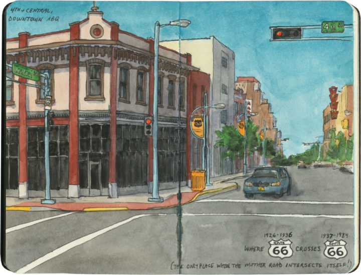
In downtown Albuquerque is an unassuming corner with a curious distinction. This is the place—the only place—where Route 66 intersects itself.

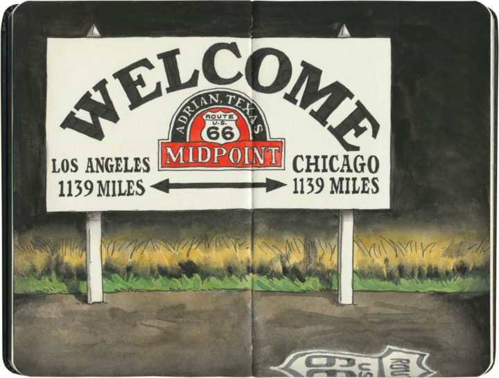
It’s not so unusual to have several Route 66-es in the same city—after all, Tulsa has at least three, and St. Louis changed the alignment of the route so many times I’ve lost track of the number. Yet nowhere else along the Mother Road do two different alignments actually cross each other. You see, when Route 66 was first established in New Mexico in 1926, the logical thing to do was to send the road through the capital city—so off to Santa Fe it went, and then it curved southward to come into Albuquerque from the north. At that time, there was no straight-line route across New Mexico, so travelers coming to Albuquerque from the east had no choice but to take that winding, partial-dirt, mountainous road through the capital first. But then, quite suddenly, all that changed: just a few years later, a new 66 cut an arrow-straight path into Albuquerque from the east and bypassed Santa Fe entirely. (And today many people have no idea that 66 ever went to Santa Fe at all.)

Like everything else along Route 66, there’s a story behind this. The short version is this: Arthur T. Hannett, who was governor of New Mexico when Route 66 was born, lost his reelection bid in 1926, and found himself with an axe to grind. Convinced he had been ousted by a conspiracy on the part of his political opponents at the state capitol, he hatched a scheme to reroute 66 away from Santa Fe in revenge.

The trouble was, he had only a little over a month before his successor would be sworn in. So he ordered nearly every piece of road-construction equipment in the northern half of the state to be diverted to his project, and made every construction worker he could get his hands on work nonstop to cut a new road bed from Santa Rosa to Albuquerque. The workers slept at the construction sites, toiled through snowstorms and skipped the holidays, and the new 69-mile road was completed in just 31 days. By the time the new governor, Richard Dillon, took office on January 1, 1927, it was too late. Despite opponents trying to block the project during those 31 days (including sabotage attempts where people put sand in the gas tanks of the construction equipment), nobody could deny the convenience of a straight, fully-paved road. The new route saved hours of driving, so before long, motorists were already using it heavily, leaving Santa Fe in the dust. It took another ten years before the road was paved all the way to the Texas border and the new section gained the official Route 66 designation, but by then it was already the main arterial across the state.

KiMo Theatre sketch by Chandler O'Leary

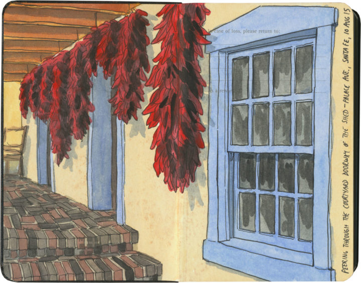
That story isn’t the only thing interesting about the corner of 4th and Central. That spot’s other claim to fame is what might just be Albuquerque’s best and most iconic building: the KiMo theatre.

KiMo Theatre sketch by Chandler O'Leary

Built in 1927 in a spectacular blend of Art Deco and Pueblo Revival styles (who knew those two went together so well?!), the theater’s name translates to “mountain lion” in Tewa, the language spoken by many of the region’s Pueblo people. The KiMo narrowly escaped the wrecking ball in the late 1970s, when residents voted for the city to buy the building. After an extensive restoration completed in 2000, the KiMo is once again hosting public performances.KiMo Theatre sketch by Chandler O'Leary

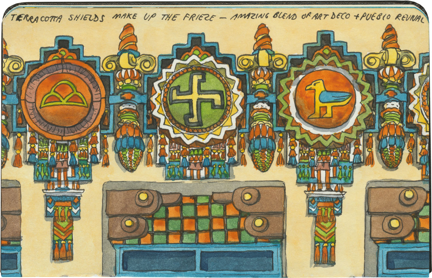
Yes, that symbol above is what it looks like; and no, it doesn’t mean what you might think. The swastika is an ancient symbol that once had positive connotations in many cultures before Hitler twisted it to his own ends. To the Navajo it stood for the Whirling Log, a healing symbol, and to the Hopi (whose traditions the above design emulates) it represents spiritual wandering.

Oh, and hey: apparently the building is haunted. The theater staff leave appeasement offerings in a back stairwell and everything. The place was closed on the day we were there, so I couldn’t get a look at the inside, but you can bet I’ll be back. Neither angry ghosts or vengeful ex-governors can stop me.

Save

Theodore Roosevelt National Park sketch by Chandler O'Leary

Butte-iful

Like Saguaro, Theodore Roosevelt National Park is divided into two separate units. Unlike Saguaro, the North Dakota badlands are an old, familiar haunt of mine. Greener and less weathered than their craggy South Dakota siblings, these buttes have a similar mystery to them, all the same. It’s not hard to see why they were dear to Teddy Roosevelt’s heart—just as they’re dear to mine.