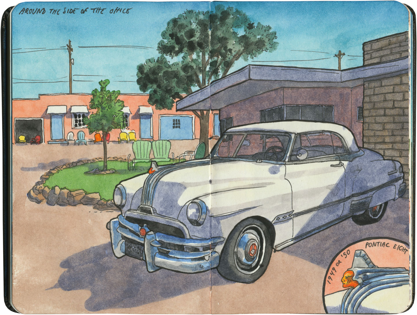
Tag Archives: Route 66

Route 66 sketch by Chandler O'Leary

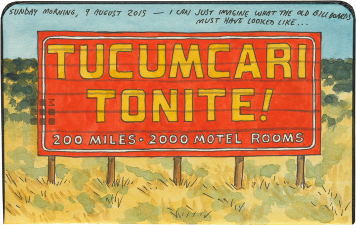
Tucumcari tonite

This post is part of an ongoing series called 66 Fridays, which explores the wonders of old Route 66. Click on the preceding “66 Fridays” link to view all posts in the series, or visit the initial overview post here.

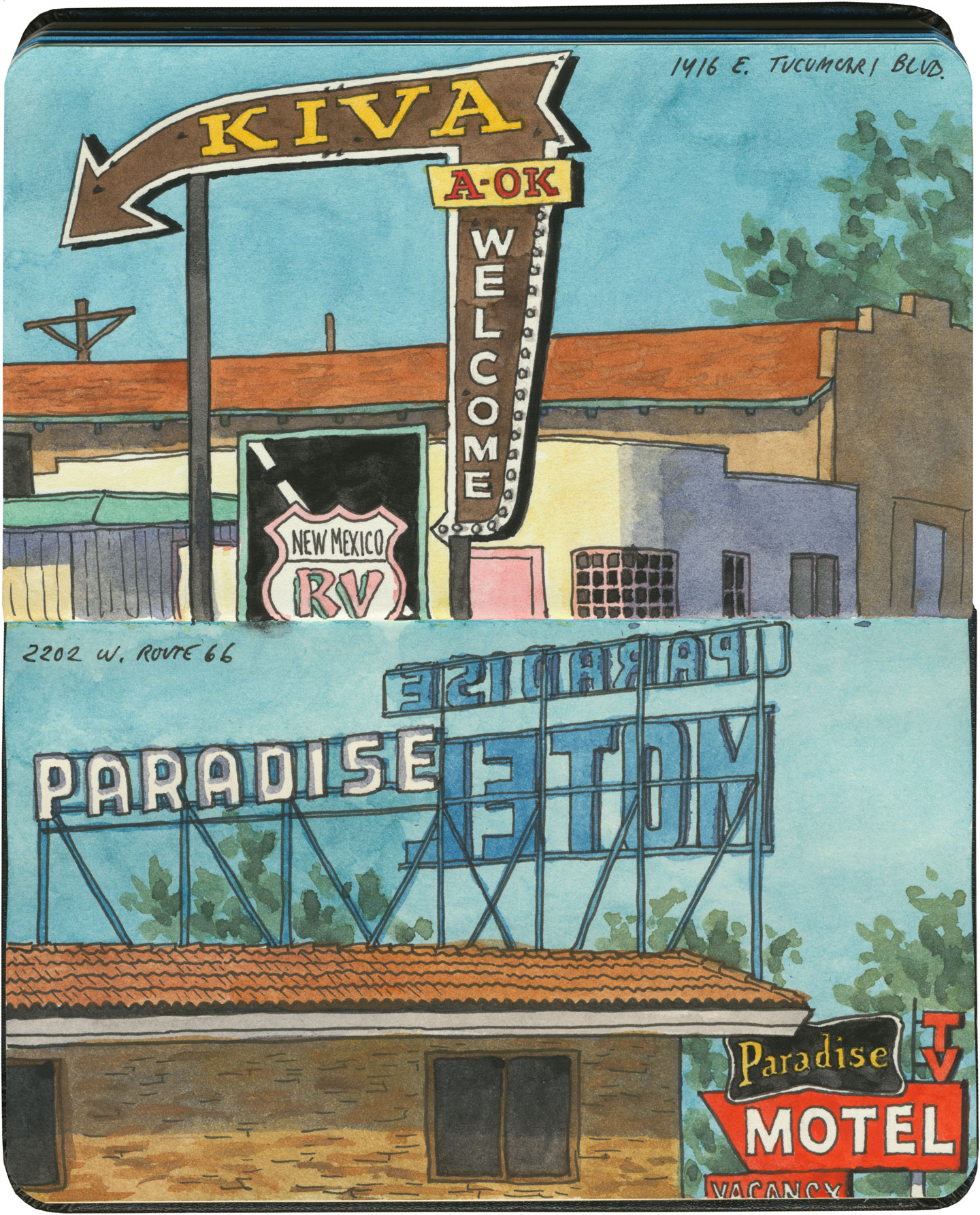
Most of the must-see treasures of Route 66 are individual landmarks or legends: Meramec Caverns, the Oatman burros, the Gemini Giant. But one of the most important stops along the way is an entire town. Welcome to Tucumcari: Googie oasis of yore, midcentury Cibola of 2000 motel rooms.

Route 66 sketch by Chandler O'Leary

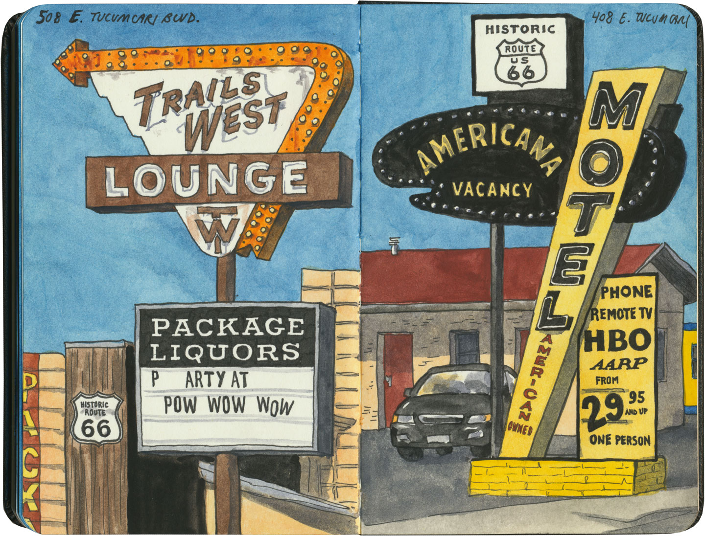
Today’s Tucumcari is somewhere halfway between worlds, simultaneously a time machine and a crumbling architectural ruin. To me it felt the way it would to visit Pompeii, only to find the city still inhabited. This is the place where, much like the stretch of 66 through Albuquerque, you can find rusted neon masterpieces everywhere you look—

Route 66 sketch by Chandler O'Leary

—except here, the neon is equally likely to mark a still-operating motel as a defunct one.

Route 66 sketch by Chandler O'Leary

Yet while the town’s pulse still keeps a beat, that mythical number of motel rooms has diminished somewhat.

Route 66 sketch by Chandler O'Leary

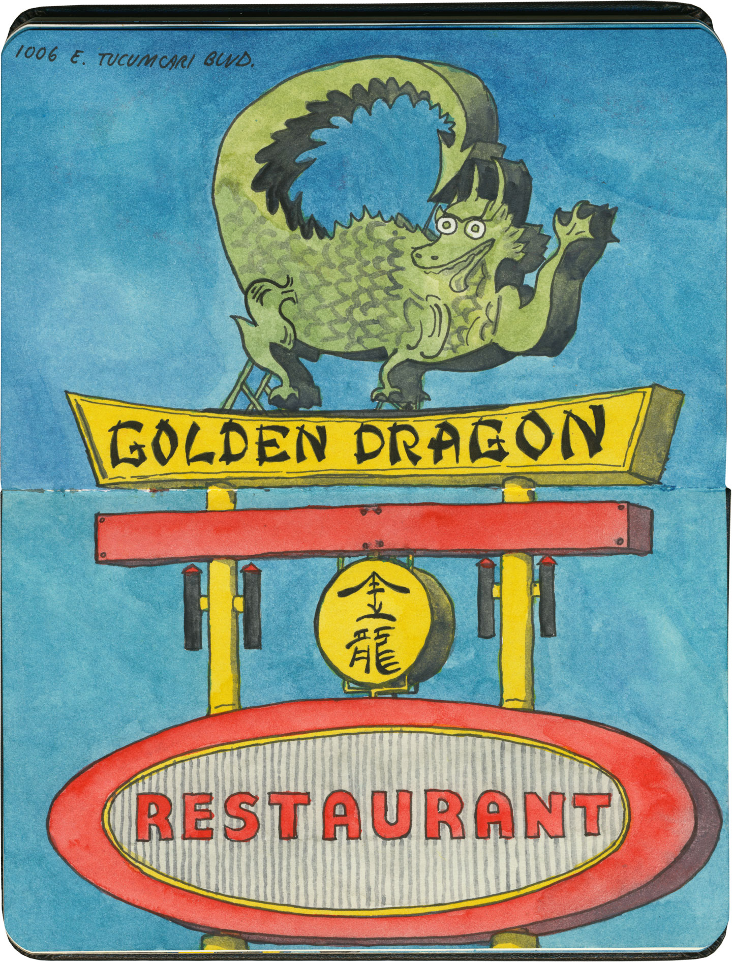
I’m sure the motels aren’t the only ones—for every business still standing, I had to wonder how many had disappeared.

Route 66 sketch by Chandler O'Leary

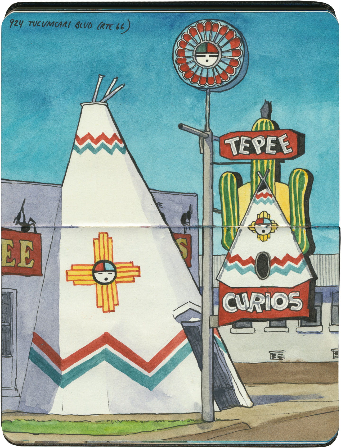
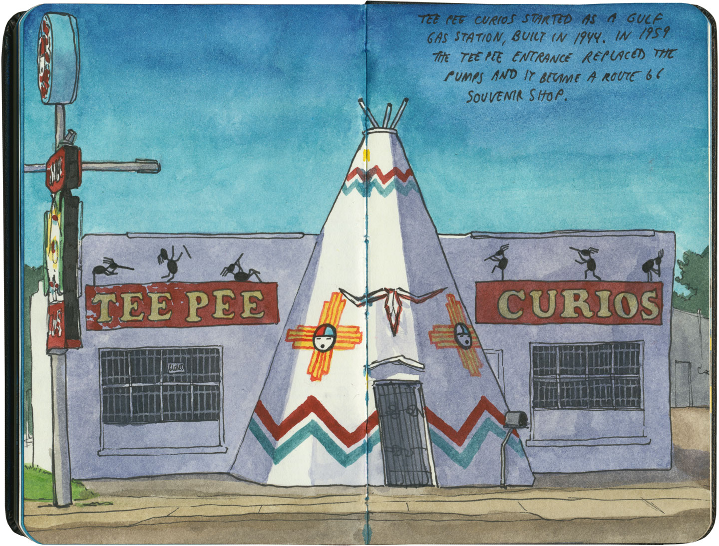
Still, Tucumcari seems to take pride in its place along Route 66. Take the famous Tee Pee Curios (no, I didn’t misspell my sketch; the building uses both spellings at once!), which remains one of the most documented attractions of the Mother Road.

Route 66 sketch by Chandler O'Leary

Sadly, I didn’t get inside, as we rolled in to town too late the night before, and we had to leave before it opened for the day. Still, it was good to see the place in such fine fettle, new coat of paint and all.

Route 66 sketch by Chandler O'Leary

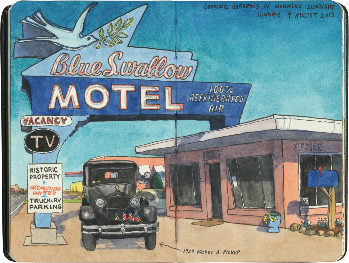
But that’s okay: the real gem of Tucumcari, and perhaps the crown jewel of all of Route 66, was where I got to devote my time. The Blue Swallow is the perfect symbol of Tucumcari: still alive, still authentic, still beautiful.

Route 66 sketch by Chandler O'Leary

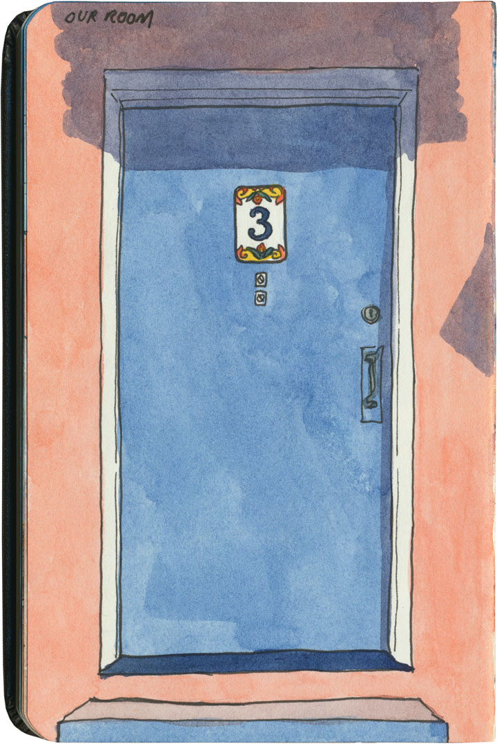
The night we spent at the Blue Swallow was the one we’d been looking forward to the most on that trip, because we just needed proof that there were still places like this left on the planet. As soon as we crossed the threshold to our room, we knew the place was in good hands.

Route 66 sketch by Chandler O'Leary

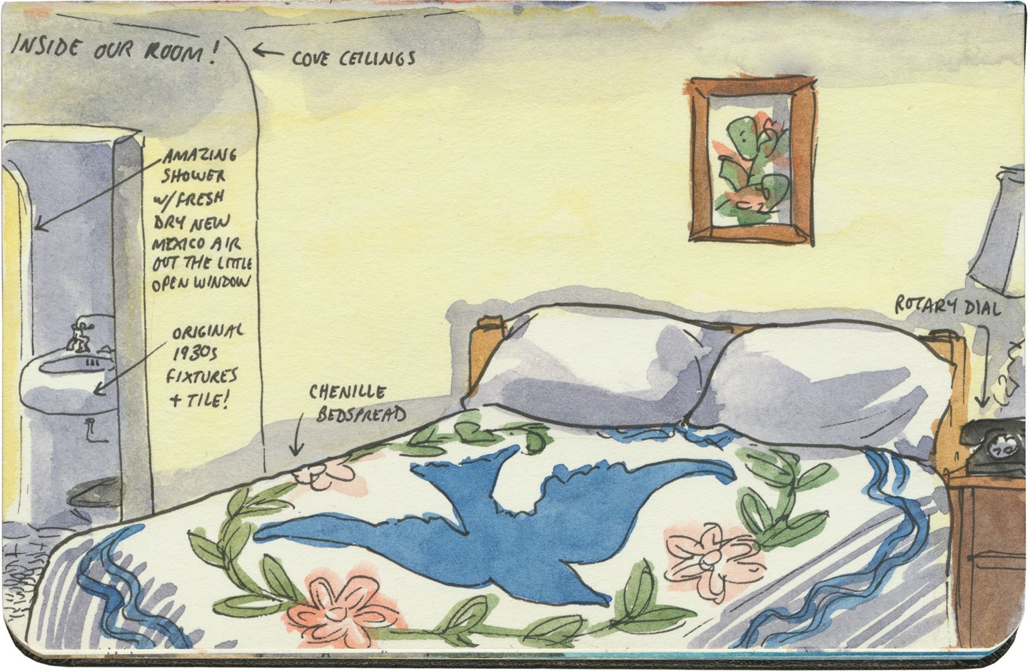
It was like stepping into 1939. The place was meticulously authentic (not to mention spotlessly clean and bright). Whatever wasn’t actually original to the room (and almost all of it was) was carefully restored to the correct period—right down to the 1939 Bell rotary-dial phones. Heck, even the price of the room was a total throwback.

Route 66 sketch by Chandler O'Leary

For me, at least, the Blue Swallow was incredibly comfortable. Maybe it’s because I live in an old house with old furnishings and old fixtures, but I just felt right at home. Anyway, this is the sort of thing I want on a road trip like this. I would have been incredibly sad if we’d opened that door to find the plaster replaced with drywall or a huge flat-screen TV taking up one wall. As it was, I nearly cried from relief to find things just as they were from the beginning.

Route 66 sketch by Chandler O'Leary

Places like the Blue Swallow and towns like Tucumcari are an endangered species. American culture, in general, prefers the new and novel to the historic—the freeway to the meandering path. That’s why it’s such a miracle that there’s any Route 66 left to enjoy at all. For every vintage motel that manages to keep thriving with each passing year, another closes its doors. And that’s why it’s going to take all of us to keep these places alive.

Still, whatever the future might hold, I’m glad to see there’s still a beating heart in Tucumcari tonite.

Save

Save

Save

Save

Route 66 sketch by Chandler O'Leary

Neon echoes

This post is part of an ongoing series called 66 Fridays, which explores the wonders of old Route 66. Click on the preceding “66 Fridays” link to view all posts in the series, or visit the initial overview post here.

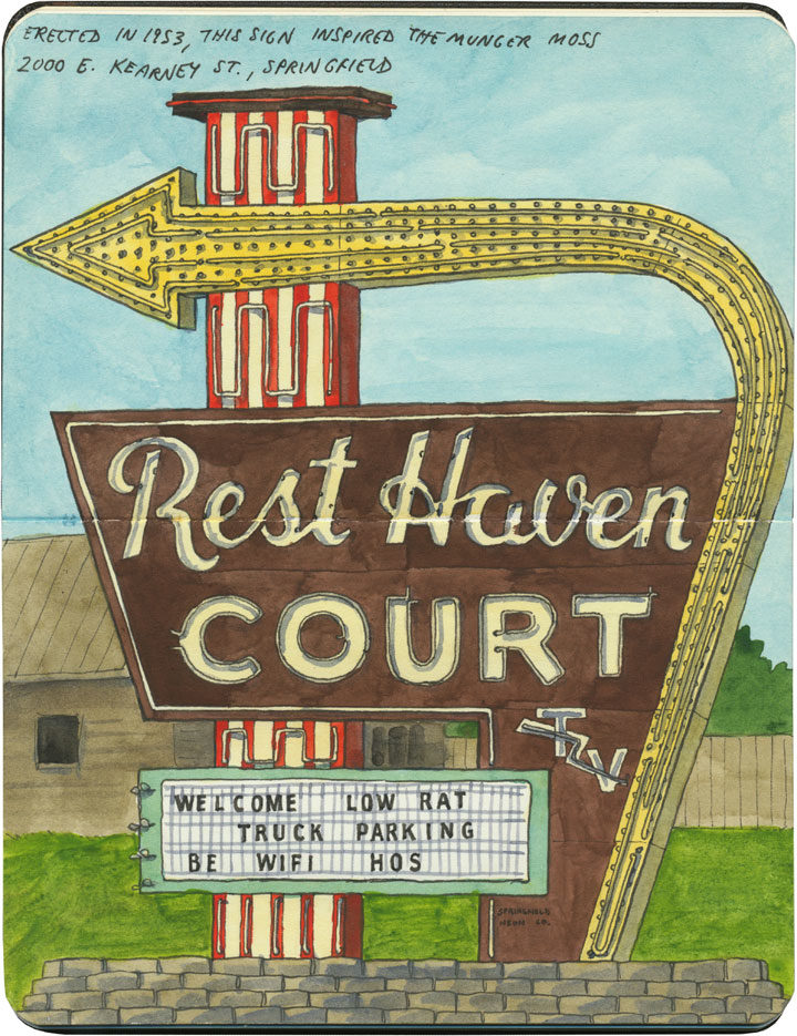
Compared to some of the other outrageous neon specimens along Route 66, this one seems downright pedestrian. Still, there’s a kind of midcentury perfection to this one, from the gorgeous script lettering to the jaunty lightning bolt through “TV.” And there’s something familiar about the shape of the sign, as well, as if one had seen it before…

Route 66 sketch by Chandler O'Leary

Ah, right. One has. This brighter, showier version is just fifty miles away in Lebanon, MO—it was built (by the same neon company, no less) in tribute to the Rest Haven sign, which the owner of the Munger Moss had admired when it was erected just a year or so before, in 1953. And both signs are a clear homage to one of the most famous neon sign designs in America: the one known simply as the “Great Sign,” which began marking Holiday Inns around the U.S. in ’52.

I’m guessing there wasn’t a whole lot of respect for intellectual property among sign scribes of the time, because this sort of design pilfering was pretty common—but I find I just can’t get too riled up about this case. For one thing, that basic Great Sign look appeared in knock-offs all over the country—clearly people thought if it ain’t broke, don’t fix it. For another, I confess I felt a little thrill when I got to see that little TV lightning bolt again: it was like a moment of Deja Googie.

Route 66 sketch by Chandler O'Leary

Big brothers

This post is part of an ongoing series called 66 Fridays, which explores the wonders of old Route 66. Click on the preceding “66 Fridays” link to view all posts in the series, or visit the initial overview post here.

International Fiberglass’s midcentury giants are scattered around the country, and the Muffer Man diaspora certainly includes Route 66, as well. But the fiberglass beefcakes along Illinois’s diagonal streth of Route 66 an extra-special breed. These men are called simply the “Brothers,” and most of them have unusual variants of the standard Muffler Man “physique.”

Route 66 sketch by Chandler O'Leary

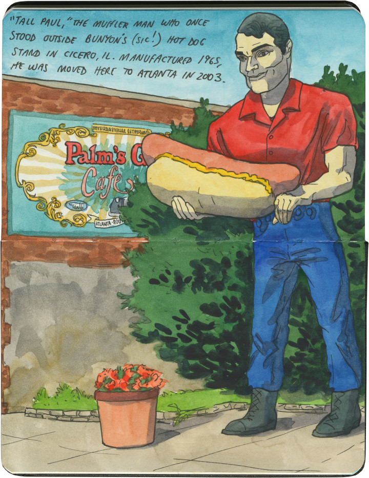
First up is this rather bizarre guy, currently located in Atlanta, IL. It seems a little random that he’s holding a hot dog rather than the standard muffler (though in my experience, Muffler Men almost never hold actual mufflers these days), but his origin story makes everything clear. You see, this guy, named “Tall Paul,” originally stood outside Bunyon’s* hot dog stand in the Chicago suburb of Cicero. When he was originally commissioned in 1966, the owner of Bunyon’s had him outfitted with a custom fiberglass frank instead of a muffler. After Bunyon’s closed its doors in 2002, Tall Paul was sent “downstream” along Route 66 to the town of Atlanta, where he’s housed on long-term loan. While he looks handsome here in Atlanta, I still wish I could see him in situ in Cicero, amidst his Chicago-dog brethren.

* Bunyon’s, as in Paul Bunyan, except it was purposefully misspelled to avoid any possible trademark infringement.

Muffler Men sketch by Chandler O'Leary

Next are the fraternal fiberglass twins of the capital city of Springfield. The guy on the left, who admittedly is not right on Route 66 (but not far off of it), is a former Carpet Viking in new garb. And on the right, just a block or two off of the Mother Road, is the Lauterbach Tire Man, now newly re-capitated after a 2006 tornado quite literally blew his head off.

Route 66 sketch by Chandler O'Leary

And then there’s the mutant masterpiece of Illinois 66, a particularly odd and endangered specimen known as the Gemini Giant.

Route 66 sketch by Chandler O'Leary

This guy stands sentry outside the now-defunct Launcing Pad Drive-in in the town of Wilmington. When he was commissioned in 1965, the owners of the Launching Pad capitalized on the Space Race fad of the era, and customized their guy with an astronaut helmet and handheld rocket. Even his name, devised by a local schoolgirl, referenced the Gemini space program. The result is not only one of the most unusual muffler men, but also one of the most recognized Route 66 landmarks.

Route 66 sketch by Chandler O'Leary

The empty Launching Pad property and the Gemini Giant are both currently for sale—they went up for auction just this April, but failed to meet the reserve price. Despite an uncertain future, the town of Wilmington appears to be committed to preserving the Gemini Giant. I certainly hope so—if any of the Brothers were to disappear from Route 66, they’d leave some awfully big shoes to fill.

Save

Save

Save

Save

Save

Save

Route 66 sketch by Chandler O'Leary

Lumberjacks of 66

This post is part of an ongoing series called 66 Fridays, which explores the wonders of old Route 66. Click on the preceding “66 Fridays” link to view all posts in the series, or visit the initial overview post here.

Since Route 66 passes through the Great Plains and the Desert Southwest, and not at all through the North Woods, it’s not a highway that brings thoughts of Paul Bunyan to mind. Yet there are a handful of Pauls along the Mother Road, if you know where to look.

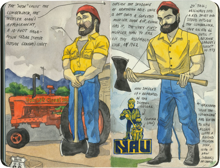
The most well-known can be found in Flagstaff (where logging actually does happen): a trio (including a set of identical-twin Muffler Men) of big brothers in matching outfits. The guy on the left of the above sketch is hand-hewn out of wood, fittingly, but to me the most interesting specimen is the one on the right half of that spread. That Muffler Man happens to be, rumor has it, the very first one ever rolled off the assembly line. Today the aforementioned wooden statue stands in his place on Route 66, and the Muffler Man now stands near his twin on the Northern Arizona University campus.

Route 66 sketch by Chandler O'Leary

The other Paul Bunyan is an oddity, indeed. He stands high above Central Avenue (the more modern alignment of 66) in Albuquerque, keeping watch beside what is now a Vietnamese Cafe. Sadly, this Paul has recently been rendered limbless…but it’s not like he needed to do a lot of logging in Albuquerque anyway.

Save

Save

Save

Route 66 sketch by Chandler O'Leary

The proof is in the pavement

This post is part of an ongoing series called 66 Fridays, which explores the wonders of old Route 66. Click on the preceding “66 Fridays” link to view all posts in the series, or visit the initial overview post here.

It’s easy to take for granted the fact that the American West is crisscrossed with highways nowadays, but those highways didn’t get there by chance. If you look closely at the routes those highways take, you can give yourself an excellent crash course in history, both human and natural. Overland exploration, trade routes, desert basins, animal migration, continental drift…all these things and more are hinted at by the map sketched out by the U.S. highway system.

Let me explain what I mean. If you happened to grow up in the Midwest, chances are your mental map would be dictated by a grid that follows the cardinal directions. In the Great Plains, particularly, where the landscape is mostly flat, dividing property lines and town borders into a standard grid makes the most sense. Much of the United States west of the Appalachians is arranged this way, in fact, in a basic grid called the Range and Township system. The system overlays a simple framework of one-square-mile sections over the entire western two-thirds of the country, dividing the landscape into rangeland for farming and six-mile by six-mile townships. Interestingly enough, we have Thomas Jefferson to thank for this system, which he devised in 1785 as a way to manage the vast swaths of land that, after the Revolution (and some years later the Louisiana Purchase), now belonged to the U.S. His reasoning, I think, was both practical and lofty: as a farmer himself, he was looking for a workable alternative to the inherited system of Metes and Bounds, England’s age-old framework for managing farmland and water access. While that system worked for the colonies, each roughly comparable in size and topography to what they knew in the Old World, the old framework wasn’t scalable to the size of the new West—particularly when tracts of land were being sold off sight-unseen to settlers and prospectors. But beyond the practical logic, I think Jefferson had more philosophical motives behind his plan. This is the guy who designed Monticello, after all, a monument to neoclassical thinking and an homage to ancient Greece and Rome. The Range and Township system applied a sense of order—however illusory—to the uncharted wilds of the West. It brought rational thought and a sense of opportunity to an area associated with chaos and the fear of the unknown.
Route 66 sketch by Chandler O'Leary

If you’ve ever visited the Great Plains, you can still see Thomas Jefferson’s plan in evidence, from the straight-as-an-arrow farm roads in rural areas, to the faithful system of thoroughfares in cities like Tulsa or Dallas, where the roads always travel from A to B in a straight line, with traffic lights appearing like clockwork at precise one-mile increments, and tenth-of-a-mile residential blocks in between.

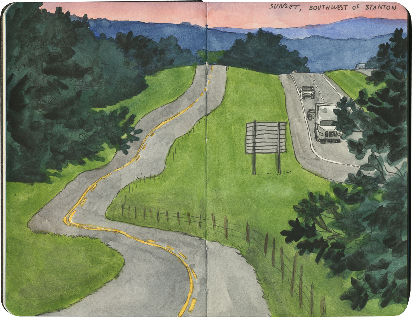
But here’s the problem: Thomas Jefferson never laid eyes on the West he gridded out like a piece of paper. He never saw nature’s rebuttal to rationality in the Rockies or the Colorado Plateau. It’s all well and good to have a sensible grid in a flat place, without major physical features to interrupt the plan. But in many parts of the West, Jefferson’s tidy squares becomes utterly useless. You can’t easily farm a quadrangle of land that’s bisected by a canyon, and you can’t run a road up and over a mountain. Travel in a straight line is impossible in many, many places. As everyone from Chief Joseph to Lewis and Clark to highway engineers could tell you, there are some places in the West where only one route overland is possible—or none at all.
Route 66 sketch by Chandler O'Leary

So if you look at a modern highway map of the western half of the United States, the limitations geography places on rationality are obvious. You can see precisely where the Corps of Discovery found their way to the Pacific Northwest, or where the stagecoaches hauled goods to Santa Fe, or how the Mormon pioneers tumbled out of the mountains to the Great Salt Lake, or the supply route linking the California Missions to Mexico. It’s all there, because centuries later we’re still traveling the exact same routes that humans always have, dodging mountains and following water to whatever their destinations were. The Conestoga wagons followed the game trails and trade routes of the various Indigenous peoples. The railroad followed the pioneers’ wagon tracks. The first pavement slabs paralleled the railroad grade, and modern Interstate freeways zoom right over many of those original roadbeds and trailways. Even the technology of conveyance was based on the older methods of travel—just look at the wheel base on a modern car, whose width matches that of railroad cars, themselves directly descended from the lineage of horse-drawn wagon measurements.

As you can probably guess by my long-winded introduction here, this stuff ties square in with Route 66 and the path it cuts to the Pacific.
Route 66 sketch by Chandler O'Leary

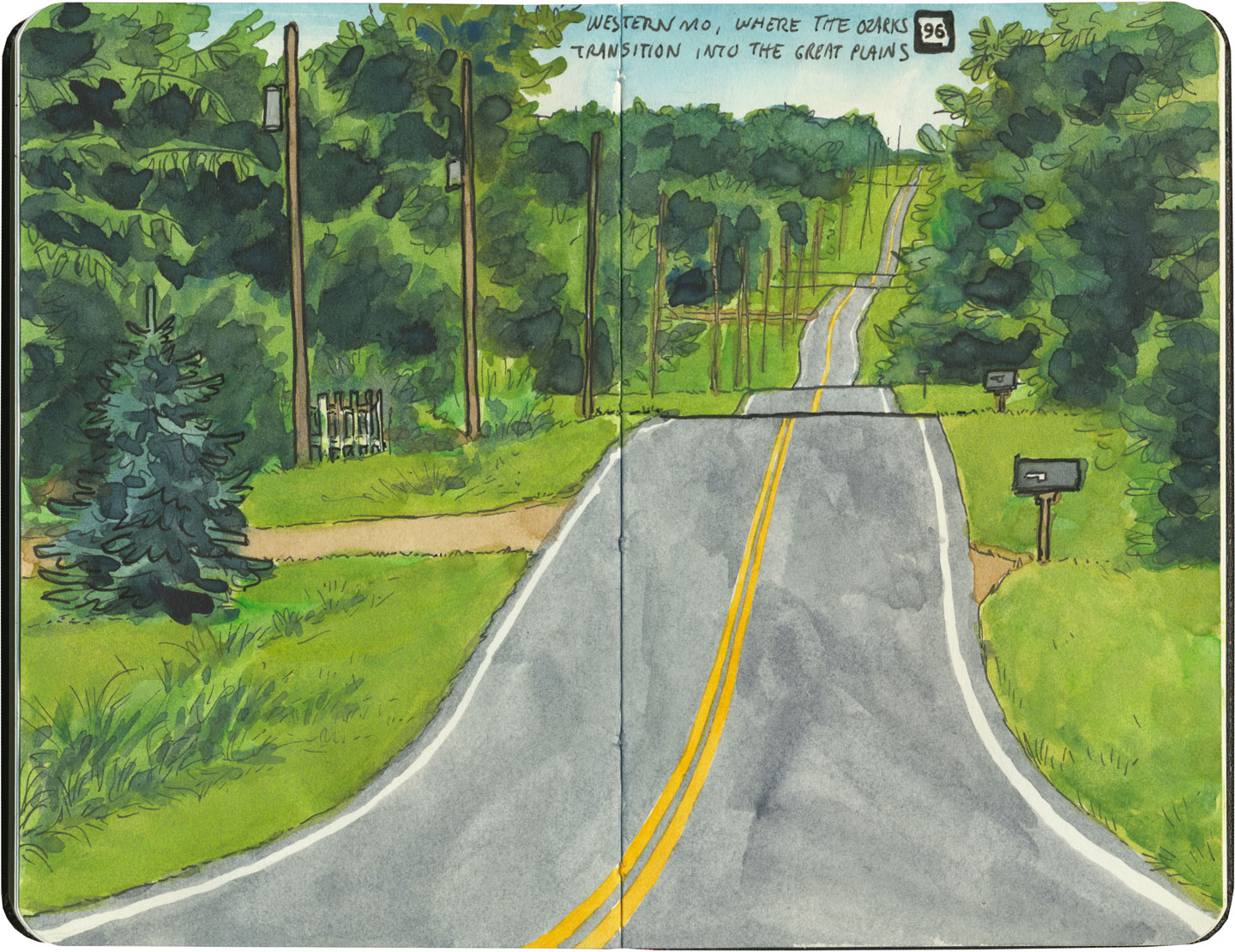
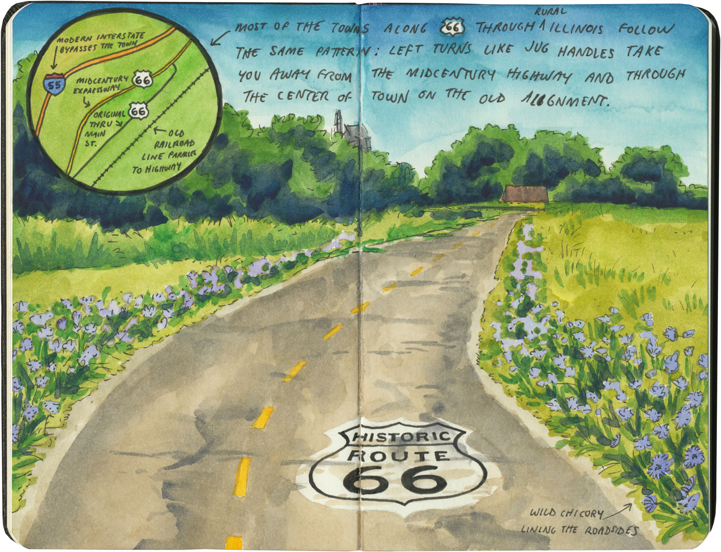
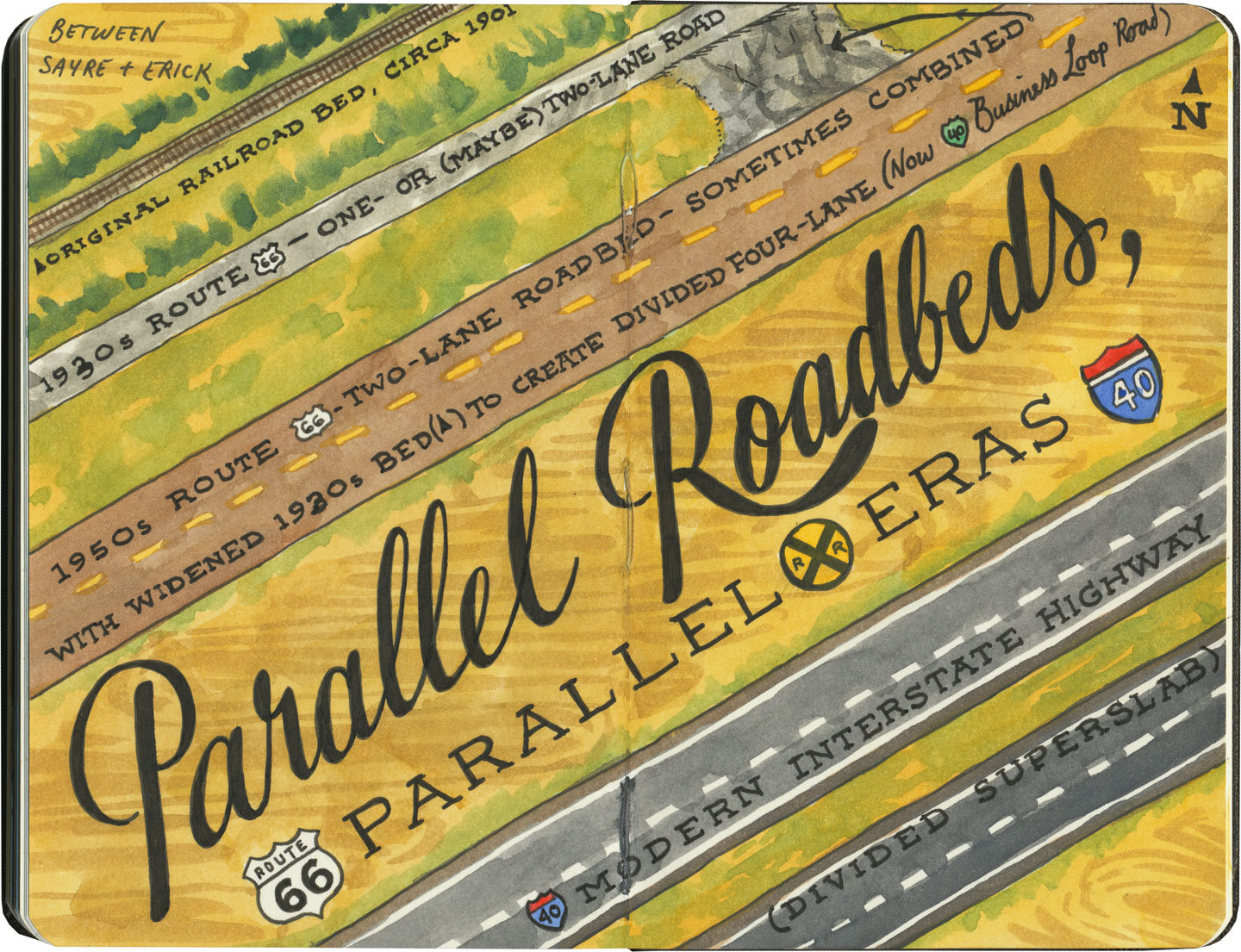
There are many places along Route 66 where you can see this progression of transportation history unfold before your very eyes. In flat places like central Illinois or eastern Oklahoma, there was no reason to reuse the same roadbed over and over again—they had all the land in the world at their disposal, and nothing to impede their path. So they simply built the new road alongside the old—over and over again.
Route 66 sketch by Chandler O'Leary

The result is a network of parallel lines, each wider than the last, each laid down at a different point in recent history. In these places, the land acts like a palimpsest, marked over and over again with new traceries of roadbeds, while the old ones, though crumbling in disrepair, still remain visible.

Route 66 sketch by Chandler O'Leary

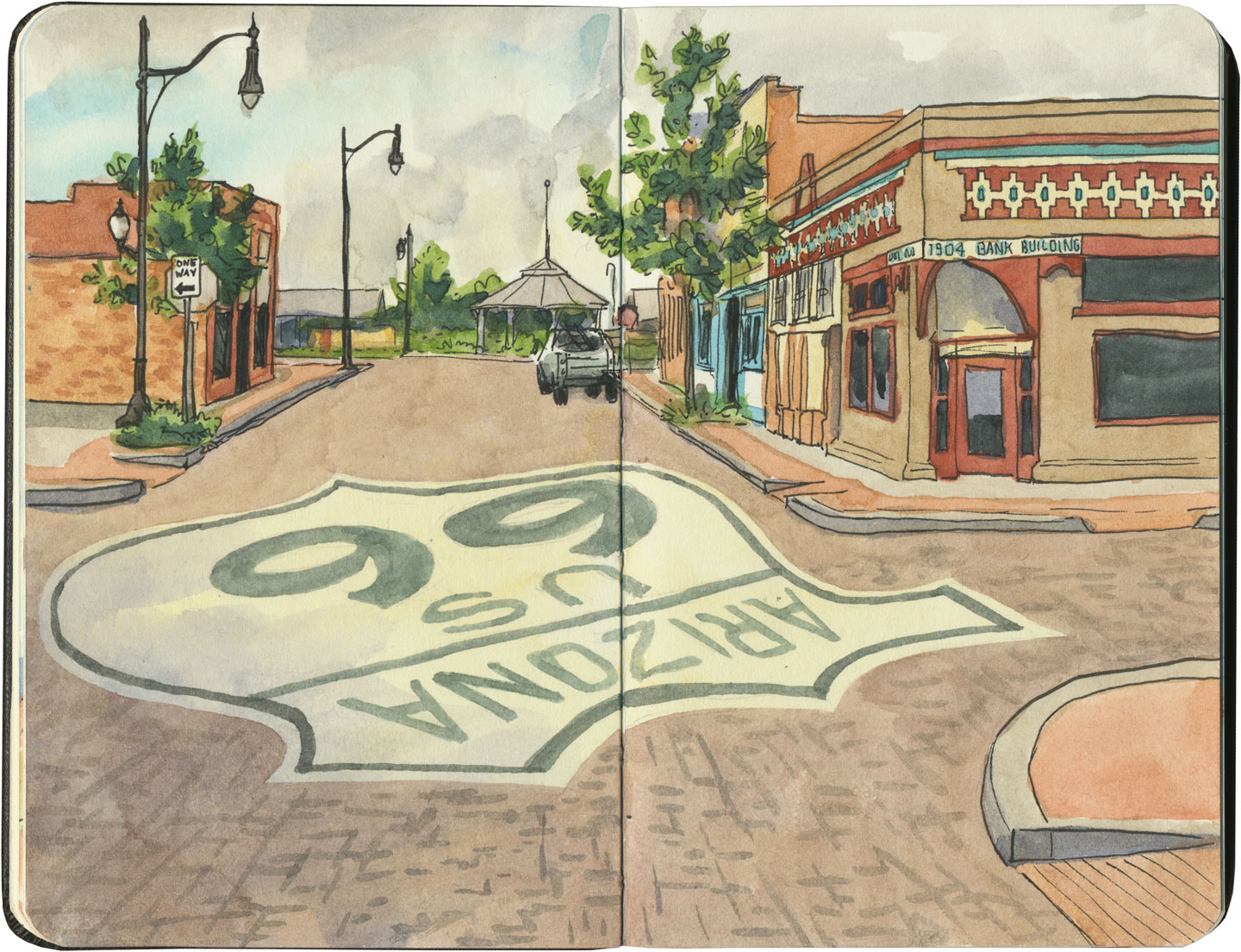
Since Route 66 was decommissioned as an official national highway, there are places where it’s difficult to discern the original route. The old roadbed might be there, but the Mother Road can get lost amid a modern tangle of frontage roads, diversions, and replaced pavement.
Route 66 sketch by Chandler O'Leary

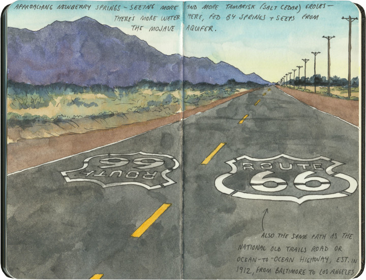
Part of the joy of traveling Route 66 is learning to recognize the old road. In some places, the path is lit up like a beacon with painted pavement and restored waymarking…

Route 66 sketch by Chandler O'Leary

…in others, tracing the original marks on the palimpsest becomes something of a quest.
Route 66 sketch by Chandler O'Leary

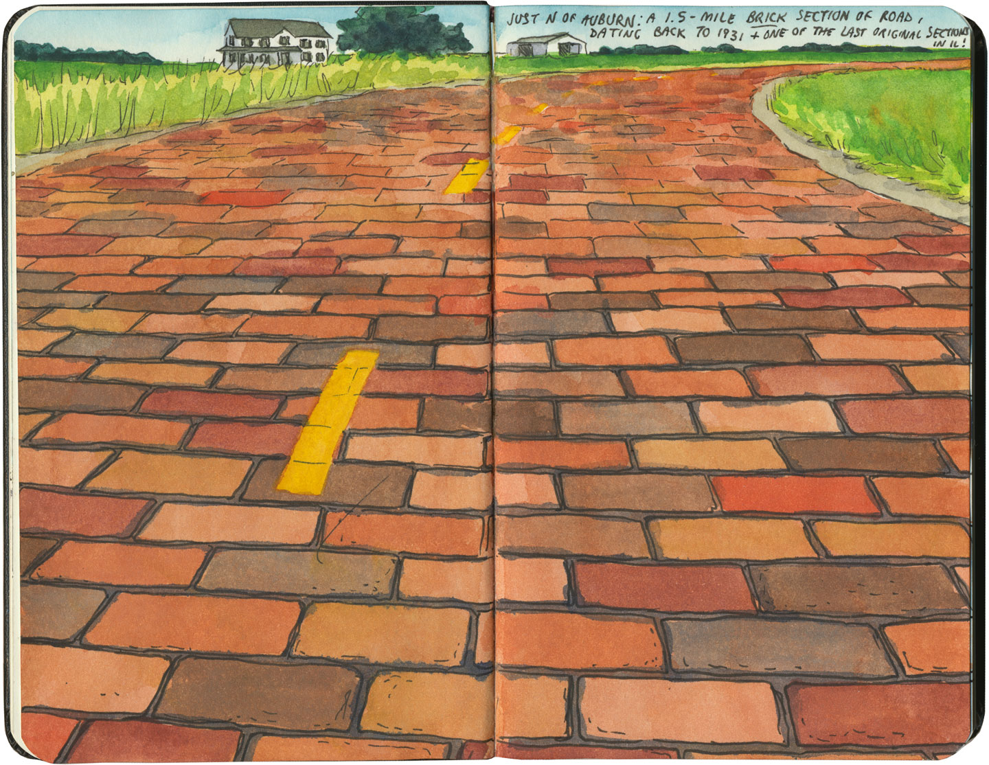
And then there are the places where the original pavement itself becomes the attraction along the way—like this gorgeous stretch of brick roadway in Illinois, paid for in the 1930s by a brick magnate and lovingly maintained as a curious relic of the past.
Route 66 sketch by Chandler O'Leary

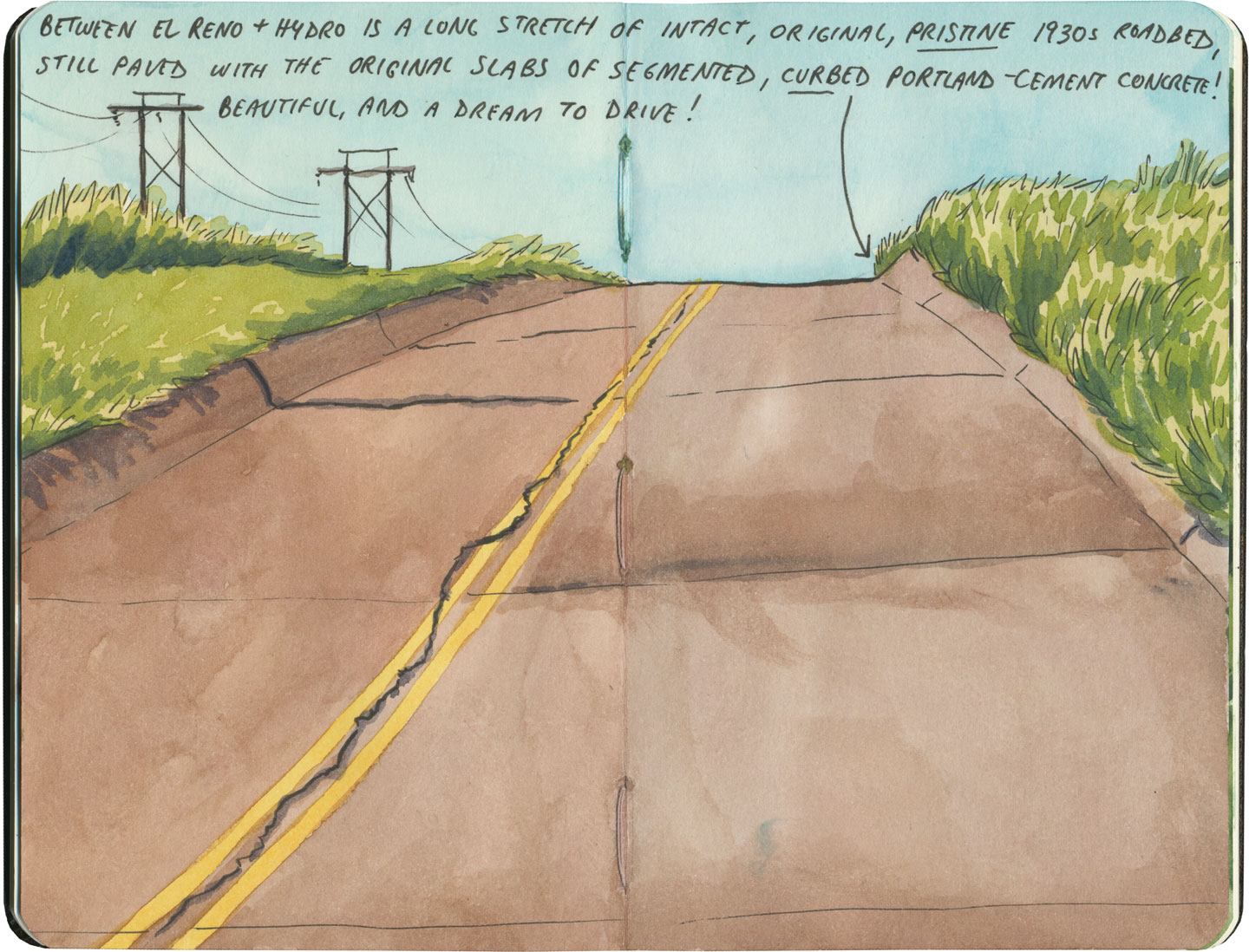
My favorite of all was the long section of 66 that traverses central Oklahoma: the combination of good craftsmanship and a remote locale has preserved the original roadbed impeccably. It sounds nerdy to say it out loud, but I dare any 66 enthusiast not to feel a thrill when seeing that curbed Portland cement.
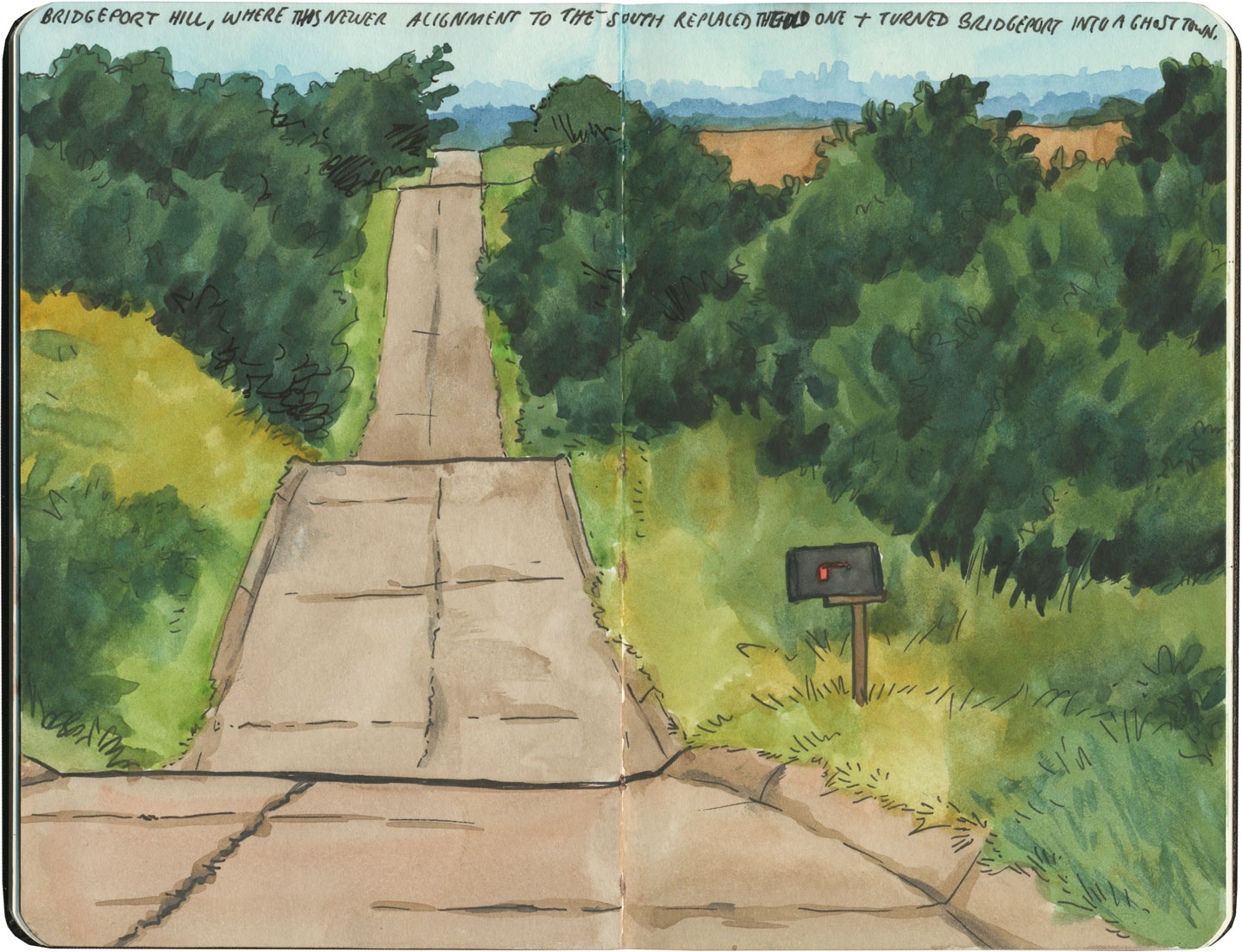
Route 66 sketch by Chandler O'Leary

By the end of our journey, we’d gotten really good at spotting the difference between old and new along the way. And whenever we lost the thread of the route (easily done, since there are so many alignments, many of which have been replaced or buried under modern roads), it became easier and easier to spot the hints that would lead us back to the Mother Road.
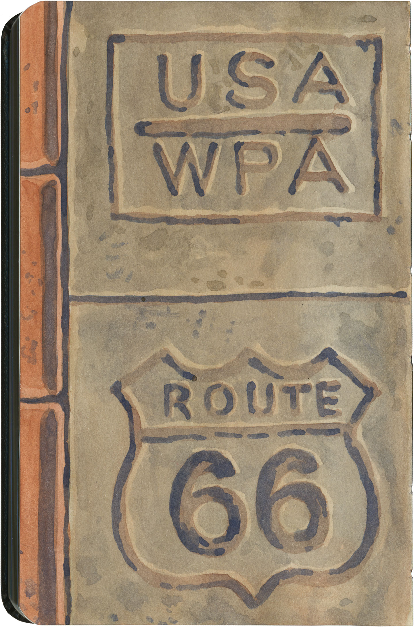
Route 66 sketch by Chandler O'Leary

What led me to travel Route 66 was a love of history and Americana, and a desire to travel a well-worn and well-loved path. I had no idea that it would be so much more—and something much closer to the feeling of solving a mystery. Beyond the fun of diners and neon, there’s a richer, subtler 66 to be discovered, if you’re willing to look a little deeper. All the clues are there—some of them stamped right into the pavement underfoot.

Save

Save

Save

Save

Save

Save

Save

Save

Save
Route 66 sketch by Chandler O'Leary

Ranch to table

This post is part of an ongoing series called 66 Fridays, which explores the wonders of old Route 66. Click on the preceding “66 Fridays” link to view all posts in the series, or visit the initial overview post here.

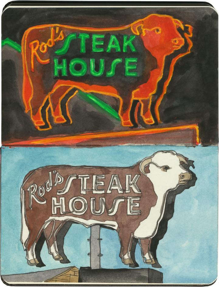
When it comes to road food along Route 66, sometimes a hot dog just doesn’t cut the mustard. When you’re traversing the Wild West, sometimes you just want a darn steak already. If a slab o’ steer is your cuppa tea, there’s no better place than Rod’s Steakhouse in Williams, Arizona.

We stayed three nights in a motel kitty-corner from Rod’s, so I ended up spending a lot of time staring at that neon sign—no complaints here, it’s a real beauty. What you couldn’t see from the motel was that the steer sign was just the tip of the fluorescent iceberg:

Route 66 sketch by Chandler O'Leary

A whole block of gorgeous neon! They had me at hello.

Route 66 sketch by Chandler O'Leary

So on our last night in Williams, we sat down for a steak dinner. Between the neon signs and the juxtaposition of cowboy decor and scores of Italian and French tourists, I was already in heaven. But you should have seen the rapture when I saw what was waiting at the table:

Route 66 sketch by Chandler O'Leary

Die-cut menus and vintage custom china pattern? Swoon.

I mean, yeah. The steak was great, too—actually, my rib eye was downright perfect. But no matter how unforgettable the meal, it’s the visual details I’ll always remember.

Chicago sketch by Chandler O'Leary

Dog days

This post is part of an ongoing series called 66 Fridays, which explores the wonders of old Route 66. Click on the preceding “66 Fridays” link to view all posts in the series, or visit the initial overview post here.

Okay, I’m starting this post with a few sketches that are not on Route 66, but that provide a good bit of context—which is to say, if you’re hankering for a roadside red hot on your travels, there’s no better place to go than Chicago.

There’s some debate as to the origin of the humble hot dog. There is the German frankfurter, of course, but what has become the ultimate American street food seems to have murkier beginnings. Various cities with German-immigrant roots lay claim to the invention, including New York (where sausages were served on rolls at Coney Island in the 1870s) and St. Louis. But thanks to the persistent legend that the modern dawg, as we know it, was first served at the World’s Columbian Exposition in 1893, Chicago has taken the story and run all the way to the bank with it.
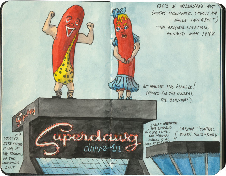
Chicago sketch by Chandler O'Leary

Today, Chicago is the weenie capital of the world. Chicagoland Mom & Pop hot dog stands outnumber the city’s combined tally of McDonald’s, Burger King and Wendy’s franchises. And many of them, like the fabulous (and slightly creepy) Superdawg Drive-In above, have been mainstays for half a century or more.

Chicago sketch by Chandler O'Leary

And just like the infamous Hot Wiener Sandwich of Rhode Island, a true Chicago Dog wouldn’t be caught dead in ketchup.

I started with these non-66 hot dog stands so you could see how high Chicago sets the bar for its tube-steak signage. If these wiener masterpieces could be found across town from the Mother Road, imagine how high my expectations were for Route 66’s offerings.

Route 66 sketch by Chandler O'Leary

Well, I’m here to tell you, I didn’t come away disappointed.

Route 66 sketch by Chandler O'Leary

And if you’re heading west on Route 66, you’re in for an added bonus. Just when you think you’ve left the Dog Days behind, you’ll reach the state capital of Springfield and meet the Cozy Dog Drive-In. The Cozy Dog was founded by one Ed Waldmire, Jr. (remember the name Waldmire—there’s more 66 lore there to share another day), who, at a USO during World War II, invented the “crusty cur,” a cornbread-battered hot dog on a stick that would become a staple of State Fair cuisine. The recipe was an enormous hit with the troops, so in 1946 Waldmire rechristened his creation the Cozy Dog, and the rest, as they say, is history.

Route 66 sketch by Chandler O'Leary

(Dairy) king of the road

This post is part of an ongoing series called 66 Fridays, which explores the wonders of old Route 66. Click on the preceding “66 Fridays” link to view all posts in the series, or visit the initial overview post here.

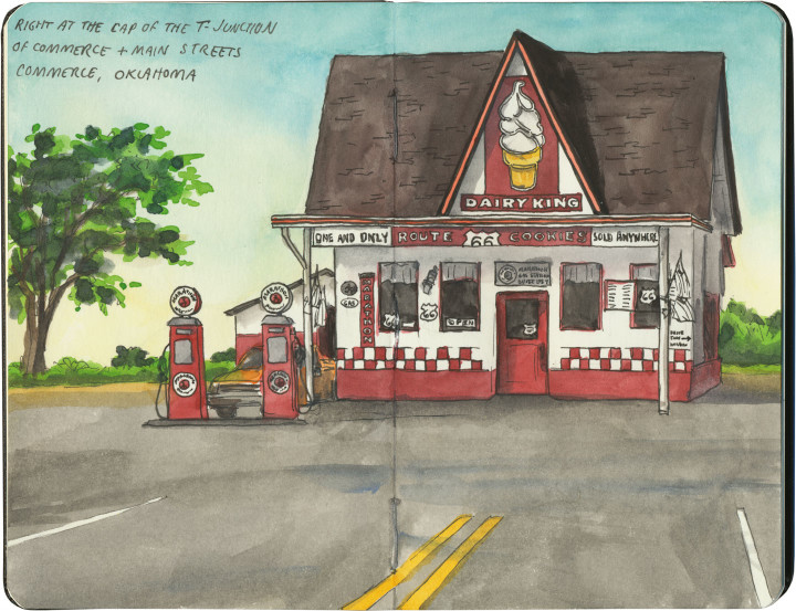
If you happen to drive Route 66 in the summer, like we did, you might just find yourself pulling into Commerce, OK at the hottest part of an absolutely scorching day. If that’s the case, this former filling station will appear on the horizon first like a desert mirage, and then like a beacon of hope.

Apparently the unique draw of the Dairy King is the legendary Route 66 cookie (yes, a cookie shaped like US Highway shields!), but I have to confess: sometimes all you want on a hundred-degree day is a little something frosty.

Route 66 sketch by Chandler O'Leary

Roadside ziggurat

This post is part of an ongoing series called 66 Fridays, which explores the wonders of old Route 66. Click on the preceding “66 Fridays” link to view all posts in the series, or visit the initial overview post here.

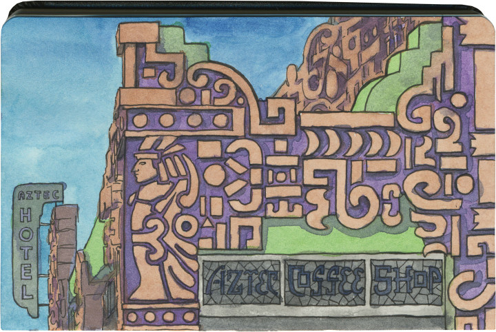
Here’s a unique one. If you drive Route 66 through the seemingly unending sprawl of greater Los Angeles, you’ll pass an ornate oddment around the halfway point of the Valley. The place is called the Aztec Hotel, and it’s apparently one of the best (and only) still-standing examples of Mayan-Revival architecture.

Did you know that was a thing? Me, neither.

Route 66 sketch by Chandler O'Leary

Nevermind that the Aztecs and Mayans were two completely different cultures, and the implications of approximating either or both in America—whatever your opinion of the genre, the Aztec Hotel’s unique relief work is quite a beauty. And amazingly, the “Mayan” style dovetails beautifully with the Art Deco era in which this place was built.

The Aztec is currently closed, but rumor has it that the building is owned by a Chinese investor, who is supposedly fixing the place up with plans to reopen in the near future. I really hope that’s the case, because based on vintage photos I’ve seen of the interior, I’m dying to get in there with my sketchbook.

Route 66 sketch by Chandler O'Leary

Burro borough

This post is part of an ongoing series called 66 Fridays, which explores the wonders of old Route 66. Click on the preceding “66 Fridays” link to view all posts in the series, or visit the initial overview post here.

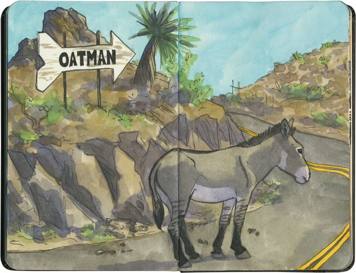
I think this is the closest I’ve yet come to experiencing the phenomenon of the sacred cow. In Oatman, Arizona, they have sacred donkeys.

Well, if not exactly sacred…then, I’d imagine, lucrative.

Route 66 sketch by Chandler O'Leary

Oatman is something of a living ghost town: what’s left is a relic of the gold rush, a dessicated hamlet tucked away in the craggy, bare mountains of western Arizona. The place is so unbelievably remote, it’s a wonder that any highway reached it at all, let alone the Mother Road.

At the time of the gold rush, prospectors brought burros with them to do the heavy lifting for them. Far more hardy than your average horse, the donkeys could tough it out in such an inhospitable place. The ore veins dried up during the Great Depression, and at the start of World War II, the mines were formally closed as nonessential to the war effort. The last few miners turned their beasts of burden loose onto the surrounding hills, and left town for good.

The burros, being burros, thrived on their hardscrabble existence, and before long had produced an entire population of feral donkeys. Their sleek, well-fed descendants roam the streets of Oatman today, stalling traffic (such as there is) and biting the fingers of unwary tourists.

Route 66 sketch by Chandler O'Leary

You have to hand it to Oatman: someone there saw the potential for a feral donkey to become a serious—and sacred—cash cow.

I’m a little ashamed to say I didn’t part with any tourist cash in Oatman. I didn’t even get out of the car. It was 116 degrees Fahrenheit outside, and while I’ll do almost anything for a good tourist trap, frying like an egg isn’t on the list. But then again, stubborn as I may be, I’m no burro—just a pale Irish gal from a cold, rainy climate.

Maybe I’ll visit in the winter next time, and buy an extra t-shirt as penance.