Tag Archives: west

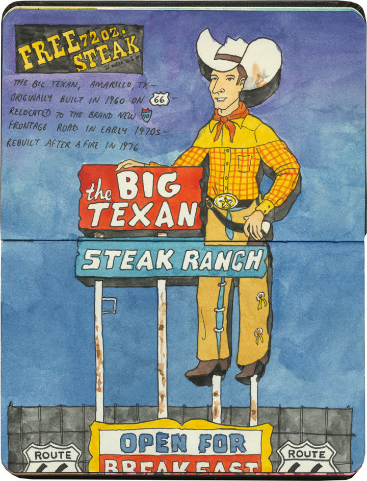
Big Texan sketch by Chandler O'Leary

Major beef

This post is part of an ongoing series called 66 Fridays, which explores the wonders of old Route 66. Click on the preceding “66 Fridays” link to view all posts in the series, or visit the initial overview post here.

The Mother Road has no shortage of good steakhouses, but nothing quite matches the spectacle of the Big Texan in Amarillo.

Big Texan sketch by Chandler O'Leary

I mean, we know that everything is bigger in Texas, but this place aims to prove it (and proclaim it, if you look closely at the signage in the above sketch!).

Big Texan sketch by Chandler O'Leary

Even the swimming pool (yes, a steakhouse with a swimming pool…the place is also a motel) is a reminder of just where you stand.

Big Texan sketch by Chandler O'Leary

The main dining room is done in the grand tradition of Meat Halls of the American West

Big Texan sketch by Chandler O'Leary

…but the Tailor and I found ourselves seated in a cozy, quiet nook. Yet even here, we had that big steer head and hot pink flocked wallpaper to remind us that this is how Texas does quiet nooks.

And that is just fine and dandy with me, thank you very much.

Save

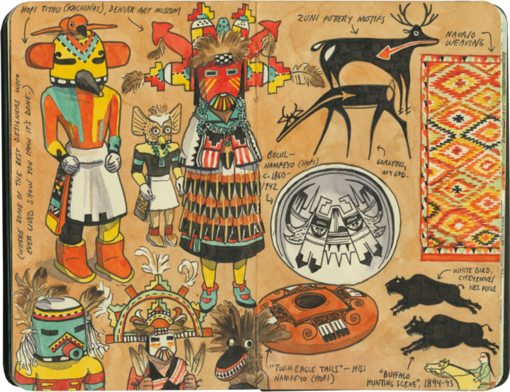
Indigenous art and sculpture sketch by Chandler O'Leary

Art-ifacts

Another place I tend to spend hours poring over American Indian artwork is the fabulous Denver Art Museum. In addition to things like beadwork, the museum devotes two entire floors to an astonishing range of Indigenous art, from Pre-Columbian pottery to Plains paintings to Salish heritage poles, and everything in between. The collection includes at least one example from nearly every American and Canadian culture—I had no hope of sketching them all, but I was determined to make a respectable start, in any case.

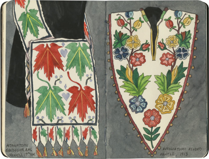
Potawatomi beadwork sketch by Chandler O'Leary

Glass pixels

Whenever I’m in Tulsa I try to make time for the Gilcrease Museum, a place devoted to the art of the American West. Yet as much I love perusing the galleries of Russells and Remingtons and Catlins, what I’m really there for is the beadwork. The Gilcrease, whose namesake was himself a member of the Muscogee (Creek) Nation through his mother’s side, boasts a collection of around 25,000 ethnographic objects. Many of these are artistic pieces created by Plains peoples of the first half of the 19th century—a time of wealth and prosperity for many Indigenous nations, which generated some of the finest design and craftsmanship this continent has ever seen. The beadwork is my favorite because it still looks so fresh and contemporary. With each seed bead acting like a pixel on a screen, there are infinite possibilities for each hand-sewn grid of colors and shapes. And the glass beads will never fade the way prints or paintings will over time. Every bandolier bag, every moccassin seems as if the person who made it had just stepped out of the room—as if all I had to do was wait a moment to have a chat with them.

Wigwam Motel (Arizona) sketch by Chandler O'Leary

Wigwam-a-rama

This post is part of an ongoing series called 66 Fridays, which explores the wonders of old Route 66. Click on the preceding “66 Fridays” link to view all posts in the series, or visit the initial overview post here.

Route 66 wouldn’t be Route 66 without its bevy of American-Indian cultural appropriation kitsch. The sheer number of faux teepees, tomahawks, totems and trading posts along the Mother Road is staggering—the number of details they get wrong even more so (like, ahem, teepees in the desert Southwest). Still, these wrongheaded landmarks are a huge part of the route’s history, and I’d be remiss if I didn’t mention them here.

Most famous of all are the two (two, I say!) Wigwam Villages that still beckon travelers from the roadside—and these were actually part of a chain of seven motels that stretched from Florida to Kentucky to California in the 1940s and 50s.

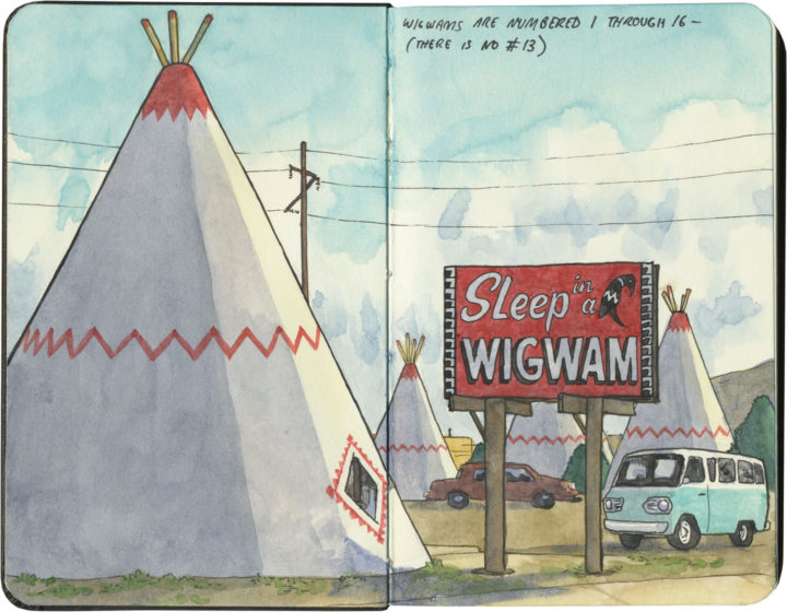
Wigwam Motel (Arizona) sketch by Chandler O'Leary

The one in Holbrook, Arizona is the most well-kept of the two remaining villages, and is decked out with a ring of restored vintage cars and its original “Sleep in a Wigwam” billboard.

Wigwam Motel (California) sketch by Chandler O'Leary

Its sister site in California once displayed a much earthier sign: “Do It in a Teepee,” (actually, the sign is still there, just tucked away in the back of the property) which contributed to a seedy reputation that the current owners are trying hard to overcome.

Wigwam Motel (California) sketch by Chandler O'Leary

If these motels seem oddly familiar to you, imagine this sketch displaying a ring of giant traffic cones instead of teepees, and it’ll click: the San Bernardino Wigwam Village was the inspiration for the fictional Cozy Cone Motel in the Pixar film Cars.

I didn’t get a chance to “sleep in a wigwam” on this trip, but it’s just as well. As much as I love themed roadside kitsch, I don’t love cultural appropriation—particularly the American Indian variety.(Don’t even get me started on fashion models wearing war bonnets, or kid’s-room teepees at the Baby Gap.) Still, I’m glad to see these motels being preserved—Route 66 doesn’t need to lose any more of its landmarks.

Save

Save

Landslide sketch by Chandler O'Leary

The long detour

I spent nearly all of April breaking in my new car with a 6500-mile road trip up and down the West Coast. I’ve done many similar trips in the past, but this one had a completely different feel to it. And that’s because the severe drought—which for more than seven years had parched California and gifted me with suspiciously perfect weather and unusually good road conditions—was over.

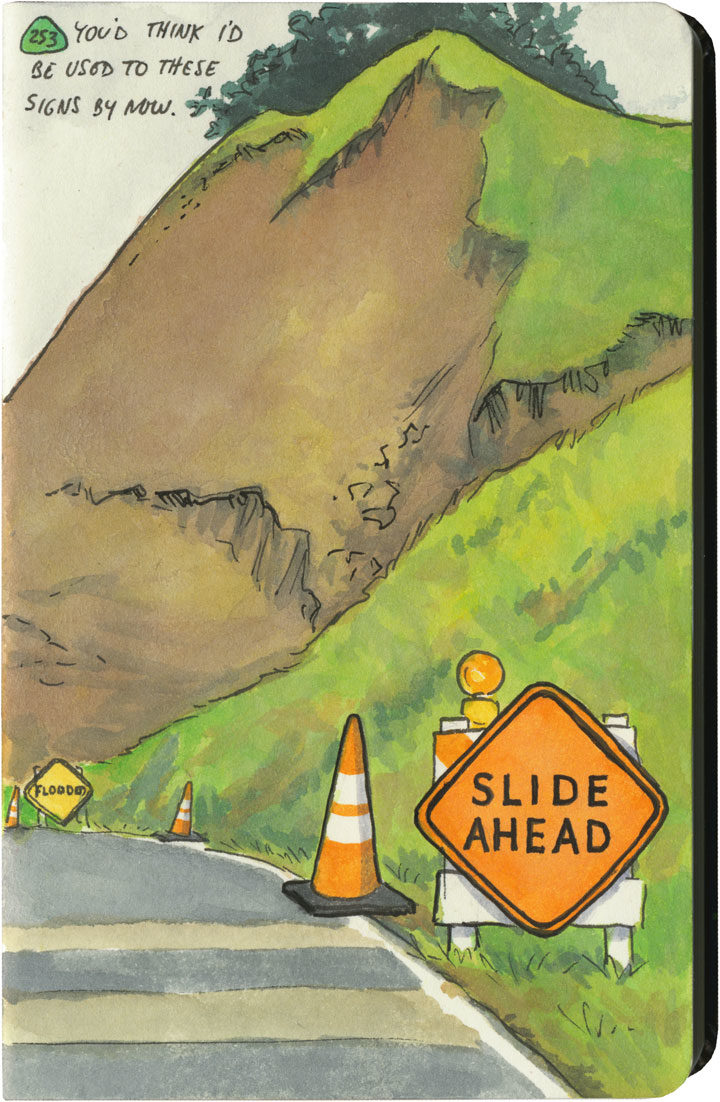
This year, California had just come out of one of its wettest winters on record. All that rain after such a long drought had brutal effects on hillsides and roadbeds all over the state. I quickly became accustomed to seeing signs like this one everywhere I went—to the point where I lost count of the number of detours, patched pavement, and in-progress landslides along my route. Over and over again I either had to make adjustments to my plans (I had to cut the Big Sur Coast out entirely, since Highway One has been closed there since February), or else take extra time to pick my way over some truly scary patches of pavement.

Landslide sketch by Chandler O'Leary

The state of affairs was so unpredictable that I got in the habit of checking road conditions on my phone a day or two ahead of each day’s planned route. On one cursory inspection, I stopped dead, my eyes widening at what I saw: Highway 101, my route through the redwoods, which happens to be the only route through the redwoods, was closed. Completely closed. No detour, the warning said.

No detour.

By this time I was familiar with the Norcal Coast—I knew that it’s pretty darn audacious of Highway 101 even to be there, what with the mountains that squeeze right up to the rugged, rain-soaked coastline. I remember driving through there in the past, marveling at the engineering required to put a road there in the first place, and being thankful that nothing had blocked my way and left me up the proverbial creek—yet I never actually looked at a map to see what kind of workaround a closure would require. Well I was about to find out.

Luckily, this little monkey wrench couldn’t have happened on a better day. This happened to be the shortest day of the trip, with just over 100 miles between hotels. And I only had one real plan for the day: to explore the Lost Coast, that rugged swath of coastline traversed only by primitive roads, where tourists feared to tread.

Nevermind—a massive rockslide just north of Leggett put paid to that plan. I still needed to get to Ferndale, though, if I wanted to honor my reservation that night and make it to the next leg of the trip. And since there was “no detour,” I scoured my maps to see just what that would mean.

Landslide detour map sketch by Chandler O'Leary

Uh, yeah. This is what it means. It means crossing back east over the mountains on State Route 20, then a trek up through nearly the entire length of the Sacramento Valley (that little Highway 99 jog was just a break to save my sanity), then back over the mountains to 101 again on State Route 36. There are no east-west highways between 20 and 36, either. This was my route, the new plan. I added up the mileage of what I’d have to do the next day: nearly 400 miles.

I set an early alarm, asked the universe to refrain from any more surprises, and went to bed.

Landslide detour sketch by Chandler O'Leary

The next day was was both beautiful and harrowing. I got to see a broad swath of the state I’d never experienced before. And I also got hit with some home truths about this modern life we all take for granted—how easy it would be for nature to knock it all right out. As I wound my way over mountain pass after mountain pass, the roads got scarier and scarier. There were places where it was obvious the hillsides were trying their best to slough off their ribbon of road—and I just hoped the mountains wouldn’t win the fight on that particular day. The very worst came near the very end, a ten-mile stretch of obviously temporary, hastily repaired state highway. The pavement was so precarious, so narrow, that they didn’t bother with a yellow stripe. And at least half of the curves were completely blind, making it necessary to do that horn-honking oh-god-oh-god-here-I-come ritual before each one.

Landslide detour sketch by Chandler O'Leary

Now, don’t get me wrong—I love mountain driving. I love curvy roads. And I love unexpected adventures. And my desire for it all is darn near insatiable. But by about the ninth hour of tortuous highway and the almost total lack of towns, services or cell signal, I’d all but lost interest in the adventure of it all. I just wanted to get there in one piece.

Lost Coast road sketch by Chandler O'Leary

When I finally did, I ended up a stone’s throw from the other end of that Lost Coast road that had been the original plan. I’d been to this spot before, and had always found that Capetown-Petrolia sign enticing and mysterious—what lay down that road, beyond that dark wall of trees?

This time, though, at the sight of all the warning signs they’d erected here (Chains required! No motorhomes! No services!), I just started laughing. Because after the day I’d just had, I could not have cared less. My curiosity had gone on strike—and in its place was a powerful desire to crawl right into bed.


Save

Save

Save

Save

Save

Save

Save

Save

Save
Sketch by Chandler O'Leary

Four-wheeled farewell

If you’ve been reading here for awhile, you’ve seen this picture before—and others like it. My car, Wild Blue, has made many appearances here over the years, because she’s as much a character in my stories as any place I’ve visited.

Sketch by Chandler O'Leary

In fact, she’s sometimes the star—though even when she isn’t, she’s never far from my mind.

Mt. Rainier letterpress print by Chandler O'Leary

She’s even made some cameos in my studio work.

Map sketch by Chandler O'Leary

She was the first and only car I’ve ever owned (thanks to years of living in dense cities, I didn’t need to buy one until my mid-twenties), and she took me nearly everywhere. I always thought I’d drive her to the moon, but it doesn’t matter that we fell a little short. She was the beating heart of my adventures, each highway another artery feeding our little love story.

Yet all stories have to end. Back in February I was gearing up for another big solo trip—a doozy this time, with 6500 miles of mostly remote mountain and desert roads. Blue already had many costly age-related repairs coming due, and I didn’t think she had another trip like that in her. So we took one last winding local drive together, and then I put her out to pasture.

Goodbye, Blue. Hello, Silver.

Car sketch by Chandler O'Leary

This new gal and I have had plenty of time to get acquainted—after all, she got well and truly broken in this spring with that big trip (more on that next time). And she’s the first car the Tailor and I have bought together, as we want to remain a one-car household. We had to make little compromises over what we each wanted, of course, but the biggest one was the compromise I had to make with the auto industry: I had to give up my stick shift. We really wanted this model, and a manual transmission simply isn’t an option anymore for this one.

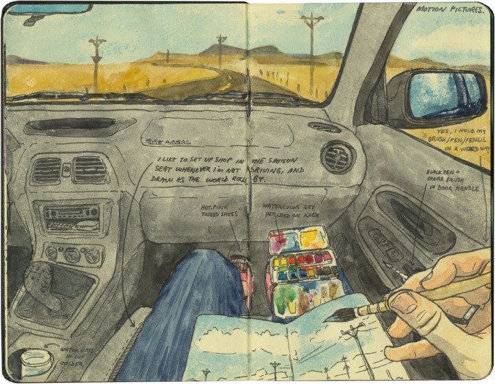
For all I had to give up, and for all the frills and furbelows that seem to accompany all new cars (though I’ll admit I love having USB ports at last)—this car has plenty of qualities that fit my personality. No GPS, for one thing—you all know how I feel about that (the Tailor and I agreed that if that had come standard, we would have paid to have it removed!). And plenty of nooks and crannies for holding all my paints and things while I sketch.

Yet while Silver is pretty and sleek and reliable and powerful, she’s not my Blue. I’ve already put close to 10,000 miles on her, but I’m still finding it hard to make the transition. Driving an automatic feels so different to me, so less engaged. And I have a lot of trouble finding her in crowded parking lots—I’m usually great at remembering where the heck I parked, but finding a silver Subaru in a sea of other silver Subarus (welcome to the Northwest) is hilariously difficult. Still, I’m sure we’ll grow to know and trust each other over time. It’s just hard to give up your first love.

Astoria sketch by Chandler O'Leary

Thank you, Wild Blue, for taking me here, there and back again—and for always keeping me safe along the way.

Astoria sketch by Chandler O'Leary

Here’s to the next quarter of a million miles, and my shiny new steed. Hi ho, Silver.

Save

Save

Save

Save

Save

Save

Save

Save

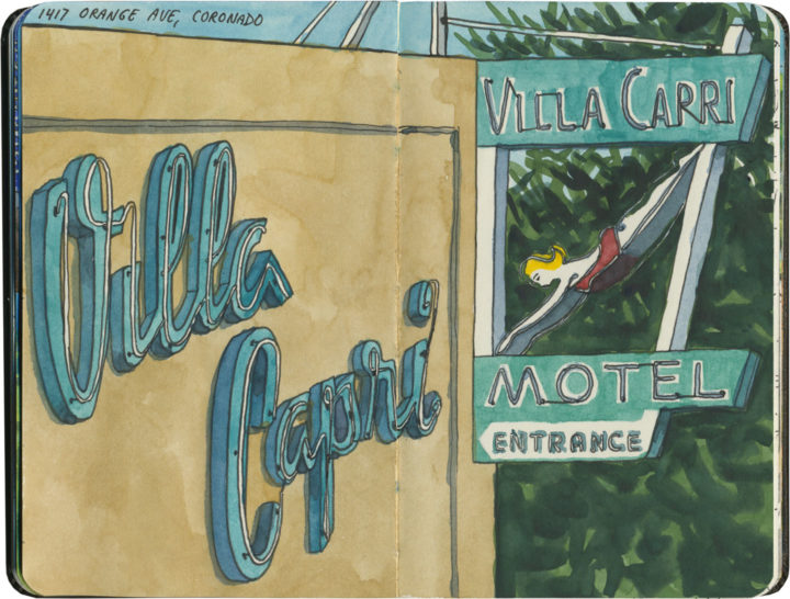
Villa Capri Motel sketch by Chandler O'Leary

Taking the plunge

I didn’t do a ton of traveling in 2016—all my adventures last year took place in the Pacific Northwest (and that’s fine with me!). Sticking close to home ended up being a necessity, as well, what with improvement projects around our 95-year-old house, and massive, years-long projects occupying me in the studio.

I have no idea what’s in store for 2017, or how much travel or sketching I’ll be able to squeeze in. I hope it’s lots, though, because I have big plans. I’m ready to dive into the new year—how about you?

Wishing you a happy, healthy, safe and successful 2017!

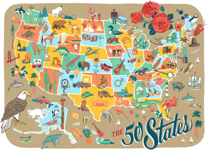
50 States pictorial map illustrated and hand-lettered by Chandler O'Leary

Rereading the map

I finished this map before the airwaves were inundated with red and blue election maps—and today it’s a good reminder that America is more than its electoral divisions. That there is good in every state, and that there is so much to love and celebrate in every nook and cranny of our nation. This is why I started the 50 States project three years ago, and I’m taking the fact that I happened to finish the series right before the most divisive election in living memory as a sign that I need to remember this fact going forward. After all, the real work of our country involves all of us.
 
Those of you who read this blog know that I express my love for every state—blue, red, purple, whatever—through my drawings. I will continue to do so, to feature the beauty and wonder and hilarity and kooky humor of every state. That is what will get me through the fear and sadness and anger I’m feeling now—and I hope it will help you in some small measure, as well. So the break I took from blogging to focus on my book is over; posting here starts back up again tomorrow.
 
In the meantime, you can celebrate all 50 States with me tonight at the Ted Sanford Gallery at Charles Wright Academy in University Place, WA, where the entire series is on display through November 29. From 5:30 to 6:30 tonight I’ll have a gallery reception and small pop-up shop. Let’s talk about the good that’s out there—from Paul Bunyan to Elvis to the World’s Largest Frying Pan, and everything in between, from sea to shining sea.
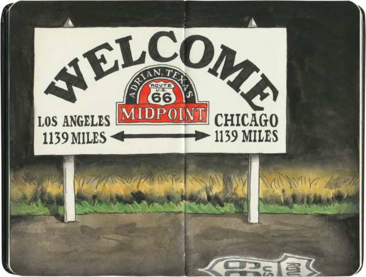
Route 66 sketch by Chandler O'Leary

Halfway there

This post is part of an ongoing series called 66 Fridays, which explores the wonders of old Route 66. Click on the preceding “66 Fridays” link to view all posts in the series, or visit the initial overview post here.

When I started my 66 Fridays series back at the turn of the new year, I knew I was in for a long road ahead. But here we are, 33 Fridays later, already at the halfway point of the series! I figured it was only fitting to pair this post with a sketch of the symbolic halfway point of the Mother Road. Since Route 66 has seen so many changes to its path over the years, it’s unlikely this sign marks the exact midpoint—but it hardly matters. I’m glad there’s a marker at all, wherever they ended up putting it.

Some of you may just be tuning in to this series now, so I figured a recap of where we’ve been so far was in order. Like everything else on this blog, my subjects jump around in space and time. So below is a list of all the Route 66 posts I’ve done so far, loosely grouped by category.

Posts about Route 66 itself:
Intro: Mother Road, Mother Lode
Chicago’s Eastern Terminus
Sundown Towns
Burma Shave
Filling Stations of 66
Suicide Bridge
Where 66 Intersects Itself
The history under your wheels

Route 66 Attractions:
Meramec Caverns Billboards
The Round Barn
The Leaning Tower
Wild Burros
Paul Bunyans
Mufflermen of the Mother Road
The Harvey House Empire
The Armory Museum
Dino Drive-Bys
Petrified Forest
The Continental Divide
Cadillac Ranch

The Mother Road in Lights:
Albuquerque’s Googie Marathon
The Dog House from Breaking Bad
The Aztec Hotel
The Munger Moss and its Antecedents
Air-Cooled Comfort
Tucumcari Tonite

Route 66 Roadside Eats:
Lou Mitchell’s
Ted Drewes
Dairy King
Chicago Dogs
Rod’s Steakhouse
New Mexico Cafes

Other Route 66 posts I’ve done (outside the 66 Fridays series):
Tulsa Googie
The Golden Driller
Old Town Ristras
The Blue Whale of Catoosa

Thank you for traveling along the Mother Road with me for so much of this year. And we still have many miles to cover—see you next Friday with the latest installment!

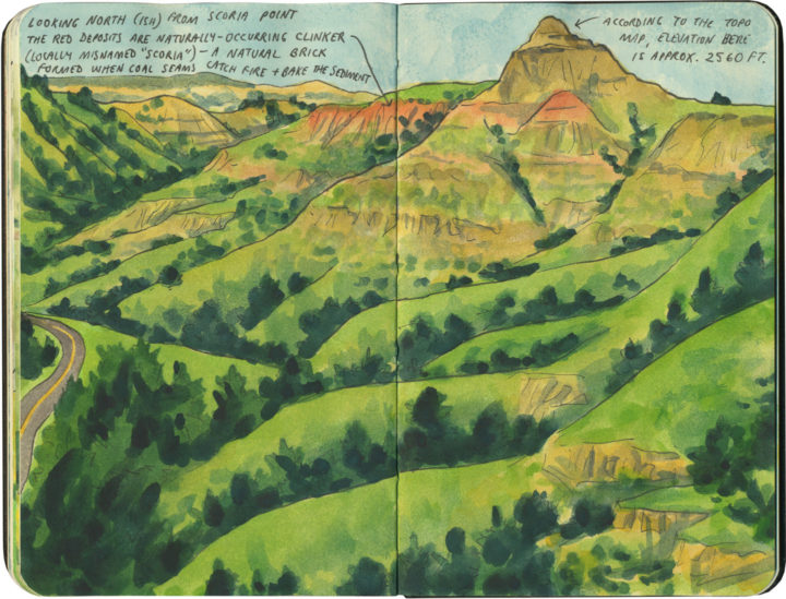
Theodore Roosevelt National Park sketch by Chandler O'Leary

Butte-iful

Like Saguaro, Theodore Roosevelt National Park is divided into two separate units. Unlike Saguaro, the North Dakota badlands are an old, familiar haunt of mine. Greener and less weathered than their craggy South Dakota siblings, these buttes have a similar mystery to them, all the same. It’s not hard to see why they were dear to Teddy Roosevelt’s heart—just as they’re dear to mine.